|
Buck Hollow/Buck Ridge Loop w/Mary's Rock |
|
|
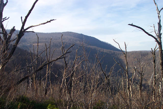
Description: Whether You do the main 6 mile loop or add the 3 mile out and back to Mary's Rock this is a pretty strenuous hike. It features a 2000 foot gain in elevation for the short version and almost 2400 feet for the long version. All of this gain is accomplished over the first half of the hike. The climb is made somewhat more bearable by the use of switchbacks but it is still quite a workout. The main route is only slightly used but even on a clear day in winter traffic lights should be installed for the side trip to Mary's Rock. Even with the heavy foot traffic the views may be worth it. More views can be had, especially in winter when the leaves are off, on the trek along Buck Ridge. Two notes of caution: During periods of high water the ford of Thornton River and the first crossing of Buck Run may be challenging. Secondly, the last 0.5 miles of the Buck Ridge Tr is quite steep and covered with loss, small rocks.
Trailhead is on the south side of U.S. 211 at a gravel pull through parking area.
|
|
________________________________________
|
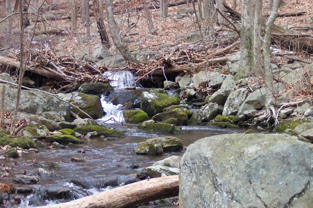
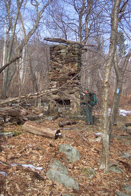
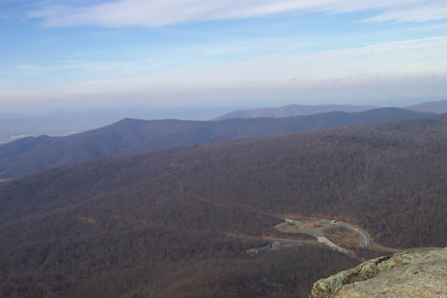
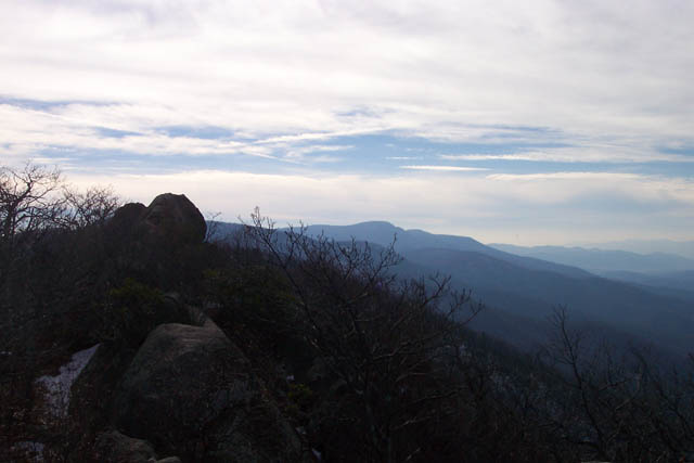
 Trail notes: From the parking area proceed down the blue blazed Buck Hollow Trail. Cross the Thornton River and then Buck Run. At about 0.24 miles pass the Buck Ridge Tr (Your return route) on the left. Continue on the Buck Hollow Tr. You will cross the run several times. For the first 1.5 miles you will be able to view the stream with its many mini-falls and chute. You will then climb steeply, via switchbacks, leaving the stream for a bit until you near the top of the Hollow where you will cross it for a final time at its headwaters. You will climb a bt more before the trail finally flattens out. At 2.7 miles from the Buck Ridge Trail junction come to the junction of yellow blazed Hazel Mountain Fire Road. To complete the 6 mile version of this trek turn left and pick up the directions after the side trip to Mary's Rock. To visit Mary's Rock turn right and walk out to Skyline Drive. Turn left up the drive for a few yards and then turn right onto blue blazed Meadow Spring Trail. Climb through a series of switchbacks, passing the ruins of an old PATC cabin destroyed by fire in the 90's, and in 0.61 miles from the Drive reach the junction of the white blazed Appalachian Tr. Turn right onto the AT. In another 0.61 miles come to a blue blazed spur trail for Mary's Rock. Turn left onto the spur trail and in 0.11 miles reach Mary's Rock (elevation 3514 at the very top). After taking in the view return to Skyline Drive and proceed down the yellow blazed Hazel Mountain Forest Road, passing the Buck Hollow Trail that you came up on on the left. In 0.4 miles come to the junction of the blue blazed Buck Ridge Tr. Turn left onto this trail. You will either be walking flat or downhill for the rest of the hike. Pass 1000s of dead trees, probably oak killed by a Gypsy Moth infestation. There will be views east of Hazel Mountain and other un-named peaks. To the west, as the trail makes a hard left to follow a series of switchbacks you'll get a pretty good view of Mary's Rock that you visited at the mid-point of the hike. Near the end of Buck Ridge Tr the path descends steeply along a rocky path. Take care! It's very easy to loose your footing here. In 2.52 miles from the last trail junction arrive at the junction with the Buck Hollow Trail. Turn right and retrace your earlier steps back to your car.
Zipped National Geographic. TOPO! GPS and Universal GPX Files GPS Text File for Non-TOPO! Users Downloadable/Printable Directions and Trail Notes __________________________________________________________________________________
__________________________________________________________________________________
Name: Susan Neill
Hike: Buck Hollow-Buck Ridge Loop __________________________________________________________________________________
Name: Michael Eckert
Hike:
Buck Hollow-Buck Ridge-Marys Rock-+ |
| __________________________________________________________________________________ |
|
|