|
Dolly Sods Wilderness Backpack
|
|
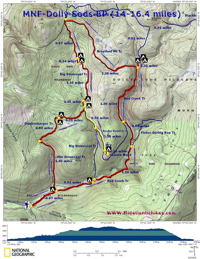
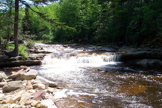
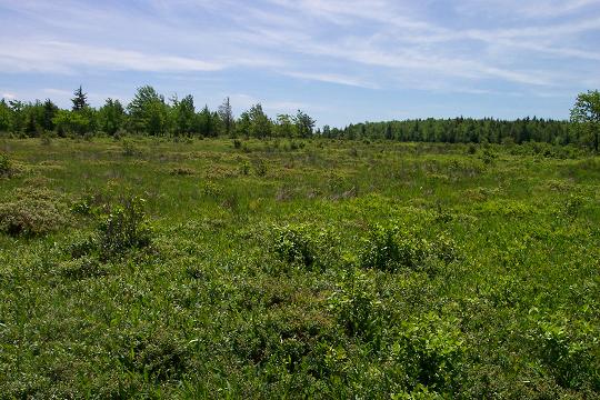
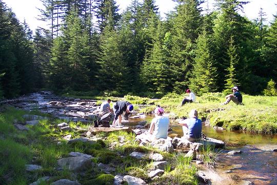
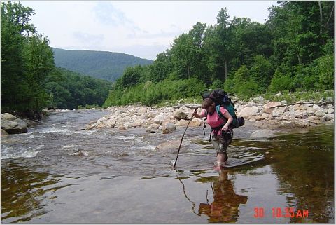
Description: The Dolly Sods Wilderness is one of the crown jewels of the Monongahela National Forest. This outing is a 15 mile backpack with an optional side trip to the Lion's Head Overlook, first exploring the heart of the Canyon, Red Creek, and then the western rim. The trip is laid out in such a way as to allow late arrival and early departures for distant travelers. The first day covers 4 miles, the second almost 7 (not counting the 3 mile round trip to the overlook) and the third about 3 miles. Mileage can easily be increased by adding side trips or the trip can be reduced to 2 days if you plan on getting there early on the first morning and leaving later on the second day. Simply change your campsites. You will explore Red Creek and its tributaries, some of the waterfalls and the blueberry bogs and pine plantations of the plateau. Be prepared for rocky and muddy trails, false trails, high water crossings and the lack of signs. Recently signs have been posted at all trail junctions but they often disappear. Furthermore, cairns may direct you onto a trail, a campsite or a dead end. Do your homework, be prepared and allow extra time for each day. |
|
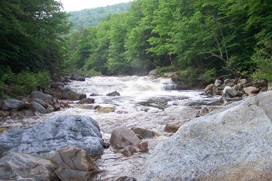
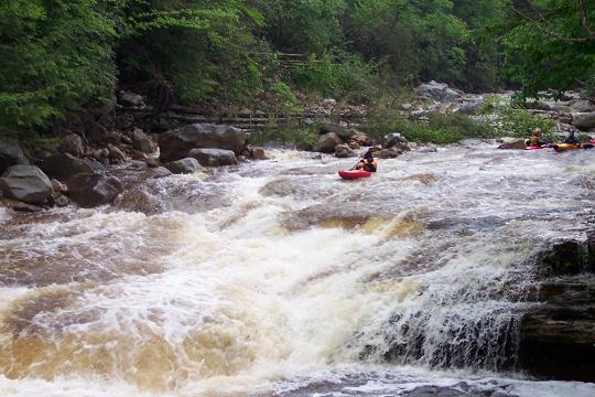
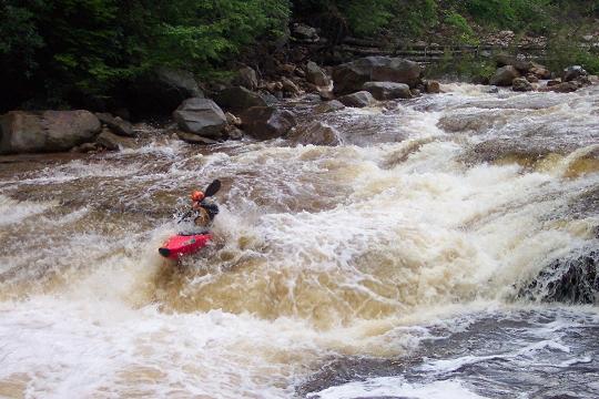
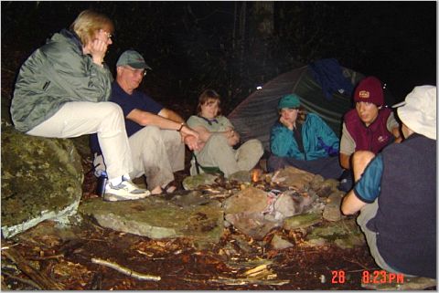
The weather at the Sods can change abruptly. If camping, bring some warmer gear for the nights. In the end of May night time temps might still reach the low 40s. Red Creek and its tributaries rise and fall rapidly during rain events. We've seen it drop a foot overnight. The hike begins behind a cabin on the left after crossing an old steel bridge. ________________________________________ |
|
|
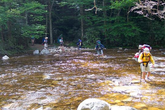
Trail Notes: Before starting, take note that there are no blazes in Dolly Sods. Recently, sign posts have been re-installed at all trail intersections but they have been known to disappear. Cairns can help but some lead to dead ends or campsites. Day 1: From the parking area, walk up Red Creek Trail. It begins as a wide forest road which stops at a backwater of Red Creek. Cross and immediately turn right on a narrow footpath, following close to the bank. Part of the trail has been blown out. This area will become apparent to you shortly. Bushwhack through this area and pick up a well-defined footpath on the other side. Follow it to a grassy clearing with a trail that comes in on the left. This is Little Stone Coal Trail. You may want to take the short trip out to the crossing to examine the ford for your return trip. If it looks too risky there is an alternate return route that will be described later. Return to Red Creek Trail. P roceed upstream, first along a railroad grade and then climbing gradually up a very rocky footpath. At about 0.91 miles from the junction with Little Stonecoal Trail you will come to a cairn and a trail that goes to the left. This trail ends at a campsite. Continue straight on the main trail. Beyond this point to the left will be a sketchy trail marked with a cairn on the downhill side that descends through the Rhododendron. The trail is hard to find and steep but is a quick connection with Big Stonecoal Trail and the rest of Red Creek Trail. This is a popular campsite. Shortly after your descent turn upstream (right) at the trail junction sign. You will join an old railroad grade for a while then bear right onto a footpath that will climb up above the creek. In 1.5 miles reach the junction of Fisher Spring Run Tr on the right. Descend to Red Creek. There are several campsites upstream from here on an old railroad grade. Follow it and pick the site of your choosing.Day 2: Retrace your steps towards Red Creek Trail. The best fording area is usually near a broken tree trunk in a slight opening on the bank. The point to reach on the other side is near a couple of big boulders on a sandy beach. Cross the creek and turn right onto the continuation of Red Creek Trail. Initially the climb will be slight. You�ll pass a couple of nice campsites on the right before the grade intensifies. |
|
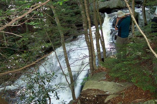
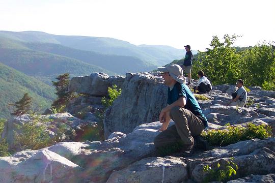
At 0.69 miles come to the junction of Rocky Point Tr. Cross it and continue to climb steeply for about another 100 yards before reaching another railroad grade. Turn right onto the grade. In 1.36 miles pass the junction of Breathed Mt Tr on the left and in another 0.2 miles reach �The Forks�. There is good camping on both sides of the Left Fork. After visiting �The Forks� retrace your steps and turn right onto the Breathed Mt Tr. Climb very steeply for about 1/3 of a mile through a predominantly hardwood forest. At the crest the woods will open up to a beautiful scene � a highlands plateau complete with blueberry bogs and young Red Spruce. For 2.3 miles you�ll weave in and out of the bogs with parts of the trail being pretty muddy. The beaver ponds shown on the map are mostly gone, filled in by the heath. I can�t note the exact location but about halfway across you will pass through a pretty impressive stand of pine (Great for camping but not sure about water availability.), then some more bogs, then a mixed forest with a lot of Red Spruce (The trail is very rocky here.), a few more bogs and a final climb through more woods to the intersection with Big Stonecoal and Blackbird Knob Trails. There will be a gray Forest Service Kiosk and trail sign in the middle of a grassy field. Head down Big Stone Coal Trail. WARNING: right at the edge of the woods there is a sink hole. Stay on the logs or circle this area. If you step in it you will find yourself in mud up to your knees!!! Continue downhill, at times walking in a stream. Soon you will be walking on a railroad grade with Big Stone Coal Run coming in from the left and a tributary coming in from the right. At about 0.97 miles from the trail junction with Breathed Mt Trail you will pass a campsite on the left. In another 0.14 miles ford Big Stonecoal Run. There are 2 more campsites right after the ford on the left. The trail then veers east, away from the run and travels roughly along the edge between bogs and grand Pine plantations. These are popular camping spots but I think the closest water source is the run you just crossed. The trail will then turn south for a short distance. Before reaching the southern most edge of the plantation the trail will jog left and uphill through the plantation. A faint trail continuing south (to the right) here will take you out to yet one more great view of highland meadows with a backdrop of mountains. Stay straight on the main trail uphill to continue. The trail will go east for just a little bit before turning south and then bending westward again. Cross to the west bank of Big Stone Coal at about 1 mile from the previous crossing and head down stream to the junction with DunkenBarger Trail. Perhaps the greatest campsite in the area is immediately to your left in a splendid stand of Spruce. This supposedly used to be an old lumber camp. FIRST ONE TO THE BEACH ON BIG STONE COAL GETS TO CAMP THERE!!!! Day 2: Side Trip to the Lion�s Head: From the campsite, sans packs but with cameras, snacks and water in hand, travel downstream on Big Stone Coal Trail. Cross the run at 0.16 miles. Visit the waterfall on your right. In another 0.56 miles or so Big Stone Coal trail will veer to the right and downhill at the junction with Rocky Point Trail. You want to go straight on Rocky Point Trail, crossing through a rocky area marked by cairns and a very small part-time stream that crosses the trail. At 0.5 miles from the last trail junction and about 5 minutes from the small stream, look for a large cairn on your left. There is a labyrinth of trails here. All will eventually get you to the top but the best one is to the right. You�ll have to step up onto the rocks from the trail. Watch out for the crevices and snakes as you explore the area. On the eastern edge of the rocks you�ll find cairns that will lead you down through a large fissure in the rocks and reconnect you to the unofficial trail. Follow it back down to Rocky point Tr and retrace your steps back to the junction of Big Stonecoal and Dunkenbarger Trails.
Head southwest on Dunkenbarger Trail. Be prepared for a lot of mud, roots and rocks, especially on this side of the hill. In about 0.75 miles come to Dunkenbarger Run and a great campsite along the run. There is more camping on the other side and to the left, a short distance down stream. Cross Dunkenbarger Run, turn upstream a few steps and then left to regain the trail. More camping is available to the right of the trail in a meadow. Just before the crest of the hill, on the left, is another great camping spot under 2 of the oldest Hemlock trees in the forest. Water is back at the run.
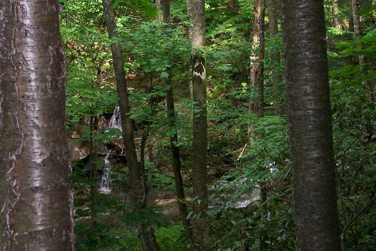
In approximately 0.8 miles from the Dunkenbarger crossing reach the junction with Little Stone Coal Trail. Turn left and descend rapidly along Little Stone Coal Trail as you get glimpses of the waterfalls to your right. Bushwhack to some of them at your own risk and enjoyment. A really big one is about 1/3 of the way down. In about 1.4 miles reach Red Creek. You�ll see a beach on the opposite side. The continuation of Little Stonecoal Tr is a few yards downstream from this beach. Make the ford and follow the trail out to the junction with Red Creek Tr in an open grassy area. Turn Right onto Red Creek Tr. From here simply retrace your steps back to the car. If the ford looks too risky, take the following high water route. Note: some bushwhacking is required. High water route from Little Stone Coal Run: Walk downstream from the ford. Sometimes you may be able to walk along the rocky bank. Cross what appears to be a stream. Actually it is a backwater of Red Creek. Shortly pass this point probe the brush for access to what appears to be an old overgrown road leading generally down stream. Eventually this will bear away from the creek and stop in a marshy area near a beaver dam that blocks the previously described backwater. If you look out beyond the backwater, over the beaver dam, you may spot an old forest road going up the side of the hill. This is the continuation of the road you are on. If you cannot easily make your way to it from the marshy area regain the creek bank as quickly as possible. Walk down the bank, searching the opposite shore for the confluence of that first backwater you crossed in the morning. When you find it turn your back on Red Creek and bushwhack in a northerly direction through some relatively open woods, crossing the backwater at a more manageable point and climbing steeply to gain the old forest road. Walk up the road keeping an eye out to the left for a well worn but narrow footpath. Follow it steeply down to the old steel bridge on Rt 45 which you drove across in route to the trailhead on the first morning. Cross the bridge and walk back to your car. ________________________________________
________________________________________
Name: Kathy Hike: Dolly Sods Wilderness Backpack Date(s): 05/19-20/13 Rating: 5
Critique: We followed the trail notes almost exactly. We saw far more bsckpackers than we were expecting on Sunday, but they were gone on Monday and we had the trails to ourselves. The campsite icons on the trail map were particularly helpful, and the campsites themselves were amazing. There are a couple of additional sites on the ridge near the Lion's Head that are spectacular. My favorite of the campsites was on Dunkenbarger trail between the two old hemlocks, but unfortunately the trail itself is in terrible shape with tons of blowdown. Next time I'll skip that trail. The variety in this 17-or-so mile loop is great and the terrain is not challenging. I found it to be a perfect, fairly easy two-day loop, and it would be ideal for first-time backpackers (especially kids) because of the relative ease, variety, abundance of water and nice backcountry campsites. I am looking forward to coming back and doing the north half of the Sods.
_______________________________________
Name: Rob Hike: Dolly Sods Wilderness Backpack Date: 05/25-27/13 Rating: 4
Critique: We did this hike Memorial Day weekend. The weather was absolutely perfect, which probably accounts for the (relatively) large numbers we saw on the trail, but still by no means as crowded as some of the more established parks and trails. The directions and descriptions were right on and very easy to follow. We camped the first night just after the Red Creek ford. There are a couple of sites on the right, and the second one before the trail gets steep was really nice, with a big fire ring and easy river access. However, the section of trail just after that site gets pretty messy. Lots of downed trees with some steep and tricky scrambles to get around. Nothing insanely hard, but it adds quite a bit of time and effort to the regular trail. We actually ended up skipping the Dunkenbarger and Little Stonecoal leg, because some guys out there warned us off, as well as the previous review on this site. Just to get onto the trail from the junction there is an immediate tree to duck, and it seems like it doesn't get much better. Other sections of trail have had a bit of work done, but still quite messy. Just be aware that there are no campsites or water spots on Big Stonecoal after the Dunkenbarger junction. So we continued down to Red Creek, and camped just after the ford. This made for a longer day than planned, but wasn't too bad. We'd even considered just hiking out that night, but I'm glad we stayed, even if the sites were pretty full and we had to ask to share a site with another group. Make sure you have solid boots, because as the description says, the trail is very rocky in parts. We didn't encounter any big muddy areas, but it has also been very dry. Any rain at all and you could easily be up to your shins. Highly recommended, just plan to spend some extra time fighting the lingering results of Sandy.
_______________________________________
Name: Joe Hike: Dolly Sods Wilderness Backpack Date(s): 4/27 to 29/13 Rating: 4
Critique: I did this hike with my girlfriend for my birthday around the end of April and overall it was a great hike. We hiked to the campgrounds near the breathed mtn trail/red creek trail junction on the first day and that seemed to be a good place to break it up. The first day there is a lot of pushing through overgrown rhododendrons and the trail is very hard to follow at places, especially between the trailhead and somewhere around the big stonecoal trail junction. After the first day there isn't a lot of green yet in the area and we saw very little wildlife aside from some birds and a deer. We also saw no other people after the first campground. The latter half of the Breathed mtn trail and especially the Dunkenbarger trail were full of downed trees. It became laughable after awhile and it felt like we were bushwhacking more than we were actually on the trail. The downed trees got very old after awhile but the area is beautiful and I highly recommend this hike. Be prepared for lots of gnats that show up if you stop near the river and very, very cold water crossings. _______________________________________
Name: K.C. Hike: Dolly Sods Wilderness Backpack Date(s): 05-04 through 06-13 Rating: 4
Two friends and I did this hike on an early May weekend. We did about 8 miles the first day, and the remaining 5 miles the second day. We had beautiful weather: 70-75 highs with an overnight low in the 30s. The greenery schedule is a bit slower in this area than in D.C., so the deciduous trees were just starting to bud. Most of the greenery was in the form of rhododendron and spruce trees. Like others, we had a bit of trouble at the early part of the red creek trail because there are a lot of misleading cairns. On the way back we followed the trail, and I found the point that we lost it on the way in. Perhaps 300 yards in, the trail descends out of a wooded area and you get your first unobstructed view of the creek. The trail appears to veer off to the left towards the creek, but it actually goes up a short muddy hill. Standing at this point, it is very hard to tell that there is a trail ahead of you because at the top of the small muddy embankment, it curves slightly to the left behind some tree trunks. Even if you can�t find the actual trail, once you hit the Little Stonecoal Trail (you�ll see cairns on either side of the creek), you can easily head back away from the river and pick up the Red Creek Trail again. We had a lot of trouble with down trees on the latter half of the trip (beginning at about the junction of the Red Creek Trail and the Rocky Point Trail). The area must have had a particularly ice or snowstorm, because the trees most affected were medium size Red Spruce. This was worst on the Dunkenbarger trail; it was to the point where we were bushwhacking around or climbing under/over downed Red Spruce every 50 meters or so. Often it was difficult to find the trail again on the other side. Other than the downed trees, this was a fantastic trip! The second half (once you leave the Red Creek Trail) was very secluded, and we encountered few people. We also encountered almost no wildlife except for an occasional bird. _______________________________________
Name: J. Parker
Hike: Dolly Sods Wilderness Backpack _______________________________________
Name: Jessica
Paolucci
Hike: Dolly Sods Wilderness Backpack ________________________________________
Name: Steve
Hike: Dolly Sods Wilderness Backpack ________________________________________
Name: Paul
Hike: Dolly Sods Wilderness Backpack ________________________________________
Name: C Griffin
Hike: Dolly Sods Wilderness ________________________________________
Name: Galen
Hike: Dolly Sods ________________________________________
Name: WaldoAR15
Hike: Dolly Sods Wilderness ________________________________________
Name: Brandon
Hike: Dolly Sods Wilderness BP ________________________________________
Name: Zeb Amoss
Hike: Dolly Sods Wilderness ________________________________________ |
|
|