Lake Sherwood/Allegheny Mt Loop

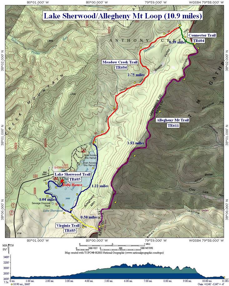
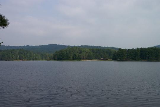
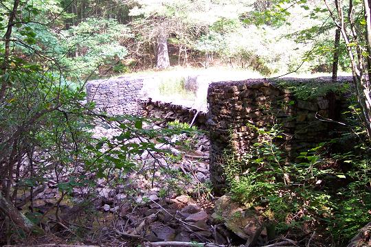
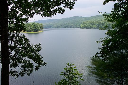
Description: This is a moderate 10.9 mile circuit featuring views of Lake Sherwood, 10 stream crossings (significant only when the water is high), old mill ruins a 3+ mile ridge walk (views have all grown in) and assorted fungi and plants. The lake portion features a mixture of pine and hardwood trees along the shore and swamp species in the backs of coves. The Meadow Creek Trail weaves in, out and through Mountain Laurel and Rhododendron thickets. In late May and early June, the best time to hike this circuit, portions of the Allegheny ridge displays thickets of red to purple Mountain Rosebay Rhododendron and Flame Azaleas. Wildlife possibilities include Red Winged Blackbirds, grouse, turkey, bear and deer. The major elevation gain is quite modest, 500 feet over 2 miles. There are some minor ups and downs typical of ridge walking.


Google Custom Directions

From the intersection of WV Route 92 and County Road 14 turn onto CO 14 and follow it for 11 miles to Lake Sherwood Recreation Area. Turn right and park near the beach bath house to begin the hike. 

The Lake Sherwood Trail is part of the Great Eastern Trail (GET).

______________________________________


Printable/Downloadable Map

View 3-D Map!

Printable/Downloadable Map


Trail Notes: All trails are blazed blue. Lake Sherwood Trail has an additional yellow dot under the blue blaze. From the bath house skirt the beach and follow the shore until you pick up the trail at the picnic area. Continue following the bank, crossing the dam and a concrete spillway on a bridge. At the junction with the Virginia Trail (1.04 mile from the beach) turn left staying on the Lake Sherwood Trail.


In 1.22 miles, come to a bridge that crosses Meadow Creek. Do not cross!!! Instead turn right onto Meadow Creek Trail. Keep an eye out for an old spill way on the creek. The structure has been stabilized with steel fencing. Continue up Meadow Creek, crossing it 10 times before reaching the junction of the Connector Trail 2.75 miles from the last trail junction.


Turn right on the Connector Trail. Climb slightly, passing the defunct Snake Valley Trail ( an old jeep road, on your right). Enter a wildlife clearing. There are now posts in the clearing directing you to the continuation of the trail but they have a habit of disappearing over time. A blue-blazed tree is at approximately 10-11 o’clock from where you entered the clearing. In about 0.4 miles reach the Allegheny Mountain Trail. Turn right. Periodically you might get very limited views of Lake Moomaw to the east. The trail pretty much follows the ridge top all the way to the Virginia Trail. In 3.8 miles from the Connector Trail reach the intersection with the Virginia Trail. The Allegheny Mt Trail tread continues south but this portion of the trail has been retired and is no longer maintained.


As of 07/04 the trail sign for the Virginia Trail had been removed but the trail is obvious. Turn right and soon pick up the familiar blue blazes. Follow this down 0.5 miles to the intersection with Lake Sherwood Trail ant the spillway bridge. Retrace your steps back to the beach house.

Printable/Downloadable Directions and Trail Notes

Critique this outing!

______________________________________

______________________________________

Name: Mark                                                                                                               Hike: Lake Sherwood/Allegheny Mt Loop
Date: spring '06                                                                                                        Rating: 5

Critique: I / we have backpacked this area on more than one occasion and all I can say is that if you find a better place with more scenic views, please let me know. In '05 we packed in for 2 days with a chain saw and clear the trail for approx. 2.5 miles. A lot of work but well worth the effort!


Going back in Oct. '06 to back pack it again for 3 days and introduce a friend to the area. Remember : pack it in = pack it out. On every trip we have carried out several bags of trash, eat it, burn it, bury it or pack it out!

______________________________________

Name: WVwanderer                                                                                                   Hike: Lake Sherwood / Allegheny Mt Loop

Date: July 15, 2006                                                                                                    Rating: 5
             
Critique: This is a nice loop. We did the hike in reverse order, hiking up Virginia trail, across the ridge on Allegheny Mt Trail, then down Meadow Creek Tr. The blueberries were ripe and abundant along the Allegheny Mt Trail, and we picked our share as we hiked. Due to the vegetation and overcast day, we didn't get any grand views of Virginia while on the trail, but they must be spectacular during the early spring/late fall time period. If you are feeling bored, you can read about and view pics of our adventure at http://wvwilderness.blogspot.com/ under the heading "Car camping, Lake Sherwood WV".

______________________________________

Name: Libby Workman                                                                                              Hike: Lake Sherwood - Allegheny Loop
Date: 07/30/05                                                                                                          Rating: 4.5

Critique: This was a nice hike. I have always camped at Sherwood and really enjoyed the lake. The only thing I would do different is, I would do the loop in reverse order. I found the hardest part of the hike was at the end. The rocks up on the ridge can be a little hard to walk on.

______________________________________

VA Hikes MD Hikes WV Hikes PA Hikes Contact Us Home