|
AT-Sunset Rocks Circuit |
|
|
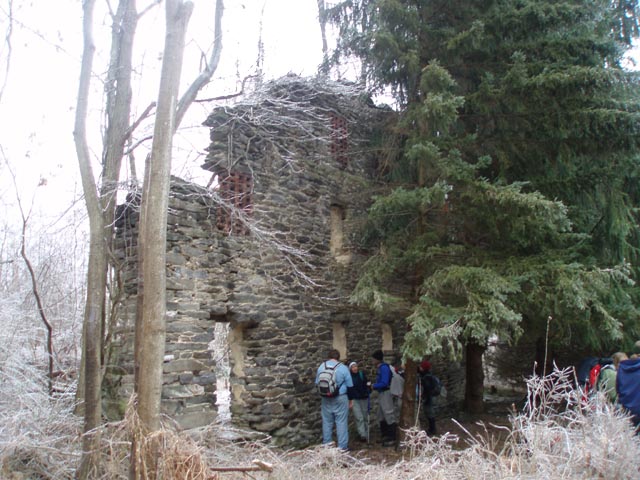
Description: This is a 8.8 mile moderate circuit hike. The first leg of the hike is repeated on the return. The hike features several modest elevation gains, pretty Tom�s Run, the remains of a stone barn built by Hessians captured during the Battle of Trenton in the Revolutionary War as well as the vague remains of a WWII POW camp , Camp Michaux. The true highlights, however, have to be a 0.4 mile fun-filled rock scramble and the namesake of the hike, Sunset Rocks itself. This hike would work well as an introductory backpacking trip since there are 2 AT shelters near the 1/2 way point. We recently added a bailout route on a logging road (Marked read on the map) if for some reason you decide not to do the rock scramble. S afety Note: The rock scramble is tricky to negotiate with crevices to cross and large boulders to climb over. It is relatively difficult for a person in good shape. We strongly advise against taking Fido out on this one. |
|
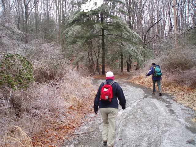
The hike starts at the parking lot near the AT bathrooms and
picnic pavilions. _____________________________________ |
Zipped National Geographic. TOPO! GPS and Universal GPX Files |
Trail Notes: The AT is blazed white. All other trails are blue. The trails/roads through Camp Michaus and the bailout route are shown here in red but are not blazed.
From the parking area return to the
intersection of Benderson Rd and Rt 233. Turn left on Rt 233 and
walk along the shoulder. Soon turn right onto the next road
following the white AT blazes. At about 0.13 miles from leaving Rt
233 the AT will turn right off of the road onto a footpath, pass some cabins and climb a set of
erosion dams. You will climb a bit more and descend to a footbridge
at Tom�s Run (1.16 miles after leaving the last
road).
Cross the bridge and turn left onto an old woods road. In 0.23
miles merge with a gravel road that comes in from the right. In 0.47
more miles the AT will bear to the right on a foot path as
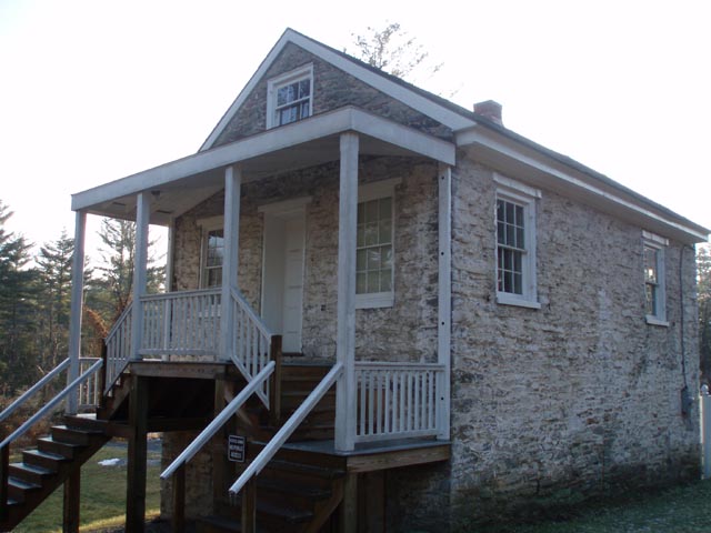
the woods road continues straight. Pass the Ruins of an old stone barn on the right. In
a few more yards arrive at Michaux
Rd.
Turn right onto
Michaux Rd and walk 0.21 miles to pick up the continuation of
the AT on the left side of the road. In about 1.15 miles arrive at
Tom�s Run shelter, a good place for
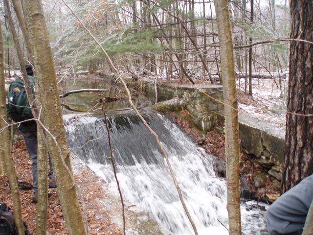
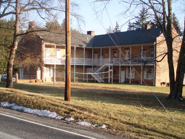
lunch. After lunch, cross Tom�s Run and immediately turn left on Little Rocky Ridge/Sunset Rocks Trail (blue-blazed). In about 0.64 miles bear left onto an old woods road and explore what is left of Camp Michaux in another 0.11 miles. |
|
There is a spillway close to the road. It�s not clear if this was to
provide a constant water source for the camp or used for milling.
Return to your original route, turning left onto the blue blazed
footpath, and in another 0.45 miles return to Michaux Rd. Turn
right here. Pass another woods road on the left. The
emergency return route mentioned earlier is beyond the log gate.
Make
the next left turn in 0.13 miles, passing a house on the left but still following the
blue blazes. Regain the trail and climb to the top of Little Rock
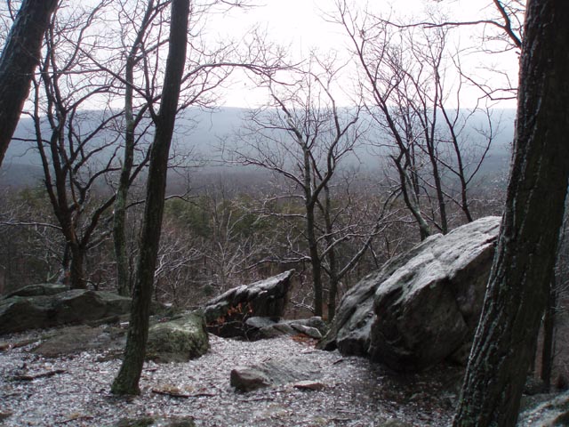
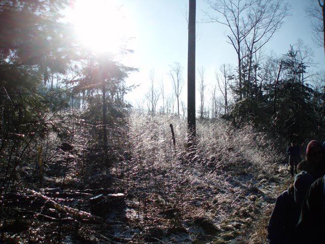
Ridge. Now the fun starts! Continue on. The trail seems to stop at a rock spline. Initially there might be some blue blazes on the rocks but in the end the best route for the next 0.42 miles or so is the one that is in your mind. If you are an avid user of trekking poles now is the time to store them. They are more of a hindrance than a help at this point. You will definitely need your hands for this next segment. On the other side of this rock outcrop you�ll pick up the blazed trail again. Soon arrive at a saddle. Continue straight, passing the blue blazed connector trail on the left that you�ll use later. Climb the other side of the saddle and arrive at Sunset Rocks. After resting and taking in the view, return to the connector trail and turn right onto it. Over the next 0.39 miles walk through a recently lumbered area. You might want to put your blinders on here as it is a pretty dreadful sight. Return to the footbridge at Tom�s Run and the AT. Turn right and retrace your earlier steps back to the car.Printable/Downloadable Directions and Trail Notes _____________________________________
_____________________________________ Name: Mountainstreamflood Hike: AT-Sunset Rocks Circuit Date: 05/12/13 Rating: 4
Critique: Hike: Overall this is a pretty good hike. The views from Sunset Rock are outstanding and the two crossings of Tom's Run are gorgeous (would be even better in late June/early July when Rosebays are in bloom). We did the hike backwards to save my knees from the steep slope of Little Rocky Ridge but this has the disadvantage of getting the best of the hike (Sunset Rocks) out of the way in the first 3 miles, leaving nondescript but pleasant 5 mile return back to the car. Also, we used Old Shippensburg Road to avoid the out-and-back on the AT between Sunset Rocks Trail and Pine Grove Furnace. One note, it appears the AT has been rerouted at Halfway spring (just passed first crossing of Toms'Run.) Rather than following the logging road to Michaux Road at Camp Michaux, the trail now proceeds on a footpath to the north and directly across Michaux Road. As a result the trail bypasses the ruins of the old stone barn. _____________________________________ Name:
Keith Robertson
Hike: AT-Sunset Rocks Circuit _____________________________________ Name:
Jeremy K
Hike: AT-Sunset Rocks Circuit _____________________________________ Name:
Hard Corey
Hike: AT-Sunset Rocks _____________________________________ Name:
iowajoe
Hike: Sunset Rocks _____________________________________ Name:
Ryan
Hike: AT / Sunset Rocks _____________________________________ Name:
Sonya
Hike: AT-Sunset Rocks Circuit _____________________________________ Name:
Greg
Hike: AT/Sunset Rocks _____________________________________ Name:
Ryan Shaw
Hike: AT-Sunset Rocks Circuit _____________________________________ Name: Craig Hike:
AT-Sunset Rocks Circuit _____________________________________ |
|
|