|
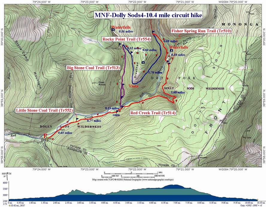
Red Creek/Big Stonecoal Circuit |
|
|
Description:
This is a moderate 10.4 mile circuit hike taking you through
some of the prettiest deciduous and coniferous forests, past
grand waterfalls, if you don't mind bushwhacking, and along some
very tranquil streams. There are a few hard parts. You will have
to negotiate four significant water crossings, at least two of
which will require either alternate footwear or will leave the
hiker walking in wet boots. Rocky Point trail can be described
as nothing other than ... rocky. Overall, the sacrifices are
worth the rewards.
If this description sounds familiar it's because some of the
trails are used in
Red Creek/Dunkenbarger Loop described
elsewhere on this site. The primary differences are that the slog up Dunkenbarger Trail and descent down Little Stone Coal as a return
route is replaced by a descent on Big Stone Coal Trail and then
retracing the initial portion of Red Creek Trail. The distance is
the same but this is probably a good 30 minutes faster, all other
things being equal.
|
|
Cross Red Creek on an old metal bridge. Immediately turn left into the driveway of the Wildlife Management Cabin. Park in the rear or on the shoulder of the drive. ________________________________________ |
|
Trail Notes: Before starting, take note that there are no blazes in Dolly Sods. Recently, sign posts have been re-installed at all trail intersections but they can disappear rather quickly.
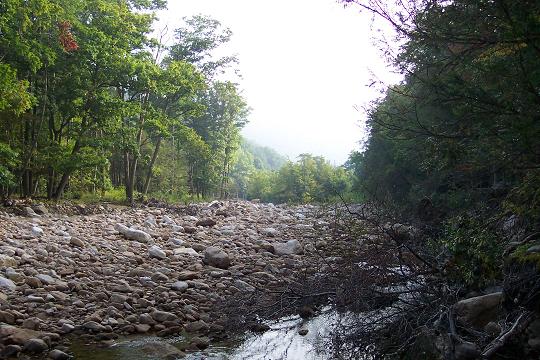
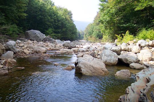
From the parking area, walk up Red Creek Trail. It begins as a wide forest road which stops at a backwater of Red Creek. Cross and immediately turn right on a narrow footpath, following close to the bank. Part of the trail has been blown out. This area will become apparent to you shortly. Bushwhack through this area and pick up a well-defined footpath on the other side. Follow it to a grassy clearing with a trail that comes in on the left (0.65 miles from the start). This is Little Stonecoal Trail.
Stay on Red Creek Trail and proceed upstream, first traveling along a railroad grade and then climbing gradually up a footpath. At about 0.91 miles from the junction with Little Stonecoal Trail you will come to a cairn and a trail that goes to the left. This trail ends at a campsite. Continue straight on the main trail. Beyond this point to the left will be a sketchy trail marked with a cairn on the downhill side that descends through the Rhododendron. The trail is hard to find and steep but is a quick connection with Big Stonecoal Trail and the rest of Red Creek Trail. This is a popular campsite. |
|
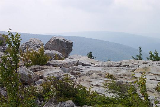
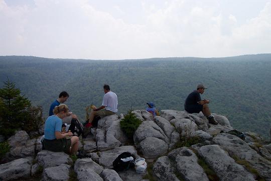
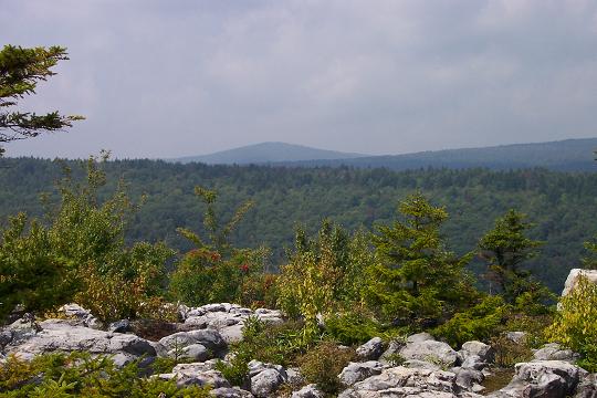
Continue up Red Creek trail as it climbs to a junction with Rocky Point Trail (0.7 miles from the ford). Soon the trail will become quite rocky as it becomes apparent that you are walking on an old railroad grade with the ballast still there.
Pass
several small
Another
route to the Lion�s Head on Rocky point Trail is just a little
further north of this one and is marked by a cairn composed of a
tall, slender rock with a pointy rock on top and more rocks around
its base. This trail is steep and rocky but well marked by
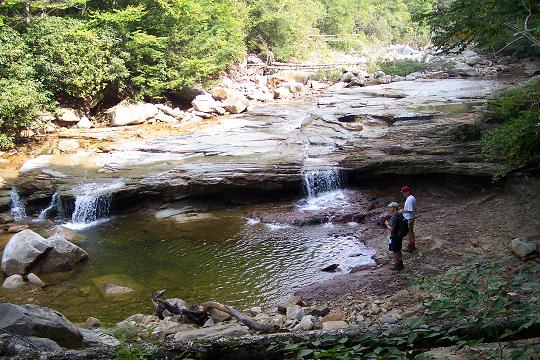
Return to Rocky Point Trail, recovering your gear along the way, and turn right. Rocky Point Trail ends at its juncture with Big Stonecoal Trail. If the water is running well continue upward on Big Stonecoal Trail (This will add about 0.6 miles to your trek.). Soon you will here a waterfall. It�s the one shown on Red Creek/Dunkenbarger Loop described elsewhere in this site. If you desire, drop your gear and bushwhack down for a great photo op. Note: the walls of the gorge are steep and slippery so take care!
Return to the intersection with Rocky Point Trail and bear right onto Big Stonecoal Trail. (If you do not opt to explore the upper falls you will be making a left here coming down from the Lion's Head.) Towards the bottom the trail splits. An old railroad grade continues straight and a footpath descends steeply down to the run itself. If you take this route merely bushwhack along the run and behind another old railroad grade until you regain the trail just before a large cairn at the confluence of Red Creek and Big Stone Coal Run. Cross and pick up the trail on the other side. Turn right at the intersection with Red Creek Trail. When you reach the obvious blowout in the bank turn left and scramble up the bank to the continuation of Red Creek Trail. Turn right and retrace the initial 1.5 miles back to the car. Printable/Downloadable Directions and Trail Notes! Red about a recent Dolly Sods trip. ________________________________________
________________________________________
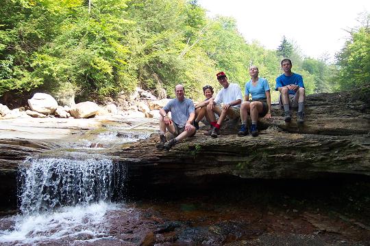
Name: Brandon
Hike: Red Creek/Big Stonecoal Circuit ________________________________________
Name: Matt
Hoffman
Hike: Red Creek/Big Stonecoal Loop (modified) ________________________________________ |
|
|