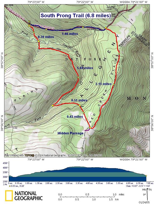
South Prong Trail

Description: This is a 6.8 mile moderate circuit hike on the Roaring Plains, Monongahela National Forest, WV following both segments of the South Prong Trail and 1.5 miles of FR19 to close the loop. The first 2.7 miles is pretty strenuous as you climb out of the creek valley, along some nice gradual railroad grades mixed with short segments of very steep footpaths. At lower elevations you’ll walk through a mature hardwood forest. As you reach the plateau the environment will suddenly change to terrain commonly seen on the Canadian Shield. The hardwoods will give way to dense Red Spruce thickets, Mountain Laurel, Rhododendron and wild Azaleas scattered amongst sandstone formations. From there the hike is mostly flat with a few short hills until you get to FR19 and a rapid descent back to your car. If time is of importance or you have an extra vehicle and the notion of road walking doesn’t appeal to you, leave a car at the trailhead discussed below and drive up to the upper trailhead. From there you can accomplish a very enjoyable 5.3 mile hike the bulk of which will have no major elevation gains.

Of, course, you’ll have to reverse the directions given in the following trail notes.


Google Custom Directions


The western terminus of the South Prong Trail shares a gravel parking are with the Boars Nest Trailhead.

______________________________________


Printable/Downloadable Map!

Printable/Downloadable Map!

View 3-D Map!


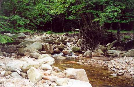
Trail Notes: The trail is blazed with blue diamonds. From the parking area walk past the forest gate and follow the grassy road down to the South Prong of Red Creek. Cross the creek at 0.35 miles and turn left on an old RR grade, passing the first of many blue diamond blazes. Soon turn right, following the blazes, and climb steeply up a footpath to a higher RR grade. Turn left onto the grade and continue on. You will by-pass sections of the RR grade a couple of more times in this manner until you reach a long stretch of RR grade near the top of the mountain.


At about 2.0 miles from the first creek crossing, the trail crosses the creek again and follows another RR grade in the opposite direction. Turn right onto a footpath and arrive at FR 70 at 0.5 miles from the last stream crossing.

Cross the forest road and continue up the South Prong Trail for another 0.45 miles.


In a small meadow at the top, the South Prong Trail will continue straight. This is your route but if you want to take a break at a refreshing area look for a faint trail marked by cairns on the right. This is the entrance to Jonathan Jessup’s Hidden Passage. Walk back until you find a fern/grass meadow with a stream that meanders through it off to the right. Small Black Cherry trees and large azaleas are dispersed throughout this scene.


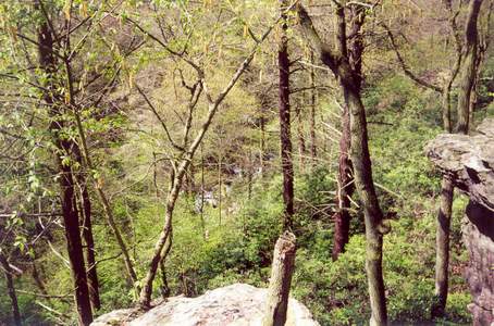
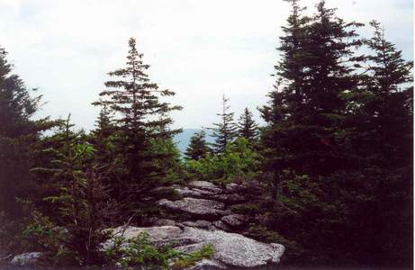
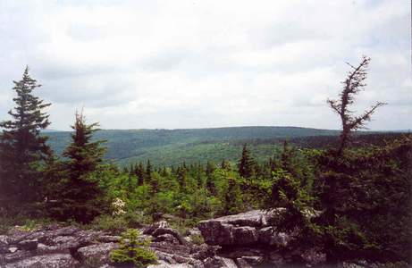
After your break, continue your original route. Shortly after leaving the hidden passage you’ll climb two short rises. Be prepared for a lot of water puddles after periods of heavy rain. The trail seems to hold it for quite some time. Keep an eye out for a sandy campsite with fire ring to the right. Behind it, if you poke and prod through the dense heath, you might get glimpses of the valley below. Further along on the left there is a side trail now marked with blue diamonds that takes you out to a rock field. This used to offer great views of Dolly Sods. The Red Spruce is re-claiming the forest at a rapid rate so you may have to go further out on the field to get a reasonable view.
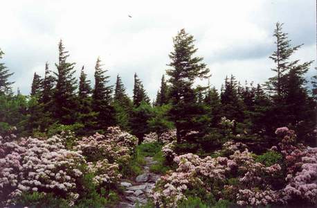
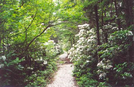
As you near the end of the trail you’ll find yourself walking through a tunnel of Rhododendron with alternating grave and boardwalk trail beneath your feet. This work was done to protect some small but rather attractive bogs. 2.5 miles after leaving the entrance to the Hidden Passage arrive at FR19. Turn left and walk 1.5 miles back to your car.

Printable/Downloadable Directions and Trail Notes!

Critique this link!

______________________________________

______________________________________

Name: Kirby Adams                                                                                                   Hike: South Prong Trail
Date: 06/03/2008                                                                                                     Rating: 5.0

Critique: This is my idea of a perfect day hike. We did it during a very wet season (and wet week) in the MNF, but found the creek crossings quite easy. I suppose the creek is just somewhat unpredictable. During our hike, there was actually a third crossing...the creek that goes through the Hidden Passage crosses the trail downstream. I imagine this is usually a step-across, but it was a get-your-feet-wet crossing on our hike.

If I had to find something negative, it would be the rockiness of the last couple miles. Good technique and good boots will prevent twisted ankles and soreness, but be ready to see a lot of rocks jutting out of the trail.

One other thing, after a lot of rain, consider a 4x4 on the forest road to the trailhead. There are some colossal potholes and rocky areas. Our Pontiac G6 didn't enjoy it - but at least it was a rental!

______________________________________

Name: Pete Flemming                                                                                              Hike: South Prong Trail
Date: 10/21/06                                                                                                         Rating: 4.5

Critique: This is an excellent hike. However, it is not noted on any sites, but should be, that crossing the creek is not particularly easy, especially if the water level in the creek is fairly high. We hiked from the top portion of the trail, so we finished with the second creek crossing about 0.36 miles from Road 19. The crossing of the creek at that point is very difficult. We ended up crossing by shimmying our way about 60 feet across a large fallen tree several feet above  the creek about 100 to 200 yards upstream from where it appeared the normal trail crossing would have been. The first crossing was somewhat difficult but not nearly the challenge as the last crossing.

M.R.Hyker Note: That's why we describe the hike from the bottom up. That way you can evaluate stream crossing difficulties early on. All hikers should follow the weather several days prior to a trip. Extended periods of rain can turn a mere trickle into a raging torrent. The South Prong is no different from other creeks in the Mid-Atlantic.

______________________________________

VA Hikes MD Hikes WV Hikes PA Hikes Contact Us Home