|
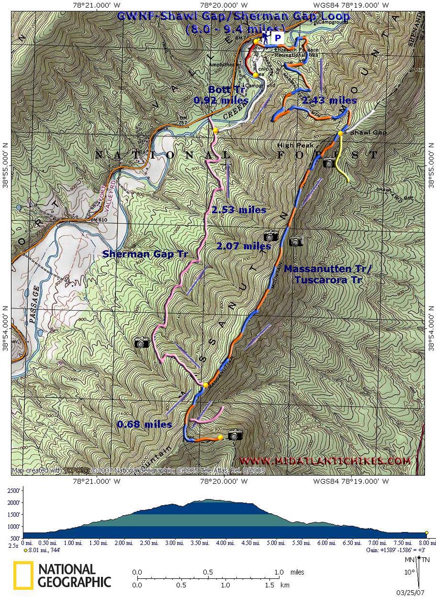
Shawl Gap/Sherman Gap Loop
|
|
Description: This is an9.4 mile, moderate trek with a maximum
elevation gain of 1400 feet with 1200 feet being gained in the
first 1.7 miles. There are several ups and downs along the
ridge walk causing one to replicate some of the elevation
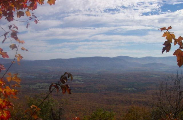
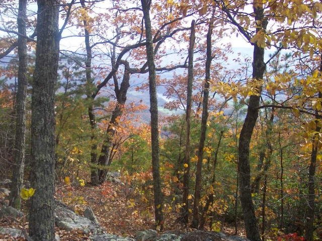
gain. This hike features great views of the Shenandoah Valley, river and SNP to the east as well as views of secluded Fort Valley to the west. There is one section, near the side trip to The Point which features the sweet fragrance of Fringe Tree (AKA Old Man's Beard) during the months of June and early July. There are only a couple of minor stream crossings of no important note on the return leg. The hike starts just across the bridge at the Elizabeth Furnace Picnic Area. |
|
_______________________________________ |
Zipped National Geographic. TOPO! GPS and Universal GPX Files GPS Text File for Non-TOPO! Users
|
Trail
Notes:
From the parking area, cross the bridge over Passage Creek and
immediately turn left onto the Massanutten/Tuscarora Trail. It
will be blazed in blue and orange with a residual yellow blaze
here and there from when this was part of the Shawl Gap
Trail. Follow the Creek for about 1/3 of a mile, passing the
ruins of
Turn away from the creek and begin to climb, crossing a part-time tributary on a footbridge. A series of short and long switchbacks bring you to the top of the ridge at about 2.43 miles from the start of the hike. The intersection of white-blazed Buzzard Rock Trail is to the left and yellow-blazed Shawl Gap Trail straight ahead.
Turn right, staying on the orange/blue-blazed Massanutten/Tuscarora Trail. Soon pass a large campsite. There is no water on this portion of the mountain so bring plenty if you intend to spend the night.
Climb
up and down three peaks with alternating views to the east of
the
At
2.07 miles from the last intersection arrive at the intersection
of pink-blazed
To
obtain more sweeping views of the Shenandoah stay on the
Massanutten Trail and head south. Here the woods look like an
urban blight area as the trees are blazed in alternating
orange, pink and blue stripes. For a short distance, The
Massanutten, Tuscarora and
|
|
Climb out of the saddle and walk out to the edge of the
knob. At about 0.7 miles from the first Sherman Gap Tr
junction, arrive at a close up view of "The Point" on the
Retrace
your steps, passing the Sherman Gap trail on the right, to the
first pink-blazed
Turn
left and descend, steeply at first, watching for more views of
At 2.53 miles from the last intersection, come to white-blazed Bots Trail. Turn right. Soon you will again be walking along the banks of Passage Creek.
In
about 0.92 miles from the last intersection the official
white-blazed trail bears right and enters the upper picnic
area. I recommend staying along the creek a bit longer,
following an obvious but un-blazed fisherman's trail (marked
red on the map)to the
lower picnic area. The bridge is at the end of this
section. _______________________________________
_______________________________________
Name: Ed S.
Hike: Shawl Gap/Sherman Gap Loop
Date: 06/13/13
Rating: 3.5
Critique: This was an OK hike, but without anything spectacular about
it. There are only a few window views, and only typical streams. The
Elizabeth Furnace ruins are a plus. The ridgeline hike never gets very
technical, and some stretches where poison ivy makes for difficult
walking. The Sherman Gap Trail seemed endless, and often fairly open to
the sun. Instead of taking the Botts Trail at the end, I continued on
the Sherman Gap Trail and then the Bearwallow Spur to reach to the
Tuscarora Trail to get back to the picnic area. My advice, take the
Botts Trail. While the ford on Passage Creek was easy if deep enough to
get my shorts wet, the bottomlands trail past it was overgrown, buggy,
muddy, and miserable. On the plus side, I got to experience my first
cicada brood since 1987.
A Periodic Cicada
_______________________________________
Name: Brandon F.
Hike: Shawl Gap/Sherman Gap Loop
_______________________________________
Name: Kris
Hike:
Shawl Gap/Sherman Gap Loop
_______________________________________
Name: Murry Moskowitz
Hike:
Shawl Gap/Sherman Gap Loop _______________________________________ |
|
|