
|
Otter Creek - SE Loop |
|
|
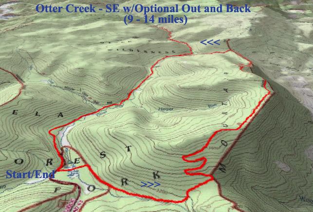
Description: This is the third of four loop hikes in the Otter Creek Wilderness. (I will be backpacking the fourth in 2006!). The base loop is a moderate 8.9 mile trek. It offers a walk through some pretty scenic hardwood and Red Spruce forest with an under-story of Rhododendron so thick in places you feel like you're walking through a refrigerated tunnel. It is very easy to turn this from a good hike into a great hike by simply adding some of the out-and-back along Otter Creek described here. Following the creek down to Possession Camp adds about 2 miles total to the hike. Traveling further to what I consider to be the crown jewel of the Wilderness, the confluence of Otter Creek and Moore Run, will make this a 14 mile trek. This would make a very nice and relatively easy over-night backpack although it can easily be done in a day if you get an early start. Note: Google Directions may call FR303 Public Rd 63.
|
|
_______________________________________ |
|
|
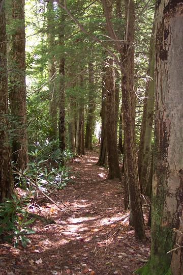
Trail Notes: Otter Creek Wilderness has no signs or blazes within the wilderness boundaries. Trailheads on the boundaries are posted. Trail intersections are marked with rock cairns. A good map, trail notes and compass are essential. From the parking area walk down the gravel road towards Condon Run. Turn right onto signed Hendrick Camp Trail. First walk through a pleasant grove of Red Spruce and Hemlock before arriving at a bog at the headwaters of Otter Creek. There is no bridge here and it seems getting across unscathed is never the same two times in a roll. Once across join an old logging skid road that gradually climbs up to a saddle on Shaver Mt. In about one mile from the trailhead arrive at Shaver Mt Tr. Turn left and climb to the top of the ridge. The climb is made easy by a set of long and well placed switch-backs. As you walk along the ridge ( I think at least part of the trail is an old woods road.) you'll walk through alternating stands of hardwoods and spruce. Descend through a tunnel of Rhododendrons and switch-back down to another saddle (Mylius Gap). In 4.2 miles from leaving the Hendrick Camp Trail come to a 4-way intersection with four cairns. Turn left onto Mylius trail and descent via footpaths and woods roads to Otter Creek in another 0.8 miles. Keep an eye out for tree fossils in the rock in the trail as you approach the final steep descent! Follow the short remainder of Mylius trail on the other side of the creek to the junction of Otter Creek Tr. |
|
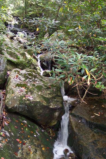
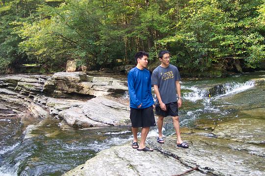
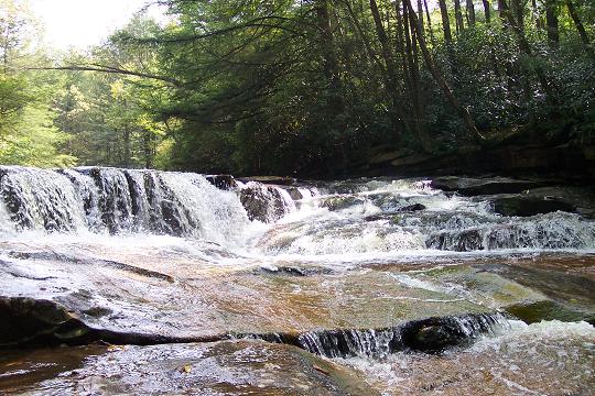
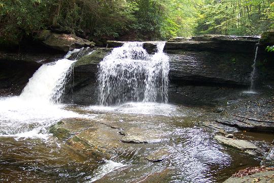
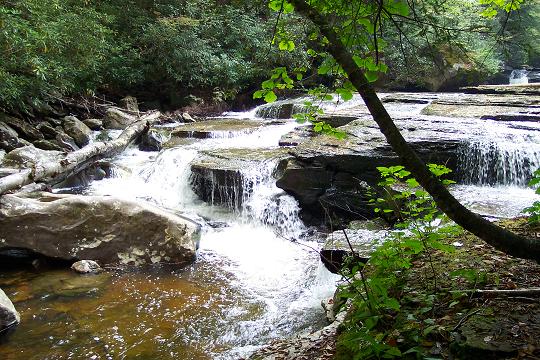
(A) If you are doing the base loop turn left onto Otter Creek Trail (upstream). In about a mile you will ford Otter Creek twice. In 1.8 miles pass the junction of Yellow Creek Trail and soon after cross Yellow Creek itself. Cross through a boggy area and climb up to yet another RR grade that parallels Otter Creek from a higher elevation. Follow this for another 1.13 miles back to Condon Run and your car. (B) If you wish to visit the water works that are the highlight of any trip to the wilderness turn right and follow the trail downstream. In about 0.7 miles ford the creek and then a small feeder stream that comes in from the right. Camping options from here down to Moore Run is almost limitless. In a mile from the Mylius Trail come to the junction with Moore Run Trail marked by a cairn on the left and Possession Camp Trail behind a large rock on the right. Just below this is a great set of rapids and the largest/deepest swimming hole on the creek. A little further downstream arrive at possession Camp, a large grassy area capable of housing 20+ tents although I've never seen more than a handful. At this point you are a little more than a mile away from the base loop. If you want to see more or are backpacking walk through Possession Camp and ford Otter Creek again. Soon pass more campsites on either side as well as a nice water fall and swimming hole (Probably #2 on the list of Otter Creek swimming holes). In 1.34 miles from the last ford arrive at a large campsite under the Hemlocks on the left and the confluence of Moore Run and Otter Creek, the crown jewel of the Wilderness. If you haven't been enticed to get a little wet yet this should do it! After spending ample time relaxing, swimming and/or sunbathing ... perhaps camping out for the night, return to where you left Mylius Trail and follow (A) back to your car. Printable/Downloadable Directions and Trail Notes ________________________________________
_______________________________________
Name: Paul Fofonoff
________________________________________
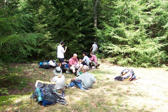
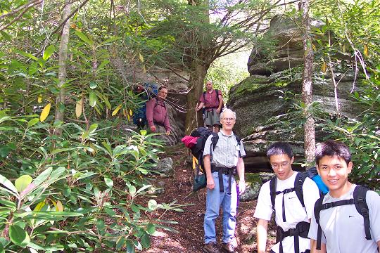
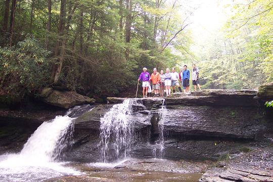
Name: Andrew Hike: Otter Creek-SE 10/24-26/14 Rating: 4 Critique: I organized this for the Mid-Atlantic Bacpackers meetup, and we turned it into a basecamp utlizing the big campsite 1.1 miles north of the Condon Run trailhead. It was a big flat site next to the creek that could accomodate all 8 tents. On Saturday we conducted as described on MrHyker's site, and it was gorgeous to say the least. Although foliage was a little past it's peak, there was some marvelous stream scenery and beautiful mature hardwood forest. My only warning would be that the Shaver's trail south of Mylius is a little hard to detect at times. My guess is this section of trail is a little less trodded. Although the wilderness area is not signed or blazed (I saw one sign at Hedrick camp, signage for Otter Creek trail at Condon has broken off) cairns still clearly mark intersections and change of direction. Enjoy this wonderful place. ________________________________________ Name: Sara Bird
Hike: Otter Creek - SE Loop ________________________________________
Name: Moonshine
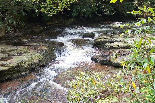
Hike: Otter Creek - SE A little below the intersection of Otter Creek, More Run and Possession Camp trails is one of the best swimming holes of the area. If you have water shoes, exploring Devil's Gulch creek bed can be fun. I wonder how this stream got such an unusual name. ________________________________________
Name: WVwanderer
Hike: Otter
Creek Wilderness SE Loop ________________________________________ |
|
|
