|
Torry Ridge-Mills Creek Loop |
|
|
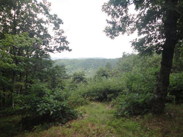
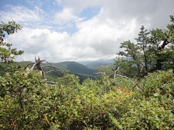
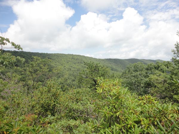
Description: This is a wonderful 15 mile overnight backpack in the George Washington National Forest. The mountain bikers and other volunteer groups keep both trails in excellent condition. The trail composition varies greatly: from smooth pine carpets to leaf mulch and sandy, somewhat rocky to having real ankle biters (especially where the trail crosses over the heads of talus slopes). The ridge walk offers several pleasant views while most of the �bottoms� hike is on an old woods road through a lush forest with good canopy. Mills Creek should nearly always be, at the most, an easy rock hop except in the worst of high water conditions. Approximately five crossings are required. There is one hard climb as you extract yourself from the valley � 1200 feet in 1.2 miles � with a sparse canopy. Most of it is aided by several well placed switchbacks but the last surge is all about you. You should enjoy this one. I know we did. Google Custom Driving Directions The hike starts at the Slacks Overlook Parking lot on the Blue Ridge Parkway. |
|
________________________________________ |
|
Zipped National Geographic. TOPO! GPS and Universal GPX Files GPS Text File for Non-TOPO! Users
|
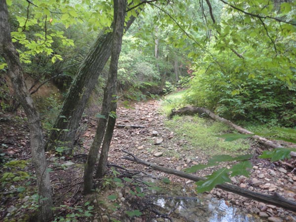
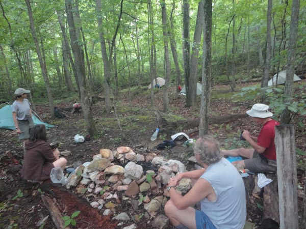
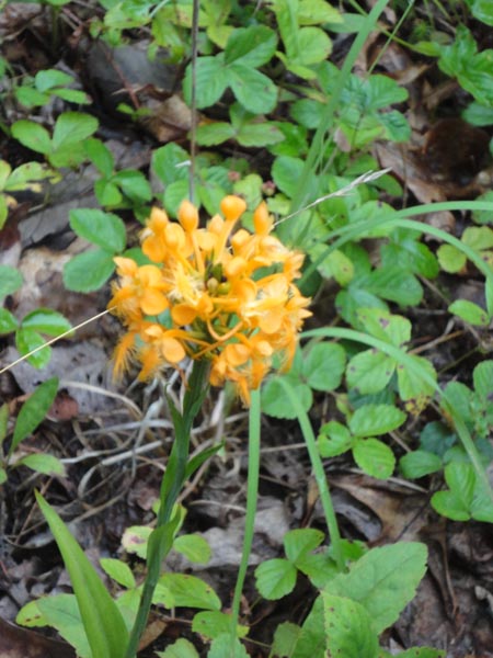
Trail Notes: As you look towards where the view used to be (or with your back to the parkway) take the spur tail to the left. It soon leads to the blue blazed Slacks Trail (not signed at this point). Turn left and follow it to its end at the Torry Ridge Trail in 0.7 miles. Continue straight ahead. The trail is marked mostly with blue plastic diamonds but you will also see an occasional yellow one. Keep a sharp eye out for window sized vistas on either side of the trail. You may have to push your way through some heath and stand on some rocks but they are there. In 2.6 miles arrive at the junction of the Blue Loop Trail on the right. If time, weather and desire permits drop your pack and descend 0.2 miles to a good view of Sherando Lake. Another view can be had from a talus slope along the main trail. At 1.0 mile from the last junction pass the junction with the northern terminus of the Blue Loop Trail. Turn left in 1.9 miles onto the Mills Creek Trail and descend to the valley floor. In 0.7 miles turn left on an old road and immediately cross a small intermittent stream. The trail follows it down to Orebank Creek where a rock hop of the same in another 0.8 miles finds you in a nice open grassy area with an old woods road crossing it. While this looks like a very useable campsite empty beer cans and other litter suggests that this spot is used by local partiers coming in from Coal Road. It�s best to turn left onto the road. In the summer you�ll pass beds of purple Knapweed, white Queen Anne�s Lace and orange Yellow Fringed Orchis. In 1.3 miles arrive at the first crossing of Mills Creek. Do not cross. Instead turn right, looking for a faint trail that leads down to a nice flat campsite with a large rock fire ring. There is a smaller, lesser used campsite up a spur trail on the left side of the main trail. The creek almost always has some water in it and is teeming with life - darters, crawfish and those funny surface walking water bugs. |
|
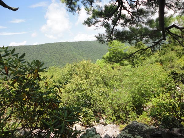
The next day cross the creek and continue a nearly undetectable climb up the valley on the wide woods road. You�ll cross the stream several times. At the last one the trail will turn abruptly away from it and begin a steep climb. In 1.2 miles reach the ridge line of Bald Mountain, a primitive car camping site and the southern terminus of the Mills Creek Trail. This is a good break spot if unoccupied as there is a great view and almost always a refreshing breeze blowing. Turn left onto dirt FR 162 and in 0.3 miles bear left at a triangle intersection. In another 0.1 miles turn left back onto the Torry Ridge Trail. The sign is set back off of the road to discourage vandalism. Over the next 1.2 miles you will experience the best views � and the rockiest trail � of the hike. The rocks end as you deftly climb down off of the last talus slope about half way back to the Slacks Trail. Turn right at this junction and retrace your initial steps of the trip back to your car. _______________________________________
________________________________________ Outing Critiques
Name: Meghan
________________________________________
Name: Privy Hike: Torry Ridge-Mills Creek Loop Date: 10/11/13 Rating: 3
Outing Critique: Thanks for the details on this hike. It is a great route with lots to see, if weather cooperates. We did not have great weather so most views were fogged out. Also, the hike out of the creek valley is very strenuous, so be prepared. Footing is rocky. The second campsite is in a great spot with a nice fire ring and creek access. ________________________________________ |
|
|