|
Upper North River-Bald Mountain Backpack |
|
|
Description: I scouted this hike in 2013 but hesitated publishing it because I wasn�t sure how hikers would feel about a two mile road walk either at the beginning or end of the hike. Then I realized that it would be extremely easy to set up a shuttle totally removing the road walk. I�ll provide driving directions as if it is a shuttle and leave it up to the hiker to decide.
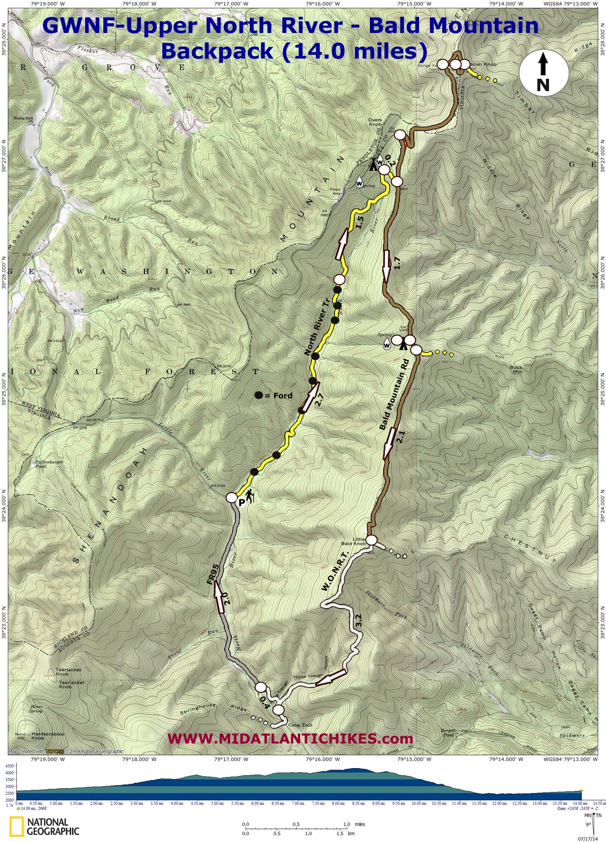
As described here the hike is 14.0 miles in length, including the road walk, with almost 2500 feet of elevation gain. That seems like a lot but note that it is stretched out over 8.5 miles (an average rate of ascent of 290 feet/mile). If hiking the seldom visited North River Trail (not to be confused with the North River Gorge Trail. See the W.O.N.R.T.-North River Gorge hike.) and its name sake headwaters isn�t enough reason to try this hike consider adding a 3.4 mile out and back packless hike to visit the astounding views from Reddish Knob. It�s a much easier approach than that described in the Reddish Knob hike. |
|
Google Maps Custom Driving Directions to the Southern Trailhead Directions from the Southern Trailhead to the Northern Trailhead
The lower trailhead has room for several vehicles while the northern trailhead has room for two maximum. Allow five minutes for the shuttle. ________________________________________ |
|
Zipped National Geographic. TOPO! GPS and Universal GPX Files |
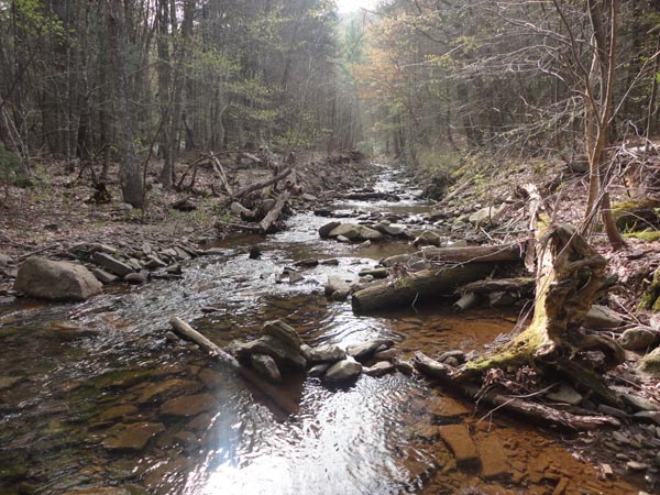
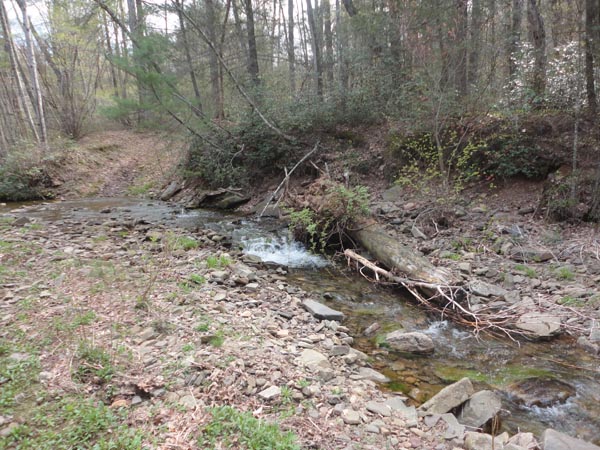
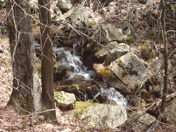
Trail Notes: There is no sign at the trailhead just south of the bridge but the trail is rather obvious as you have to walk over an earthen bearm and pass a primitive car camping site. The trail is an old logging road and easy to follow. The yellow blazes are faded but frequent. Over the next 2.7 miles you�ll cross the river eight times as it passes through alternating hardwood and hemlock forests. It is much narrower and shallower than further downstream. After the last ford the trail veers away from the river and joins another gated road. Initially the climb is steep but soon moderates. Ignore any trails to the left. Eventually the trail degenerates into a footpath. In 1.5 miles the trail descends back to the river, now a small brook. It takes one wide step to get across it. If you wish to camp near this reliable water source turn around and walk up a short hill to a pretty wide open clearing. If the stream is dry there is a piped spring further up this trail near dirt Shenandoah Mountain Road.
From here it is an easy 0.2 miles to dirt Bald Mountain Road. If you wish to complete the Reddish Knob side bar stash your packs in the woods and bring your valuables, water, snack and camera with you. Use the trail notes in the previously sited hike. To continue the base hike turn right onto Bald Mountain Road. You�ll pass several wildlife clearings suitable for camping but they have no water source. You will also pass a memorial to a woman who froze to death on the mountain. In 1.7 miles arrive at a large clearing to the right marked by a large maple tree with limbs that would making hanging a bear bag easy. In the back of the clearing is an overgrown trail that leads towards a reliable spring. The trick is finding the spring since it has, as often is the case with springs, decided to relocate itself. I�ve provide the waypoint that marks its exact location. (Thanks Bob H.!)
Shortly after this clearing the road descends through another clearing (This one sloping and not suitable for camping.) with the junction with the Buck Mountain Trail on the left. Continue along the road for 2.1 miles arriving at the junction with the white blazed Wild Oak National Recreation Trail. |
|
Turn right and follow the rocky footpath as it descends towards North River. During periods when the leaves are not on the trees keep an eye out for views of the surrounding mountains especially of Big Bald Knob to the south. In 3.1 miles turn right onto a high water trail. (Crossing the river here adds more to the road walk and might be treacherous during high water periods.). Arrive at the southern parking area in 0.4 miles, crossing Horse Trough Run along the way. If you didn�t park vehicles here turn right onto gravel North River Road and walk 2.0 miles back to the northern parking area.
________________________________________
________________________________________ |
|
|