|
Gambrill State Park |
|
Description:
I'd like
to thank Tim Ryan of the Howard County, MD Sierra Club for showing
me this trail system.Gambrill State Park is a narrow 1100 acre tract of land 6 miles west
of Frederick, MD that straddles the Catoctin Mountain Ridge. It is
popular with hikers, mountain bikers and equestrians alike. Some of
the fifteen plus miles of trail closely follow the park road. This
moderate 7.9 mile loop limits this while at the same time allowing
the hiker to visit all three vistas. The trail blazings are quite
complicated. All trails, except the Catoctin Trail, are loops of
varying sizes. At times the tread might be shared by 2, 3 or , for a
very short segment, 4 trails, each possessing its own color. Each of
these blazes will be painted on the trees. The map shown here has
each trail segment colored to match what you'll see on the trail.
The hike starts at the first parking area on the right. If this is full proceed to the next parking area (on the left) at the Nature Center/picnic area. Should you have to park at the upper lot start the hike from the Middletown Overlook and proceed in a counter clockwise direction.
|
|
_______________________________________ |
Zipped National Geographic. TOPO! GPS and Universal GPX Files |
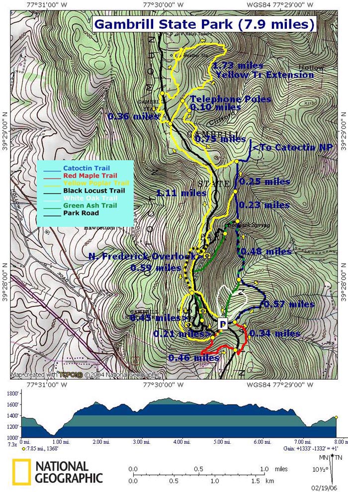
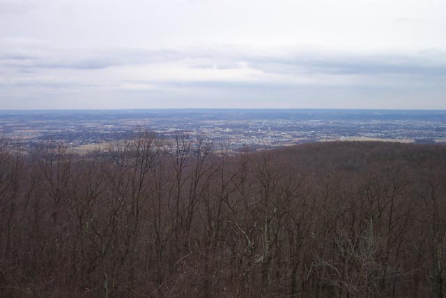
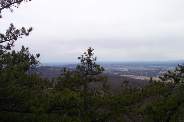
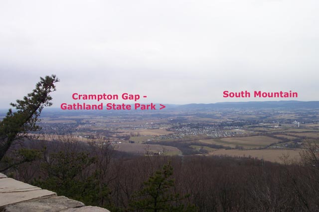
Trail Notes: From the kiosk at the lower lot turn right (south) onto blue/black Catoctin/Black Locust Tr. Soon pass Red Maple Tr on the right. In 0.57 miles the Green Ash Trail will come in from the left. Trail will be blazed blue, black and green. Climb for 0.48 miles. The Green Ash and Black Locust Trails will leave to the left. Stay straight on all blue Catoctin Trail. In 0.23 miles Yellow Poplar Tr will come in from the left. Trail will now be blazed blue and yellow. In another 0.25 miles the Catoctin Trail will bear right. Bear left on Yellow Poplar Tr. The trail will be blazed in yellow only. In 0.75 miles turn left onto a telephone line swath. In 0.1 miles arrive at the junction with the Yellow Poplar Tr Extension. If you want to shorten the trip by 2 miles turn left and pick up the directions later. To complete this loop as described turn right onto the extension. (Note: there is a sign saying the extension adds 3.0 miles to the circuit. This is incorrect. GPS data measures the distance to the continuation of the old trail at 2.2 miles.) In 1.73 miles cross the park road. In another 0.36 miles (and close to the park road) rejoin the old Yellow Poplar Tr as it comes in from the left. In about 1.11 miles come to the junction with the Black Locust Tr. Turn left and cross the park road to visit the North Frederick Overlook. It will be to the right a bit. You'll cross another section of Yellow Poplar Tr as you go and come back. As you return from the overlook continue South on Yellow Poplar/Black Locust Tr (Black and yellow blazes) for 0.59 miles. You might be able to see the Nature Center on the left as the trails split. Stay left on the Black Locust Trail to the picnic area and Middletown Overlook with a broad view of the town by the same name and South Mt which carries the AT through Maryland. Another vista, South Frederick Overlook, is across the picnic area loop. |
|
In 0.45 miles from the last trail junction make a sharp right turn onto Green Ash/Black Locust Tr (Green and black blazes). Descend through switchbacks to a 4 way junction. Yellow Poplar trail comes in from the right. Yellow Poplar, Black Locust, Green Ash and Red Maple Trails continue to the left. If you want to shorten the hike turn left and in 0.2 miles arrive at the Park Rd and your car(s). For this hike continue straight onto the Red Maple Trail. Skirt the Rock Run camping area and in 0.46 miles from the last trail junction cross the Park Rd. The trail turns north and in 0.34 miles ends at the Black Locust/Catoctin Tr that you began on. Turn left and soon return to your vehicles. Printable/Downloadable Directions and Trail Notes ________________________________________
________________________________________
Name: Adventure
Runner
Hike: Gambrill State Park ________________________________________
Name: Dustin Hike: Gambrill State Park
Date: Almost
Every Weekend in summer
Rating: 4 ________________________________________ |
|
|