
| Allegheny Front Trail - West Loop |
|
|
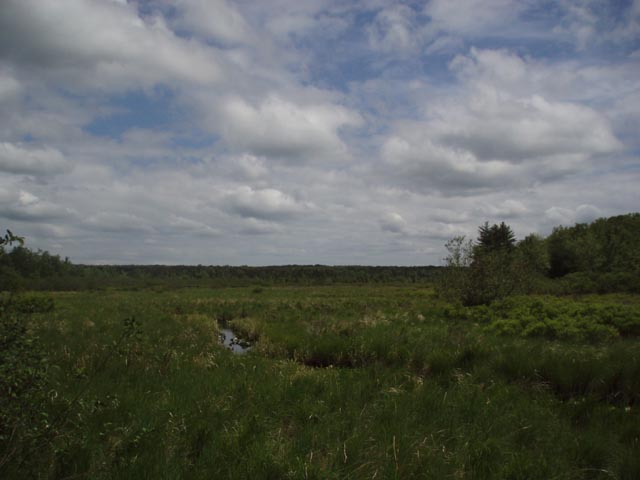
Description: This is the Western sister of Allegheny Front Trail - East Loop described elsewhere on this site. It is a moderate 31.5 mile backpack trip utilizing the trail systems of the Black Moshannon State Forest and Park of Pennsylvania. Several years ago Ralph Seeley came up with the idea of developing a trail that would circumnavigate the entire Black Moshannon Forest. The route would traverse approximately 40 miles of trails transporting the hiker through mature hardwood forest, sections struggling to recover from past cuttings, beautiful trout streams, scenic vistas, Pine plantations, Rhododendron thickets, Hemlock groves and finally, the bogs of Moss-Hanne. To provide variety and shorter routes the Moss-Hanne and Shingle Mill Trails would be added as cross connectors right through the heart of the state park. Volunteer trail building crews from all across PA were assembled. In 2003 the project, now known as the Allegheny Front Trail, was completed. The skill, effort and engineering that was required to make this happen is akin only to that found in the beaver that constantly change the topography of this fantastic hiking venue.This outing starts in the center of the park, follows the Shingle Mill Trail north to pick up the Allegheny Front Trail (AFT) which is then followed in a counter-clockwise direction to re-enter the park on the Moss-Hanne Trail which is then followed back to the starting point. |
|
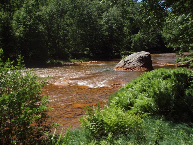
I break the trip down into 3 days. Day 1 is mostly walking along beautiful streams and creeks with one challenging climb before descending to �The Big Red Mo�, a named derived from the precipitated iron minerals due to acid leaching from local coal mines. The focal point of day 2 is Scenic Six Mile Run and its surrounding plateaus. Day 3, as with the Eastern variant of this trek, features a relatively easy romp through the bogs and swamps of Moss-Hanne. The stone bridges and long boardwalks make this segment a pleasure. Immediately turn onto Julian Pike. Mooring area #1 is immediately on the right. Drive approximately 0.25 miles to Ranger Station and inform them of your intentions. If they are closed leave a note with vehicle description and tag#, persons in your group and emergency contact info under the office door. Return to mooring area #1 and begin the trip.
_____________________________________ |
|
Zipped National Geographic. TOPO! GPS and Universal GPX Files |
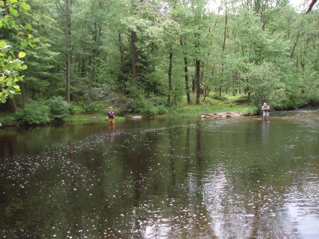
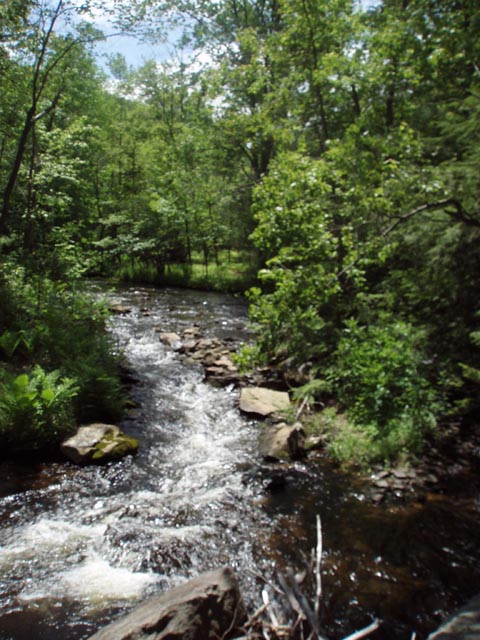
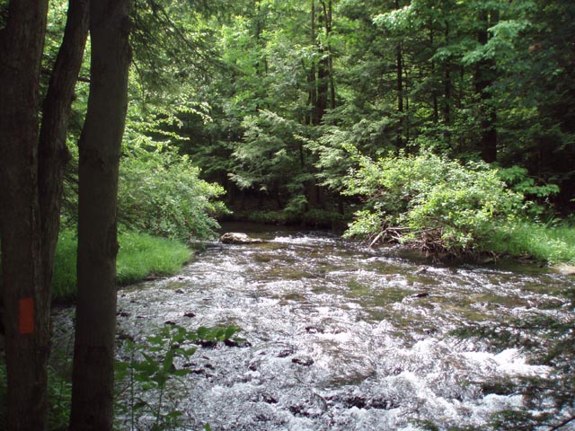
Trail Notes: All trails are signed and blazed. There are a couple of woods roads (active and inactive) that are crossed and noted in this description. AFT sign posts with pertinent distances are installed at every road crossing. Feel free to start/end this hike at any of these locations keeping in mind water sources, camping areas and park camping policy. Park policy asks that hikers not camp within a mile of the park boundary. For this outing the northern limit is Huckleberry Road. The south-western limit is about I mile before Shirks Road. Day 1: From Mooring Area #1 proceed north on Julian Pike. Cross Rt 504 and follow Black Moshannon Rd for 0.42 miles. Turn left onto a gated service road. Cross Black Moshannan Creek on a bridge and immediately turn right onto blue blazed Shingle Mill Tr. At 1.72 miles from joining the Shingle Mill Trail cross Huckleberry Road. Although all of Shingle Mill Tr is beautiful the best part is the section north of Huckleberry Rd. Note the campsites marked on the map. In 1.83 miles from Huckleberry Rd join the yellow blazed AFT. Turn left. Climb steeply for 0.44 miles. Cross an active gravel road. Shortly arrive at a cabin access road. Turn right here and pass a stone cabin on the left. The road becomes grassy beyond some boulders blocking the way. Follow the road to a �T� intersection with another grassy road that borders a clear-cut area. Turn left here. In about 0.18 miles, just beyond a double blaze, make a sharp right turn onto another grassy road. In about 0.14 miles the road will split. Take the left fork and descend towards Red Moshannon Creek. In another 0.25 miles, as the grassy road continues, veer to the left onto a footpath. There will be double blazes on a tree but they might be hard to spot. As you reach the creek continue upstream. In 0.84 miles a side trail goes off to the left and seems to come down in another 0.35 miles. Ignore it. In another 0.92 miles you will cross Tark Hill Run, climb over a hill and then descend steeply to a trailside campsite. This area can hold several tents. The water from Red Mo is potable upon filtering or boiling but has a rusty taste. The best water is in the stream you just crossed. You will either have to climb back over the hill or bushwhack down the creek to collect it. |
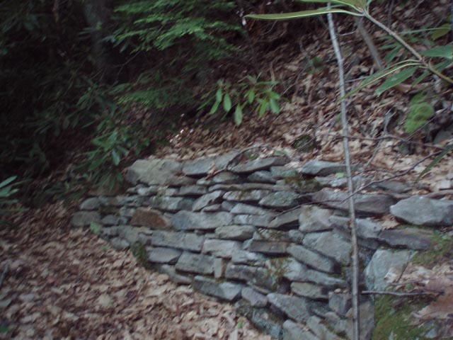
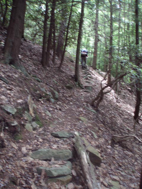
|
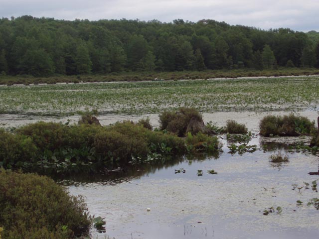
Another option is to continue on, through what appears to be an old logging camp, for another 0.55 miles to Sawdust Run. Instead of crossing the run turn right onto an old woods road that leads down to the creek. Just before reaching the creek, cross the stream. There is a nice spot tucked under the Hemlocks and Rhododendron that can hold several tents. I don�t think there is a fire ring but you are right on a good stream. This is the second tent icon along that trail segment on the map. Day 2: Begin the day by veering away from the Big Red Mo and climbing steeply, up and over a ridge. At the top, if you wander off of the trail to the right you�ll find a good view of the creek. Descend again to parallel the creek for a bit longer. At 1.2 miles from the last campsite arrive at Casanova (AKA Munson) Rd. Turn right and walk for a few yards on the road before turning left onto a footpath. Climb up a small rocky ridge and descend into Six Mile Run Drainage. There is a very large campsite here and might be another option for day one�s camp if you were up to the mileage. Note though that there is a spur trail that leads back to the road and a parking area thereby making this site pretty accessible to fishermen and hunters. Turn left (upstream) and in another 0.25 miles pass another viable campsite. I don�t recall a fire ring but, as with most sites on this trek, is nestled among the Hemlocks and Rhododendron and has a carpet of Hemlock needles for padding. During the next 2.5 miles you will alternate between walking along the stream and climbing up and over steep but short stretches of sidehill trail. (Take note of the cribbing and stone steps installed by the trail crews. A lot of work went into this section of trail.) You�ll pass a couple of more potential campsites along the way. At the end of this section cross Rt504 and then a wooden bridge over a feeder stream that leads to an A-frame home. Turn left here and switchback up to a railroad grade/woods road which follows the run but from high above it. In 1.27 miles from the road, cross a gas line right-of-way. In another 0.37 miles the trail splits. Take the right fork. In another 1.19 miles pass a small trailside campsite w/fire ring. You are close to the run at this point but the bank looks pretty steep. In another 0.45 miles reach Clay Mine Road. Turn right here and cross Six Mile Run on a bridge. Turn right onto Six Mile Run Rd but in a few steps turn left into the woods on a footpath. Climb steeply at first. The grade becomes more gradual soon. Over the next 2 miles you�ll traverse open woods. There are a couple of places where the trail is �iffy� but the blazes are there. The trail will make a sharp left turn and follow a mostly dry stream bed for about 1.0 mile before veering away from it and descending to Six Mile Run where it will then turn right and follow the run upstream. In about another 0.5 miles pass a cabin and pond on the left. Cross the access road to stay on the trail. Cross Six Mile Run Road and pass the always interesting Wolf Rocks. In 0.63 miles from the last road crossing descend to Six Mile Run again. You could possibly camp here but if you turn right (upstream) and walk another 0.13 miles you�ll find a relatively nice campsite with a fire ring suitable for about 6 tents. The next good campsite is about 2.5 miles away. This is a good place to call it a day. Day 3: Continue east on the AFT. It will soon join a wide, grassy gas line right-of-way. Cross Six Mile Run on a wooden bridge for the last time and climb a gradual hill. Shortly after passing a couple green pipes coming out of the ground on the right turn left onto a footpath (0.68 miles from camp). In a couple of hundred yards arrive at dirt Wolf Rock Road. Turn left here. In 0.41 miles the road splits. Bear right and in a few steps turn right off of the road onto another footpath. In another 0.93 miles cross Clay Mine Road again. In about 0.48 miles the trail cuts through a couple of Hemlock Groves along the headwaters of Black Moshannon Creek. You can put several tents in each but I don�t recall seeing any fire rings. These are the last viable places to camp before entering the 1 mile park restriction zone. From this point on camping is not allowed. In another 1.25 miles reach Shirks Road. Turn right and cross Black Moshannon Creek on a bridge. In about 100 yards turn left onto a footpath. You are now in Black Moshannon State Park. In 0.71 miles arrive at the junction of Moss-Hanne Tr (Blazed with orange triangles). Turn left onto it. The Moss-Hanne Trail is a mix of foot path, old woods roads, rock bridges and wonderful boardwalks. In another 1.02 miles (After crossing the first of several boardwalks) cross the apparently abandoned Airport Trail. In another 1.28 miles cross a small backwater. Here the trail goes un-blazed to the left into a Pine plantation and to the right (blazed) towards the lake. Turn right here. In another 2.09 miles join the Indian trail that comes in from the left. Turn right, following the duel blazes for 0.25 miles (orange triangle and red circle). The Indian trail will turn left. Continue on the Moss-Hanne Trail to it junction with the Bog Trail (Starts as a gravel road) in another 0.43 miles. Turn right onto the Bog Tr and follow the boardwalk around to the launch ramp on West Side Road. Turn right onto West Side Road and in 1.21 miles arrive back at Rt 504. Cross the bridge and return to your cars. Printable/Downloadable Directions and Trail Notes ______________________________________
______________________________________
Name: Jason Dashbach Hike: Allegheny Front trail -West Date(s): 11/22-23/14 Rating: 4
Critique: A friend and
I completed this hike the weekend of 11/22/2014. We started Saturday
morning and finished up Sunday. We followed the trail notes and went
counter clockwise as recommended. The notes were, as always, spot on and
the trail is very well maintained with wooden signs/posts at all the
intersections. Navigation is definitely not an issue on the AFT with how
well it is currently being maintained.
______________________________________
Name: Shortstack and Wooly Bully Hike: Allegheny Front trail-West Date: 08/02-04/14 Rating: 4
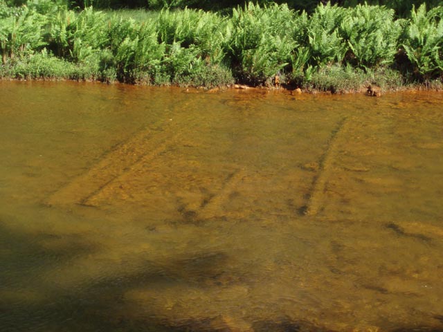
Outing Critique: DAY 1: After checking in at the park office, we parked at the "upper lake lot", and proceeded north on the Shingle Mill Trail. The trail follows the Black Moshannon Creek. Even with the dark tea-colored water this creek provides for a great walk, with lots of twist and turns, some deep pools, and lots of rhododendron, Cardinal Flowers, and Joe Pye Weed along the banks. The large flat rock at around 3 miles makes for a great lunch spot. Farther along the trail we saw a dark, mucky spring with a few spots of contrasting white sand jetting out from the bottom. Moving sand this fast requires a substantial flow of water. At the end of the Shingle Mill Trail the AFT heads west, thru an active logging zone, past some overlooks of the I-80 viaduct, and then down to the bank of the Red Moshannon. We continued along the "Red Mo" to Sawdust Run, but couldn't locate the "DAY 1 campsite". No evidence of a road to the right leading down to the Red Mo. We found a pretty good tenting area around 0.1 miles past the run, on the left side of the trail, complete with a big flat rock for cooking and a conveniently located fallen log. 10.1 miles for the day. DAY 2: The day started with steady rain. At 6:30 the rain tapered off enough to let us cook breakfast and enjoy the wood thrush song , but then picked back up before we could break camp. We took advantage of the next lull to pack up our wet gear and head out along the AFT, in heavy rain at times. Six Mile Run made for a scenic section of the trail. The relatively consistent width and slope of the creek bed make it appear man-made in places, but the deep pools and fast flowing water made it very scenic. Lots of wood thrush song in the background, and some high pitched �screams� from the treetops. Possibly porcupine calls? The trail veers away from the creek, thru some pine plantations, and past Wolf Rocks. Aside from a geologist's dream of impressive scale, rounded edges, layers, slots, and overhangs at Wolf Rocks, there was an equally impressive mound of porcupine scat under one of the rocks. Upwards of 1/2 cubic yard, enough to demonstrate the angle of repose! At 13.5 miles for the day we stopped at a campsite under the hemlocks. Set up camp, waited out some more heavy rain, and turned in at 8:30. Lots of mourning doves, and a brief appearance by a whippoorwill. DAY 3: No rain! A few miles on the AFT, and then on to the Moss Hanne Trail. Great views from the extensive network of boardwalks over the marsh. Water lilies, cat tails, and blueberries! Lots of grazing along this section. Also saw some bushes that looked like blueberries but had red fruit. More wood thrush song, that same bird must be following us around the loop. Continued northward, thru more pine plantations, over a drier marsh area with expansive views, and then along the lakeshore back to the car. Blazing and signage made it pretty easy to stay on track. Over three days we saw no other backpackers on the trail. Just one trail runner, and then one family along the boardwalks. Even after factoring out the rain, the AFT-West was OK but not as nice as the other side of the loop, the AFT-East.
______________________________________
Name: Steve H
Hike: AFT West, Dam to Munson Rd ______________________________________
Name: Steve
Hike: Allegheny Front Trail - west loop ______________________________________
Name: Gregory St. Clair
Hike: AFT, Western Loop ______________________________________
Name: MikerTheHiker
Hike:
AFT-West ______________________________________ |
|
|


