
|
Big Run Loop Trail Circuit |
 |
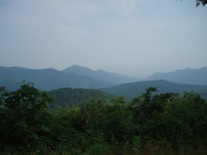
Description: First, forgive me for not
having more photos posted for this hike. This is not meant to
imply that this is a "less than worthy hike". When I scouted
this circuit I combined it with the
Doyles River Loop described on this
site. After the starting point at the vista I put the camera
away until I reached the waterfalls of the above mentioned hike.
While there are no cascading falls or grand vistas this is, none
the less, a very rewarding trek. This has got to be some of the
healthiest forests in the park. There was no sign of blight or
fire anywhere. The trail takes you deep into a a hollow though a
series of long switchbacks to the point that you don't realize
you'll have to climb back out some 1000 feet in elevation to get
back to the top. It's also a route that apparently isn't heavily
traveled so you can expect some solitude throughout the course
of this 5.9 mile moderate loop except for the portion of the AT
that is part of the Doyles River loop.
Special Note: Google Maps and other on-line mapping programs might suggest you use old fire roads that are no longer accessible by automobile. Use a real map to confirm your route. This trailhead is just south of Mile Post 81 on Skyline Drive. Additional parking is just north on the opposite side of the drive at the Doyles River Trailhead Parking Area. |
|
________________________________________ |
|
Zipped National Geographic. TOPO! GPS and Universal GPX Files GPS Text File for Non-TOPO! Users
|
Trail Notes: From the overlook find the break in the stone wall with the trailhead post for the Big Run Loop Trail and a kiosk. Descend via a series of very long switchbacks. For a while you will be walking on a relatively flat intermediate ridge line. While it falls away from either side of the trail you can sense larger ridges around you. At 2.32 miles from the beginning cross the headwaters of Big Run and climb steeply a short distance to the southern terminus of the yellow blazed Big Run -Portal Trail. A short distance to downstream and to the right of this trail is a "No Camping" sign. This used to be the site of a shelter. To explore more pools along the run you can hike down this trail. TO complete the hike as described walk through this junction. You will still be on the Big Run Loop Tr but it will now be blazed yellow (Open to equestrians). In a hew yards the trail will make a hard switchback to the left and begin a long, steady climb along the side of a hill. As you approach the top the trail will again switchback. In 1.33 miles from the last trail junction arrive at a 4X trail intersection. To the right is the blue blazed Rockytop Trail. Straight ahead is the yellow blazed Madison Run Spur Trail. To the left is the continuation of the Big Run Loop Tr (Now blazed blue agai.). Turn left onto it. The climb is a lot more gradual here. In 0.65 miles reach the junction with the AT. Turn left onto it. In 0.35 miles cross Skyline Drive. Soon you'll walk through the Doyles River Overlook with views of that drainage. In 1.20 miles from the drive crossing come to the intersection with the Doyles River Tr. Turn left onto it and in a few yards arrive at the Parking area for that trailhead. Turn left and walk down Skyline Drive to your starting point. |
|
________________________________________
Name: Siva
Srikanth
Hike: Big Run Loop Trail ________________________________________
Name: Richmond
Hiker
Hike: Big Run Loop Trail ________________________________________
Name: Natasha
Hike: Big Run Loop Trail MRHyker Note: Oops! My bad! That was the waypoint for the Doyle River Loop trailhead I did on the same day. It's fixed now. ________________________________________ |