| Pocahontas - Fork Mountain Backpack |
|
|
Description:
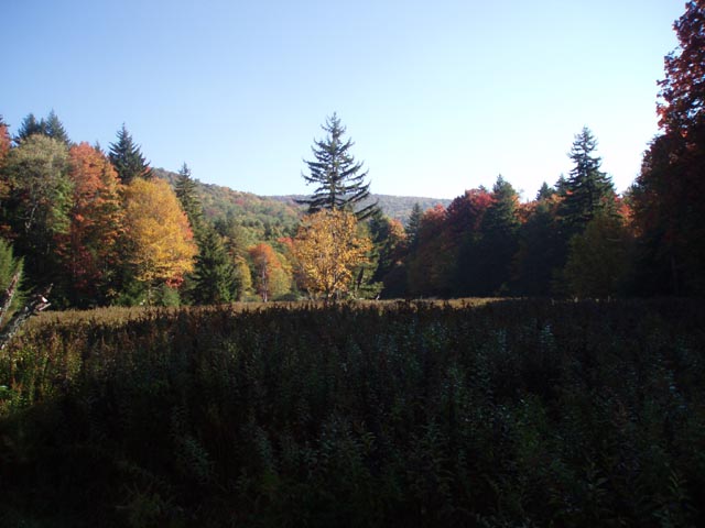
I consider this to be a low end strenuous 32.7 mile backpacking
trip using sections of two of the longest and least used trails
in the Gauley Ranger District of the Monongahela National
Forest. I think this is why this circuit appeals to me. Four of
us hiked it over a Columbus Day weekend and, except for the
scenic Falls of Hill Creek (Yes, you can drive to it.) and a
primitive car camping site near the beginning, we saw no other
people. There are a couple of nice vistas (one created by a huge
logging clear-cut) on the Fork Mountain leg of the trip and the
aforementioned Falls of Hill Creek. The main allure has to be
the solitude over so many miles of walking through dense mixed
forest. Along the way you will pass through/around some huge
boulder fields, some resembling castles or forts. The downside of this trek is some road walking required to close the loop. The beginning isn't too bad, only 1 mile, give or take, as you leave Summit Lake but at the end of the trip you have to hike 2.5 miles up Summit Lake Road. |
|
This can be
remedied by turning the trip into a shuttle, leaving one car
at the Pocahontas trailhead and the other at the western
terminus of the Fork Mountain Trail where Rt39 crosses the
Cherry River on a bridge. This might
lengthen the trip by a couple of miles and you may have to
adjust your campsites accordingly but you won't have to walk
on any roads and you'll lose a significant amount of
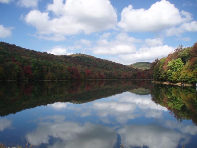
elevation gain. Notes: There is only one semi-established campsite on this loop but lots of places to pitch your tent. There is ample water sources between the beginning of the hike and the Falls of Hill Creek area. There are some seasonal springs (marked on the map) on Fork Mountain. The most reliable water source on this segment is about a 0.75 to 1.0 mile walk down the steep Big Run Trail. Plan your route accordingly. North Bend Picnic Area is for day use only. If you park there overnight your vehicle may be vandalized or towed. Park at the Summit Lake launch ramp area. ______________________________________ |
|
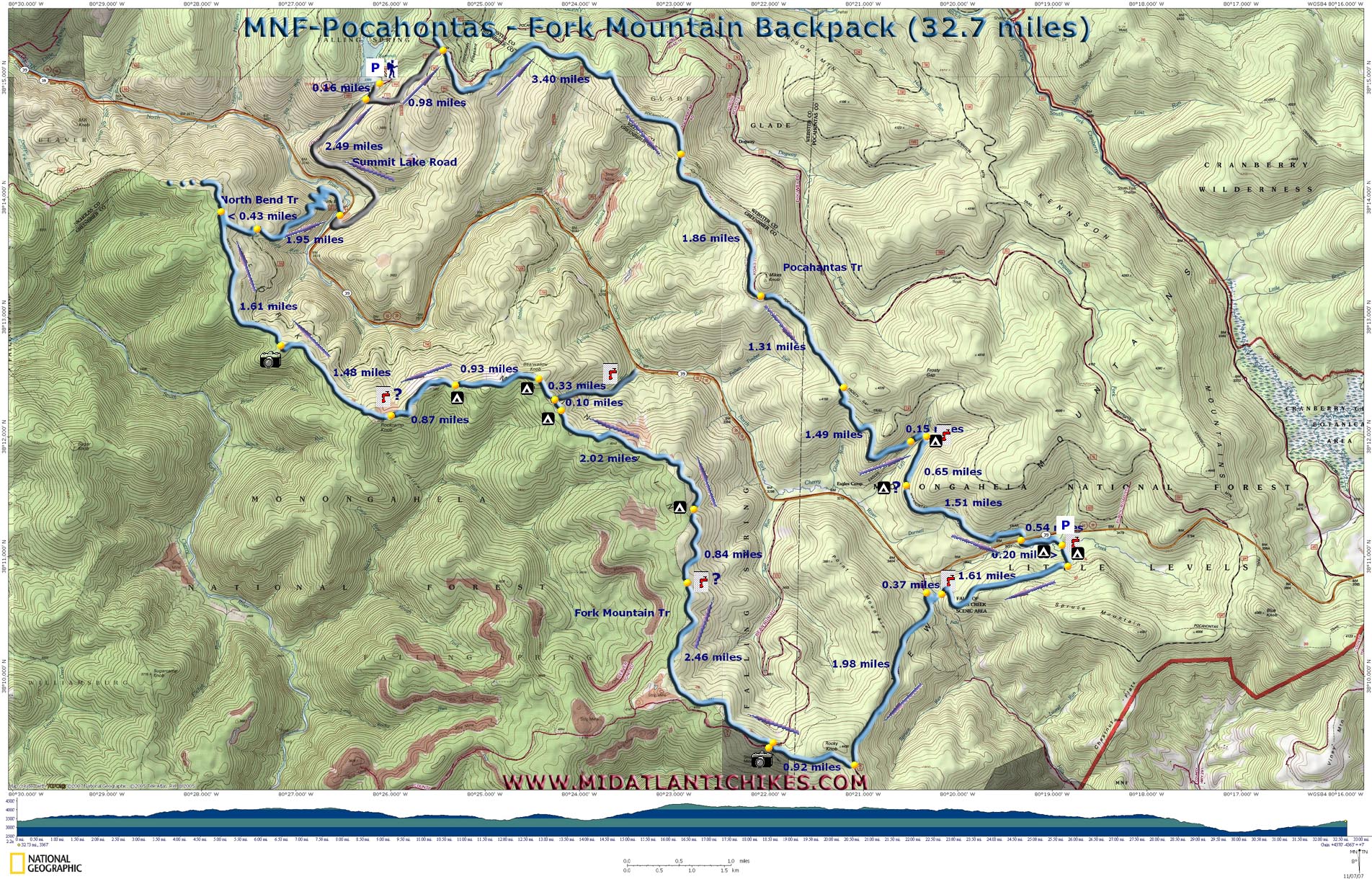
Printable/Downloadable Map (11X17 best) Zipped National Geographic. TOPO! GPS and Universal GPX Files |
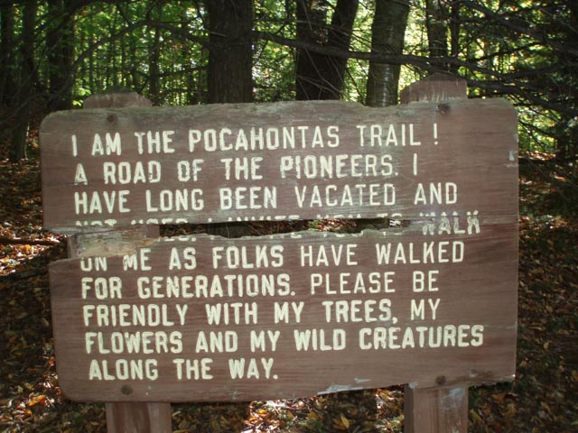
Trail Notes: All trails are blazed with blue plastic diamond. Trail junctions are signed.
From the Summit Lake parking area walk down the entrance road for 0.16 miles. Turn left onto a gravel service road. In 0.98 miles reach a grassy area and another woods road coming in from the left. Continue straight ahead a few more yards and turn right onto the Pocahontas Tr. For the rest of the hike you will be hiking through a mixed hardwood forest with beautiful stands of Red Spruce and Hemlocks. In 3.40 miles merge onto the wide and grassy Pocahontas Road which comes in sharply from the left. continue straight (south-east). The section is maintained in this form for vehicular access to a monitoring station on Mikes Knob.
You'll come to the base of Mikes Knob in 1.86 more miles. It's an open grassy area with an old sign post. There is another grassy road to the left that climbs to the top of the knob. We checked it out and there are no views there. Continue straight and in 1,31 miles pass the junction with Frosty Gap Trail on the left. |
|
In another 1.49 miles you will descend into the Left Branch drainage. Eagle Camp Trail comes up on the right from Rt39 here. In 0.15 miles arrive at a bridge with a small, semi-established campsite. You can tell it is not often used. If doing the circuit as described this is a good place to call it a day.
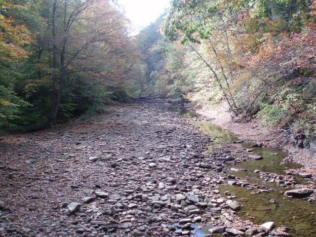
As you continue on you'll quickly cross another bridge and in 0.65 miles walk past a boulder field. To the right (downhill) and behind the boulders there is a nice knoll covered with Hemlock that looks like a good place to pitch some tents. There is a seasonal spring/stream a few yards further down the trail. Over the next 1.51 miles you will descend and cross RT39. Although it is close to the highway there appears to be some good camping areas between here and just beyond the crossing of Hill Creek. Shortly after crossing the creek on an old bridge you will bear left onto an old woods road and climb to the junction of the Fork Mountain Trail. Turn right onto it and in 1.61 miles ford the creek just above the first waterfall and arrive at a paved trail. If time, endurance and water conditions allow consider hiding your packs and take the tour of these beautiful gems. (Be prepared for a lot of boardwalk and steps as you descend into the gorge, remembering that you have to climb back up.).
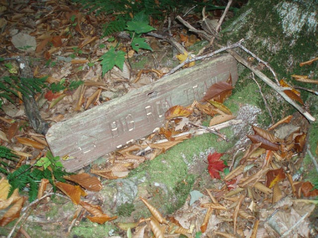
To continue follow either the paved trail or a gravel one that cuts across the other in a couple of places to the parking area. Here you will find latrines. Turn left and walk to the back of the parking lot and pickup the continuation of the Fork Mountain Trail. There is no sign but it is an obvious old woods road. This begins the hardest climb of the trip. In 1.98 miles and after climbing over numerous erosion dams you'll reach a gravel road. The trail makes a hard right just before it but I think somebody removed the sign and blazes because we couldn't find it on this end. If this happens to you simply turn right onto the gravel road. In 0.92 miles arrive at a 4X intersection. To the left is a nice panoramic view. To continue on turn right here onto Bear Run Road (CO 223) and in a few steps come to where the trail crosses the road. It is signed and blazed at this point. From here until you leave the trail at the North Bend Trail you are literally on the ridge of Fork Mountain. Parts of the trail might be overgrown with a short, thin understory but there seems to be a greater frequency of blazes in these areas. You will have to decide where you hope to get water and where you want to camp. The first possible water source is a spring flowing across the trail at about 2.46 miles from the road. It looked pretty doable when we were there. You might have to dig a sump to collect the water. In another 0.84 miles you'll reach a relatively flat area with a rich canopy of evergreens that can hold some tents. In another 0.1 miles there is an old grassy woods road that leads to the forest boundary with signs for a hunting club. This is the last viable camping spot before the Big Run Trail which is 0.1 miles further down the trail. There is reliable water in Big Run but you might have to hike downhill between 0.75 and 1 mile to get to it.
In another climb up and over Bearwallow Knob where you will find more potential camping on the left. In another 0.93 you'll find yourself on a bit of a plateau with good flat ground all around you. There are 2 springs/seeps 0.87 miles further along the trail. We found rolls of landscaping cloth at both of them. It seems as if someone, perhaps the forest service, are attempting to construct pools here. The last one has the remains of a demolished bridge/boardwalk piled up by it. These are the last water sources along the ridge.
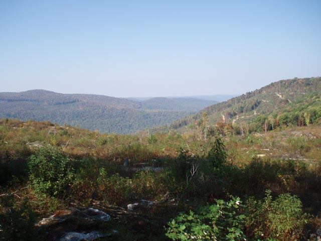
In 1.48 miles from the last water source the trail follows the edge of a clear-cut. We had to work around some large blowdowns in this area. To the left is a nice view. It's even better if you climb up on the rocks to the left of the trail. In 1.61 miles from the clear-cut arrive at the junction with the North Bend Trail. It is a signed and blazed old woods road. Turn right and in 0.43 miles arrive at a gravel service road. Turn left here and walk up to its end. Turn right onto the signed and blazed continuation of the North Bend Trail which will once again become a woods road. In 1.95 miles cross a footbridge over the Cherry River and arrive at the North Bend Picnic Area. Turn right onto RT39 and in a few yards turn left onto Summit Lake Road. In 2.49 miles arrive back at your car. ______________________________________
______________________________________ |
|
|