|
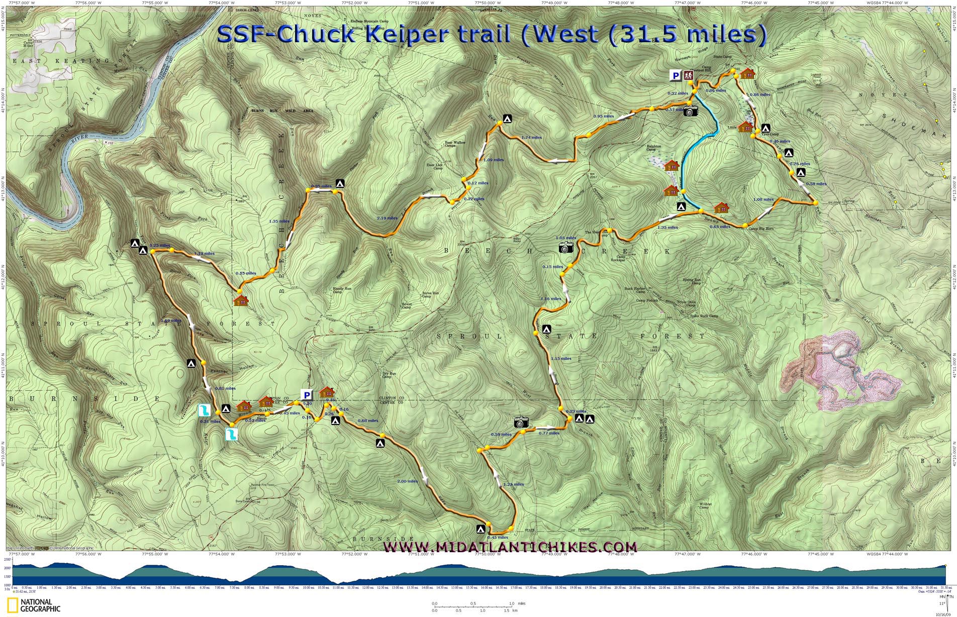
Chuck Keiper Trail - West |
|
|
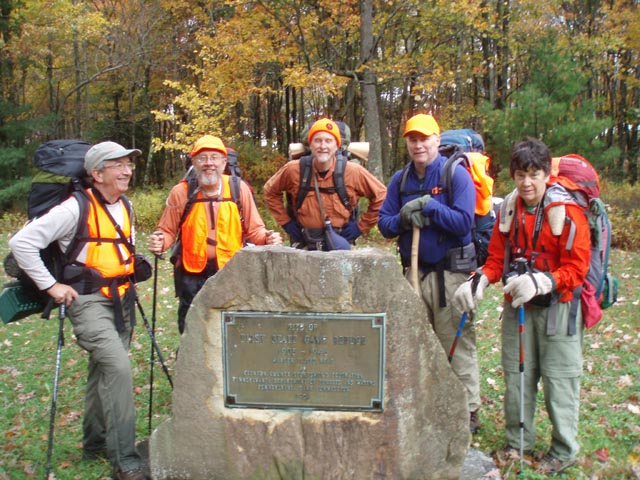
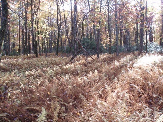
Notes: Special thanks to Scott Adams of WWW.PAHikes.com for recommending the Yost Run campsite for our first night, to Jeff Mitchell, author of �Backpacking Pennsylvania - 37 great hikes�, Jon Wiborg and others on the Backpacker.com Forums for their insight on camping opportunities for our second night. The map provided by the Forest Service and some descriptions of this loop show the initial 0.57 miles of the main trail and final 0.86 miles of the Connector Trail being on Rt144. These trail segments have been moved off of the road. Description: This trail, located in the Sproul State Forest, PA, is named after Charles Keiper, a dedicated conservationist and wildlife law enforcement officer. The entire loop is 52 miles in length but can be divided into a 31.5 mile western and a 23 mile eastern loop. The East Loop is described elsewhere on this site. The western loop is described here. While not quite as scenic as the Black Forest Trail the CKT is still a quality trail with a variety of environs including hardwood forests, highland bogs and swamps, Hemlock glens with pretty streams coursing through them, White Pine plantations and nearly bald plateaus created by the ravages of man (fire and logging). The tread is a mixture of footpaths, railroad grades and old logging roads. |
|
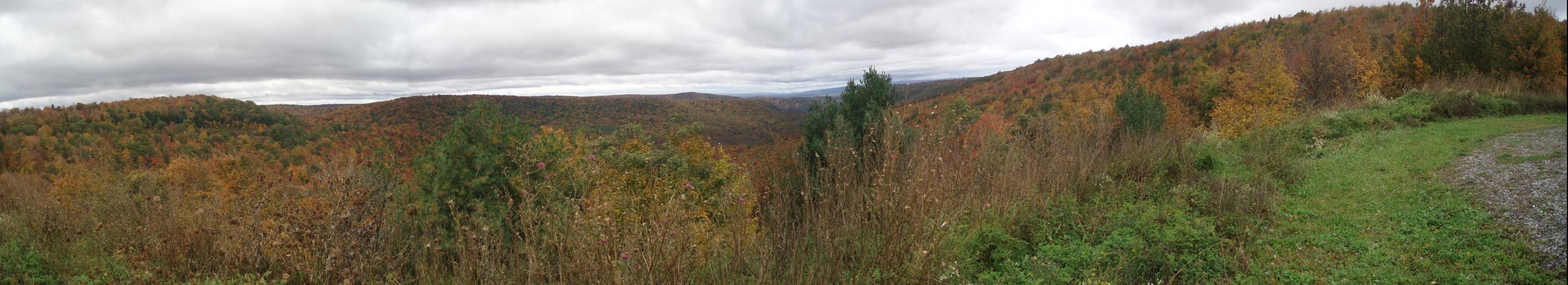
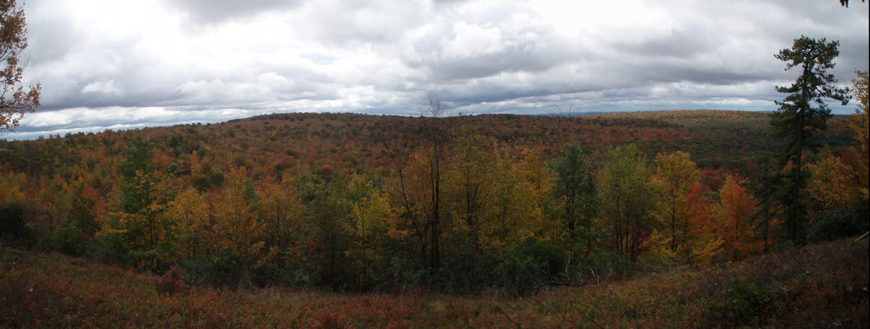
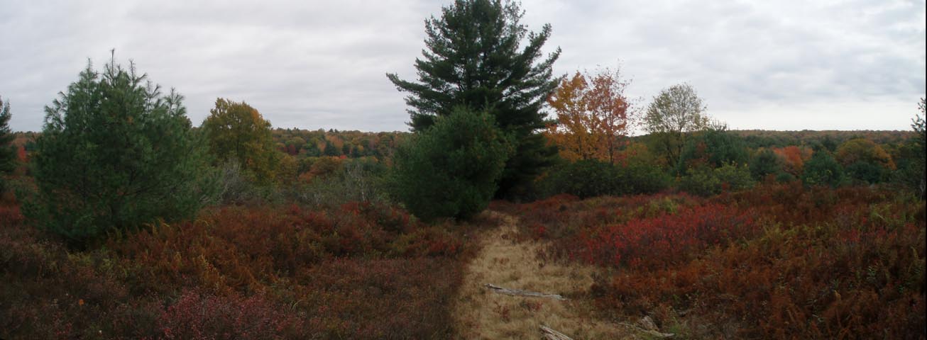
This beautiful hike comes at a substantial cost. Not only is the trek 8.5 miles longer than its sister hike, it involves over 5,000 feet of elevation gain (some quite steep) and several miles of hard side-hill trails. Fortunately most of this is completed over the first fifteen miles leaving the last 16.5 miles a real pleasure to hike. The hike starts at the Fish Dam Run Scenic View. ________________________________________ |
Printable/Downloadable Map (11X17) Zipped National Geographic TOPO! GPS and Universal GPX Files |
Trail Notes: The main trail and the connector is blazed with orange paint. From the Fish Dam View parking lot cross Rt 144 onto Swamp Branch Road. Just behind the small kiosk bear right onto a weedy footpath. Climb up to an equally weedy old haul road and turn right onto it. In 0.32 miles from the parking lot turn left onto a spur trail to visit a nice vista. Continue on the haul road. The trail will leave it and descend once again to Rt 144. Cross it. The trail continues to the left behind a Forestry Monument. It climbs gradually, initially on a grassy haul road and then a footpath. At 0.95 miles from the monument the trail forks. Bear right here, following the blazes. (I believe the left fork will rejoin the trail after once again coming down to Rt 144 but I cannot speak of its condition.) Shortly after this begin the first of several descents on a side-hill trail.
At 1.74 miles from the last junction, turn left, cross Fish Dam Run and climb steeply up to Jews Run Road. (800 feet E.G. in 1 mile.) Turn left onto the road for just a few steeps before turning right onto J U Branch Trail. Bear right staying on another grassy haul road before bearing to the right again onto a footpath marked with an orange blazed hiker post that is 0.37 miles from Jews Run Road. Begin another side-hill descent, this time along J U Branch and Burns Run. At 2.19 miles from leaving J U Branch Trail pass a potential campsite. |
|
In another 0.35 miles cross the run, turn left and begin a steep, rocky climb up Owl Run (900 feet in 1.25 miles). Keep a sharp eye out. As the trail approaches the crest of the hill it will make a hard right hand turn and ascend straight up the side of the hollow. It is very easy to miss this turn if you are not watching for the blazes.
Once at the top arrive at a dirt Fire Road. Turn left here for a handful of steps before turning right onto the Plantation Trail. In 0.53 miles arrive at a hunters cabin. Turning left on the access road (yellow blazed Yost Run Loop Trail) leads out to Rt 144. You want to turn right and pick up the continuation of the trail behind the wood shed. Descend on another side-hill trail. At 1.13 miles switchback down to Second Fork and follow it out to a large delta as it joins Yost Run in another 0.25 miles. This area can handle several large groups of campers while affording each some degree of isolation. It has at least three fire rings. After hiking 11.4 miles this is a good place to spend the night listing to the streams and Barred Owls as you settle down in your sleeping bag.
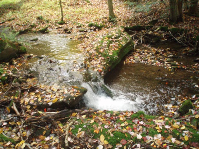
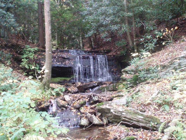
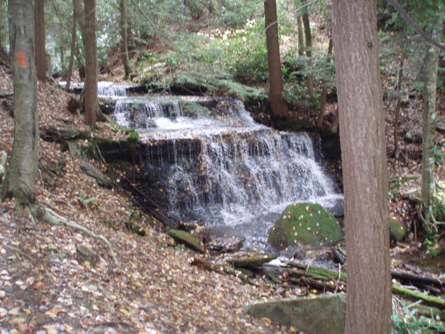
The next day continue on the orange blazed trail as it ascends the side of Yost Run. There will be several view of the waters works but they will be difficult to enjoy as all of the ascent along the stream is tricky side-hill work. The trail and stream join each other a couple of times before the former turns left to leave the gorge. Small campsites can be found at both places. The first is 1.69 miles from the previous campsite. At the last spot, another 0.81 miles upstream, there is also a nice waterfall at the confluence of Kyler Fork and the main stream. You have to cross hear to get a really good view of it and the campsite. In another 0.31 miles arrive at a much larger waterfall on the main stream. Shortly after this the trail turns left and joins a hunter's cabin road. You'll pass a smaller cabin before arriving at Camp Bloom 0.53 miles from the last waterfall. Here the climb moderates significantly. 0.45 miles after Camp Bloom turn right onto another road and follow it out to Rt 144 for another 0.20 miles, passing a parking area for the Yost Run Loop and Eddy Lick Run trails. Cross the road and in 0.16 miles turn left onto a hunter's cabin road. Follow this for 0.26 miles. A road will split off to the left. Stay straight/right and turn right at a green cabin in another 0.26 miles.
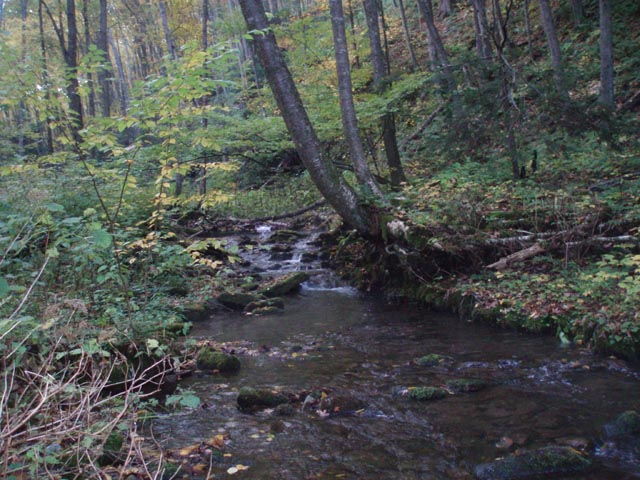
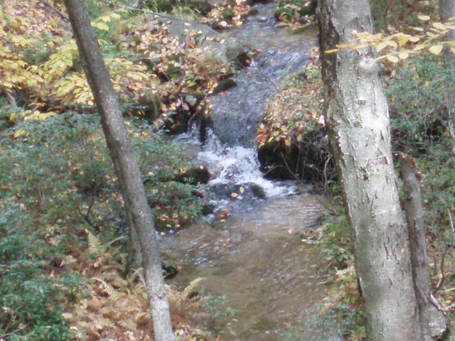
Shortly after this last turn, turn left onto a gas pipeline swath but in just a few steps turn right onto a footpath to begin a gradual descent along pretty Eddy Lick Run. (Don't cross the stream on the swath at this point!) Although much smaller than Yost Run you'll probably enjoy this stream more as the easy-to-walk footpaths and railroad grades spend most of their time at water's edge, only turning away to make crossings across feeder streams. The gentle gurgling and sandy white bottom of the stream, along with the Hemlock, Birch and Rhododendron forest, adds a real sense of serenity to the hike. Slow down and enjoy it. You'll cross the stream several times. Campsites or potential campsites can be found at 0.16 miles from the pipeline and then again another 0.68 miles further downstream. The last good campsite is at the end of a railroad grade under some shady Hemlocks just before crossing the Run for the last time on a very solid bridge. It will be behind your right shoulder, downstream a bit, as you face the bridge while standing on the trail. After this bridge the trail climbs slightly before descending to and crossing an un-named tributary. There is a bridge made of four wobbly logs but the crossing is nearly dry most of the time. After the crossing the trail climbs a bit before turning left onto a woods road. In about 0.45 miles from the crossing the road will turn to the right. Don't follow it. Instead continue straight on an old railroad grade. It is in pretty good condition except near the top where erosion has taken a bit of a toll on it. In 1.25 miles from leaving the woods road turn right and soon cross De Hass Road, joining the Walker Trail on the other side.
In 0.59 miles cross a very wide pipeline swath and then its service road. A nice view can be had here. Shortly after this pass through an area that has been devastated by fire. There is a large kiosk dedicated to a forester for reclaiming the burned area with a White Pine planting. We only saw about 5 pine trees here. Most of the burned area had been taken over by short but dense fields of Sassafras. The chance of a real forest returning here is pretty slim in my opinion. Shortly after passing through this area descend through a dense Hemlock forest to West Branch and perhaps the best campsite in the entire CKT loop and its side trails (0.77 miles from the gas pipeline). Across the stream there is a large flat area with a nice fire ring and stone furniture. The area is somewhat bisected by a line of young Hemlocks giving the appearance of 2 rooms, if you will. Since this is such a good site and you've already hiked 10.4 miles I recommend calling it a day here.
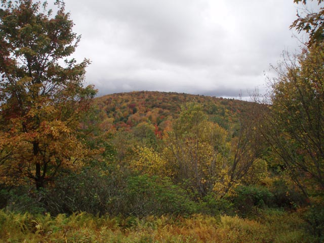
Continuing on, follow the trail on a railroad grade for 0.23 miles. Cross the stream, veer right a bit and begin hiking up Panther Run. This appears to be a re-route as you might see a small bridge going across the run to your right. Ignore it and follow the blazes. You will eventually join another railroad grade. In 1.15 miles arrive at a stream crossing and small campsite. Cross the stream and begin a gradual climb out of the drainage. In 1.15 miles turn right onto a grassy woods road and in 0.15 miles arrive at Hicks Road. Cross here, picking up the Weaver Trail on the other side. Nice views, especially in the fall, can be had before descending to Penrose Road. This is the site of a recent re-location. The FS map I have shows the trail continuing on a woods road, somewhat parallel to the road. You want to turn left at the register and cross the road, joining Swamp Branch Trail. This is another piece of easy walking. One section is a large swath (almost like a pipeline) through some young White Pines. In 1.35 miles from Penrose Road cross Swamp Branch on a robust bridge. Potential campsites can be found here.
Immediately after crossing the stream, step up onto a heavily rutted hunter's camp road. This is Swamp Branch Road, the same road you stepped on, ever so slightly, at the very beginning of your trek on the first day. If for whatever reason you wish to end the hike now turn left onto it and follow it for 2.1 miles back to your vehicle. You'll pass a couple of hunter's cabins along the way. The first appears to be brand new and the mother of all PA hunters' cabins. The second looks to be on its last legs, ready to fall down at any moment. There will be one gradual climb near the end. This short cut will save about 3 miles of hiking.
To do the entire circuit turn right onto the road. In 0.65 miles turn left near Camp Big Horn and up and over a low ridge. This was part of the view you saw shortly after starting the hike. In 1.08 miles from leaving Swamp Branch Road turn left onto the Connector Trail and follow the East Branch of Big Run. You will find two campsites to your right, one is behind a small hill. In about 1.0 miles from leaving the main trail turn right on a dirt road, passing Tyro Camp. There are potential campsites in this area. In a few steps turn left onto a footpath. Here you'll follow the eastern edge of a highlands bog before joining another road. In 0.86 miles from Tyro Camp pass another cabin on the right. Just before reaching Rt 144 turn left onto another footpath and follow it for 0.86 miles back to intersection of Swamp Branch Road and Rt 144. Your vehicle awaits you on the other side.
________________________________________
________________________________________ Outing Critiques Name: Gary Hike: Chuck Keiper trail - West Date(s): 08/09-10/13 Rating: 1
Critique: This trail has not been maintained in quite some time, I'd estimate at least 2 years. Anybody attempting this trail please go with the knowledge that you will be bushwhacking and sliding down once narrow footpaths that are now nonexistent. The trail is deceiving because the footpath in the beginning and sections near roads are pretty navigable, but once you pass a creek for the first time the trail quality deteriorates. After spending an entire day bushwhacking with the hopes that it would get better I cut my planned 3 day trip to an overnighter and headed home disappointed. I wish this trail was still a trial as I think it would be a nice hike but in its current state and in rain is almost dangerous on some of the sections that used to be footpaths that are now just rock slides.
M.R. Hyker note: It is to my understanding that the trails have been cleared as of 2014.but blowdowns are always problematic on the CKT. Report all problems to the Keystone Trail Association.. ________________________________________
Name: Jeremy
Hike: CKT- West ________________________________________ |
|
|