|
Gifford Pinchot SP |
|
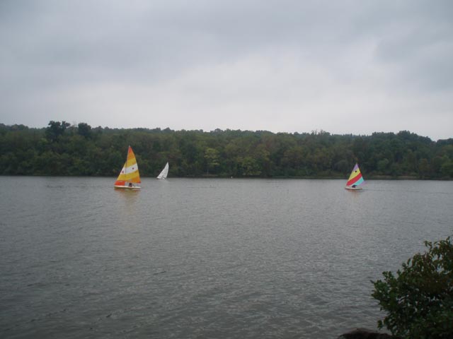
Description: For an 8.8 mile circuit this is a relatively easy hike. The total elevation gain is less than 200 feet. For that reason no Elevation Profile or 3-D map is given. Gifford Pinchot SP is very popular in the summer months with swimming, fishing, canoeing, kayaking and sail boating being popular activities. During this period the lakeside trails see a lot of foot traffic but the more outlying trails see significantly less. During colder months foot traffic over all greatly diminishes. While not as �wild� as some of the other hiking venues to the west, this is a great place to introduce others to hiking, take the family out for a walk or rehab an injury prior to trying something more challenging. If you do this one during the summer bring a bathing suite for later. The beach and bath houses are top drawer! |
|
The hike starts at the Quaker Race Area. Park near the kiosk behind the concession stand and bath houses. ________________________________________ |
|
Zipped National Geographic. TOPO! GPS and Universal GPX Files |
Trail Notes: Major trails are signed and blazed. Short cross connectors may not be and can be a point of confusion. There are also a few �unofficial trails� created by hikers taking short-cuts. Any trail blazed blue is part of the Mason-Dixon cross country tail. From the kiosk walk out to the main park road and turn left as if leaving the park. In a few steps turn right at a grassy area onto the signed Quaker Race Tr. As you climb a couple of short hills note the blazes. Initially we thought these were an off-white but later decided they are a very pale yellow. In 0.96 miles join the white blazed Lakeside trail (right and straight ahead). Continue straight and in a few steps cross a park entrance road (The Headquarters cabin you drove past on the way in is to the left and uphill a bit.) In 0.49 miles a horse trail will come in from the left. Continue straight. In another 0.55 miles another horse trail comes in from the left. Soon pass yet another trail to the left and descend to where Rock Creek empties into the lake. Cross the creek here. It is usually pretty easy but take care since the rocks are flat and might be slippery. Continue to follow the white blazes out to a gravel road. Cross it and join the blue blazed Mason-Dixon Tr. The trail will descend to paved Alpine Rd. Turn right here and follow the shoulder to a parking area on the other side of Beaver Creek. Turn right through the lot and pick up an old woods/service road with blue blazes. Pass the dam on the right (a good break spot). From this point your route will stay within view of the lake for a while. In 1.23 miles the trail will come out onto a gravel access road for a launch ramp and boat mooring area. Bear to the right here cutting across the lawn to pick up the trail on the other side. Shortly after rejoining the footpath a short, unmarked trail (the Fern Tr) goes off to the left. Continue straight. |
|
The Lakeside/Mason-Dixon Tr will then also bear to the left at another unmarked junction. Stay on the unofficial but obvious trail that follows the lake to a nice viewing/lunch spot called Boulder Point for obvious reasons. After taking a nice lunch break take the white blazed Boulder Point trail about 100 yards to the junction of the Lakeside Tr. Note that the blazes are now white. (The Mason-Dixon Tr leaves the Lakeside Tr a short distance after the last fork.). Turn right onto the Lakeside Tr. After crossing a small stream arrive at a fork. To the left is the Alpine Tr. Stay to the right, following the lake. Parts of the trail will be asphalt as you pass through a recreation area, playground and restrooms. The trail goes behind the restrooms.
Just as the trail passes a round Interpretive Center (brown building) make a sharp left turn onto a footpath. Soon cross the Oak Tr at an unsigned junction. (The next few steps happen close together and are not signed.) In a few steps turn right onto another unsigned trail. Shortly after that turn left at the next �T� junction. Climb to the Gravel Tr (name is obvious). Turn left but almost immediately turn right, leaving the Gravel Tr. Note that you are now following the blue blazes of the Mason-Dixon Tr.
Arrive at the junction with the Pinchot Tr (signed/ left and right. It�s a loop.). Turn right here and in 0.18 miles arrive at the first of two junctions with the Old Farm Tr. Turn left to stay on the Pinchot Tr. In another 0.18 miles arrive at the junction with the Ridge Tr to the right. Turn on to it. The blue blazes of the Mason-Dixon will go with you.
In 0.24 miles pass the second junction of the Old Farm Tr on the right. In 0.12 miles an old woods road goes straight but the Ridge/Mason-Dixon Tr bears to the right. Follow the blazes. In 0.64 miles cross the campground driveway. In a short distance another old woods road comes in from the left. Continue to follow the trail.
In 0.86 miles arrive at PA RT 177. (There are bathrooms at the boat launch area across the road.) Turn right and cross the bridge. Turn right through a stone wall. Note that the Lakeside Tr blazes are again white. In 0.46 miles cross a gravel service road and then another woods road. Arrive at a �T� intersection. Turn left and in a few 100 yards cross a small stream on a bridge and arrive at the picnic area and parking lot. From here you can see the bath houses. Return to you cars.
Printable/Downloadable Directions and Trail Notes ________________________________________
________________________________________
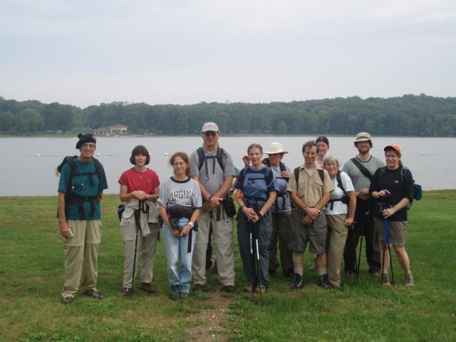
Name: Danny H.
Hike: Gifford Pinchot SP (East side)
________________________________________
Name: jon
Hike: Gilford Pinchot SP ________________________________________
Name: BaldBear
Hike: Gifford Pinchot SP ________________________________________
Name: Matt
Culbertson
Hike: Gifford Pinchot SP ________________________________________ |
|
|