|
Hammersley Wild Area BP w/Day Hike & Bushwhack |
|
|
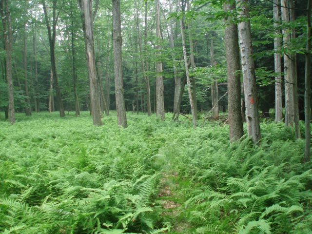
Description: The STS (Susquehannock Trail System (STS) is an eighty-four mile loop through the State Forest of the same name. Ten miles of it passes through the 30,253 acre Hammersley Wild Area. It is the second largest Wild Area in the state (The Quehanna Wild Area being the largest at 48,000 acres.) This hike includes a 6 mile in and 6 mile out backpack along with an 11.4 mile loop in between made possible by including a 1.3 mile walk along a gasline right of way and a pretty rugged 2 mile bushwhack down Dry Run Hollow back to camp. The highlights include beautiful woods with a rich understory of ferns and low bush blue berries, nice campsites, �The Pool�, several beaver meadows, the Twin Sisters Trail and an amazing mountain top meadow created by a forest fire in 1964. One more plus � while hiking this for the first time the closest we came to other human interaction was a Red Spotted Newt we saw during the day hike. If you wish to just attempt the day hike or a quick out and back to the mountain top meadow you can park at the Twin Sisters Trailhead on Old Spring Road and start there. |
|
Google Custom Driving Directions Park at the white Forestry Maintenance shop at the end of Fire Lane. ______________________________________ |
Printable/Downloadable Map (11X17 best) Zipped National Geographic TOPO! GPS and Universal GPX Files |
Trail Notes: From the Forestry Maintenance shop take Fire House Lane out to Main Street. Turn left and cross Kettle Creek on a bridge. Turn left onto Route 144. Cross Cross Fork on a bridge. Pass one or two side roads on the right. At 0.55 miles from turning onto Rt 144 pass Windfall Road, turn right, climbing over the guard rail and join the continuation of the orange STS. You�ll soon find yourself hiking up a ravine on an old railroad grade. The trail then switchbacks away from the grade to the left and joins the Twin Sisters Trail in 0.2 miles. Turn right and continue to climb. In 1.9 miles from joining the Twin Sisters Trail turn left as that trail continues straight. Descend to Hammersley fork as you follow the west side of the Elkhorn drainage. There is one campsite as the trail drops quickly to the run and another where the trail turns right and crosses the run and an island at 1.49 miles from leaving the Twin Sisters Tr. There is some more camping before the crossing if you continue to follow the old railroad grade towards the confluence of the run and Hammersley Fork. There is a set of old bridge abutments at the ford.
Climb slightly to a sidehill trail. In 0.22 miles from the ford there is a large campsite below you next to the fork and another 0.39 miles further upstream. You have to look carefully for trails to get you down to them. In another 0.45 miles descend to an old railroad grade and arrive at �The Pool�. This has got to be one of the top 10 trailside swimming holes in PA. Here you will find a large grassy area for camping. Please take care of it. It tends to get over-used at times. A few steps further up the trail you�ll find a smaller site to the left under the trees. This is home for the trip if doing the hike as described.
To complete the day hike continue upstream on the STS. The railroad grade will go to the right and eventually disappear. At this bend cross Dry Run and join the continuation of the STS on a footpath. In 0.66 miles from the crossing turn left, descend and ford Hammersley Fork as you cross an island. This has good potential as a campsite. The trail then turn right and follows an old grade through a weedy meadow that seems to have apple trees growing in it. The trail will begin sidehilling again. At 0.4 miles cross a small stream and then Darling Run. There is a small trailside campsite here. |
|
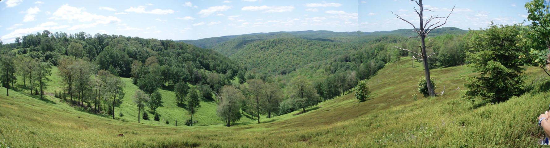
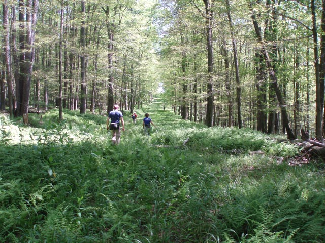
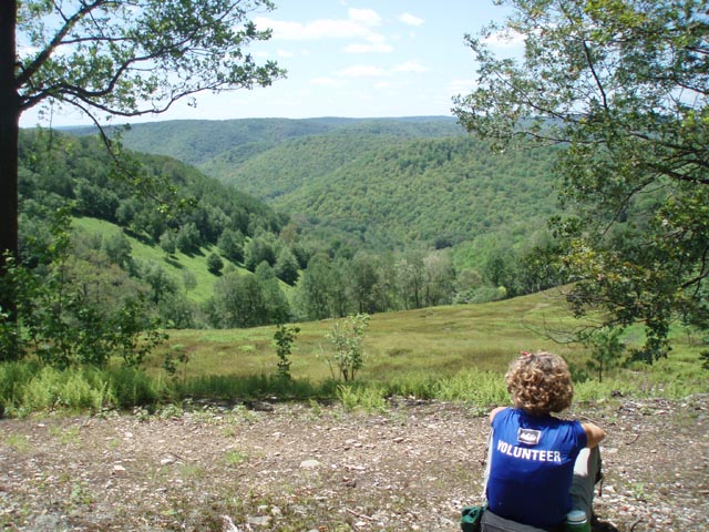
In 0.96 miles find another campsite at Bunnell Run. There are a couple more campsites a little further up the run. Sidehill for another 1.89 miles high above the beaver meadows and arrive at a pipeline right of way. Bid fair well to the STS. Turn right and descend to the fork which is just a small stream at this time. This is the last reliable water source on this hike. Cross it and climb steeply up the gas line. It is mostly grassy in places but will have thick ferns in others. You�ll descend and climb a couple of more times before reaching gravel Old Spring road in 1.34 miles from crossing the fork. Turn right onto it and in 0.46 miles arrive at the northern terminus of the Twin Sisters trail and a gravel parking area. Turn right. The trail is in the back, right corner of the parking area. This trail is still blazed orange but with circles. In 1.83 miles arrive at the 1964 site of a large forest fire. For some reason the forest never recovered. What is left is a beautiful grass and Hay-scented Fern meadow, dotted with trees and surrounded by the forested flat top mountains of the region. After several hundred yards of such views the trail re-enters the woods.
In 1.71 miles from the first forest fire sign (You�ll pass another at the southern end of the meadow.) keep an eye out for a three rock cairn on the right. Backup a few steps from it and make a sharp right hand turn. Carefully walk through the woods looking for a seep. Cross it and turn slightly left and downhill. You should soon find a nearly perfectly straight trench. This was perhaps an old skid trail that was used to drag logs down the mountain to the fork below where they were then loaded onto trains. While there are too many blowdowns across it to use as a real trail it makes for a good reference line to follow down to the headwaters of Dry Run. From here it is a simple matter of turning left and following the stream for 1.93 miles back to camp. At times you�ll be in the stream, at other times the stream will be under the stream bed (hence the name) and yet other times you�ll leave the run to make your own cross country route. The hollow is littered with blowdowns making the going very slow. In the summer the banks of the run are lined with thickets of Stinging Nettles so be prepared and take you time. You know you are getting close to the end when you have to work around a 3-4 foot waterfall.
On the final day it is a simple matter of retracing the route used to enter this wonderful place. When back at Cross Fork check out Deb�s Cross Fork Inn, home of the �Bubba Burger�. It was closed when we did the hike. Please let me know what it was like.
Printable/Downloadable and Trail Notes ______________________________________
______________________________________
Name: Diane and Dave Hike: Hammersely Wild Area Daye(s): 07/04-05/14 Rating: 4+
Critique: My wife and I did this backpack and dayhike over the July 4th weekend. We followed Mike�s directions completely. I even downloaded his GPX route onto my GPS. It made finding the start of the bushwack real easy. Being the holiday weekend we did encounter 7 other backpackers, 2 dayhikers, and a trail maintenance volunteer. The pool was beautiful, deep, and cold. The gas pipeline was rather steep at times. The views from the wild fire meadow were great. The ferns in the meadow were hip high. The blazes along the Twin Sister trail were a mixture of rectangles and circles, either orange or yellow or both (one on top of the other). Finding the start of the bushwack was made easy as the 3 rock cairn is now a 5 rock cairn and it�s right in the middle of the trail. The bushwack down the Dry Run was trying at times since the valley was chock full of Stinging Nettles. We tried hiking along the side of the run and at times down the middle of the creek. Whichever route had less nettles. There were also a lot of blowdowns which made the going more difficult. After the backpack we enjoyed the bubba burger at Deb�s Cross Fork Inn and ice cream at the general store across the street. I�ve attached photos of the parking area in front of the DCNR garage, the start of the trail along Rte 144, the start of the gas pipeline, the end of the pipeline at the gravel road, the 5 rock cairn signifying the start of the bushwack, the bushwack down Dry Run, and the humongous bubba burger.
______________________________________
Name: Mark T.
Hike: Susquehannock Loop (23miles) ______________________________________ |
|
|