White Oak Canyon/Cedar Run


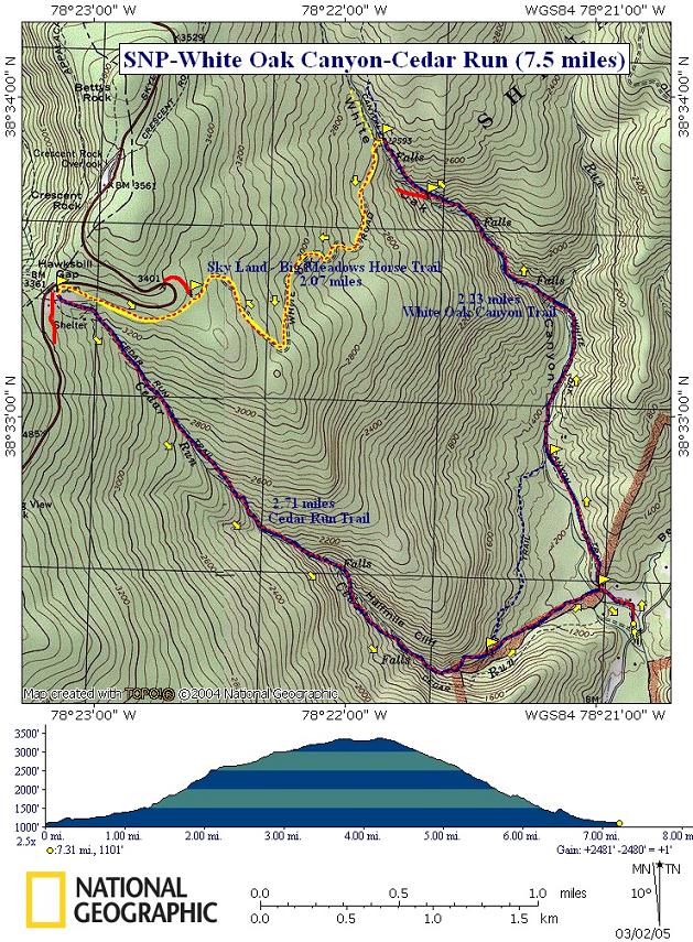
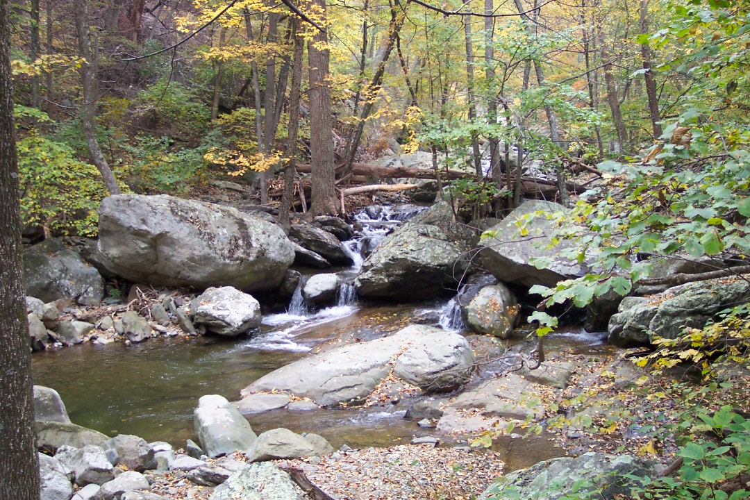
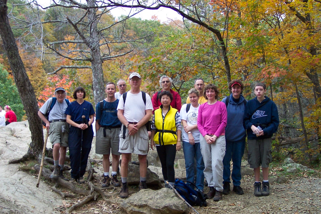
Description: This is a pretty strenuous 7.5 mile circuit but will be worth every ounce of effort. It is probably the second most popular hike in the entire SNP with Old Rag holding the # 1 spot. While some prefer to hike it in the spring when the falls are at their most powerful I prefer to do it in the fall when the colors are most intense. Still others prefer to hike this loop in the winter when the falls are in suspended animation.

The hike starts at the signed parking lot on Rt600.


Google Custom Directions


Google Maps might try to tell you to use old park roads or trails that are not accessible by vehicle. Confirm your route with a real map. The directions in the printable/downloadable Trail Notes are accurate if you are coming from U.S. 211 (Sperryville)

______________________________________


Printable/Downloadable Map

Get Printable/Downloadable Map

View 3-D Map!


Trail Notes: From the kiosk, follow blue-blazed White Oak Canyon Trail. Cross Cedar Run on a bridge. Pass blue-blazed Cedar Run Trail on the left and then Cedar Run-White Oak Canyon Link Trail also on the left.


Proceed to slowly 
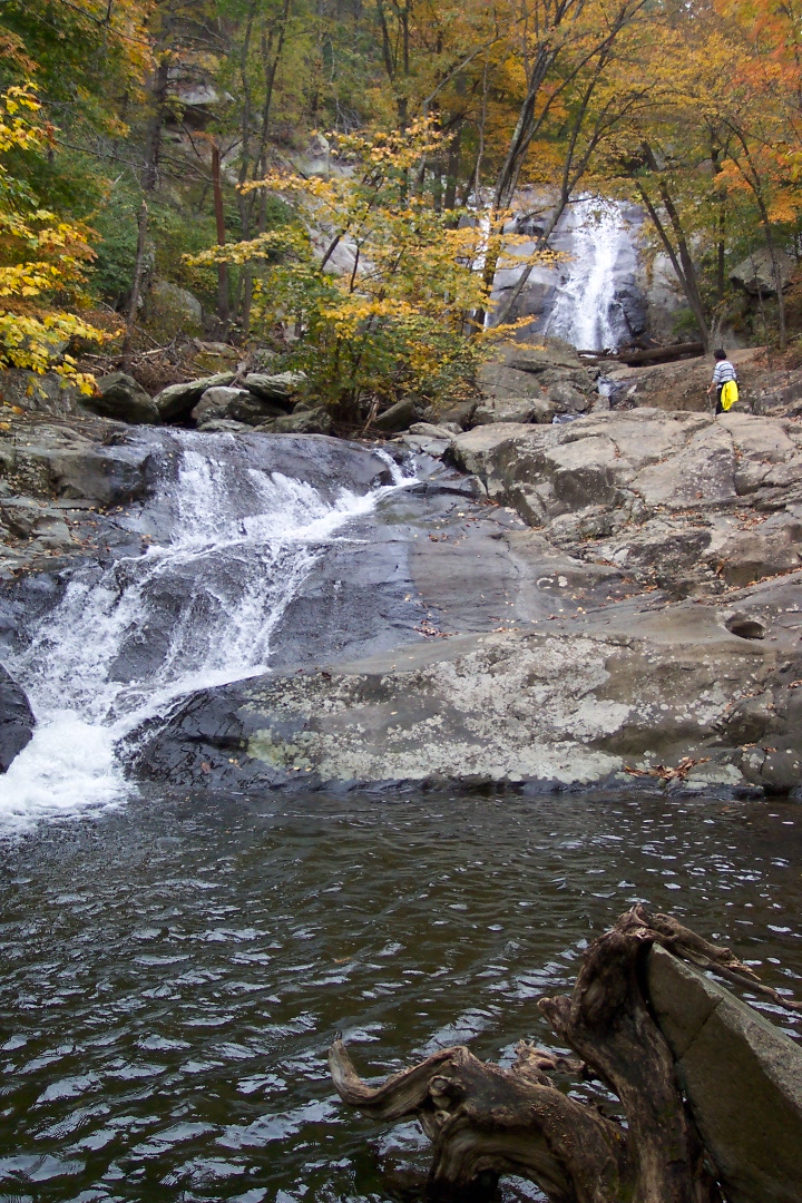
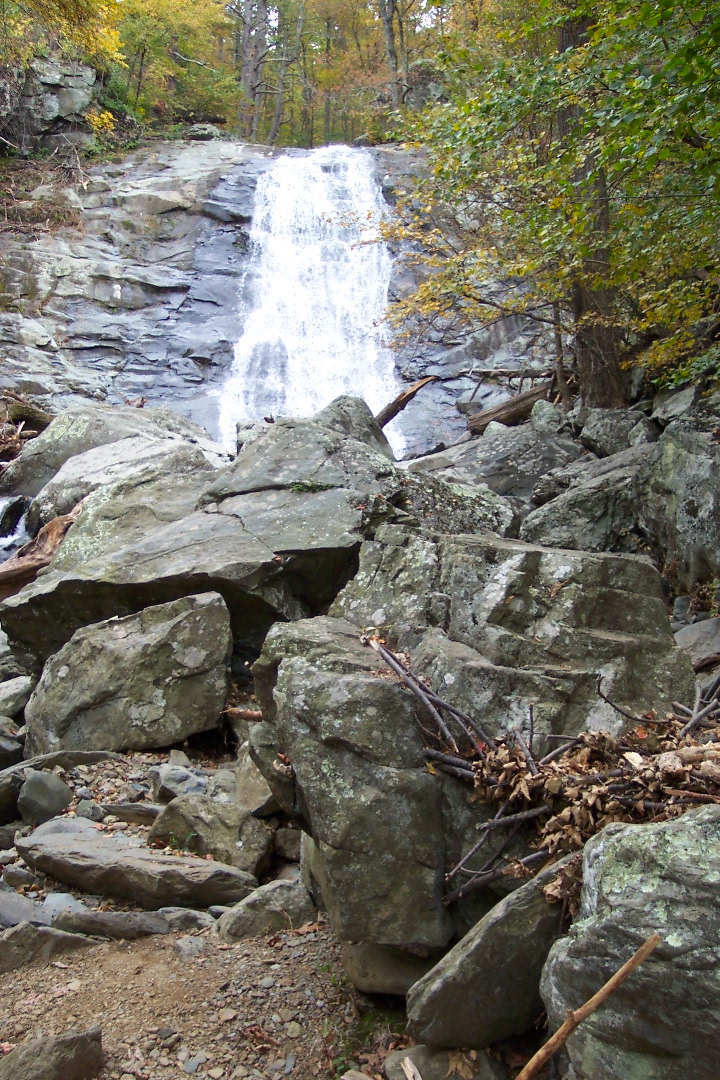
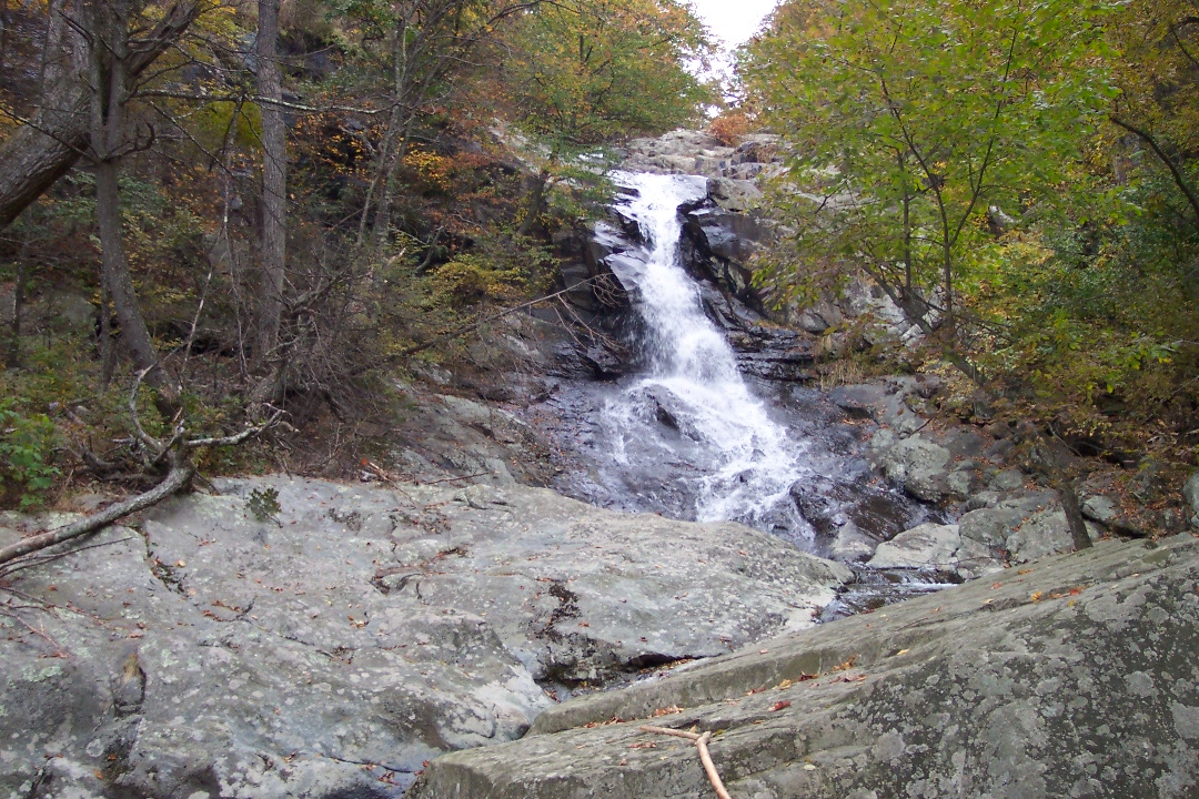
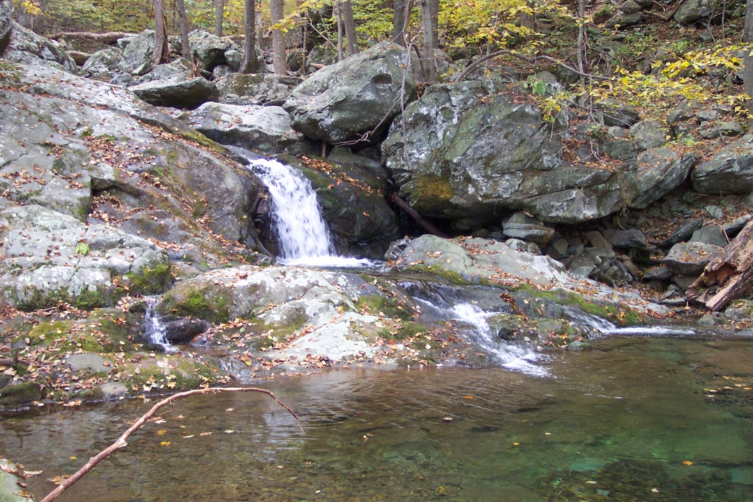
switchback up the canyon taking in the views of the magnificent falls. You probably wouldn't want to do this portion quickly anyhow. At 2.7 miles from the start, come to a concrete post with no markings. This trail leads to the base of #1 Falls, a spot missed by many but worth the extra time to explore.


Return to the main trail and switchback up to the top of #1 Falls for a different perspective. At about 3 miles cross a small bridge and turn left onto yellow-blazed Skyland-Big Meadows Horse Trail. You will still be gaining elevation along this old forest road but at a much more gradual rate.


In about 1.5 miles the fire road will swing right. Stay on the horse trail almost to the Cedar Run parking lot on Skyline Dr. Turn sharply left on the blue-blazed Cedar Run Trail.
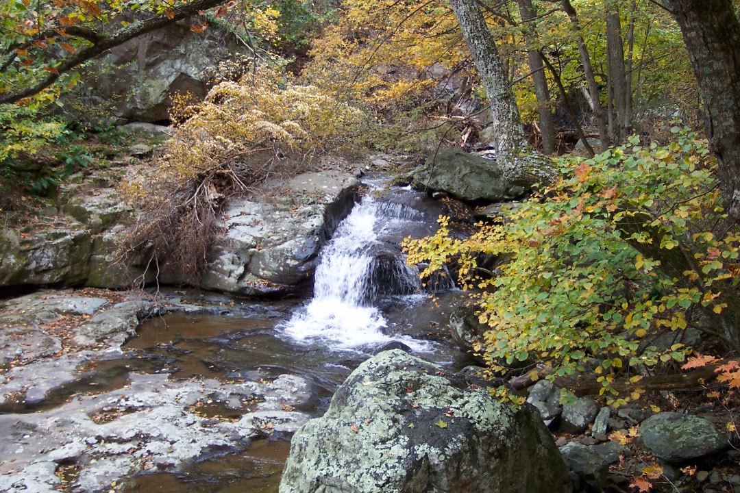
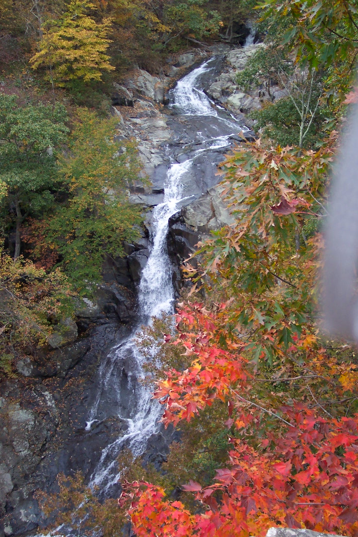
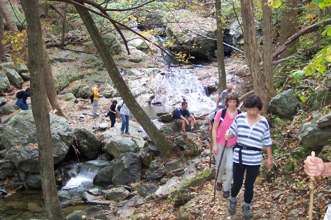
 

Over the next 2.4 miles you will pass several rapids, water falls and, about halfway down, Halfmile Cliffs. You will cross Cedar run twice. The second time is at the bottom. Watch the blazes as an old woods road continues straight while you have to turn left for that final crossing.


Pass the link trail and White Oak Canyon Trail on your left as you return to the parking lot.

Critique This Outing

________________________________________

________________________________________

Name: .Com                                                                                                              Hike: White Oak Canyon-Cedar Run

Date: 01/226/14                                                                                                     Rating: 5


Critique: Ol' rusty bucket & i had a free day together & chose white oak canyon loop for our hike.  weather was magnificent, although that brought out the crowds.  we started at the base of the canyon, hiking up white oak trail & taking in the great views of the many waterfalls.  we decided to extend out hike a bit, so we hiked up to skyline drive, and walked about 1/4 mile south to the next overlook where we could access the AT.  we took the AT SOBO for about 1/2 mile or maybe a bit longer, to the next parking lot on skyline drive.  we crossed the road and started down cedar run trail.  less crowded than white oak trail, a bit steeper as we descended.  all in all, we think our hike was about an 11 mile loop.  it was helpful to follow the map from www.midatlantichikes.com, as well as a good map of the shenandoah park.


________________________________________


Name: Andrea L                                                                                                       Hike: White Oak Canyon-Cedar Run
Date: 4/29/2012                                                                                                     Rating: 5

Critique: This was a very fun and scenic hike. It took my husband and I about 5 1/2 hours to complete this hike. We took breaks about every hour. The views along this trail are a must see, especially the waterfalls. I was amazed at how clean and clear the water was along this hike.

This strenuous hike has a very steep uphill climb on White Oak Canyon and a very steep downhill hike on cedar run. My husband and I hiked this together and enjoyed walking the yellow blazed horse trail/fire road, but only because it gave us a break from the steep elevations of the uphill white oak canyon. This trail was wet in a few spots so you had to use some caution so as not to slip in the mud or on the rocks.

The trail paths are marked by concrete posts. With the blue trails you will find along the path that every so many trees there will be a splash of blue paint and for the yellow trails, yellow paint. We found the paint markings on the trees more useful than the concrete posts.

The trail notes offered on this website are very helpful. I had them printed out and in my pocket while doing this hike. However, when the notes indicated you cross Cedar Run twice I assumed there would be a bridge. No bridge. You had to carefully walk or crawl over rocks and logs. A bit intimidating for me since I have not done many hikes but it did add to the fun and excitement of the hike.

________________________________________

Name: Bill (aka Juanvaldz)                                                                                   Hike: White Oak Canyon/ Cedar Run
Date: 1/30/2010                                                                                                     Rating: 4

Critique: This was the first winter hike for the "Stanley Adventure Hiking Team"
Conditions at the White Oak Canyon Trail head parking lot: 12 degrees, 3 inches of fresh snow. Wind: none (thankfully)
White Oak canyon is pretty consistent uphill trek. The conditions made it MUCH less than ideal. The snow and ice cover required every step to be planned in the rough areas. The falls in the winter are a site to see. Ice covering everywhere the water was splashing, freezing things in place.

We took a lunch break near upper falls where the bridge crosses the stream (Robinson River) Caution, there are two trails at this point, The White Oak Canyon trail, and the White Oak Fire Road. The published White Oak Canyon-Cedar Run hike requires you to take the left at this intersection onto the fire road. (Don't ask us how we know this, we wont tell) The fire road is wide and much better suited for a winter hike than the rocky trail. You continue to gain elevation until you come within view on Skyline drive, where you turn south onto the Cedar Run trail.

At the 5 hour mark we start the downhill leg of the hike. At times the trail is VERY narrow and in the winter conditions, trekking poles are a must. A number of times, the poles were the only thing that stopped a slide in to the icy waters of Cedar Run. Its surprising how few pictures you take when you are worried about taking an unwanted winter swim. To say it was adventure coming down is an understatement. There are two stream crossings, and you study every step you are going to take, because mistakes here are unforgiving.

We averaged 1.1 mph for the entire hike with rest breaks and lunch. Could we have done it faster, sure, but safety was more of a concern, rather than speed.

I cant wait to take this hike again in the spring. Would I do it again in the winter??? I think so, but my brain may have frozen a little too!

________________________________________

Name: Dominic Frasca
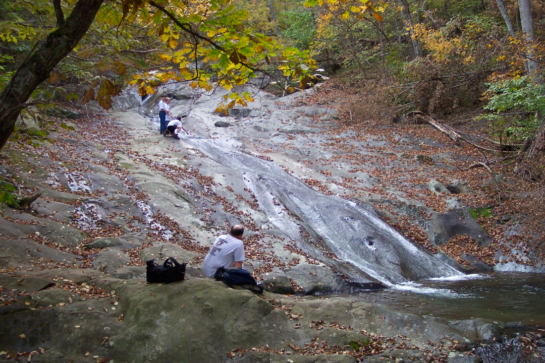
                                                                                            Hike: White Oak Canyon/Cedar Run
Date: 04/18/09                                                                                                       Rating: 4

Critique: Good hike, however: DO NOT USE the Google maps directions. They are totally, completely, horribly inaccurare. Directions on the trail notes are correct.

________________________________________

Name: Carol Branscome                                                                                         Hike: White Oak/Cedar Run
Date: 7/20/07                                                                                                          Rating: 4.5

Critique: Have done several permutations of this loop in the past but this time we did Cedar Run up, crossed the Skyline Drive and then took the trail to Hawksbill summit and lunch. Lots of vertical (about 3300 feet) for those so inclined.  Returned the same way we went up.

Cedar Run is in good shape with only 2 trees to climb over. On the way up despite the camp group of kids at the sliding waterfall, the trail was extremely quiet.  On the way back down, even quieter and there was only a raccoon washing his paws at the sliding waterfall.  Cedar Run has fewer people than White Oak so is more enjoyable despite it being much steeper.

________________________________________


Name: Koyote                                                                                                           Hike: White Oak Canyon/Cedar Run
Date: 4/29/07                                                                                                          Rating: 5

Critique: This hike was just wonderful! I did add to the hike by hiking the full length of the White Oak Canyon trail up to Skyline Drive. I crossed Skyline at Skyland and headed south on the AT. I took the spur trail up to Betty's Rock to gain the summit. I then continued down the AT to cross back over Skyline and head back down the Cedar Run Trail. Thanks to mike for the suggestion. The hike was 11.1 miles with about 5000 ft. in total elevation change. I started at 6:50 am and was off the trail at 2:30.


The trails are well marked and obviously well traveled. I was fortunate and did not see a single soul heading up White Oak until I reached the intersection with the Limberlost trail. The Streams and waterfalls were perfect and beautiful! Wildflowers lined the trail most of the way, though Spring lost it's grasp a bit towards the top. Trails were well maintained and without obstacles. A trail crew had recently cleared the Cedar Run Trail per the ranger I contacted to check on conditions. some loose stones on the Cedar Run Trail bear a bit more caution when you are tired and heading down. I stopped for a half hour, much needed, rest and lunch at Betty's Rock. Conditions were a bit raw on the western side of the Mountain making me wish I had packed a light pullover. The streams offer multiple opportunities for cooling off and re-supply of water if you have a filter. This hike is a must do and would be gorgeous in the Fall. Absolutely one of my favorites!

________________________________________


Name: Galen                                                                                                             Hike: White Oak Canyon/Cedar Run

Date: 4/14/07                                                                                                          Rating: 3.5

Critique: My wife and I did this hike on a rainy Saturday in the Spring with our two dogs. This was a hike in three distinct parts - a strenuous climb up White Oak Canyon, an uneventful walk along the horse trail, and a steep descent along Cedar Run. It took about 5 hours.

WOC has some really nice waterfalls with plenty of photo opportunities and rest stops. For the adventurous, you can stray off-trail and get a closer look at the falls. There are also some neat rock formations. The climb takes a lot out of you. I was shedding layers the whole way up. the top waterfall is a great place lunch stop.

The horse trail is somewhat boring, but in hindsight, a good rest after all that climbing.

In my opinion, the descent along Cedar Run might be just as interesting as WOC. I don't recommend doing this part in the rain as we did. It can get very slippery with all the rocks on the trail. Trekking poles are great if you have them. Cedar Run just keeps descending, down and down and down and you're along side it. The water falls over small rocks, big rocks, deep pools, and gentle streams. Pretty cool. There's a couple of deep stream crossings near the end so bring dry socks.

In all, this is a memorable hike. I'd imagine it's pretty amazing in the summer and fall. Next time I'll do the whole thing in reverse.

________________________________________


Name: Jean-Louis                                                                                                    Hike: White Oak Canyon/Cedar Run

Hikedate: 7/4/05                                                                                                    Ranking: 5

comment: This is a very pleasant hike with plenty of spots to stop and look at the stream for pools or waterfalls. On the way up the White Oak Canyon trail there is a small copperhead snake (venomous) that has decided to make the trail its home. It is marked with an orange ribbon and stones on the path encourage hikers to walk around its house, inside a rock crack.

We extended the loop by continuing up on White Oak Canyon trail (i.e. not turning left on the fire road) till we reached the Limberlost trail. Turned left on Limberlost (easy trail going through a hemlock forest devastated by the Woolly Adelgid insects) then continued till we saw on the left the sign for Crescent Rock Trail. We continued on the Crescent Rock Trail till we reach the road. We turned left on the road and enjoyed the beautiful views off Crescent Rock Outlook. Then we continue on the road descending till we reached the White Oak Fire Road on the left and finished the loop as described here. This longer loop took 6hrs and added summit views to the hike.

________________________________________

Name: Jason                                                                                                             Hike: White Oak Canyon/Cedar Run
Date: 4/23/06                                                                                                          Rating: 5

Critique: This is a great hike but be prepared to work for it. Over the first four mile, you gain over 2300 feet, much of that is not via switchbacks either, just straight up the hill.

However, the rewards our well worth it. The waterfalls on White Oak Canyon are numerous, large, and quite a site. Plentiful wildflowers are also present, as you hike up the moist canyon.

We hiked this a day after a heavy rain, so the streams were full and both White Oak Canyon trail and Cedar Run trail seemed to ooze water everywhere, so be prepared to get wet and muddy. Horse trail/fire road at the top is quite unremarkable but you can make good time on this trail, which is good because you won't going up or down on the other trails.

Hike took us about 5.5 hours, but we took lots of breaks and also the distance appeared more like 8.2 miles rather than the 7.5 miles that is published.

________________________________________

Name: Greg                                                                                                               Hike: White Oak/Cedar Run
Date: 9/9/06                                                                                                            Rating: 5

Critique: This is a great hike.  The first waterfall is fantastic, the second is also breath-taking but the trial does not present as good a view as the first.  This is a difficult hike, due to the pitch of the trail.  The trail is in excellent condition, although I could see how it could be very slick on a rainy day.  The description on this web site is accurate with the one exception of the length.  The NPS guide indicates the loop described is 8.2 miles.  I highly recommend the hike and the drive to it is also nice.

________________________________________

VA Hikes MD Hikes WV Hikes PA Hikes Contact Us Home