Long Pond Backpack |
|
|
Description:
4.5 mile backpack in, 4.5 out on Long Pond Trail,
The hike starts on the north side of Fifteen Mile Creek Rd just after crossing a small bridge. |
|
_______________________________________
Trail
Notes:
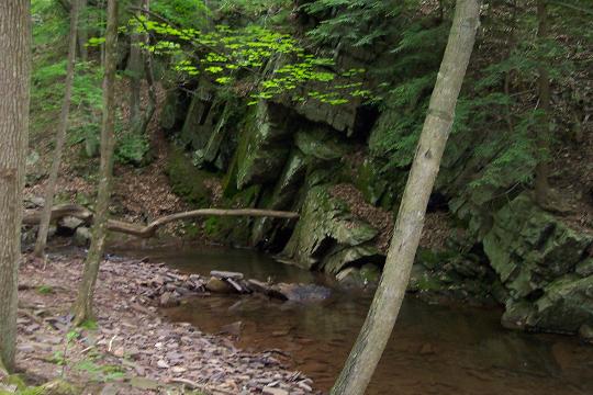
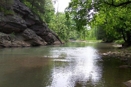
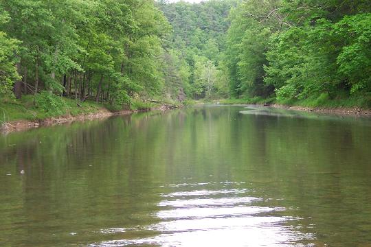
Long Pond trail will hug the side of the hill for a while but an easy open woods bushwhack across the bench or flood plain will lead you to some nice creek-side views.
After the bench, the trail will climb slightly and soon bring you down to a smaller stream. Your route will take you across the stream and steeply up the side of the ridge. Before doing so follow the stream down to Fifteen Mile Creek to visit a great campsite with fire ring and stone furniture and an awesome view of the creek (0.2 miles from the last trail intersection). I think this section requires some splash hiking!!!
After this visit rejoin the hike and climb almost to the top of the ridge. The descent is significantly more gradual and offers some great views of the mountains to the west and north.
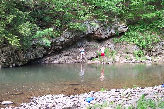
In about 0.8 miles from the last campsite, come to what I call The Oldsmobile Campsite. To find out why I've given it that name review Don's photos. Here again is an area worthy of a wading adventure or just a plain old aquatic frolic.
After resuming the hike you will again climb steeply up the ridge passing "Slippery Rock Waterfall". An inadvertent step onto a large flat rock in front of it might tell you how the name was derived. Please walk around it! If you�re hot, walk under the cold water for a quick refresher.
Immediately
after this geological wonder an old animal trail goes straight and
ends in a dead end on a very steep slope.
Turn Left onto Dug Hill and follow it for approximately 1.0 mile, passing a couple of primitive car camping sites on the left as you go.
Turn left onto a gated fire road. There are some false fire roads along the way but stick with the blazes. Near the end you will cross a wildlife clearing. The trail is almost directly across but a little to the right.
Descend
steeply on another old forest road. Pass a shelter on a hill to the
right. In 1.4 miles after leaving
Zipped National Geographic. TOPO! GPS and Universal GPX Files
|
|
_____________________________________________________
_____________________________________________________ Name: Jo Ellen Hike: Long Pond Backpack Date: 06/08-09/13 HRating: 2.5
A group of us did this hike as our first one of the season. We actually did not do the whole hike, but camped at what we think was the "Oldsmobile" campsite. However, we couldn't figure out why you call it that. I tried to look at Don's photos, but they are not longer available on shutterfly. So, what gives? Why "Oldsmobile"? It was a good first outing as it had some elevation and some water crossings. Even with all this rain, the "slippery rock" waterfall had no water....but it did have a slippery rock. It was fun, but nothing that would draw me back.
M.R.Hyker Notes: Thanks for telling me about Don's photo links being broken. I removed them. As far as the Oldsmobile site ... there used to be an old Oldsmobile hubcap hanging on a tree there. I guess someone took it. _______________________________________
Name:
Ed. S
Hike: Long Pond Backpack _______________________________________
Name:
Marty Shobert
Hike: Long Pond Backpack _______________________________________
Name:
Sarah Weammert
Hike: Long Pond Backpack _______________________________________
Name: Gary Bailey (aka Gear
Gary)
Hike:
Long Pond Backpack _______________________________________ |
|
|