Tea Creek/Tea Creek Mt Loop


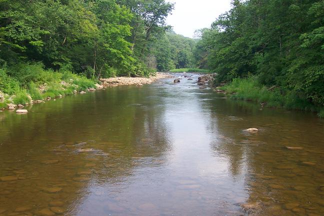
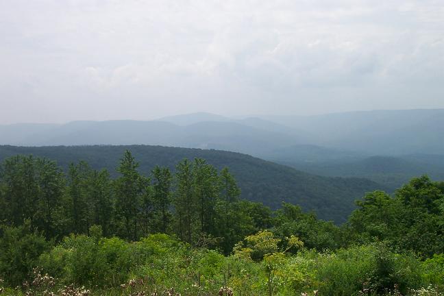
Description: This is an 11.3 mile moderate circuit hike through a very scenic area of the Monongahela NF. More than half of the trails are actually old railroad grades used by lumber companies long ago. The forest is a mix of deciduous and conifers (mostly Red Spruce which is coming back strong in some places). There is a 1500 foot gain in elevation but all except the steep climb to the ridge line of Tea Creek Mt is spread out over the first 7 miles. A brief excursion along the Right Fork Connector Trail will bring you to a recently constructed boardwalk with viewing blinds that lead you to a beaver pond with Red Spruce and Gauley Mt as its backdrop (See photo on this page.).


The hike starts at the small Tea Creek Day use area near the Kiosk.

Google Custom Directions

______________________________________


Printable/Downloadable Map

Printable/Downloadable Map

View 3-D Map!

Zipped National Geographic. TOPO! GPS and Universal GPX Files

GPS Text File for Non-TOPO! Users

Trail Notes: All trails are blazed with blue diamonds and are signed although bear are fond of removing them. From the Kiosk, travel up-river, crossing Tea Creek on a bridge. There will be an old trail immediately on the other side on the left. Bypass it. Soon turn left up a hill to the signpost for Tea Creek Mt Trail (right) and Tea Creek Trail (left). Turn left, climb over the crown of the hill and descend to an old, overgrown railroad grade that parallels Tea Creek.


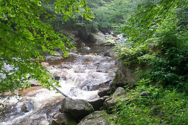
For the next 2.5 miles follow the creek up the drainage. You will cross two streams. A bridge has recently been constructed over one. Come to an Adirondack shelter, often trashed out by fishermen, and the confluence of Tea Creek and the Right Fork of Tea Creek. There is an Olympic size swimming hole here. Make a sharp about-face and take North Face Trail up the back of the mountain for about 0.4 miles.


Turn hard left onto Right Fork of Tea Creek Trail. The last time I was there the post was gone and the sign was propped up on a tree. The trail is obvious since it too is an old railroad grade. You will climb gradually for a bit and then descend for the first of several stream crossings. In 1.6 miles from the last trail junction come to the junction of Red Run Trail, Red Run and a scenic lunch spot.

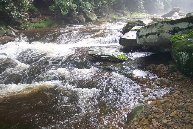
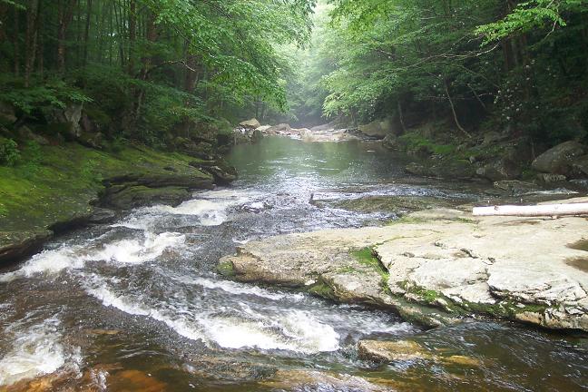
Cross Red Run and continue upstream passing a couple of nice camp sites, a huge beaver dam/pond and meadows full of young Red Spruce. Just before you climb out of the drainage come to the Right Fork Connector Trail on your left. If you desire, turn left here to visit the previously mentioned boardwalk.


Return to the Right Fork Trail and ascend onto a large open meadow. The trail fades away here but if you simply walk straight you will reach a gravel road. Turn right into a small parking area and the trailhead for the Tea Creek Mt Trail. There might not be a sign here but a quick look into the woods will reveal a Kiosk and the trail.


This is by far the hardest part of the day as you climb almost 500 feet in less than 0.3 miles. Thankfully there are some switchbacks and the climb is short. The rest of the hike, until the final descent, is flat with a few gentle knobs to walk over. You may lose the trail in a rock field but the field is narrow and the trail on the other side is well defined.


Pass the southern terminus of North Face Trail on the right and descend steeply passing Tea Creek Trail on your right just before reaching Williams River Trail. Turn right and walk back to your vehicle.

Read about our recent trip.

Critique this outing!

______________________________________

______________________________________


Name: Jack B                                                                                                              Hike: Tea Creek/Tea Creek Mt Loop
Date: 05/19/12                                                                                                          Rating: 4

Critique: Very enjoyable hike. Hiked counter clockwise per directions. Found all the trail heads to be well marked (and mapped). The trail was wet throughout and it's amazing that mountain bikers push through (or sink in). The creeks were beautiful, the forest deep and dark. I don't know if the referenced beaver has moved out, but the "beaver pond" looked low with water only in the channels. Trail is obvious throughout, though quite overgrown in spots. Know your stinging nettle and consider wearing long pants. The trail and creeks make up for any little inconvenience like that, though! Would recommend this area and I want to better explore the whole area.

______________________________________


Name: stretch                                                                                                             Hike: Tea Creek Reversed
Date: 03/19/2011                                                                                                      Rating: 5

Critique: Tea Creek Trail isn't the only trail with blue diamond blazes, all trails in the area have them. Tea Creek Trail no longer parallels the creek when you first cross the bridge, the first third mile or so is eroded and bypassed so that Tea Creek Trail takes you into the mountain at first. Make sure you get Tea Creek Trail instead of Tea Creek Mountain trail, unless you want to hike the loop in reverse (which I enjoyed).

Tea Creek is beautiful, especially the right fork of tea creek, which had even stronger tea colored water. The water was very foamy, there were whirls of foam that stood more than a foot high. The old railroad ballast is very coarse, so make sure you wear sturdy shoes.

All signs at trail intersections were new and in excellent shape, the trails were well marked. I don't believe the Adirondack shelter exists anymore, the only shelter we saw was at the intersection of tea creek and right fork of tea creek. There are privy bathrooms at the parking area.


______________________________________


Name: Jim Kirk                                                                                                             Hike: Tea Creek-Tea Creek Mt (modified)
Date: 4/10&11/10                                                                                                      Rating: 5

Critique: I went up Tea Creek and camped at the shelter.

Instead of turning off North Face I stuck on it.

That is a truly awesome trail especially the remnants of the 2 logging camps with what look like the frames of old bunk beds, piles of metal eating plates and at the second camp an old crosscut sticking up out of the ground with a hand cranked blacksmiths' forge laying by it.

______________________________________


Name: The Fire Warlock                                                                                              Hike: Tea Creek/Tea Creek Mountain Loop
Date: 11/9/06                                                                                                              Rating: 5

Critique: We started at Tea Creek Campground and hiked the 3 miles plus into the shelter. At this time of the year, it was VERY wet footing and mostly streambed hiking. Thank goodness for XCR boots, eh? The shelter was finally reached and luckily it was in fine shape with a nice existing fire ring, including a huge piece of old iron, which we put to good use as a semi-fire/wind shield when the rains came on night two. We set up camp, though there was difficulty finding room for our 4 tents. The next day we completed a 10 mile day-hike loop (with some trepidation about leaving our tents and gear), though this was to prove unfounded. This whole area is completely untouched and pristine, with lots of evidence of glaciated boulders, and the famous "ice tea" pools, formed by conifer and mineral leachates leaking into the surrounding drainage.


Strange to see crystal clear water in pools, but the color of deeply steeped tea. We tiredly reached camp and found that someone? had left us a loaf of bread hanging in the shelter. A great trip for sure. Sorry it took me a year to find this site. -The Fire Warlock (Don't ask)

______________________________________

VA Hikes MD Hikes WV Hikes PA Hikes Contact Us Home