Beyond
this campsite is an obvious grassy jeep road. Follow this to the
intersection with the Pipeline Swath. This is about 0.7 miles from
where the �Hidden Passage� ended at the base of the �Meadows�.
Turn
left onto the Pipeline Swath and descend about 0.33 miles, cross a
small stream and arrive at the remains of an old road that
intersects the Pipeline. This is the beginning of Jonathan�s Canyon
Rim Trail. If you feel up to a side trip stash your packs here and
proceed down the Pipeline for another 0.2 miles or so until you see
a cairn on the right directly across from a Forest boundary sign on
the opposite side of the swath. This marks a trail out to a pretty
nice overlook.
Return
to the intersection of the old road. And turn left (if going up the
swath) onto the old road. There is a dead tree with a blank sign
mounted high on the trunk. This is the �iffiest� part of the hike.
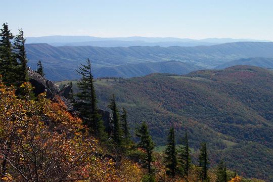
Proceed
down the road a short distance than turn right and cross a small
stream. Skirt the edge of a small bog to your right. From here to
the next overlook it is mostly an open woods bushwhack. Keep the rim
or edge of the hill in sight and to your left and avoid any thickets
to your right.
You will
eventually arrive at a very large oak tree with multiple trunks near
the beginning of another meadow/bog. Turn left here and head towards
the rim. You will find a footpath that leads out to the canyon and
another fantastic view. You�ll pass another multi-trunked tree on
your right. From here to the turn-off at the Tee Pee Trail the path
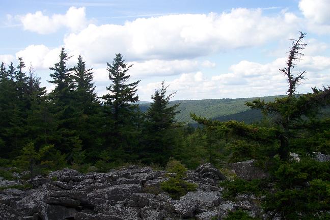
will be more obvious with cairns marking the way
through several boulder fields. Stay close to the rim and you can�t
get lost.
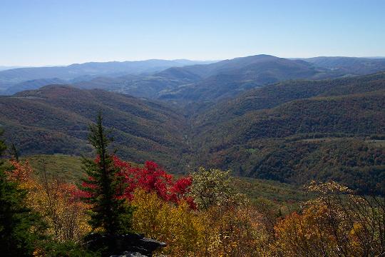
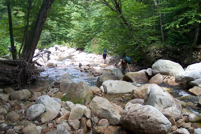
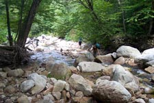
At about 0.6
miles from leaving the Pipeline you will cross Roaring Creek and
pass red forest boundary blazes and a survey marker. Continue
following the rim. Almost any side trail to the left is apt to lead
you to a view of the surrounding area. At 0.6 miles from the creek
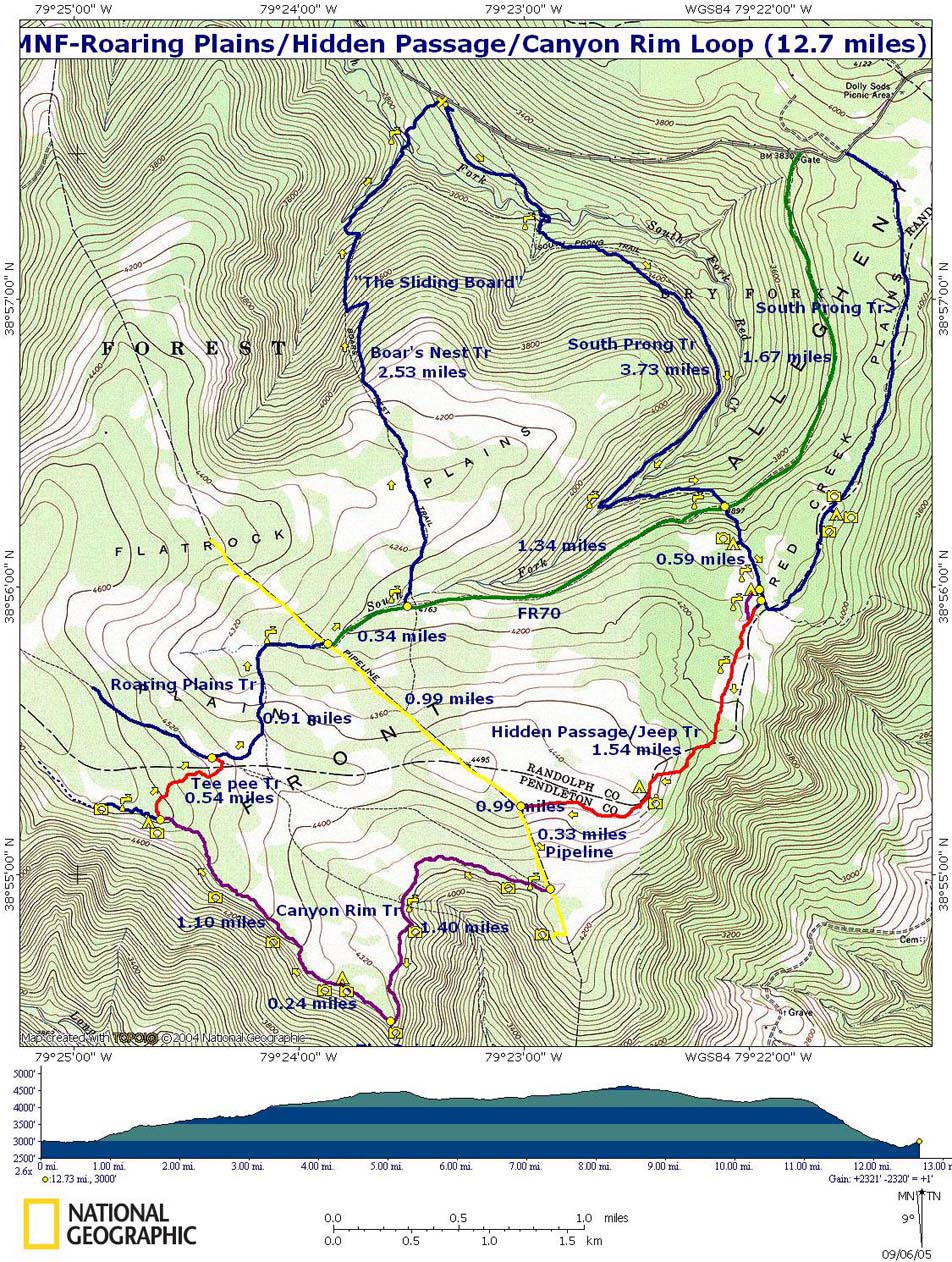
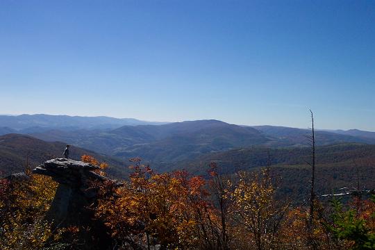
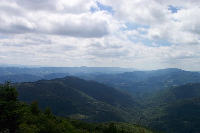
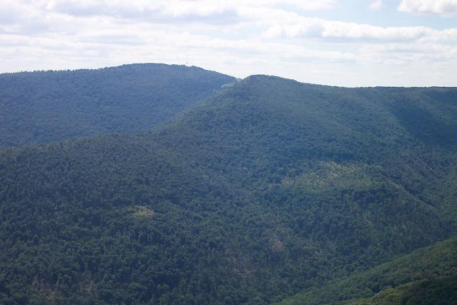
crossing arrive at �The Point�, the intersection of Roaring Creek
and Long
Run
Canyons. This is just
about the mid-point of the hike and a great place for lunch. A quick
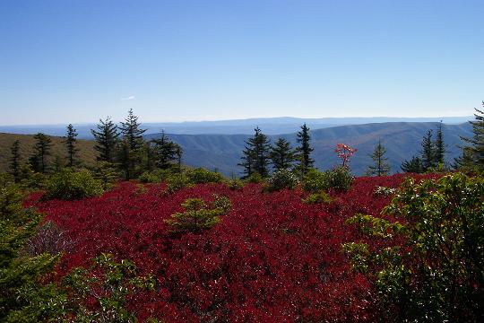
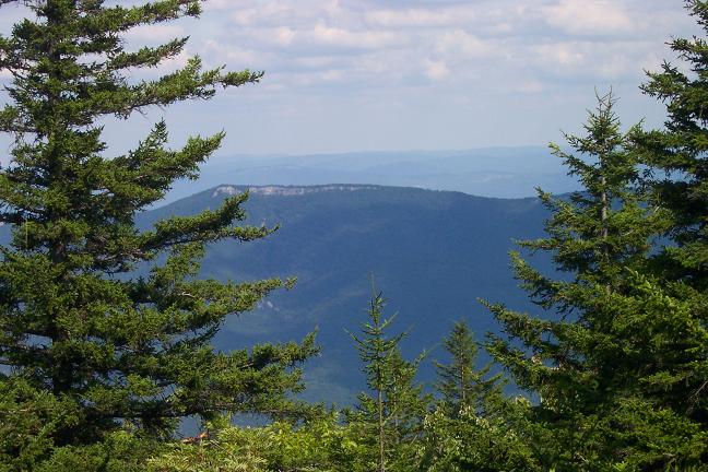
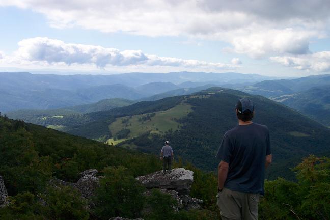
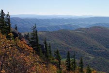
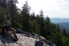
excursion to the rocks out on the tip leads to the best views of the
day: Smith Mountain, Four Knobs, North Fork Mountain, Shenandoah
Mountain, Chimney Rocks, Champe Rocks, Seneca Rocks, Spruce
Mountain, Hay Stack Knob and more can be observed from one spot by
simply turning your head.
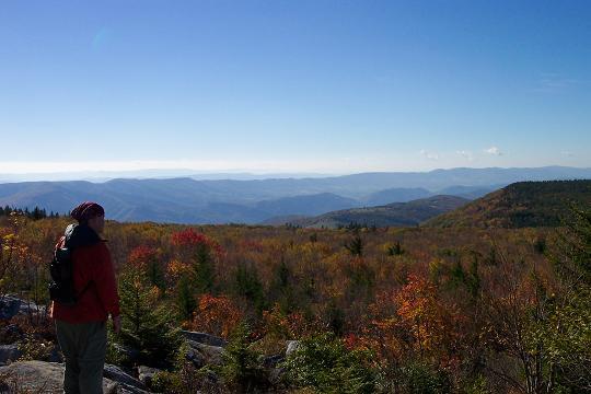
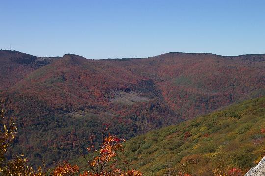
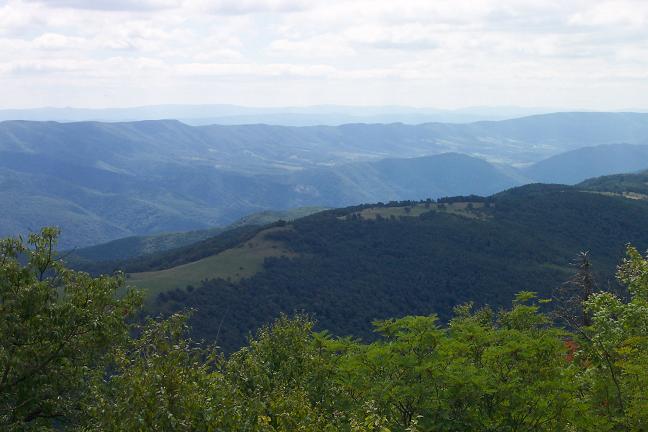
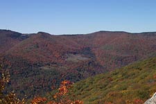
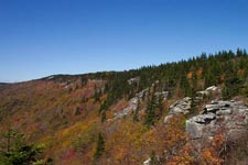
From
�The Point� travel north-west along the rim, crossing more boulder
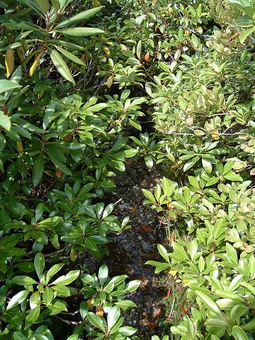
fields and passing through alternating Rhododendron and heath
thickets and stands of Red Spruce stopping for the views along the
way. If you�re backpacking, there�s a nice established campsite with
a fire ring sheltered by Red
Spruce about 0.3 miles from �The point� but it is dry. There is one
or two sites suitable for a tent or two just before this without
fire rings. In another
1.1 miles arrive at the junction with the Tee Pee Trail at another
established dry campsite with a fire ring. Turn right here
and search for a faint hunter�s trail. It's not obvious at first
since some unknowing hiker(s) used the markers to build the afore
mentioned fire ring. Poke around in the Rhododendron until you find
the trail. Proceed down the trail (North-east) until you
reach a campsite with fire ring. Be wary of any side trails. Some
are old deer trails while others were hacked out with machetes by
lost hikers! The continuation of the trail is to
the left of the campsite. Continue on until you reach a large heath
thicket. The trail seems to disappear here but it is slightly to the
right. As you push through the brush you can see the trail at your
feet.
In about
0.54 miles from leaving the canyon rim you will arrive at a large
flat rock with a cairn on top of it. In front of it is a wet sandy
trail which is actually the headwaters of Roaring Creek
AND an old
RR bed. Turn left, walking upstream through the dense laurel, and
quickly come to the intersection of the Roaring plains Trail. You
are now back on official forest trails.
Turn
right on the Roaring Plains Trail and travel 0.91 miles to its
eastern terminus at the Pipeline Swath. FR 70 is just a little to
the right. Walk down FR 70 for about 0.34 miles to the Boar�s Nest
Trail. Turn left on the Boar�s Nest Trail and cross the South Prong
for the third time. Climb a short distance to the top of Flat Rocks
Plain and continue north on this well worn and sometimes very wet
and muddy trail. Just as you start to descend there will be a rock
outcrop to the left which offers fine views. On a clear day you can
see Dolly Sods in the distance.
At
about 1.3 miles from the last trail intersection you will descend
steeply on what I like to call the Sliding Board. There have been a
few switchbacks added but the going is still hard on the knees and
feet. Towards the bottom the trail joins a railroad grade that
follows the drainage of Camel Run to the final crossing of South
Prong (about 1.2 miles from the start of your descent). Cross the
creek and climb the bank on the other side. Pass through a small
meadow and cross a RR grade. Climb steeply up the hill for 0.3 miles
to your cars.
Printable/Downloadable Directions
and Trail Notes
Read about our latest trip
there.
Critique this
outing!
________________________________________
   
________________________________________
________________________________________
Name: Tony Van Vugt
Date(s) of Hike: 08/08/15
Hike Name: Roaring Plains Circuit
Ranking: 5
Outing Critique: This area is one of the
last places that you can really call backcountry in the
mid-Atlantic. Just north is the Dolly Sods, while very beautiful, it
has become so popular it�s hard to feel like you�re really out in
the wilderness alone. Roaring Plains is Dolly Sods 15-20 years ago.
But this is also for good reason. The trails are harder to follow,
and good map and navigation skills are a must. Don�t take this
hike's author lightly when he says this area can be unforgiving. The
weather can change in minutes, and being ill prepared can make for a
tough time.
But with proper planning, your reward is one of the most beautiful
areas on the east coast. The Roaring Plains circuit has beautiful
views, high mountain fields, plenty of excellent camping, and
solitude that is hard to find in such a spectacular place.
________________________________________
Name: Jeremy
Date(s) of Hike: 08/12/2015
Hike Name: Roaring Plains Circuit
Ranking: 5
Outing Critique: The trails are pretty well
marked with cairns these days, only had to pull out the GPS a few
times. Lots of the trails were small streams, some water proof
footwear would have been appreciated. Pants and long sleeves are
pretty much a must at this time of year as the path is very
overgrown.
One thing to note on this hike, if you click the map picture
you'll get a different map than if you click the link under it that
says Printable/Downloadable map.
(M.R. Hyker Note: Actually they are for the same route but of
different vintage. To prevent any confusion they are now both the
same.) The
linked map shows a campground near the end of the Roaring Plains
Trail, but I couldn't find it. There is a tiny clearing near the
water that might be ok for a hammock or 1 man tent, but I wouldn't
want to camp there personally.
Got a bit of a late start and camped the first night at the
campground at the South Prong and Hidden Passage Trails junction. It
was a beautiful site with a large fire ring and stream. The jeep
trail and lots of blueberries and raspberries to snack on. Hiked the
next day around the rim and managed to scare up a large rattler in
one of boulder fields. Made it through Tee-Pee with some fuss, it's
a really wet trail, but decently easy to follow. Planned to camp at
the site mentioned above, but couldn't find it, which made for a
very long day and a nigh time hike down Boar's Nest and over the
creek to get back to the car.
Overall, the views and variety of environments make this one of
the best backpacking trips I've ever been on.
I found a small stuff stack with gear along the trail, if you lost
one, contact a mod to contact me, tell me what's in it, and I'll
mail it to you.
________________________________________
Name: Ben
Hike: Roaring Plains Circuit
Date:
05/25/14
Rating: 5
Critique:
Over memorial day weekend I led a trip in Southern Dolly Sods and
Roaring plains. We intended to take the hidden passage trail and
hike all of the Canyon Rim, stopping at the large campsite where it
meets the Roaring Plains Trail. Because we weren't making great time
we decided to stop at the campsite at the Tee Pee trail. The Hidden
Passage Trail was easy to follow. The canyon rim was generally not
too difficult either. Having the GPS waypoints on my GPS helped. We
took the Tee Pee trail back to the Roaring Plains trail. It was
quite overgrown but somebody has put cairns along most of it so we
were able to follow it without incident and get to the Roaring
Plains Trail. The views along the canyon rim are just spectacular.
If you bushwack to some rocks near the Tee Pee trail campsite you
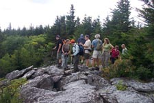
can get a great view to watch the sunset. The Tee Pee trail campsite
itself was well sized and easily held 8 tents.
________________________________________
Name: Bill
Hike: Roaring Plains Circuit
05/09/14
Rating: 4
Critique: We followed the trail notes and they were quite helpful.
This had to be one of the best hikes and worst hikes I've ever done in
summer. The worst part was loosing the trail 1/2 way on the Tee Pee and
ending up bushwhacking thru thick laurel to the pipeline. The trails are
just not marked well. The rock and bog on the trail seemed to never end
either. But the rest of the trail made up for it and more. There was
truly a full range of experience and the views on the rim were
fantastic. Campsites were all inviting and I am looking forward to doing
it again. A map, compass and even a GPS are a must for this trail, this
is not for novices. I would rate this trail very highly, thanks WV.
________________________________________
Name: Bill Thomas
Hike: Roaring Plains Circuit
Date(s): 08/11-13/13
Rating: 5
Critique: What an amazing hike! Thanks for the trail notes and GPS
route waypoints. Could not have done it without these two critical
pieces of information. We left the parking lot mid afternoon and were at
the nice campsite by the stream way before dark. What a beautiful place
to spend a peaceful night. The next day we took our time and enjoyed the
many excellent views on our way to the Tee-Pee campsite. We just about
lost the trail just after getting off the pipeline swath -- "iffy"
indeed! We filled up all our water at Roaring Run as a precaution, and
good we did, as Tee-Pee was dry (until it rained late that night!). A
nice campsite, but no views. Next time I will stop at the campsite just
down the trail from �The Point�. Tee-Pee trail and the subsequent
Roaring Plains Trail were very wet - basically like walking a stream all
the way to the swath. Boar�s Nest Trail was also quite wet -- only dry
part was on top! Last view is great, then a very steep descent. The last
ford was wet, as we couldn't find any rocks to hop across. But after all
that downhill, the water actually felt really good. And our cars were
still there!! A great hike! But would have been much more challenging
without the tools on this site. Thanks!!!!
________________________________________
Name: Tasha
Hike: Roaring Plains Circuit
Date(s): 07/05-06/13
Rating: 5
Critique: These directions were great and guided myself and 2
adventurous girlfriends almost seamlessly for an overnight backpacking
trip. The "unofficial" trails are pretty well trodden by now and
currently marked with cairns often enough for experienced hikers to
follow fairly easily. The rocky terrain and steepness hiking down Boar's
Nest Trail were rough on the knees, feet, ankles; however the views from
the canyon rim were worth every step! Our trip was over a holiday
weekend and we didn't see anyone else on the trail over the 2 days....a
great alternative to the traffic in the Dolly Sods. Thanks so much for
sharing the info!
________________________________________
Name: Tom O'Donnell
Hike: Roaring Plains Circuit
Date: 09/22/12
Rating: 5
Critique: I've got to say this is, hands down, the best hike on Roaring
Plains. The trails are all in excellent shape except there is currently
a large blow-down on the South Prong trail that requires a hands and
knees crawl to get under with a pack.
The infamous Tee Pee Trail is becoming more distinct with each passing
year and I had little difficulty following it this time. There are some
strategically placed cairns that help a lot. The trail is hemmed in
close with laurel, but the footway is pretty distinct. However, it still
requires attention to stay on the trail.
Thanks to someone who cut out some bad blowdowns on the Canyon Rim
Trail. Those would have been some bad spots to negotiate! The really
rocky footway on this section is probably the most tiring part of the
hike, but the views make it all worth it.
I had previously done all of the pieces of this circuit at different
times, but had never done it as a complete hike. Total time on the trail
was almost exactly 9 hrs.
Surprisingly I had the most trouble of the day finding the path to the
rocks for the view of the South Prong, the rhododendron wall is really
thick there. Look for the many-branched tree.
________________________________________
Name: Jeff
Hike: Roaring Plains Circuit
Date: 10/21/11-10/23/11
Rating: 5+
Critique: Amazing hike, I appreciate all of your hard work putting this
page and hike together. I won't lie and say it was easy but my buddies
and I found all the trails, including the infamous tee pee trail. Your
directions were invaluable and the trails were just as you described.
We put an extra cairn in the campsite where the tee pee trail intersects
the canyon overlook trail at the campsite as we had a little bit of
difficulty finding it for a minute. My only regret for the whole trip
was when we walked out on the canyon overlook trail, it was fogged in, I
can only imagine what that must look like on a clear day. When my knees
forgive me for this trip, I definitely plan to go back. Thanks for
everything, it was probably the best trip I have ever been on and
certainly an amazing adventure.
________________________________________
Name: Steve Appler
Hike: Hybrid - Roaring Plains Circuit-modified
Date: 10.8.11
Rating: 5
Critique: October 7th 9th, 2011
My brother Greg, my son Austin and I just enjoyed a backpacking trip
using mostly the trail described here as the MNF-Roaring Plains/Hidden
Passage/Canyon Rim Loop, but we didnt turn off at the Tee Pee Trail, but
instead followed the Canyon Rim Trail all the way to its junction with
the Roaring Plains Trail before returning on the Roaring Plains Trail
route.
This was an arduous backpack trip and for those who would prefer to
enjoy the spectacular views without the chore carrying a heavy pack
through some very difficult terrain I would suggest setting up a base
camp as described in
Roaring Plains Base Camp and Day Hike and make the Canyon Rim Trail
a day hike. M.R.Hyker suggested that to me, but I had to try it.
We reached the western end of the South Prong Trail (also the FR19 end
of the Boars Nest Trail) about 5:15pm on Friday and started hiking down
the South Prong Trail at 5:35pm. I had not thoroughly read the hike
description on this site. Don't make that same mistake. Instead, I
followed the trails that came with my Garmin GPS. We got into big
trouble. We turned left before reaching the South Fork of Red Creek
(this was the mistake) and followed what we thought was the South Prong
Trail for some time before it disappeared. (Disappearing trails was to
be a frequent theme for this whole weekend trip). We knew we needed to
eventually ford the creek, so we bushwhacked our way down a very steep
slope through very dense laurel thickets until we reached the creek,
crossed without much difficulty and then had to contend with even more
dense thickets on the other side. Eventually, we struggled up that steep
slope and found a very faint South Prong Trail. By now it was getting
dark and we donned our headlamps. We crossed FR70 in the dark and found
a group of cars parked there. Ive backpacked there numerous times over
the last 20 years and have usually found the gate to FR70 to be locked
at FR19, so dont count on driving down this road for a short-cut. We
climbed the steep slope up to where there is a great streamside campsite
(as described in MNF-Roaring Plains/Hidden Passage/Canyon Rim Loop) and
we kept moving on. Very shortly after that we located (actually, my GPS
located it and I was damn happy about that) the intersection with the
Hidden Passage Trail. I had downloaded the trip coordinates from this
site which were extremely helpful throughout the trip since trails were
constantly disappearing. (We ran into some hunters training their dogs
to hunt bear who said that there were 9 of snow up there the week before
and that had obscured many trails by beating down grass and foliage over
the trails).
We followed the Hidden Passage Trail (generally) for awhile until we
simply lost it. By this time it was about 9:00pm and we decided to give
up on the trail and just walk straight to the waypoint of our campsite
destination. That wasnt easy since theres a lot of spruce in the way,
but we emerged into a semi-meadow area where we found a trail and
finally a spectacular site with moonlit views of about 180 degrees. We
set up camp and we collapsed. It was about 10:30pm.
We woke to an extremely beautiful scene. Mountaintops far below us rose
above mists in the valleys. The leaves were near their colorful peak.
The cranberries and blueberries were fiery red and the sunrise lit this
spectacular scene magnificently. In my 30+ years of backpacking this was
among the most impressive campsites I've experienced. My thanks to M.R.
Hyker for bringing this (among many other great trips) to my attention.
We packed up in the morning and enjoyed an easy hike through very Dolly
Sods-like plains cranberry & blueberry low-growing brush with grasses
and low laurel thickets interspersed with spruce groves until we arrived
at the pipeline where we turned left. We delayed making our turn onto
the Canyon Rim Trail so that we could enjoy the overlook we found at the
top of the pipeline rise. Then we turned back and turned left into the
Canyon Rim Trail. Or, so we thought.
If you read the trip description here you will read that the Canyon Rim
Trail is the most difficult trail to find. That is VERY true. First, do
not follow the obvious trail through an established streamside campsite
and down the mountain. Its seductive, but its wrong. We only missed
doing that because my son, Austin, pointed out that going down just
didnt match the topo there. We then widely and systematically scoured
the area looking for any sign of trail and found nothing. (There was
another hiker who was looking for that dead tree with a sign in it as
described on this site that tree must have fallen down. We met him a
long time later coming in from the other direction because he could not
find the trail). We had just decided to give up finding the trail and to
simply bushwhack our way from GPS waypoint to waypoint starting with a
small meadow when the aforementioned hunters came through the meadow
towards us. We asked if they knew where the trail was and they responded
that we were on it. That's when we learned that the previous weeks snow
had caused many mountain trails to be obscured. Once we made our way
across the meadow we found and lost the trail numerous times in the
dense laurel thickets. We followed the advice of the hunters and
MidAtlanticHikes.com and kept the canyon rim close on our left and this
worked fine, though the hiking here with packs was exceptionally
difficult in the brush and with the constant, though gradual ascent.
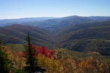
There are spectacular overlooks all along the Canyon Rim Trail. The
Point is especially beautiful and wide ranging. There were so many views
that we started to pass some by and others provided wonderful excuses to
remove our loads and to spread ourselves on the cool rocks in the warm
sun. It was glorious weather.
We passed a couple nice campsites along the rim, too, though none had
the open views of our first nights site. We came across a long section
where we had to jump from rock to rock to stay on trail. Thank you to
each of you who placed the cairns along that path or we could possibly
still be there. That section seemed endless and the trail promptly
disappeared again on the western end.
We never noticed where the Canyon Rim Trail met the Tee Pee Trail, but
we found the dry campsite that was mentioned there. We knew we were
nearing our destination for the night at the junction of the Canyon Rim
Trail and the Roaring Plains Trail and since that area was said to be
dry we chose to pump water from a small spring under a rock near the dry
campsite. We could actually hear the water running behind the rocks.
M.R.Hyker had warned me that the water was dirty there, but it looked
clear. Of course, he was right and it clogged my filter even through my
pre-filter. I found the same thing back in June when I pumped water out
of Red Creek down near The Forks. There's some kind of mineral in that
water that just clogs filters badly. We got enough water to get by,
though, and kept on going.
We collapsed on one more rock outcropping and not long after leaving
there stomped through a bog at the edge of some clearings in the spruce
and followed the trail up a gentle grade until we finally made it to the
trail junction where we found about 20-30 tents already set up.
Apparently there was a Washington Backpacking club who came in via the
Roaring Plains Trail. There was plenty of room for us, though, and we
set up on the edge of the camp with a nice overlook of the valley to the
southwest.
The wind howled all night. Over the years Ive found that is typical of
most of the Dolly Sods and the Roaring Plains area. We camp in hammocks,
so we got a nice rocking motion all night. That is, when we didnt feel
like we were being blown out of the trees. We packed up late Sunday
morning, doubled back to the Roaring Plains Trail which was our first
clearly marked trail of the weekend. It was well blazed and wide open.
As a matter of curiosity we found that end of the Tee Pee Trail as we
passed by. There were colored flags hanging in the laurel there and my
GPS confirmed we were at that junction. We stayed on the Boars Nest
Trail, descended, found the pipeline and turned right, and shortly after
that came to the end of FR70 onto which we turned left. There were about
10 cars parked there which we passed and shortly afterward we turned
left onto the Boars Nest Trail.
The Boars Nest Trail is well marked, wide open and from FR70 climbs
steeply for short time before leveling out. There are some great views
across the open mountains, meadows, more spruce groves, more laurel
thickets and brilliantly lit deciduous forest all around us. Then, we
began the painful descent back into the South Fork of the Red Creek
valley that lasted more than a mile. I had photography equipment and my
load was much weightier than I prefer. Going downhill hurt. We finally
made it to the creek and rested. Then we turned our sights to that last
very steep climb back to the car. We headed out to Seneca Creek to eat
badly and drink great beer in celebration of one more excellent trip.
I'm going back there, but next time I'm going to alter my route and trim
my load back to my normal almost ultra light weight. I like long
distance backpacking trips, but this trip was long, difficult and with a
heavy backpack it wasn't as easy to enjoy the magnificent sites as it
would be with a lighter daypack. I'll probably make base camp near where
we spent our first night this trip, take the Canyon Rim Trail (now that
I know how to find it) as a day trip, turn off at the Tee Pee Trail (if
I can find that end of it), turn right onto the Roaring Plains Trail and
when I reach the pipeline turn right and walk the mile back up the
pipeline until I turn left onto the Hidden Passage Trail and back to
camp. Look for me there in a few weeks.
________________________________________
Name: Dave Barry
Hike: Roaring Plains Circuit
Date: 1010/09
Rating: 2
Critique: The Canyon Rim Trail could be a great experience. However, we
missed a least three trail junctions (tee pee in particular) and were in
a somewhat dangerous position for half a day because of it. The trip
ended late with a trip leader with a wrenched knee and gashes on his
face (from a fall) and two participants who would not try it again. The
poor trail documentation and rugged terrain are a dangerous combination.
Big Suggestion for the all trail descriptions - give compass headings
and distances. For instance, the instruction for finding the tee pee
trail is something like "starts behind the campsite a short distance
into the laurel thicket". A much more effective description would be
something like "about 150 yards NW (300 degrees) of the fire ring". By
the way the thicket is actually small pine trees.
We greatly appreciate the huge effort involved in MidAtlantic and the
wonderful hikes it documents. The GPS tracks will be increasingly useful
as more of us obtain that equipment.
________________________________________
Name: Paul Fofonoff
Hike: Roaring Plains Circuit
Date: 10/10-11/2009
Rating: 5
Critique: I led a trip to Roaring Plains for the DC Chapter of the
Appalachian Mountain Club on Columbus Day Weekend. It turned out to be
the most spectacular but also the most strenuous hiking that I've done
in Mid-Atlantic region, comparable in roughness and dramatic views to
some of the roughest trails in New England, and except in altitude, to
some of the rougher trails in the West. We followed Mike's route up to
the Tee Pee Trail, which we hunted for but could find no trace. We
considered a bushwhack, but instead continued rockwhacking along the
Canyon Rim, following the cairns through a seemingly endless boulder
field. Throughout the route, we had to stop periodically to look for
paths or cairns. We were lucky to have good weather for most of the
trip, as clouds lifted on Saturday afternoon, but rocks and leaves
remained slippery, especially on the Boars Nest Trail (the 'Sliding
Board'). This is one of those trips where you tell yourself 'Never
Again' the day after, and then start thinking about returning as the
aches and scratches start to heal, when you look at memories and
pictures. Mike, thanks, for getting us out there!
________________________________________
Name: Sara Bird
Hike: Roaring Plains Circuit
Date: 09/05-06/009
Rating: 5
Critique: Challenging, but well worth it. Spent the night just northwest
of the point. Map and trail descriptions were just enough to keep us on
trail for the most part. Internal sense of direction didn't hurt, but
clearly didn't help when getting lost on Tee-Pee trail. Trail was marked
with flags, but missed a crucial right hand turn through some boggy area
and ended up in open but barely navigable field of heath thickets.
Backtracked saw the missed flag and were able to continue on out to
Roaring Plains trail with only minimal head scratching. Breaked for
sustenance and wit-gathering at the site of the old "teepee" What's the
backstory here? Anyone?
(M.R. Hyker Note: There is/was an old hunter's canvas tee-pee standing
back in the woods that you could see from the edge of the small campsite
in a thicket. I think it has fallen down since I last hiked it.)
Thanks for the route and I know I'll do it again soon.
________________________________________
Name: Jeff Slahor
Hike: Roaring Plains Circuit
Date: 10/18-10/21 2007
Rating: 5
Critique: Gotten back into backpacking in the last decade and covered a
fair amount of the Mon Nat Forest along with other trips east of the
Miss. This was clearly one of the greatest I've done to date. It was
fairly easy to jump trail, miss connections, etc. but between the three
of us we were able to put one complete brain together and complete the
loop. Relatively short but a good work out both physically and
mentally. Kudos to the keeper of this website for extremely accurate
information. Thanks.
________________________________________
Name: Jeff
Hike: Roaring Plains Circuit
Date: October 6, 2007
Rating: 4.5
Critique: My brother, son and I took the entire loop described here in
one long day hike. Although I consider our route finding abilities
pretty good we did manage to get confused a couple of times (not lost).
At first we missed the 'right turn and cross a small stream' and
started heading downhill before realizing our mistake. Soon after we
wandered away from the rim following a sort of trail then had a knock
down drag out fight with thickets to get back to the rim. My brother
climbed a tree to scout out the most feasible way through the thick
thicket. My brother led us through very nicely on the Teepee Trail. On
my own I think I would have gotten all mixed up here. The first large
flat rock with a cairn on it that we came to was not the place to turn
left on a sandy trail. A second large flat rock without a cairn was the
place to turn left. I was surprised how mucky this trail was during a
dry October, must be an incredible mess during a wet Spring. The
succession of viewpoints on this hike were fantastic. Only the short
ugly stretch on the Pipeline Swath kept me from giving a rating of 5.
________________________________________
Name: Brendt Jacobsen Hike:
Roaring Plains Circuit
Date: 6/30/07-7/3/07 Rating: 5
Critique: Excellent, challenging hike! As other posters have ventured,
the Tee Pee Trail is a trail in name only. The only way to follow it
was with a GPS with route mapping or following the foot prints on the
ground. However, the views and scenery are excellent and well worth
the walk up the mountain. Last camp site on the Roaring Plains circuit
by the gas line is a little to be desired. It wasn't bad for us, but if
it rains or it is warm enough for skeeters, you might want to rethink
your camp spot as the site sits in a swampy low level bog.
________________________________________
Name: M&C Anderson
Hike:
Roaring Plains
Circuit
Date: 7/2006 and 6/2007
Rating: 5
Critique: I'd like to offer some thoughts on the Tee Pee bushwhack,
which is an important but not critical tool for traveling in this
wonderful corner of wild West Virginia. This isn't a "trail" and should
not be interpreted as such. It is hard to find and hard to follow.
Indeed, it is nothing more than a meandering, old, stubborn tread that,
if it is found, can be used to hasten an exit from the canyons rim area.
Think of it as a bushwhacking aide in that it allows penetration into
otherwise impenetrable terrain. It's short enough that getting lost
would take some doing, but it also should not be mistaken for a trail
where the route is rational or obvious. If you can't find it, don't
worry too much because you can continue along the rim and climb over
some incredible boulder fields before running into the official forest
service trail a bit to the west.
________________________________________
Name: John Truslow
Hike: Roaring Plains
Date: June 8-11, 2007
Rating: 5
Critique: Fantastic place! I love this area more each time I go.
We hiked from the upper (Eastern) South Prong trailhead to a base camp
near the beginning of the Hidden Passage. A fierce storm blew in just
before dinner with deafening thunder, hard rain and strong winds -- a
humbling but enjoyable experience.
After a night of Roaring Winds, we day-hiked the Hidden Passage and
Canyon Rim trails with little confusion and only occasional
head-scratching.
Then came the Tee Pee trail. We had some trouble even finding it (a tiny
bit of flagging tape), and even more trouble staying on it due to the
many game and lost hiker side-trails. Then at the "flat rock with cairn"
we got confused, explored each of the possible paths and picked the
wrong one -- the "obvious" path/stream headed right and followed it into
a large boggy area. Beautiful, but not the best hiking. Realizing our
error, we bushwhacked our way around the bog and back to the trail -- a
long and tedious detour through the laurel and rhodo thickets. I know
why they're called THICKets.
Once back on Roaring Plains Trail, the rest of the circuit was
uneventful with much conversation about our missed waypoint.
The next day, we followed Roaring Plains Trail back to the area of the
missed Tee-Pee Trail junction -- and proceeded to walk right past it.
Backtracking, we came to a water bar with a cairn and tiny piece of
flagging tape. Exploring 100 yards down the "stream" at the water bar,
we came to a familiar flat rock.
Now comes a confession. Not knowing that the trail notes on this site
mention "a large flat rock with a cairn on top" we proceeded to re-cairn
the junction to hopefully clarify things. To us, the cairn appeared to
lead you straight forward through the junction rather than a hard-left
turn. (Note: if passable, straight ahead is even closer (70 yards?) to
the main trail than the left turn up the stream. We did not explore this
option.)
We moved the cairn closer to the trail and doubled-up to signify a turn.
We also placed another cairn (at some distance, but within sight) in
each of the proper directions. It made better sense to us, and we were
proud to help the next folks though a tricky area.
Then we discovered these trail notes and our well-intentioned act seemed
more like vandalism. Many apologies if we have caused any confusion. I'm
considering another trip to replace the missing cairn, but welcome
opinions.
Either way, Beware the Tee-Pee Trail and take a hard left at the large
flat rock.
We'll be back!
________________________________________
Name: Jim Kirk
Hike:
Roaring plains
Date: many times
Rating: 5
Critique: If you haven't had enough cool rocky terrain after the canyon
rim, follow it to the end where it intersects Roaring Plains Trail.
Make a left on Roaring Plains and go out and check out the cool rock
hunting blind on the rise there where Roaring Plains meets Flatrock,
Then come back and camp there at the nice camping area you have already
passed thru where Canyon Rim meets Roaring plains.
The next day head back toward the pipeline on Roaring plains trail. On
your left there's a trail cut off marked by a peice of iron stove or
something surrounded by little rocks. This trail leads out a ridge
weaving in and out of the woods and rocky outcroppings like Canyon Rim
ending up at the microwave tower road that connects to the pipeline. If
you still have time hand a left on the pipeline and looking for cairns
on your right at about 25 to 50 yards and go down over the hill to Camel
Rocks. Good view. You can see the bushwhack rock outcrop off of Boars
Nest from there!
________________________________________
Name: Paul Wilcox Hike:
Roaring Plains Circuit
Date: May 10-15 Rating: 5
Critique: An amazing hike. Makes a great 5 day trip if you add the
Dolly Sods
Circumnavigation to it. However, beware of the Tee Pee trail.
________________________________________
Name: Paul Senstad
Hike:
Roaring Plains
Date: 5-07-07
Rating: 5
Critique: it would be very hard to find any fault with this truly
awesome trail! However, I could not find the Tee Pee trail, although I
never saw or overlooked the hunters campsite. I just kept following the
cairns and orange tape and found myself at the far western end of the
Roaring Plains trail. I hope to hike this again. Thank you for a great
great hiking trail!
________________________________________
Peter L. Hike:
Roaring Plains
Date: April 28, 2007
Rating: 4.5
Critique: Definitely a great backpacking locale. I will have to do it
again with better weather. We hiked in Friday evening to the
intersection of the Hidden Passage and South Prong Trail. We camped
along a stream there and the weather promptly turned sour. It rained
lightly off and on during the night and the wind picked up. I now know
how the Roaring Plains got its name. Saturday was socked in, overcast
and cold. The temps stayed in the mid-40s for most of the day. The trail
was as described and easy to follow for the most part. I used the
provided waypoints in my GPS device, which ended up saving the day. The
Tee Pee trail is definitely the sketchiest part of the hike; once the
trail runs into the laurel thickets, it becomes very difficult to
follow. There are numerous deer trails that scatter off the 'main'
trail. If we didn't have a GPS, we'd probably still be stuck in the
thickets. I would advise adding more detail about negotiating this
stretch of the trail.
Overall a wonderful place and I plan on returning when there is better
weather so I can enjoy the views.
M.R.Hyker Note: I'll let your comment
stand as a warning about the Tee Pee Trail.
________________________________________
Name: Jonathan
Jessup Hike: Roaring
Plains Canyon Trail
Date:
8/20/2005 Ranking:
5
Critique: This is just one of those hikes that takes your
breath away. It requires a high skill level though. Be
careful up there and take caution. Study the map!
Mike thanks for your wonderful web site! Your journeys in the
wilds are a life changing practice! To be in nature for as
long as you have is to realize inner
peace.
________________________________________ |