|
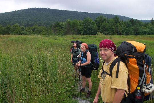
Tea Creek Backpack |
|
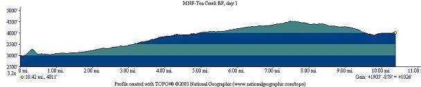
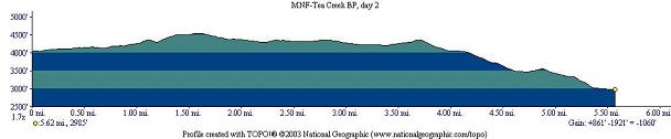
Description: This is a 16 mile, 2
day backpack through the Tea Creek drainage. Easily 2/3rds of the
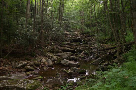
hike is along railroad grades. While this implies hiking along
gradual slopes it also entails stepping on a very rocky surface
often times punctuated by old rail road ties. Most of the time is
spent walking under a very dense canopy of mixed hardwoods and Red
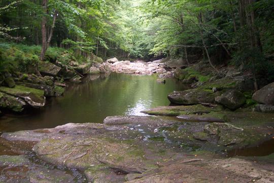
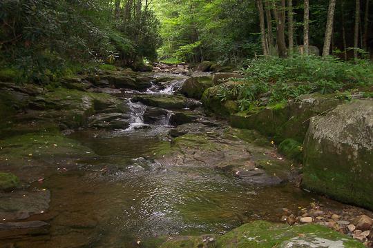
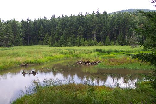
Spruce. Tea Creek, Right Fork and Red Run are all beautiful streams
featuring rocky cascades and swimming holes in the lower areas and
swampy, beaver modified tracts in the upper
areas.
When I first scouted
this hike I did it in segments as a series of smaller loop and
shuttle hikes. My maps suggest hiking 10.5 miles on day one and
camping along the Right Fork and accomplishing the final 5.5 miles
on day 2. While there are 3 |
______________________________________ |
|
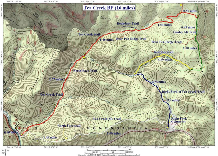
Trail Notes: All trails are blazed with blue plastic diamonds and signed. From the kiosk follow the Williams River Trail. Cross Tea Creek on a wooden bridge. By-pass the foot trail the follows the opposite bank. Continue on Williams River Trail. Turn left on Tea Creek Mountain Trail. Its sign and that for Tea Creek Trail is just a few steps up the trail. Turn left onto Tea Creek Trail. Follow the switchbacks up and over the hill to an old railroad grade. In 2.8 miles from the beginning arrive at a shelter, swimming hole and the confluence of Right Fork of Tea Creek with Tea Creek. Signs for North Face and Right Fork Trail are also there.
Cross the Right Fork and continue up Tea Creek. This section is slow. The trail still contains much of the rock ballast used for the railroad and several old ties as well. Furthermore there are more than 10 crossings of Tea Creek along this segment. At 1.4 miles from the Right Fork Crossing reach the junction of Bear Pen Ridge Trail from the right and the Boundary Trail from the left.
The
trail follows the Creek for about another mile before making a
hairpin right turn and following another railroad grade up the hill.
0.5 miles after this turn Tea Creek Trail turns left at a sign and
Tea Creek Connector Trail continues straight up the grade. Follow
the Connector Trail for 0.5 miles until you reach the Gauley
Mountain Trail.
Turn right onto Gauley Mountain Trail and slowly climb about 0.5 miles passing the east terminus of Bear Pen Ridge Trail. In another 1.1 miles arrive at Red Run Trail. The signs and the MNF Trail Guide notes the length of this trail as being 2.5 miles. I and others believe the actual distance is closer to 1.7 miles. If need be, you can camp at the headwaters of the run about 0.3 miles down the trail. Places for tents might be found to the right of the trail against a hill. Its best to continue down Red Run Trail to it�s junction with Right Fork Trail. |
|
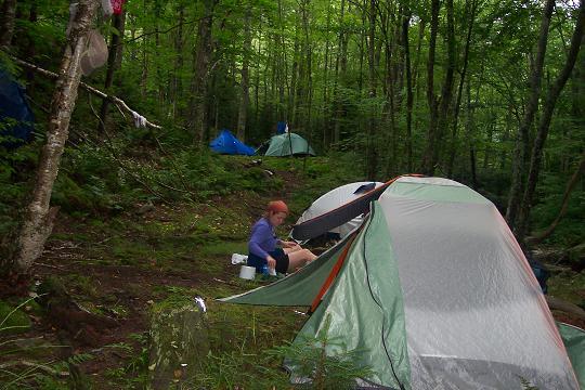
Follow Right Fork Trail until you cross Red Run. There you will find
a nice shelf to camp on. Further out on the point are even better
more isolated sites that are not visible from the trail.
On day
two climb the steps carved into the hill by the
This is
probably the hardest part of day two, a steep ascent up the side of
the mountain. You�ll gain 400 feet in about 0.25 miles via a set of
switchbacks. After that the rest of the hike is either flat or
gradual climbs crossing a rock field and three knobs. At 3 miles
from the Tea Creek Mt Trailhead pass North Face Trail on the right
and begin a rapid descent. At 1.4 miles pass Tea Creek Trail on the
right and arrive at Printable/Downloadable Directions and Trail Notes Read about a Tea Creek BP adventure. ______________________________________
______________________________________ |
|
|