|
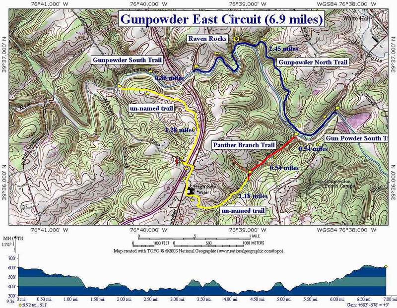
Gunpowder Falls East Circuit |
|
|
Description: This is a relatively easy 7 mile
circuit. There are a few steep hills and several stream crossings
however, the hills are short and most of the stream crossings are
narrow. This is a good winter hike or a trek when you need to stay
close to home but just need to get out in the woods for a while. The
highlights are the falls at Raven Rocks, a popular lunch spot, and
the hardly visible ruins of the gunpowder mills on Panther
Branch. Park on either shoulder of Bunker Hill Rd near the gate for the Gunpowder Archery Club. |
|
___________________________________________________
Trail Notes:
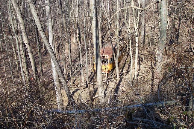
Walk back to Collett Dr. and turn left onto it. Pass a few homes on
the left and then walk around a barrier. Judging by the railroad
ties on the side of the old road and the derelict BTC Street Car you
pass on the way, I suspect this used to be the end of the line that
at one time ran into the center of Baltimore. As you descend, the
road will bend to the left leaving the sounds of I-83 and a nice
meadow on the right. Hawks can be spotted in the surrounding trees
at times as they search the meadow for their next
meal. Pass the remains of an old
farm on the left. Several foundations can be seen. The most obvious
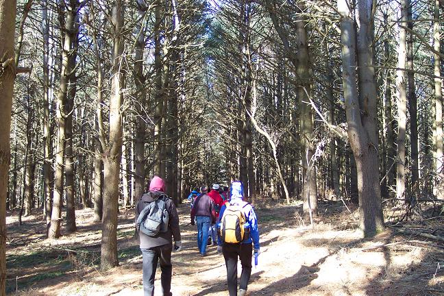
is an old silo. Climb a short hill and enter a pine plantation.
Faint blue blazes remain on a couple of the trees suggesting that
this was once an official park trail. At the end of the pine
plantation the most worn trail bears to the right (east) to join up
with the Gunpowder South Trail. To walk along more of the river bear
to the left here (west). The trail is pretty faint if you can find it
at all. Just walk down the hill through open woods, keeping towards
the center of the hill as you descend. You�ll notice that the hill
is getting narrower. The old trail should soon become apparent. Arrive at an old
amphitheater with wooden seats not far from the river (1.28 miles
from the start). Turn right onto white blazed Gunpowder South Trail.
Watch the blazes. In a while the trail will split. The old trail
will continue to follow the river. If you take this route you will
be compelled to negotiate some serious blow downs and a blowout of
the river bank. Instead take the right fork up the side of the hill,
descending just before I-83. Walk under I-83 and
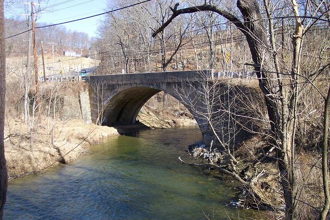
soon arrive at York Road (0.86 miles from the amphitheatre). Turn
left, cross the bridge and turn right onto blue blazed Gunpowder
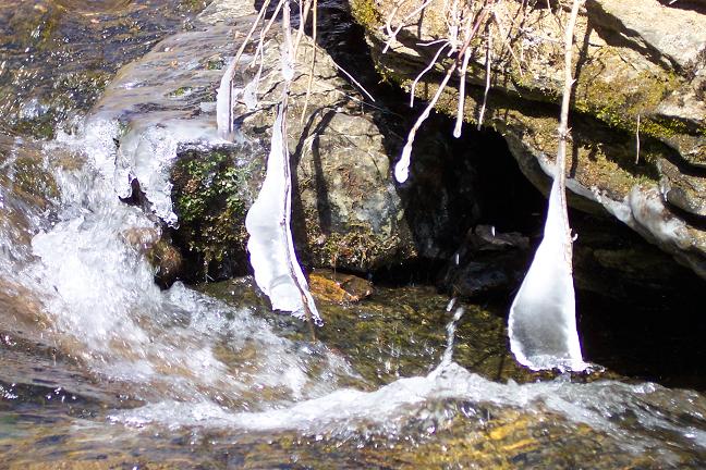
North Trail. In about 0.8 miles reach scenic Raven Rocks, a great
lunch spot. In the early spring, Star of Bethlehem flowers bloom
along its edges. Continue along
Gunpowder North Trail, ascending and descending the only 2 major
hills on the trip. They are steep but very short. At one mile after
leaving Raven Rocks the trail ends at a gravel drive. Turn right and
follow it out to Falls Road (0.33 miles from the trail
end). Turn right on Falls
Road, cross the bridge and turn right again, back onto white blazed
Gunpowder South Trail. In 0.54 miles reach the junction with pink
(?) blazed Panther Branch Trail. There is no sign but the trail is
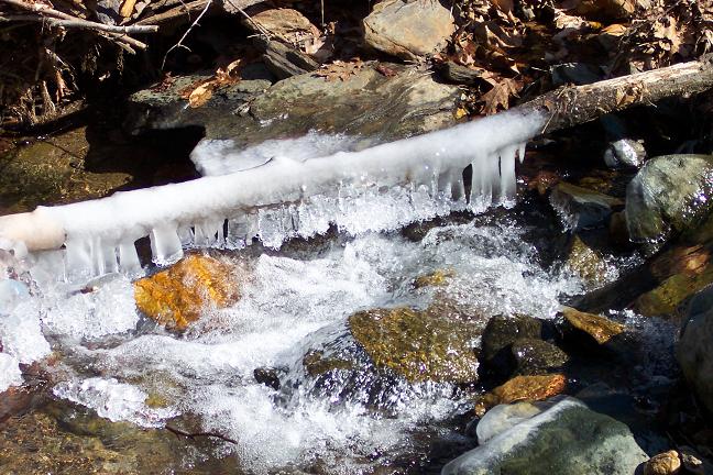
obvious. There are 2 places where you can cross Panther Branch.
There is a narrow rock hop closer to the trail junction and a wide
�splash� crossing a little farther up stream. Pick
one! Continue up Panther
Branch. Watch for old stonework on the hill on your right with
breaks in it. Behind it used to be the millrace for the gunpowder
mills. At the fork in the stream the trail and blazes goes right.
From here you can look downstream and get a better view of the
millrace. Where you are standing probably used to be a dammed
pond. Shortly after bearing
right look for an obvious trail that crosses the right fork. Cross
here, leaving Panther Branch Trail but still following Panther
Branch. You�ll soon pass the ruins of an old hearth on the right. I
think this was used to make charcoal which was used in the
production of gun powder in the
mills. You�ll cross Panther
Branch about 4 more times, most of these are easy rock hops but be
careful. The most innocent little rock can be quite slippery and
very quickly deposit one on his/her
bottom. After leaving the official Panther Branch Trail you want to keep an eye out on the ridge to the right. Where the top is flat and open happens to be the edge of Hereford High School�s Athletic fields. On the stream, just above this feature, you�ll make your last crossing. You should be able to pick up a trail that follows a trough up the back of the hill and very quickly deposits you onto a nice pine needle, wide road which ends at the edge of the school property. From here, turn right and follow the baseball field. At a break in the fence follow the third base line to the south side of the school. (There is fencing blocking your progress on the north side.) From there follow York Road and Bunker Hill Road back to your car.
Zipped National Geographic. TOPO! GPS and Universal GPX Files GPS text File for Non-TOPO! Users |
|
_____________________________________
_____________________________________
Name: Trailbuzzer Hike: Gunpowder-East Circuit Date: 04/15/15 Rating: 4
Ccritique: The trail notes are a little bit dated but they are more than sufficient to follow the intended trail. This is a nice hike with some great scenery along the river. Very little contact with others along the way except for a few fly fishermen. The trail is mostly flat along the river but there is enough up and down in other places for a some cardio challenge. The scenery along the Panther Branch gorge (around 5.5 miles) is especially magnificent.
_____________________________________
Name: Dave Hike: Gunpowder Falls East Circuit Date: 10/12/13 Rating: 5
Critique: This needs to be updated--I think the park may have built some trails that make the early description obsolete.
_____________________________________
Name: Bruce Hike: Gunpowder Falls-East Circuit Date: 06/22/13 Rating: 4
Critique: The description is good. I made it without the map, but used my gps a couple of times to make sure I was on the approximate right track. The trail was overgrown in spots, but for the most part not too difficult. I saw a total of 7 people on the hike. 4 runners, two other hikers and a guy standing by the water at one of the entry points. I took a dog with me and had no problems. The other two hikers had a dog as well.
_____________________________________
Name: Ed. S
Hike:
Gunpowder Falls East Circuit _____________________________________
Name: Adventure Runner
Hike: Gunpowder Falls (Hereford) East _____________________________________
Name: Kingston Bowen
Hike: Gunpowder Falls-East _____________________________________
Name: Paul Schwartz
Hike: GunpowderFalls-East
Name: Matt
Hike: Gunpowder Falls-East
_____________________________________
Name: Rob
Hike: Gunpowder Falls-East
_____________________________________ |
|
|