Trail
Notes: From the parking area take the spur trail (white diamond
blazes) to white blazed Mountain Loop Trail. Turn left. In about 0.5
miles the blue blazed Northern Peak Tr will come in from the left.
Continue straight (right) on the dual white/blue blazed Mountain
Loop/ Northern Peaks Trail.
*
Soon the white blazed Mountain Loop
Trail will leave to the left. Continue straight on the single blue
blazed Northern Peaks Tr.
Note: If you
want to bag a couple of more vistas and add a short but
challenging rock scramble start the hike by turning left at the
kiosk onto the orange blazed Sunrise Tr and almost immediately
start a steep rocky climb. Near the top the trail flattens out.
Turn left on a red blazed and follow it to the summit. After you
take in the vista follow the red trail back down, passing the
orange blazed Sunrise Tr you came up on to the right, to the
blue blazed Northern Peaks Trail and the Charles Lambert
(McCormack) Vista.
Turn right here and follow the blue blazes out to the white
blazed Mountain loop Trail. Turn left here and pick up the
remainder of the directions marked with an * above.
I n another 1.2 miles descend
and cross yellow blazed Saddle Back Trail. Avoid the woods road
signed "THIS IS NOT A TRAIL" off to the right. Follow the blue
blazes and sign for White Rocks. Climb back up to the top of a peak,
pass a gigantic cairn and a defunct section of the blue trail to its
left (You just hiked up the reroute.) and in about 1.2 miles from the last trail
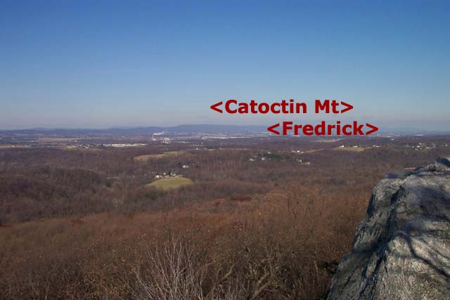
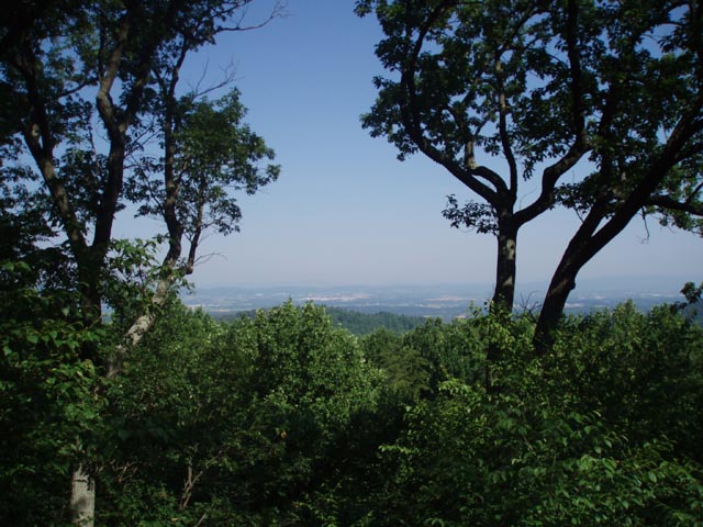
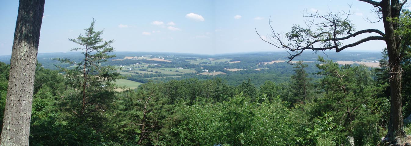
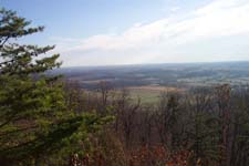
junction arrive at White Rocks, a great lunch spot with both north
and south views.
Descend and turn left onto Mt. Ephram Road. In
a short distance, cross a stream which often flows over the road,
and turn left onto the continuation of blue blazed Northern
Peaks Trail. (Yellow blazed Saddle Back Trail leaves on the opposite
side of Mt. Ephram Road.)
Climb for about 0.9 miles to an intersection
with white blazed Mountain Loop Trail. Turn right ( straight) here
and follow the dual white/blue blazes. The blue
blazed Northern Peaks Trail will soon turn off to the
left as well. (If you wish/need to shorten the hike you can take
this trail up to the Western View area and take the park road back
to the East View Area.) Continue on the white blazed Mountain Loop
Tr. There will be another spur to the left that will take you
to the Potomac Overlook. (If you visit it return to the Mountain
Loop Tr and turn left.) Arrive at an old road and the
junction of yellow blazed Saddle Back Tr at the base of the mountain
(about 0.6 miles from the last trail junction). The yellow blazed
Saddleback trail will share the tread for a while.
Turn left onto this road for a few hundred feet
and then right on another park road. . Pass the Stronghold mansions
and turn left onto the main park road behind the farm buildings you
drove through when you arrived at the park. Soon the white blazes
re-enter the woods on a footpath to the left.
Climb about 0.7 miles back to your car. You'll
cross the park road one more time before the steepest climb.
Printable/Downloadable Map
View 3-D
Map
Zipped
National Geographic. TOPO! GPS and Universal GPX Files
GPS Text File For Non-TOPO!
Users
Printable/Downloadable Directions
and Trail Notes
Critique this
outing
________________________________________
________________________________________
Name:
Adventure Runner
Hike: Sugarloaf Mountain
Date: 1/13/13
Rating: 4
Critique: I ran the mountain today. Have been hiking and running
here since I was a little kid. This is one of my favorite spots to
hike or run.
There is a network of loop trails and summit trails here that allow
you to create a route suitable for you. Personally, I like parking
at the bottom of the mountain at the entrance gates. I take the
white trail up to the East Overlook, climb to the summit on the
orange trail, go down the red trail and then complete the circuit
around the mountain on the blue and white trails.
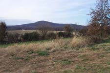
Although the mountain is not very high, it's a lot higher than any
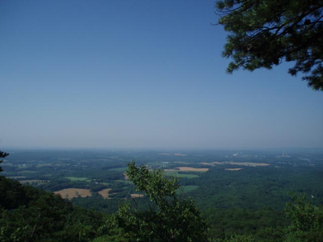
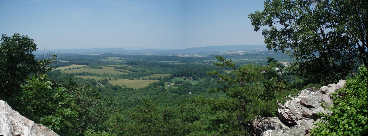
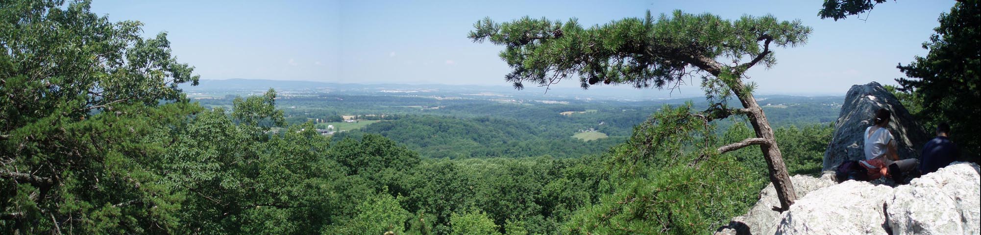
of the surrounding land, so there are a number of great views. The
summit is nice, but I think the best views are probably from White
Rocks at the north end of the blue trail.
The trails are also fairly steep as a result of the difference in
elevation. Nothing insane, but there are some climbs. The only one
that might cause anyone any trouble is the orange trail, but it's a
blast if you like steep, rocky trails. Some of the trails are
suffering from erosion and braiding from all the use and abuse,
especially around the summit area, but they still have a nice flow
to them.
Being the closest mountain to DC is this area's only drawback. It's
convenient for a quick getaway with a real mountain flavor, but
don't expect any solitude unless you come early on a weekday in bad
weather. Parking can also get tight in some of the smaller lots.
________________________________________
Name:
Laura
Hike: Sugarloaf Mountain
Date: September 1, 2012
Rating: 2
Critique: I was really looking forward to this hike, and was
disappointed on so many levels.
First, we opted to take the "scramble" up the orange blaze; we are
experienced hikers who just finished a week in the Eastern Sierra.
It was horrible. The trail is suffering massive erosion, and is a
*very* steep grade of nothing but rocks and roots. Calling it
"steep" is disingenuous; it is treacherous, especially considering
that many people were hiking with young children who were crocs and
flip flops. M.R. Hyker Notes: I
don't think we can be any clearer than the warning in red posted in
the Trail Notes. We cannot be responsible for parents who let their
children wear crocs or sandals when hiking. That is neglect on their
part.
The mountain was far too crowded for me. Noisy crowds of people
everywhere.
________________________________________
Name:
Joseph Dooley
Hike: Sugarloaf Mountain
Date: 8/31/2011
Rating: 3.4
Critique: Stronghold Corporation opens the park at 8 am, so don't
make the same mistake I did and time your arrival for a dawn summit.
I ended up driving around Hyattstown for an hour.
The trails at Sugarloaf intersect each other like a spider web, so
unless you visit White Rocks you're never really more than a mile
from your car. If you want a REAL rock scramble, there's an
unofficial rock wall between the two parking lots (closer to the
East View). Despite that you are parking only about 200 feet below
the summit, the vista is very good on a clear day. Graffiti artists
have sullied the summit and the West View, unfortunately. Don't
forget to contribute a rock to the cairn.
________________________________________
Name:
Aaron Resnick
Hike: Sugarloaf Mountain
Date: May 30, 2011
Rating: 4
Critique: A small group of us hiked this great trail on a warm
Sunday. While it was Memorial Day weekend, we found only moderate
crowds on the orange trail leading to the top of Sugarloaf. The
parking lot wasn't even entirely full. The crowds thinned out
considerably once you get on the blue Northern Peaks Trail and/or
white Mountain Loop Trail.
The route offered great vistas, as well as tree cover over a vast
majority of the loop trail, keeping hikers as cool as possible.
________________________________________
Name:
Linda
Hike: Sugarloaf Mountain
Date: Sept 15 2010
Rating: 4
Critique: First off, someone needs to proof read the directions -
particularly the ones on the "Printable/downloadable directions." I
printed that off to lead a hike of 9 other ladies yesterday. Some of
the ladies had printed off the first page of the hike site instead.
That page is correct - the "printable" ones are not. Specifically -
the front page of the hike says to come down to Mt. Ephraim road,
turn left, cross a stream, etc. THAT is correct. The "printable"
directions tell you to turn RIGHT on Mt. Ephraim road and says
nothing about a stream crossing. That is completely wrong.
Also - where the map shows the Green Trail running right into the
Blue Trail.....either it actually does not meet the Blue Trail or it
is so poorly blazed that it is impossible to figure out where they
connect. We followed it to where the staircase comes up - and from
there lost all trace of it. No blazes, no indications of where to go
next. So we backtracked and followed the Red Trail back to the Blue.
One vista point is listed as the "Lawton vista" on the directions
but when you get there the name of it on the signpost is "McCormack
vista."
The Blue Trail comes up to a cleared area, about 1/2 or mile or so
before White Rocks, where there is an old stack of stones - appears
to have been an attempt at a structure of some kind. From there the
Blue Trail goes both to the right and to the left. The directions
say nothing about either this "land mark" or which way to go.
Fortunately we had a copy of the map and figured it out. If someone
is hiking only with the printed directions, they'd wouldn't know
which way to go.
I'd have given this hike a 5 but for the incredibly bad blazing and
signage.
M.R.Hyker Note:
Corrections have been made. The stone steps are part of the Green
trail. They lead to the road. Turn right when you reach the road and
in a short distance you'll find the Blue trail.
________________________________________
Name:
Vern
Hike: Sugarloaf Mountain
Date: May 24, 2009
Rating: 3
Critique: This was a fun little hike. The only problem is that it
was over way too soon! There are a lot of good views, for very
little effort.
It was Memorial Day weekend, with temps in the eighties, so the
mountain was busy and full of families with young children. There
sure was a lot of noise going on at White Rocks, so we only stayed
long enough to choke our lunch down. Of course the noise did not
prevent us from getting some great photos.
Most of the trails are quite rocky, but all in all, they are well
maintained and well blazed. The views from each of the vistas are
outstanding.
Please note that a map or some other navigational aid is necessary.
The trails are a bit confusing, and I ran across one person who was
just plain lost. The trail description and map provided here makes
it easy.
Sugarloaf is worth the trip, I'm just not sure I would go out of my
way to repeat.
________________________________________
Name:
Cory
Hike: Sugarloaf Mountain
Date: 9 Sep 07
Rating: 4
Critique: I enjoyed this hike. I agree with Heather (Mar 06) that
the last part of the hike is a bit to steep for my liking but that
could be solved by simply doing the hike, as suggested, in reverse.
Aside from that I didn't encounter that many people (though there
were a lot of cars parked there...where were they all at??) and the
trails are well marked and maintained. Overall, I think it's a
great way to spend a few hours and plan on going back later on in
the fall when the leaves change color.
________________________________________
Name:
Heather Hike: Sugarloaf
Mountain
Date: March 12, 2006 Rating: 3.5
Critique: Definitely try and start your hike early on Sugarloaf
because by noon the mountain is pretty crowded. The first 6 miles of
this hike were great and I enjoyed the suggested route. The last 1.4
miles take you back onto park roads and heavier trafficked areas. I
love a great climb that gets my heart pumping, but having that at
the end of the hike was not optimal in my opinion. All-in-all a nice
quick hike that will get you away from the city, but not necessarily
city folks. :-) |