
|
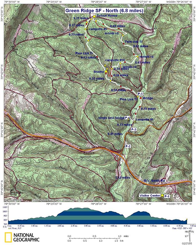
Green Ridge North Circuit |
|
|
Description: This is a moderate �spoon-shaped�
circuit utilizing the Pine Lick and Twin Oaks Trails. Since the Pine
Lick Trail starts at the
|
|
This circuit uses a mixture of footpaths and woods roads.
Pine Lick Trail descends from the Visitor Center and follows Fifteen
Mile Creek and then Pine Lick north before climbing a short ridge
and ending at the northern terminus of Twin Oaks Trail. Just north
of the south junction of Pine Lick and Twin Oaks, on Pine Lick
itself, is a recently constructed Google Custom Directions to starting Point 4 on Fifteen Mile Creek Rd ______________________________________ |
View 3-D Map of 8 mile Version! Zipped National Geographic. TOPO! GPS and Universal GPX Files |
Trail Notes: All trails are blazed with hard to distinguish light beige diamonds ranging in size from 2X2 to 8X8 inches. They really blend in well and are hard to pick up. Major trail intersections are signed.
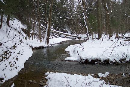
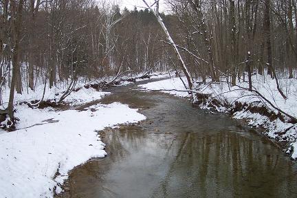
Begin at the brown stake marking Campsite #1 at the south-east corner of the bridge. Walk down the driveway. Pine Lick trail loops around the campsite and crosses the driveway close to the base of a hill. There is no sign. The trail climbs part way up the hill on a very narrow foot path. You�ll pass through a nice stand of Hemlocks and descend to the creek for a bit. You�ll traverse a lesser hill and at 0.7 miles from the start cross the creek on a foot bridge and come out on Fifteen Mile Creek Rd.
Turn right onto the road and cross over a bridge/culvert. There will be a rope swing over a swimming hole in the creek to the right. After crossing the bridge/culvert turn left to regain Pine Lick Trail. There is no sign.
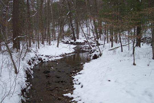
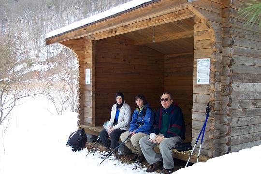
You�ll cross Pine Lick several times. In 0.59 miles arrive at the southern junction with Twin Oaks Trail. (You�ll descend on this trail later.) Continue up Pine Lick for another 0.3 miles to a shelter on your right.
In about 0.4 miles from the shelter you�ll leave the valley, climbing steeply over a short distance to gain a ridge. In another 0.3 miles, come to an unsigned fork in the trail. Stay to the left, following the blazes.
In 0.25 miles arrive at the back of Campsite #5. The trail
turns left here and parallels |
|
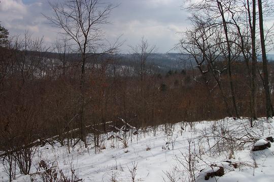
Take care! Although I believe this old road later links up with the trail again, Twin Oaks Tr quickly turns left onto a foot path, leaving the road behind. The trail follows an un-named hollow for a bit, eventually descending to the stream before climbing to the ridge and rejoining the old woods road at a wildlife clearing and pine grove 0.69 miles after originally leaving the road. As you leave the pine grove the road eventually breaks down into a foot path and climbs over a ridge with a nice view of more easterly mountains. The hollow below you seems to be struggling to recover either from a fire or a long ago clear cut.
Descend to the bottom of the hollow. Blazes are scarce here due to a shortage of standing timber to paint on. Cross two streams steeping up onto a wide woods road after the last. As you reach the crest of the hill there will be 2 �hiker posts� guiding you to make a hard right turn onto yet another woods road. This junction is approximately 0.62 from the last wildlife clearing.
As you approach yet another crest at 0.42 miles from the
previous woods road junction, the trail leaves the road on a foot
path on the right marked with a� hiker post�. Gradually climb for
0.25 miles and cross
In a few yards, come out onto a woods road. To the right is a yellow forest gate and campsite #10. Turn left onto the forest road. There are two options at this point. You can either stay on the forest road which switchbacks down to the shelter you visited earlier or, in a few yards, turn left onto a blazed foot path and follow it down to the previously passed southern junction with Pine Lick Trail. Whichever you choose, once you�ve reached the Pine Lick Trail, turn south and retrace your earlier route back to the cars. If you�re hot and sweaty you may want to consider visiting that swimming hole you passed on the starting leg of the hike! Printable/Downloadable Trail Notes! __________________________________________________________________________________________________
__________________________________________________________________________________________________
Name: Navig8tr Hike: Green Ridge North Circuit Date: 08/16/14 Rating: 3
Critique: I took this circuit as an overnighter to test some new gear. I started near campsite 1. I was glad to find that the blazes were recently painted, and Pine Lick in blue, Twin Oaks in purple, unlike the description above. I ended up doing most of the circuit the first day, and camped in campsite 11. I was surprised to find all the small streams dry, and 15 Mile Creek was an occasional stagnant, muddy , shallow puddle. I took 2 liters of water and took the last gulp when I reached the car. Overall a nice walk in the woods, but maybe better for late spring when the water might still be flowing.
__________________________________________________________________________________________________
Name: Ed S. Hike: Green Ridge North Circuit Date: 09/29/13 Rating: 4
Critique: A good hike, among the hollows and low hills in Green Ridge State Forest. I started at the old US40 crossing, and also took the spur to the Mason-Dixon Line to extend the hike. The hike runs often in the lowlands of creeks in the area, fairly dry at this time of year. Others are up on narrow benches constructed in the steep bluffs high above the creeks. In other places, it wonders along the low hills and shale barrens of the area. The trails are not that busy, which makes it a good place for seeing wildlife. The trails are often narrow, and you do have to be on a near constant lookout for poison ivy, especially near road crossings and floodplain campsites.
Photo of an Eastern Hogneck Snake ___________________________________________________________________________________________________
Name: Brian Vallelunga
Hike: Green Ridge North Circuit ___________________________________________________________________________________________________ |
|
|

