|
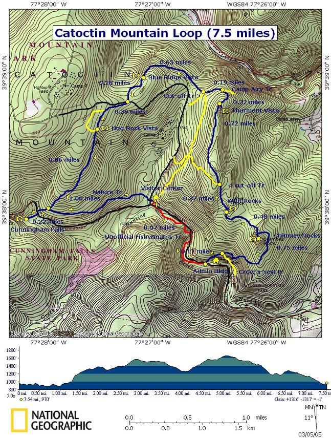
Catoctin Mountain Loop |
|
Description:
This is a moderate 7.5 mile loop in
Google Custom Directions to Catoctin Mountain Visitor Center
|
Trail Notes: The Park service did away with
blazes several years ago in an attempt to make the park seem more
like wilderness. With the exception of the unofficial Fisherman�s
Trail all trail intersections are well posted with details and
distances. Furthermore the trails are well worn. It is almost
impossible to get lost here if you bring this map or one you can
obtain for free at the
Starting at the
Turn left onto this trail and begin to climb, with the aid of switchbacks, to Chimney Rocks. You�ll pass the Crow�s Nest Trail on the right and in about 0.9 miles reach the spur trail to Chimney Rocks.
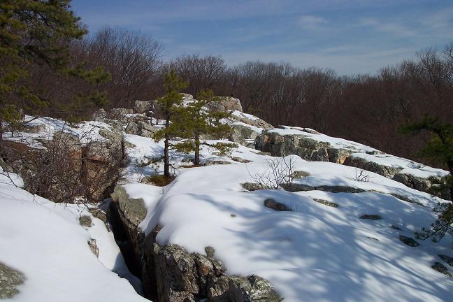
After enjoying the view return to the main trail and follow the sign directing you to Wolf Rocks. Reach the spur trail for Wolf Rocks in 0.48 miles. Climb around this unique Quartzite outcrop but watch out for the deep crevices!!!
Return to the main trail and
turn right following the signs for Thurmont Vista. In 0.37 miles
pass a sign for a cut-off trail leading to
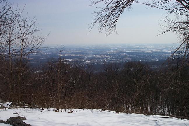
Arrive at Thurmont Vista in 0.7 miles from the last trail junction. Here you can enjoy the view on a bench or one of several rocks.
Return to the main trail and
turn right following the sign toward Park Central and Hog Rock. In
0.22 miles come to an intersection with a near parallel trail with a
sign � �
In another 0.15 miles arrive
at a four way intersection. Turning left takes you back to the
In another 0.65
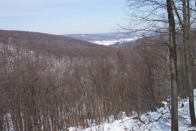
miles arrive at the Blue Ridge Summit Overlook. Enjoy the view and
return to the main trail and turn right. From here the remainder of
the trip will be flat or downhill with the exception of a few short
hills on the Nature Trail.
In 0.25 miles arrive at a
picnic area on
From here
follow the signed trail to the right. Descend quickly, passing the
Nature Trail (the return leg) on the left at 1.0 mile and soon
arrive at Rt77. Turn left on the shoulder of Rt77. In a short
distance cross the road and follow the gravel trail and boardwalk to
view Cunningham Falls.
Return to the Nature Trail
and turn right onto it. The sign says that the distance is 1.2 miles
back to the Zipped National Geographic. TOPO! GPS and Universal GPX Files GPS Text File for Non-TOPO! Users |
|
________________________________________
________________________________________
Name: Jeremy
Outing Critique: I hiked this on a
Friday in late September and had the park virtually to myself. I
enjoyed the multiple overlooks and did some rock scrambling on
Chimney Rock. I accidentally took a wrong turn and added a two mile
down and back to Camp Airy (the trail is not on the Park Service
map).
Name: Adventure Runner
Hike: Catoctin Mountain Loop ________________________________________
Name: Joseph Dooley
Hike: Catoctin Mountain Loop ________________________________________
Name: pEtE
Hike: Catoctin Mountain Loop ________________________________________
Name: Kylena Cross
Hike: Catoctin Mountain
Name: Vern
Hike: Catoctin Mountain Loop ________________________________________
Name: Ryan Culloty
Hike: Catoctin Mountain Loop ________________________________________
Name: Matt Zimmerman
Hike: Catoctin Mountain Loop ________________________________________
Name: Jason S Colflesh
Hike:
Catoctin Mtn Loop ________________________________________
Name: Zeb Amoss Hike: Catoctin Mtn loop ________________________________________
Name: Tom Fournier Jr
Hike:
Catoctin Mtn Loop ________________________________________
Name: Bob von Pentz
Hike:
Catoctin Mountain
________________________________________ |
|
|