|
Allegheny Front - East Backpack |
|
Description:
This is a moderate 30 mile back pack trip utilizing the trail
systems of the
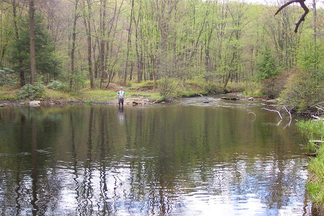
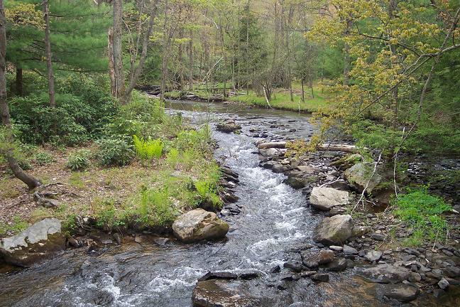
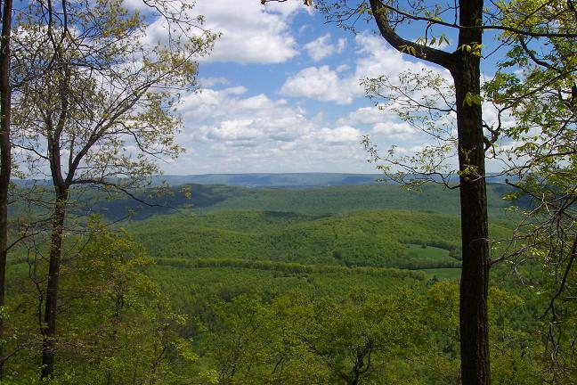
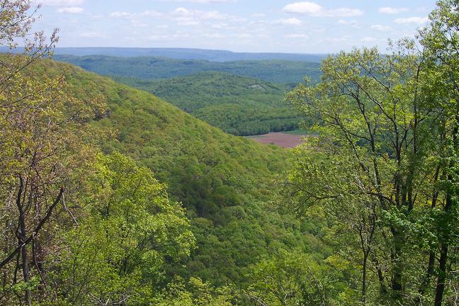
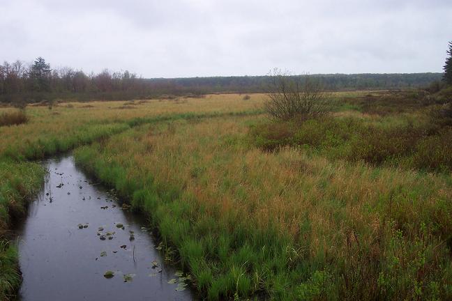
This outing starts in the center of the park, follows the Shingle Mill Trail north to pick up the Allegheny Front Trail (AFT) which is then followed in a clockwise direction to re-enter the park on the Moss-Hanne Trail which is then followed back to the starting point. I break the trip down into 3 equal 10 mile segments. Day 1 is mostly walking along beautiful streams and creeks with one modestly challenging climb. The focal point of day 2 is a challenging ridge walk with great vistas. |
|
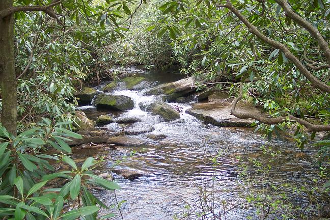
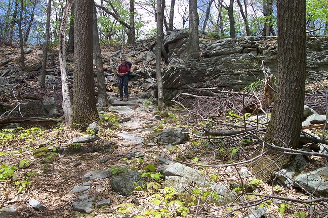
There is a 3 mile segment of steep ups and downs on the rockiest trail I�ve ever been on but the views are satisfying rewards. Day 3 features a relatively easy romp through the bogs and swamps of Moss-Hanne. The stone bridges and long boardwalks make this segment a pleasure. For more info on the AFT go to:
Immediately turn onto Julian Pike
(Note: Google
Maps calls this Beaver Run Rd).
Mooring area #1 is immediately on the right. Drive approximately
0.25 miles to Ranger Station and inform them of your intentions.
If they are closed leave a note with vehicle description and tag#,
persons in your group and emergency contact info under the office
door. Return to mooring area #1 and begin the
trip.
_____________________________________ |
Printable/Downloadable Map of North Section
Printable/Downloadable Map of South Section Zipped National Geographic. TOPO! GPS and Universal GPX Files |
Trail Notes: All trails are signed and blazed.
There are a couple of woods roads (active and inactive) that are
crossed and noted in this description. AFT sign posts with pertinent
distances are installed at every road crossing. Feel free to
start/end this hike at any of these locations keeping in mind water
sources, camping areas and park camping policy. Park policy asks
that hikers not camp within a mile of the park boundary. For this
outing the northern limit is
Day 1: From Mooring Area #1 proceed north on Julian Pike.
Cross Rt 504 and follow
At 1.72 miles from joining the Shingle Mill Trail cross
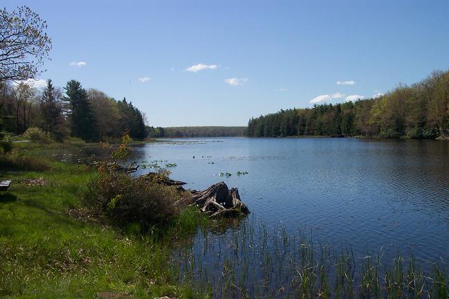
In another 0.81 miles the AFT crosses Black Moshannon Creek on a bridge and passes in front of a green cabin/cottage to cross Benner Run on yet another bridge. Turn left after crossing the bridge and follow Benner Run for 1.38 miles before re-crossing the run on another bridge. There are a couple of small campsites between the two crossings. It�s possible that more sites might be found on a slight rise to the right of the trail if you can work through the thick leather leaf plants that seem to blanket the entire forest.
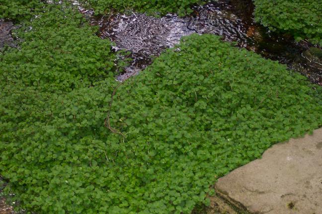
Shortly after the last crossing pass and unsigned blue blazed trail on the right. This follows Benner Run further upstream and may provide yet more camping opportunities. Stay on the AFT and climb up and over the next ridge to Hull Run. There are two water sources here but offers little in the way of campsites.
In 2.89 miles after leaving Benner Run cross a gravel woods road. In another 0.33 miles join the Rock Run Ski Trail. Turn right here. The trail will be marked with both orange and blue blazes. |
|
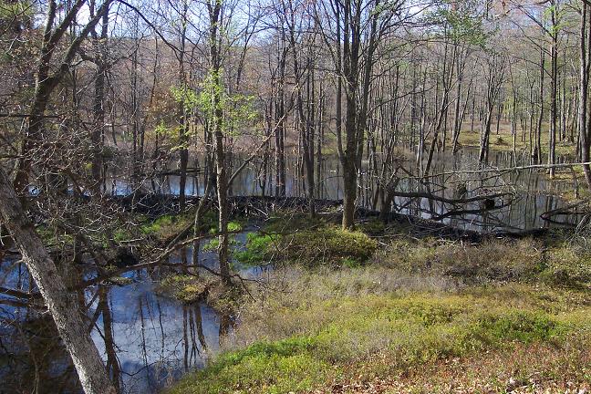
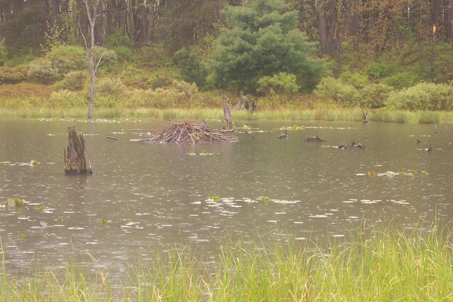
In 1.03 miles descend to Rock Run. You can either camp here, just above the bridge for the Rock Run Connector Tr or walk uphill for another 0.5 miles to a nice bench along a huge beaver dam/pond. Day 2: Continue up Rock Run. There are a couple of small but nice campsites at water�s edge along this section. Cross Rock Run and at 1.96 miles from the Rock Run Connector bridge meet the junction with the upper portion of Rock Run Ski Trail. Turn right onto orange blazed AFT.
Soon find yourself walking along the headwaters of Benner Run. There are several potential campsites along this section. Cross Benner Run and walk across an open meadow to a Red Spruce plantation. At 1.26 miles from leaving the Rock Run Ski Trail come to a grassy woods road. Turn left onto the road following the orange blazes. In another 0.3 miles leave the road turning left onto a footpath. Re-enter the meadow and cross a grassy maintenance road for a set of radio towers over your left shoulder. In another 0.15 miles arrive at Rt 504.
Cross Rt 504. In 0.13 miles cross another woods road. The
path itself will become a well rutted road as it descends steeply.
In another 0.21 miles make an abrupt right turn up a rocky foot path
and in 0.51 miles come to a partly obscured overlook. Descend steeply and ascend
several times visiting the vistas along the way. The last vista is
signed �Ralph�s Magnificent Vista� in honor of Ralph Seeley. Leave
the last vista and scramble through an area known, for obvious
reasons, as �
At 0.60 miles from Ralph�s Magnificent Vista cross Underwood road. In another 1.62 miles cross Smay�s Run Trail. This is a good spot to call it a day. A slightly more secluded campsite is just a few more yards down the trail at the bridge that crosses the run.
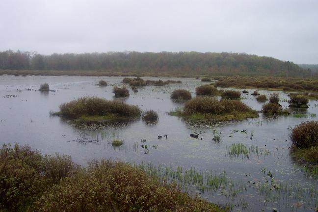
Day 3: Continue west on the AFT. In 1.1 miles cross Julian Pike and join the Moss-Hanne Trail. It will be blazed with orange triangles and is a mix of foot path, old woods roads, rock bridges and wonderful boardwalks. In 2.6 miles pass a spur trail that leads out to Shirk�s Rd on the left and then the continuation of the AFT. Turn right to stay on the Moss-Hanne Tr with its orange triangles.
In another 1.02 miles cross the apparently abandoned Airport Trail. In another 1.28 miles cross a small backwater. Here the trail goes un-blazed to the left into a Pine plantation and to the right (blazed) towards the lake. Turn right here.
n another 2.09 miles join the Indian trail that comes in from the left. Turn right, following the duel blazes for 0.25 miles (orange triangle and red circle). The Indian trail will turn left. Continue on the Moss-Hanne Trail to it junction with the Bog Trail in another 0.43 miles.
Follow the boardwalk around to the launch ramp on West Side Road. Turn right onto West Side Road and in 1.16 miles arrive back at Rt 504. Cross the bridge and return to your cars. Printable/Downloadable Trail Notes Critique this outing! ______________________________________
______________________________________
Name: Hardcore/Wooly Bully/Shortstack Hike: ATF-East Date(s): 08/03-05/13 Rating: 4
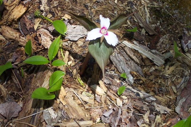
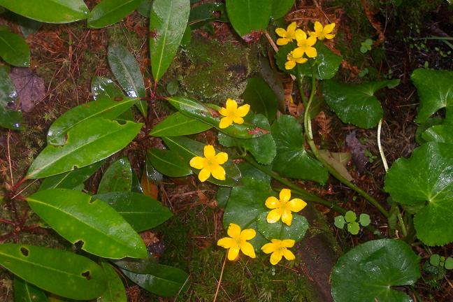
Critique: Encouraged by word of recent trail clearings and re-blazing for a trail race on AFT, Hard Core, Shortstack, and Wooly Bully stopped at the Black Moshannon State Park office, to sign in, get maps and trail updates from the park ranger. We faced light rain as we headed north up the Shingle Mill Trail, descending along the Black Moshannon Creek, charming with plenty of flowers, including Hollow Jo- Pye Weed and Cardinal Flower, sometimes growing in the center of the creek. After joining the AFT, we headed east through fields of ferns and ended the day at a campsite just past the Rock Run cutoff trail. Day one was a nice woods hike with relatively smooth trails and little elevation gain. Overnight temperatures were in the low 50's, with some traffic noise from I-80, and owl and coyote calls in the distance. Day 2 proved different. The weather improved with nice, low-humidity conditions for the remaining of the trek. After crossing Rt. 504, the trail became very rocky (ROCK ALERT!), with some steep sections. At one of the rougher sections, we meet backpackers from the Penn State Outdoor Club, participating in a five-day "Freshman Orientation." We continued up towards the overlooks enjoying more ferns, three "named vistas," and lots of blueberries! After crossing Underwood Road, the blazing (fresh yellow paint to this point) disappeared for a while, and then turned red. The blazes and trail maintenance had been good to this point, but the trail race must have ended here. Three tired hikers almost called it a night at the first Smay's Run campsite along a wood road, but fortunately decided to take the second site under the hemlocks. Again, we had the campsite to ourselves except for the owls and whatever roams through campsites at night (deer?), and everyone slept well. Day 3 included fantastic views of marshlands from a network of boardwalks and more blueberries. The trail notes may need updating here, as we had a few confusing sections getting on to the Indian Trail and Bog Trail was not labeled until on top of it, but we ended up in the right place, along the lake on beautiful boardwalks. The last two miles of the circuit were road-walking past nicely kept lakeshore houses. Overall, this was a nice trail, 32.8 miles total. It was a little rocky, rutted, and steep in the middle as accurately described in the trail notes, but otherwise moderate, seeing only a few groups of hikers and mostly, well marked except as noted. A plus for summer outings here, the beachfront was open and the bathhouse available for showers and changing.
______________________________________
Name: Bob Ardner
Hike: AFT-Eastern Section ______________________________________
Name: Jason Daschbach
Hike: AFT - East Loop ______________________________________
Name: Chris
Hike: Allegheny Front Trail loop ______________________________________
Name: Tammy
Hike: AFT-East ______________________________________
Name: MikerTheHiker Hike:
AFT-East ______________________________________
Name: Joseph
Tinker Hike: AFT East BP ______________________________________ Name: Joan Paswell Hike: Allegheny Front - East Date: 9/15>9/18 Ranking: 5 Critique: I'd been wanting to do this particular backpack trip for the last two years. I was pleasantly suprised when I came across your website! With the almost identical trip that I had planned and with all this fantastic info on it and other hikes. I've saved this site to my favorites. I went with two other women hikers that I met through the Allegheny Sierra Club. We had an approx. 4 hr drive to the Black Moshannon state park. We stopped at the park office and got are free backcountry camping permit. We started out about 2pm on Thurs, hiking on the Shingle Mill Trail then joining the AFT. The trails were easy-going and very scenic and enjoyable. The many ferns and some of the trees were changing colors for fall. We hiked 6.5 miles and camped at a campsite along Benner Run approx. 1.25 miles after passing the green cabin. There was one smaller campsite before this one. But the second one which we chose was much nicer. On Friday, there was one modest climb. We lunched at a great little spot where the Rock Run Ski trail branches off the AFT. We hiked on passing several campsites, but it was too early in the day to stop yet. We planned to camp by Benner Run (headwater area) but it was completely dry! We continued on another 2 miles to Rt 504. I called the park office to inquire if the rangers knew if water was available further along the AFT or down along Smays Run where streams were marked on our maps. We were informed that it was doubtful if water was available along the AFT after crossing Rt 504 but that it was available on Smays Run. The park ranger offered us a lift there; so we took him up on it. We did find water at Smays Run but it was very low. We camped there two nites. On Saturday we did a dayhike east on the AFT to the ridge/vistas and back (7.5 miles). Sunday we backpacked west on the AFT then Moss Hanne trails back to the park (10 miles). We all highly recommend this loop; it was very enjoyable. ______________________________________ Name:
Mark Hike: Allegheny Front Trail ______________________________________ |
|
|