|
Dolly Sods North BP
|
|
|
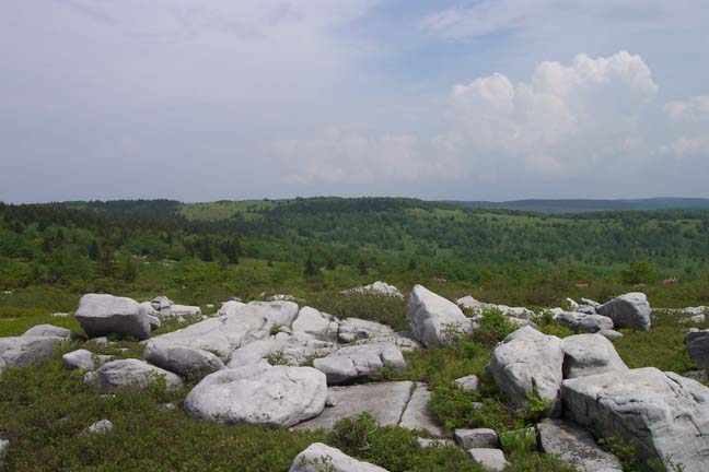
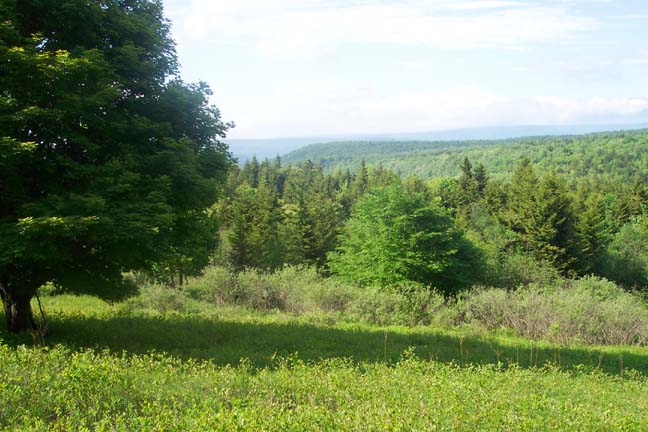
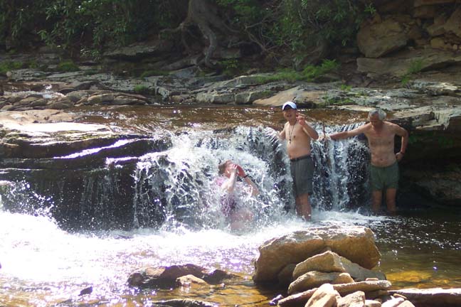
Description: This is a moderate 15 mile backpack through the scenic Dolly Sods North. You�ll walk through areas of breath-taking beauty. The entire trek is one big photo op. There are some deciduous forest along the way but you�ll spend most of your time walking through heath bogs on Dobbin Grade, grassy plains sprinkled with Spruce groves along Raven Ridge and the rocky, tundra-like ridge of Cabin Mountain. There will be views in every direction. Although there are suitable campsites throughout the area this description has you camping in a Red Spruce grove along the Left Fork of Red Creek. After breaking camp stash your packs near the junction of Black Bird Knob and Red Creek Trails and enjoy a romp in the waterfalls and swimming hole of �The Forks�.
There
are some wet spots, especially along Dobbin Grade so have some dry
footwear waiting for you back at the car. Also remember that
mountain top weather can change with a wink of an eye and in many
instances you might be totally exposed to the elements so pack
accordingly.
As you reach the top of the mountain the large trees will disappear and the road will make a final sharp left-hand turn. Park here on either side of the road. The Bear Rocks trailhead is about 100 yards further down the road. There is limited parking there but these spots are often full. |
|
________________________________________ |
|
Trail
Notes:
First I need to thank Trudy and John Phillips
and Jonathan Jessup for sharing their maps with me. Their insight
has made my exploration of the North Sods quite enjoyable.
I�ve
hiked most of these trails 3 times now and carried my
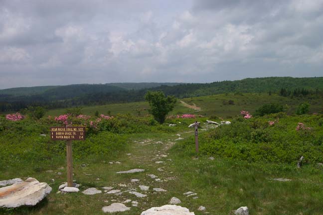
From the cars walk south on FR75 for about 100 yards and turn right onto an old jeep trail named Bear Rocks Trail (Tr522) and blocked by boulders. You will gradually descend to Dobbin Grade, passing a seriously eroded section of the jeep trail (A footpath to the left gets you around this.) and a mini-bog sheltered in a hollow. You�ll climb out of the hollow and descend to Dobbin Grade (TR526) at 1.02 miles from the start. The jeep trail is also badly eroded here. There are optional trails on either side.
Cross
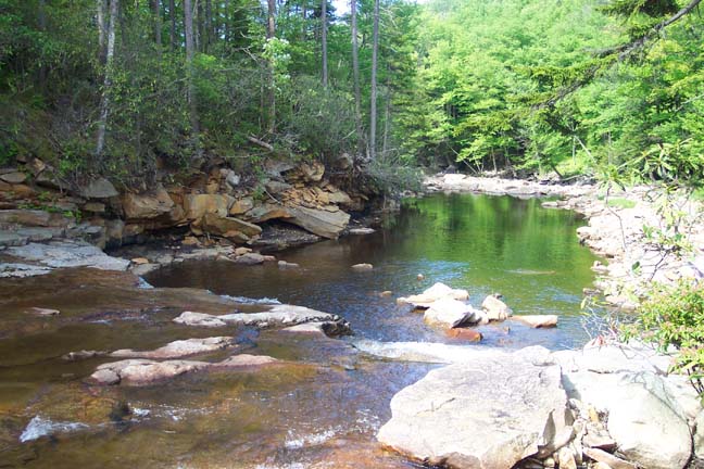
Dobbin Grade and descend further through a grassy area to Red Creek.
There are a few good campsites here. Cross the creek. Climb to the
first rise. You�ll end up on an old ATV trail. Do not take the ATV
trail but turn right onto a footpath at the
It
may be possible at certain spots to climb to the northern edge of
the ridge for views of Dobbin Slashing and distant ridges. At about
0.2 miles from the last trail junction pass Beaver View Trail
(Tr523) on the left. Soon reach a large grove of mature Red Spruce
to your left (South). As you look at it there is a lone deciduous
tree to its left, possibly a fruit tree. This approximates an
opening in the grove and the front door of a fantastic campsite
protected from the elements. |
|
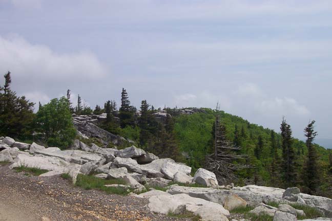
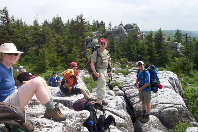
At 0.86 miles from the Spruce Grove turn left onto a footpath cut through some small Red Spruce. In another 0.44 miles arrive at Rocky Ridge Trail (Tr524). Turn left here. From this ridge you can get sweeping views of Dolly Sods and much of what you just hiked.
Continue
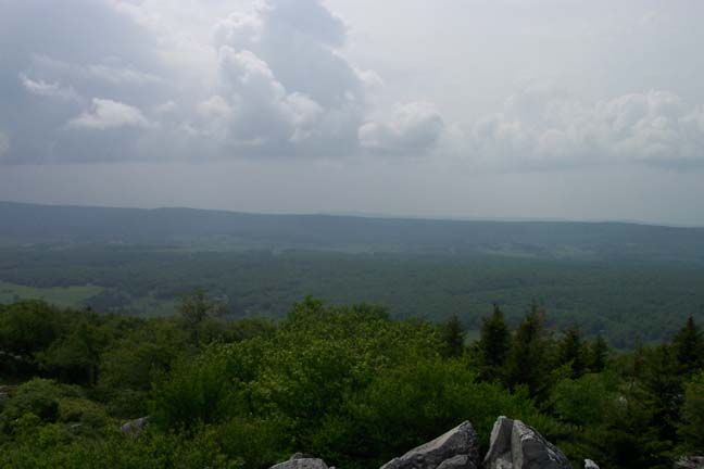
south on Rocky Ridge Trail. At about 1.18 miles the trail veers
slightly to the right and crosses Rocky Knob. Weather permitting
this is a great lunch spot with views of
In
about 0.3 miles from Rocky Knob you�ll pass a trail intersection in
a wet area with a large boulder. The trail to the left is marked
with
In another .04-0.5 miles arrive at the junction of Harmon Trail (Tr528). Turn left here and, in 1.44 miles, descend to the junction of Black Bird Knob Trail (Tr511). There is a galvanized sign post there but the sign itself was never installed. Turn left onto Black Bird Knob Trail. In about 0.2 miles descend to and cross the left fork of Red Creek. Immediately after crossing the creek turn left onto a footpath and follow it into a large Red Spruce Grove. There are several nice campsites to choose from. The largest is on the west bank.
The
next morning return to Black Bird Knob Trail and turn left (east)
onto it. You�ll pass through a thick growth of Spruce, open, grassy
meadows and deciduous forest. In about 0.7 miles from the left fork
arrive at the junction with Red Creek Trail. The sign is missing but
it is marked with two large
After enjoying �The Forks� recover your packs and return to the last trail junction. Turn right onto Black Bird Knob Trail. In 0.34 miles turn left onto Upper Red Creek Trail (Tr509) and follow it up, over and down an open grassy hill to the junction of Dobbin Grade Trail (Tr526).
Turn right onto Dobbin Grade Tr. This is an old rail road grade that was used to haul lumber in days gone by. Being an RR grade the climb out of the bog is very gradual with several boggy areas along the way. Soon after making the last turn you�ll pass Raven Ridge Trail on the left. Continue on Dobbin Grade. Cross the right fork of Red Creek and immediately turn left to stay on the trail. If you stay on the road that goes up to a wind whipped tree you�ll turn around to enjoy a fantastic view of DSN.
If
you walk up to the vista, return to Red Creek and continue up Dobbin
Grade. At about 1.05 miles from the crossing arrive at Beaver Dam
Trail (Tr520) on the right. This trail takes you out to FR75. In
another 0.62 miles reach the junction with the Bear Rocks Trail.
Turn right here and retrace your initial steps back to the
cars. Printable/Downloadable Directions and Trail Notes ______________________________________
______________________________________ Name: Sally Hike: Dolly Sods North Backpack Date(s): 04/12 to 13/14 Rating: 5
Critique: I did a quick overnight trip and was not disappointed. A few notes: 1. The signage is much better than when this trail was first described. In places where it is indicated there is just a post or a cairn, there are now clear signs. 2. That said -- there are points where a certain trail turns or looks uncertain and there are no blazes to guide you. The description is very helpful here -- also look for footprints. 3. Some boggier places now have wooden walkways, which are nice. 4. This hike was wet when I went, but the weather was nice, so it worked out. Definitely prepare with waterproof boots! And bring extra socks! You're going to need them. A pair of Chacos or the like for crossing streams would be a nice extra. 5. You have to park farther away than this description indicates -- this adds about a mile at the beginning and end of the hike. And the beginning, it's all uphill. At the end, it's downhill. 6. You should pack in water for the first couple of miles as there isn't a place to get water until you're on the hike (so fill up at home or at a rest stop). Once on the hike, there are about 4 places to fill up on water: the first is your first crossing of Red Creek. The second is the small spring described next to the emergency camping spot (though I wouldn't be certain if this would be flowing in dryer times or late summer), the fourth is at your camping spot by red creek, and the fifth is when you cross Red Creek again on the second day. I liked so many sure opportunities for water since it meant I didn't have to carry a lot (which is heavy!) This was a fantastic trip. The weather in mid April was very warm and the solitude was a delight. There were small patches of snow left, which I took advantage of when I got hot and put a scoop in my cap to cool down. I will definitely be returning.
______________________________________
Name: Laura Hike: Dolly Sods North Backpack Date(s): 10/19-20/13 Rating: 4
Critique: We did this hike October 19, and loved it. The area is really like nothing else in Virginia, but more like what you would see in Canada, or Scotland. In reading about Dolly Sods, I saw that it was classified as a sub arctic bog, but I have yet to understand how something in Virginia came to be classified as sub arctic. The place is certainly popular enough�hardly room to park the car. We saw plenty of hikers and groups on Bear Rocks Trail. But after we got onto Rocky Ridge Trail, we were on our own. Great views, really amazing landscape. Even at this high point, the many rocks on the ridge were seated in water, and the heath was as damp as a wet sponge. The directions were good, and the signage was better than I had expected. It can be a bit tricky to pick your way down the southern part of Rocky Ridge trail, as it is only rocks, and there really is no discernible path. There is the odd cairn here and there. Red Spruce Grove was a fabulous campsite�large, sheltered, near water. My only complaint is that is very popular, and that in the hollow, sound carries *very* well. We thought another group had camped only a short distance away, but when I went to get water, I saw that they were actually at least twice the distance we had thought�yet we could here every word and laugh at their camp. The next day, things got�interesting. We enjoyed hiking along Blackbird Trail and Upper Red Creek. We were prepared for boggy areas, with waterproof boots and gaiters. What we weren�t expecting was nearly a solid mile of trail that was bog. I don�t know if forces of nature had conspired against us, or if it is typically like this. Hiking through boggy sections was at first run of the mill, then as they stretched out and got longer and wider, more difficult. When we had covered more than a mile and still weren�t leaving them behind, they began to mar the enjoyment of what would otherwise have been a very pleasant hike. I am still wishing I had taken the turn at the Raven Ridge Trail, although I have no way of knowing whether this would have been better. We met several hikers coming from the opposite direction who had given up on the trail. Some had their shoes off, and were in the process of draining. One fellow had gone into the bog up to his knee. All of them were turning around. Disappointing as this section of the trail was to me personally, my greater concern was for the trail, and the landscape itself. Most hikers, when faced with a boggy section of trail, were going around. This meant that the trail was widened, and the natural landscape given way to numerous boots wishing to stay dry and mud free. I can�t help but think this will have a extremely negative impact on this section of Dolly Sods. I really loved the hike in Dolly Sods, and would go back there again in a heartbeat.
______________________________________
Name: Mike Hike: Dolly Sods North BP Date(s): 05/24-26/13 Rating: 5+
Critique: This is my favorite trip yet, not that I am experienced much. But the scenery is so beautiful, the hiking so easy, water is so readily available, and the campsites are like something from a dream, it has to be a 5+! The trails were well marked, unlike some of the older reviewers have stated. The campsite about 1 mile into the hike had room for up to 5 tents, and a nice fire ring. The campsite further along on the left branch of Red Creek (where it says Camp Here on the map) is tremendously large. It was almost big enough to be a campground, and was perched right along the Creek. Be forewarned that the trail just crosses a beaver dam down near where the Upper Red Creek and Dobbins Grade Trail intersect. You will see the ponds from a distance and realize the trail goes right through them over the dam. The Dobbins Grade is very muddy and you will get muddy and wet without fail (maybe not true in drier times of year?). Overall, this is a beautiful trip with lots of vistas, varieties of terrain and plant life, and gentle climbs and descents. I would even say beginners could easily do this trip.
______________________________________
Name: Gregory St. Clair
Hike: Dolly Sods North Backpack
______________________________________
______________________________________
Name: Mark Hike: Dolly Sods North BP ______________________________________
Name: BCW Hike:
Dolly Sods North BP
Name: Jim Kirk Hike: DSN
BP
Critique: I hiked parts of this once before with Mike, and then last
weekend did the Bear Rocks>Dobbin>Upper Red Creek> to Red Creek Forks>
Rocky Point> Big Stonecoal>Red Creek. ______________________________________
Name: HLG Hike:
Dolly Sods North BP ______________________________________
Name: NCH
Hike:
Dolly Sods North BP ______________________________________
Name:
mw Hike: Dolly Sods North BP ______________________________________ |
|
|