|
Ramsey's Draft-West |
|
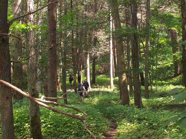
Description: I first read about this mystical place about 8 years ago. Back then it was reported that by now (summer of 2005) that all of the giant Hemlocks in this wilderness would be killed by the Wooly Adelgid. I�ve hiked in venues to the north, east, south and west, always seeming to bypass RDW. I finally made it out there. Although the plight of the kings of this forest continues there has been some kind of temporary remission. There are still many of these majestic trees to see although many more are dead.
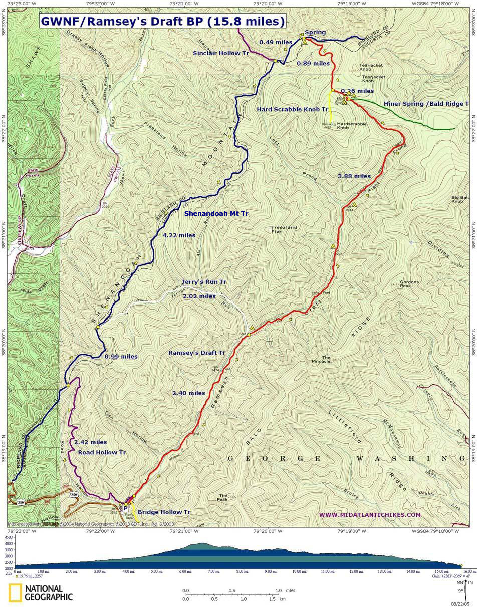
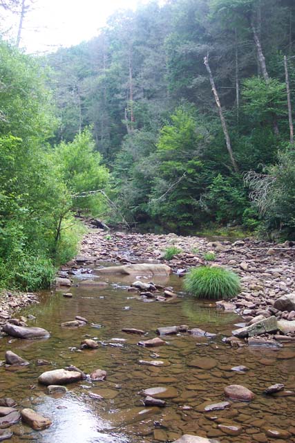
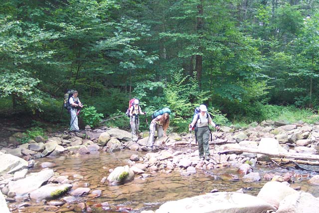
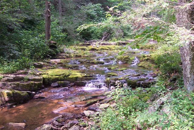
This is a 15.8 mile outing with the highest elevation gain being about 1700 feet, most on the first day. The initial 5 miles up the draft are relatively easy once you subtract out the 20+ draft and stream crossings. These can make the hike difficult during periods of high water. Personally, I don�t mind getting my feet wet but whether the water is high or low slippery rocks can be dangerous. Take appropriate caution! In between crossings you�ll alternate between wide woods roads and footpaths as the trail bypasses severely storm-damaged portions of the original road built by the CCC in the 30�s. There are a few good campsites �in the bottoms� but this hike gets you, after a substantial I mile climb through a rocky area, to the cream of the crop at Hiner Springs. You have your choice of a large grassy meadow on one side of the spring or camping under a couple of the old silent giants with Hemlock needles as your mat on the other side.
The next day takes you past Hard Scrabble Knob (A side trip up there adds about a mile to this trip as described) to the Shenandoah Mt Tr. |
|
This is one heavenly trail as ridge walks go. You�ll turn south here and follow the ridge back to the Road Hollow Trail. There are virtually no rocks on it until you turn off onto the latter trail. You�ll be mostly walking on grass, pine needles or leaf mulch for 5.5 miles with mostly gentle hills to walk up and down. We found just 2 or 3 full views along the trail but there are places where the trail goes behind the ridge. I�m sure some quick scrambles to the top at these spots bring even more views. The Road Hollow Trail is a teaser. It�s rocky in places and changes elevation several times in both directions � as if its not sure it really wants to take you back down to the draft or not. Eventually it does.
The hike starts at the kiosk behind the picnic area, at the end of a gravel road.
The Shenandoah Mountain Trail is part of the Great Eastern Trail (GET). ________________________________________ |
Zipped National Geographic. TOPO! GPS and Universal GPX Files |
Trail Notes: Most trail intersections are signed. There are no blazes. Currently all crossings of the Draft are marked my cairns but these can be easily removed by swift water. A little bit of scouting will find the well worn trail on the other side in most cases.
From the kiosk walk up the main trail that parallels Ramsey�s Draft. There are 2 trails to the right. One leads to a campsite while the other crosses the Draft to connect with the Bridge Hollow Trail. Soon after that pass Road Hollow Trail on the left. This is your return route.
In about 0.75 miles make your first crossing. You�ll do this over 20 times so trying to describe each crossing here is futile. In 2.4 miles from the beginning cross Jerry�s Run. The Draft will still be visible to your right. There will be a trail heading up Jerry�s Run before the crossing. Ignore it. Immediately after the crossing pass the signed junction with Jerry�s Run Tr on the left. There is a nice campsite here.
Continue crossing Ramsey�s Draft as you ascend. The trail will become steeper and rockier. In 3.88 miles from Jerry�s Run arrive at Hiner Springs and your campsite for the night. Note the sign for Bald Ridge Knob on the right. The USFS map calls this Hiner Spring Tr but it does connect with Bald Ridge Tr just the same. If, for some reason, you are doing this loop in reverse be sure you do not take this trail. Ramsey�s Draft trail is hard to spot in this direction while the other trail is quite obvious.
On day 2 continue up Ramsey�s Draft Tr. At 0.26 miles arrive at Hard Scrabble Tr. The option to visit it is yours. If you do add 1.0 miles to your trip.
Continue straight on Ramsey�s Draft trail for 0.89 to the junction with the Shenandoah Mt Tr (left and right) and Tearjacket Tr also to the right. (I�m not actually sure where this trail goes. It�s not on the USFS map but seems to go to Tearjacket Knob. Don�t know if there are any views up there or not. Must find out.) There appears to be a relatively reliable spring just over the crest of the hill here. Turn left onto Shenandoah Mt Tr to continue. |
|
Arrive at the junction w/ Sinclair Hollow Tr to the right in 0.49 miles. Stay straight on the Shenandoah Mt Tr. In another 4.22 miles pass the junction w/Jerry�s Run Tr on the left. Continue straight on the Shenandoah Mt Tr.
At 0.99 miles from the last junction arrive at Road Hollow Tr. Turn left onto Road Hollow.
In about 2.42 miles arrive back at Ramsey�s Draft Tr. Turn right and retrace your first steps back to the cars. Printable/Downloadable Directions and Trail Notes _____________________________________
_____________________________________ Name: Dottie Rust Hike: Ramsey's Draft-West Date: 05/25-26/14 Rating: 5
Critique: Hiked this on Memorial Day weekend with my husband and we could not have picked a better hike or chosen better weather. We ascended Ramsey's Draft Trail and returned via Shenandoah & Road Hollow Trails, as per Mike's trail notes. RDT indeed has 20 water crossings, the lower crossings required sandals and the upper crossings were managed by rock-hopping, or rock-stretching in some places. This past winter was a tough one as can be seen by the numerous blowdowns on RDT. . .some mighty big trees blocked the trail and it will take awhile before they can be cleared. Nothing that can't be hiked over/under/around with a bit of patience. Lots of very pretty campsites along the Draft. . .at Hiner Spring at the top, we found ourselves alone and set up our tent on a nice flat spot. As we were eating supper 3 hikers arrived, they found themselves another flat area on the other side of the spring. The spring was open and flowing, so water was not an issue. Next day was an easy hike up the remainder of RDT, then it was all downhill on the beautiful Shenandoah Trail to Road Hollow. All in all a great hike, almost total solitude which was nice for us, as it was our 32nd anniversary hike. _____________________________________
Name: Andrew
Hike: Ramsey's Draft West Loop
_____________________________________
Name: Sarah Alice
Hike: Ramsey's Draft Wilderness _____________________________________
Name: B
Hike: Ramsey's Draft _____________________________________
Name: Ryan
Hike: Ramsey's Draft Wilderness
_____________________________________
Name: Javaslinger
Hike: Ramsey's Draft
________________________________________
Name: Frank Green
Hike: Ramsey's Draft _____________________________________
Name: Noah
Hike: Ramsey's Draft
_____________________________________
Name: John
Hike: Ramsey's Draft _____________________________________
Name: Brandon Wu
Hike: Ramsey's Draft
_____________________________________
Name: Natasha
Hike: Ramseys Draft _____________________________________
!Name: John McLuckie
Hike: Ramsey's
Draft _____________________________________
Name: Chris
Hike:
Ramseys Draft _____________________________________
Name: Andrew
Hike:
Ramsey's Draft _____________________________________
Name: George Young
Hike:
Ramsey's Draft
Name: wacbzz
Hike:
Ramsey's Draft M. R. Hyker Notes: I have had a couple of reports of people hiking in from the Shenandoah Mt Tr who could not find the Ramsey's Draft Trail at Hiner Spring and ended up a good distance on the Bald Knob Tr before realizing their error. That is one reason why I designed the route to go up the creek. Other reasons for the direction of my route: more options to camp should one decide to stop early in the hike, a substantially more gradual elevation profile going up the Run VS going up Bald Knob, easier, safer, better views going UP the Run and actually the fords are not all that difficult to fine. The only slight exception might be the one near Jerry's Run. I plan on doing wachzz's route next year but in reverse so I'll have both sides of the valley covered. _____________________________________ |
|
|