|
Laurel Run-Stack Rocks Circuit |
|
Description: 6.5 mile strenuous
circuit hike featuring incredible views beyond Big Schloss!!!
1600 ft. elevation change over 2.2 miles. Wild Flags, Pink
Lady Slippers, Rhododendron and Mountain Laurel in season. (If
the gate on FDR 252 is closed park there and add 2.5 miles to
the outing. Call GWNF-Lee Ranger District to get a list of
gate closure dates.)
If the gate is open at the Laurel Run crossing continue up FDR 252. Note the yellow blazes on your right. Park on the shoulder where yellow blazes leave the road to the right and begin to follow an old forest road. If the gate is closed begin here and add 2 miles to the hike.
The North Mountain Trail is part of the Great Eastern Trail (GET). |
|
________________________________________ |
|
Trail Notes: Although this is only a 6.5 mile circuit the first 2.2 miles are pretty grueling. The yellow-blazed Laurel Run Trail knows no kind way to get you to the top of North Mountain except by climbing steeply, even with switchbacks, up a sometimes rocky, sometimes sunny trail. Assuming you were able to drive through the gate, start by hiking up this trail. It starts off wide, flat and grassy. Soon you will pass another forest road on your right. The Forest service uses this road to apply lime to Laurel Run to control the pH and protect the fishery. Remember this junction at the end of the hike. Shortly after passing this intersection the trail becomes steeper, rockier and more exposed to sun. Great views of Long and Devil's Hole Mountains are to your right. As the trees grow taller you may have to peek through them to get a better view. Purple wild flags line this trail in May. Mountain Laurel and Rhododendron manifest their brilliance in June and early July.
Switchback through several stands of old growth woods and open wildlife clearings. You know you are close to the top when you come to a large flat rock blocking the trail.
As you continue on you will notice the trail becomes soggy. At this point look for side trails to the left where you will find a grassy area complete with campsites and a small pond. You passed better water on your way up, a spring that crosses the trail. The Laurel Run Trail ends on SR 691 at a parking area. You've completed the majority of your climbing for the day. This is also the north terminus of the orange-blazed North Mountain trail. Proceed south along North Mt. Trail as you climb gradually to the top of a knob. To the left is a white-blazed spur trail that will take you out to a nice ... but small ... overlook surrounded by pitch pines. There are great views here but the view to the left is partially blocked by the forest.
If you wish to see more expansive views and/or you have a large group continue along the main trail. Descend into a slight saddle. In June you smell a sweet fragrance coming from the bushes around you. I don't yet know what it is. Spice bush? I suspected Old Man's Beard (AKA Fringe Tree) but couldn't find any. |
|
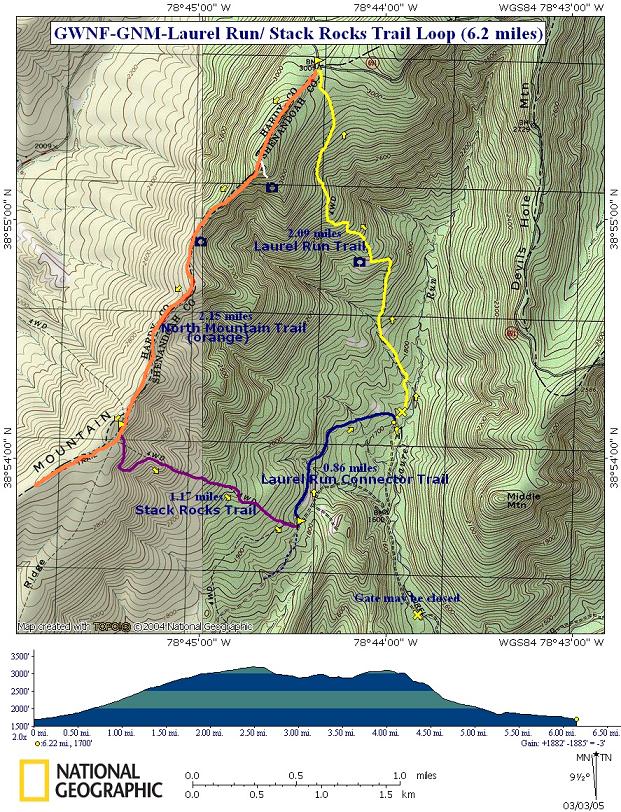
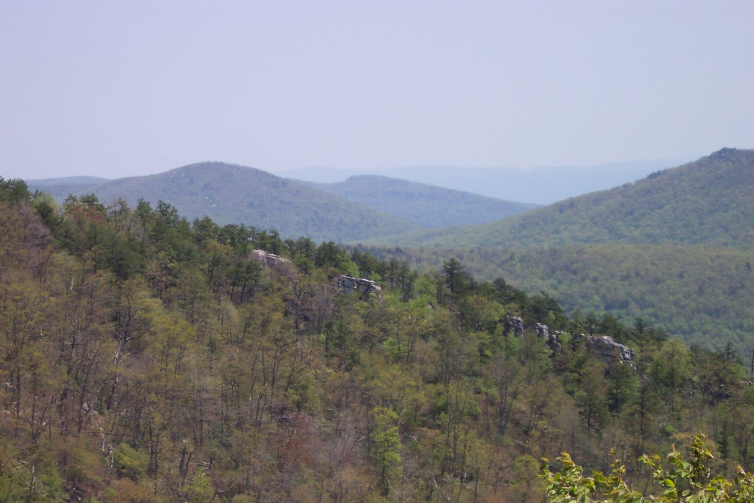
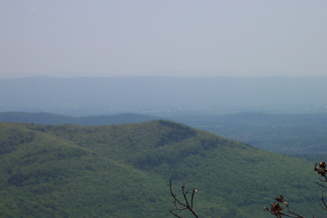
After walking through these bushes the ridge will suddenly narrow and plenty of rocks to your left will provide the crew with plenty of seating for the best view on the trail. After taking in Devil's Hole Mountain, Tibbet's Knob, Long Mountain, Big Schloss (which is barely visible over Devil's Hole Mt), and possibly even Massanutten Mountain on a clear day continue south, down through another saddle and up to and through an open grassy area with more great views.
You'll re-enter the woods as the mountain expands and climb gradually to the intersection of purple-blazed Stack rocks Trail. Turn left onto Stack Rocks Trail and descend, steeply at times, to FR 252 (AKA blue-blazed Laurel Run Connector Trail). Keep an eye out for more wild flags and Pink Lady Slippers under the trail-side shrubs.
Turn left onto the blue-blazed forest road. Don't fall asleep here. If the crew is small and quiet enough you might see a wild turkey perched or flying. Soon return to your cars.
Now where was that nice "cool down" spot? ________________________________________
________________________________________
Name: Friedrich
Bort
Hike: Laurel Run ________________________________________ |
|
|