| John P. Saylor-North Loop |
|
Description:
John P. Saylor served PA in the House of Representatives and
was a staunch conservationist and supporter of the Wilderness
Act of 1964. This trail located in Gallitzin SF was named in his
honor. The entire trail is 18 miles long - two loops joined
together by a suspension bridge across Clear Creek. Described
here is the 12.3 mile northern loop. One might think 12.3 miles
is long for a moderate hike but the trail quality is excellent
except around the immediate vicinity of Wolf Rocks and there is
only 1000 feet of elevation gain during the entire trek, most of
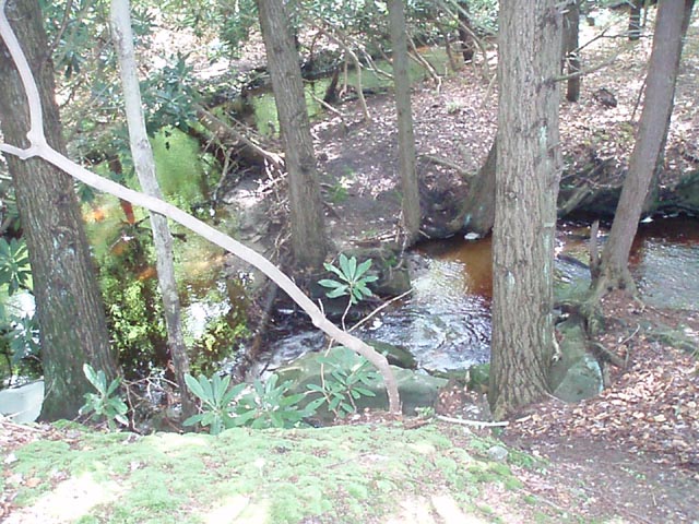
which is quite gradual. Besides the vandalized Wolf Rocks there
is nothing really fantastic about this hike yet, for some
indescribable reason I'd have to count this in my top 10
favorite PA day hike. Google Maps Custom Driving Directions The hike starts at the first parking lot in the Babcock Picnic Area off of PA Rt 56. |
|
________________________________________ |
Zipped National Geographic TOPO! GPS and Universal GPX Files |
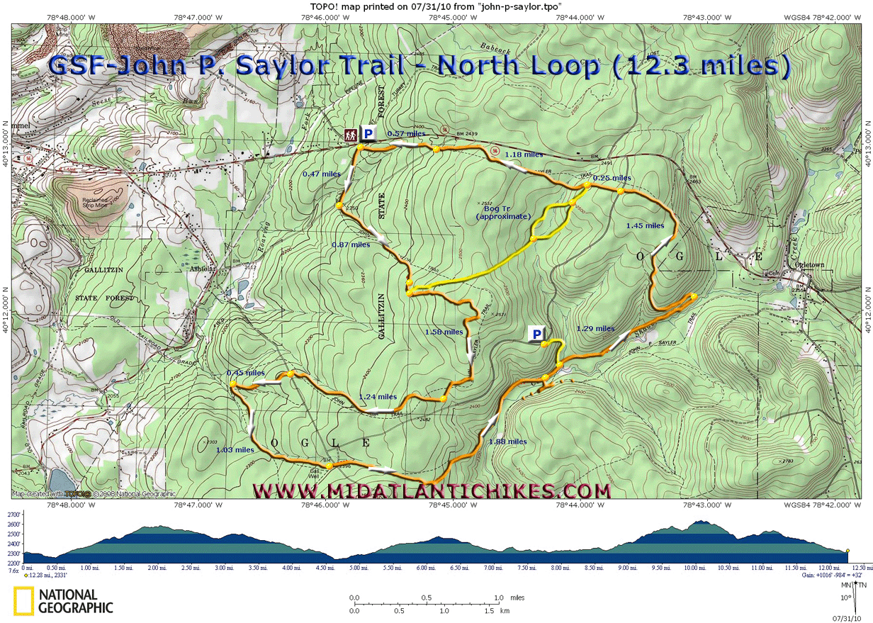
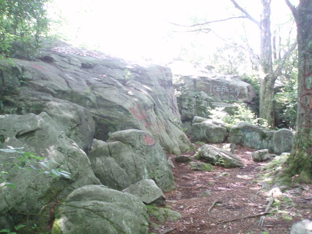
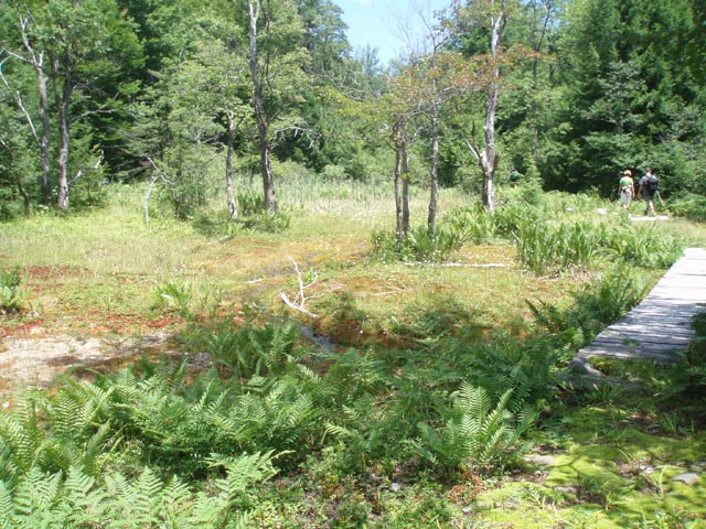
Trail Notes: From the parking area walk down the picnic area drive to the Kiosk and join the orange blazed trail. In 0.47 miles cross a road and begin to follow a red stained stream for 0.87 miles. The trail will become very rocky as you approach Wolf Rocks. There used to be a view from atop them but the trees have now obscured them totally. The trail remains quite rocky until shortly after passing the yellow blazed Boulder and Bog Trail on the left below the rocks. The trail is easy to follow for the next 1.58 miles. As you pass through some young spruce trees and a clearing (the remains of camp 51) cross a small stream and immediately turn right at a sign post. (Continuing straight will take you out to Shade Road. ) In another 1.24 miles cross another gravel road and join an old haul road. In 0.45 miles the road will disintegrate, Turn left onto a footpath and pick up a railroad grade. The grade becomes more apparent as you cross a stream where there must have once been a culvert or trestle. The trail immediately bears left and follows the stream in a straight line up a hollow to a gas well road (1.03 miles from joining the grade). As of this writing there is a lot of logging activity to the right of the trail. Once at the gas well road turn left onto it to its intersection with a gravel road. Cross it to pick up the continuation of the trail. This is the only really wet area that we encountered. Once you near the crest of the hill you'll discover why. A boardwalk follows the southern edge of a small but pretty highlands bog. In 1.88 miles watch for an orange "T" blaze in a dense Hemlock forest along Clear Shade Creek. This is where a suspension bridge joins the northern and southern loops and also makes for a great lunch spot. |
|
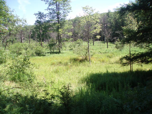
As you continue on look for the remnants of an old splash dam in the creek. This is the reason why a lot of the land around the upper reaches of the creek looks like a beaver bog. Heavy silt deposits from the logging days has made it impossible for a normal forest to return. Also look for the Nordic cross country ski trail on the left. (It is shown on the accompanying map as being blazed yellow but I think it is blazed blue.) In another 1.29 miles the old grade you've been hiking on will make a very sharp left turn and proceed gradually to the top of the plateau. In 1.45 miles from leaving the creek cross Shade Road one more time. Pass the junction of the signed Boulder and Bog trail in another 0.25 miles. The trail starts veering slightly to the north to the point at which you can not only hear the traffic on Rt 56 but see it. Here you are actually walking on old 56. In 1.18 miles from the Boulder and Bog trail cross one last gravel road and in another 0.57 miles return to your car.
________________________________________
________________________________________ |
|
|