
|
|
Long Mountain/Trout Pond Loop Description: This is a longer, more difficult version of The Trout Pond Circuit described elsewhere on this site. The base hike starts and ends in the same place but also includes a steep climb up Long and Devil's Hole Mountains, 1.6 miles of road walking and a descent off of Trout Pond Ridge. If hiked when the leaves are off of the trees partial views of the surrounding mountains and valleys can be had. The walk up county road 691 provides broad views of Mill Mt with Big Schloss, Tibbet's Knob, Massanutten Mt and Shenandoah National Park to the east. The hike along Trout Pond Trail passes a vista with views into the Monongahela National Forest. On a clear day one can see Spruce Knob (the highest point in WV). If you want more unobstructed views and a little more mileage add a one or two mile (total) out and back on the North Mountain Trail (See photos on the Laurel Run-Stack Rocks Circuit and Laurel Run-Falls Ridge Loop Links.). Turn left onto Trout Pond Campground driveway. Turn left onto gravel road with "no camping". This is the trailhead for the Fisherman's Tr. |
|
________________________________________
|
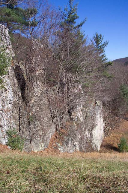
 Trail notes: Most trails are signed. All trails except the Nature Trail in the campground have painted blazes on the trees. From the parking area follow the blue blazed Fisherman's trail for about 0.4 miles to Rockcliff Lake. Turn left onto the Lake Trail. (There is no sign at this junction.) In another 0.4 miles arrive at the dam. The white blazed Lake Trail turns right. Yu may want to follow this for a bit to check out some interesting rock formations both in the Lake and below the dam. Return to the last trail intersection. Follow the orange blazed Chimney Rocks trail across a clearing and into the woods. The trail will be on a woods road for a bit but will soon switchback down to and cross a stream. Arrive at Chimney Rocks. Turn right to stay on the trail. In 0.86 miles from leaving the Lake Tr arrive at purple blazed Trout Pond Trail, left and right. Turn left onto Trout Pond Trail. It will proceed slightly downhill before making a sharp right and ascending up a draw to yellow blazed Long Mt Tr in about 0.4 miles. Turn right onto Long Mt Tr. Shortly it will turn left up a draw but will quickly turn right and proceed up through a rock scree. Watch the blazes as the trail is not always apparent. After regaining a more obvious trail it will switchback a bit and proceed steeply up the back of Long Mt. In about a mile from turning onto Long Mt Tr the grade will moderate as you follow the side of the ridge and in another 0.8 miles reach a grassy jeep road with a clearing on its left. Follow this for about 0.5 miles to RT691. Turn right onto Rt691 and travel about 0.92 miles to the junction of orange blazed North Mt and yellow blazed Laurel Run Trails on the left. ( Turn around for views of Tibbet Knob, Bib Schloss, Massanutten Mt and the Blue Ridge as you walk along.) [If you wish to have more mileage and/or views turn left here and follow the North Mt trail approximately 0.5 miles to a white spur trail on the left. Follow it a short distance to a rock outcrop and nice views. Better views can be had further down the North Mt Tr. Retrun to Rt691 and turn left continuing with the main loop.] In another 0.9 miles arrive at gated and signed, purple blazed Trout Pond Trail. The entire trail is an old jeep road, grassy at first but becoming more rocky as it descends from Trout pond Ridge. Turn right here and ascend briefly, passing Bee Hive Knob Trail (Don't know if there is a view there or not.) in 0.13 miles and then walk through two wildlife clearings. In about 0.5 miles from the Bee Hive Knob Tr junction arrive at a splendid vista with views of the lake and the westward ridges. On a clear day you can see Spruce Knob (the highest peak in WV). There is a bench and interpretive sign so you can't miss it. Descend on the jeep road and arrive at the campground loop road in another 0.72 miles. Turn left and walk down the road passing two bathhouses. Turn left onto a nature trail at the second one. It is marked with a huge Spruce Tree. Cross the campground entrance road. Pass Trout Pond. Come to a fork but bear right following the interpretive signs around the pond. Walk through a picnic area and arrive at a parking lot. Turn right and walk up to another parking lot. Turn left into the lake area and immediately turn left onto white blazed Lake Trail. Follow the boardwalks and footpath back to the junction of blue blazed Fisherman's Trail. Turn left onto this trail and retrace your earlier steps back to the car. Zipped National Geographic. TOPO! GPS and Universal GPX Files GPS Text Files for Non-TOPO! Users |
|
__________________________________________________________________________________
__________________________________________________________________________________ Outing Critiques Name: MSF Hike Name: Long Mountain-Trout Pond Loop Date: 05/11/14 Rating: 4
Critique: Overall this was a very enjoyable hike. We did the loop on a beautiful sunny day after spending the weekend at Trout Pond campground and didn't encounter another soul on the trail. Although the hike includes a bit of forest road walking, the views of Wolf Gap/Massanutten/Shenandoah NP along that stretch more than make up for it. We included the out-and-back to the first overlook along North Mountain Trail, and though this added a bit more ascent along particularly rocky tread, it was well worth it as we were rewarded with an amazing view southeast beyond the southern tip of Massanutten. I would highly recommend doing this hike if you are staying at Trout Pond. __________________________________________________________________________________ |
|
|


