|
Loyalsock-Link Loop with out-and-back to the Haystacks |
|
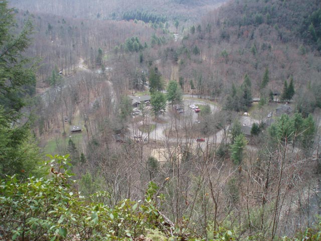
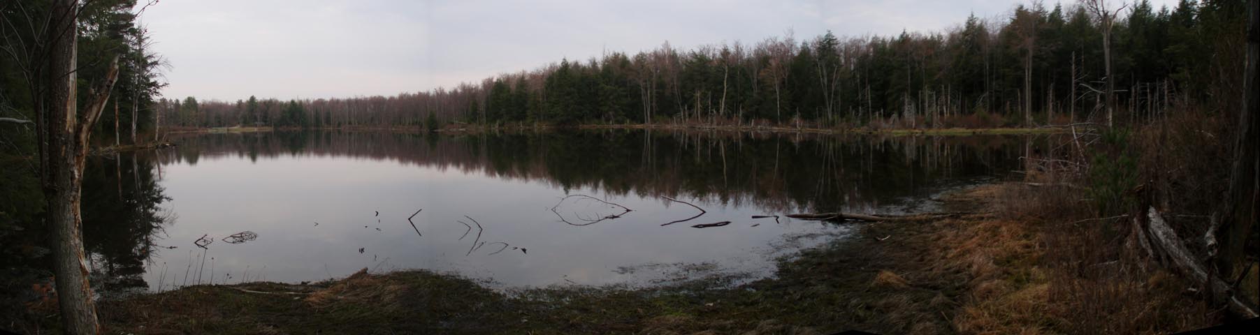
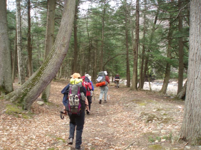
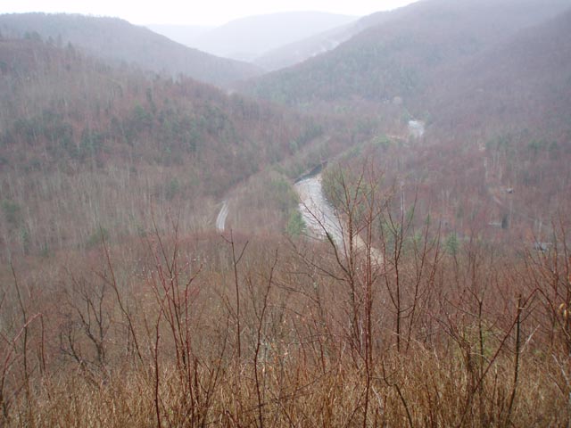
Description: The Loyalsock Trail is a 59.3 mile linear trail. The use of blazed connectors, ski trails and old logging roads and grades make smaller loops possible (especially in the eastern portion of the trail). Described here is a 17 mile circuit with a 5 mile out and back to the beautiful Haystack area of Loyalsock Creek. We give an overall rating of �moderate� to this trek but also note that there are some steep climbs and descents throughout along with a bit of a rock scramble along the upper portions of scenic Double Run. There are three vistas (Yes Agnes, one you can drive to!), waterfalls, dense Hemlock forests, Sone�s Pond and the creek itself to visit. We did this hike over three days but it can be easily done in two if you choose your campsites right and get an early start. Google Maps Custom Driving Directions The hike starts at the World�s End State Park Visitor Center. Make sure you register inside before setting off on your trip. |
|
________________________________________ |
|
Printable/Downloadable Map (11X17 Best) Zipped National Geographic TOPO! GPS and Universal GPX Files |
Trail Notes: From the Visitor Center parking lot turn right onto the park cabin road and cross Loyalsock Creek on a bridge. Immediately turn left into a parking area and then left onto the shared Loyalsock and High Rocks Tr. (The Loyalsock is blazed with red disks with a yellow �LT� painted on it. Most turns are marked with double red disks and/or a yellow arrow with a red bar.) Cross High Rock Run and climb steeply reaching the vista in 0.63 miles from the last parking lot. Continue to follow the rocky trail up to a more gradual footpath which eventually connects with a smooth, gradual grade. In 0.93 miles turn right (Not the way Dottie is pointing.) onto gravel Loyalsock Road but in a few yards bear left into the woods again.
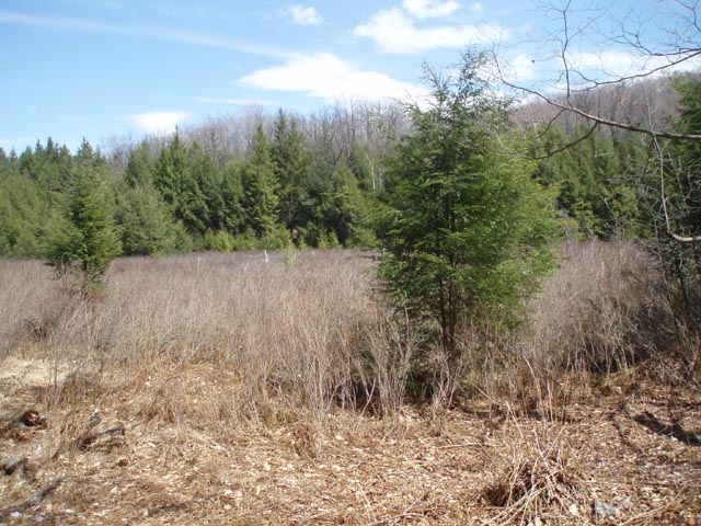
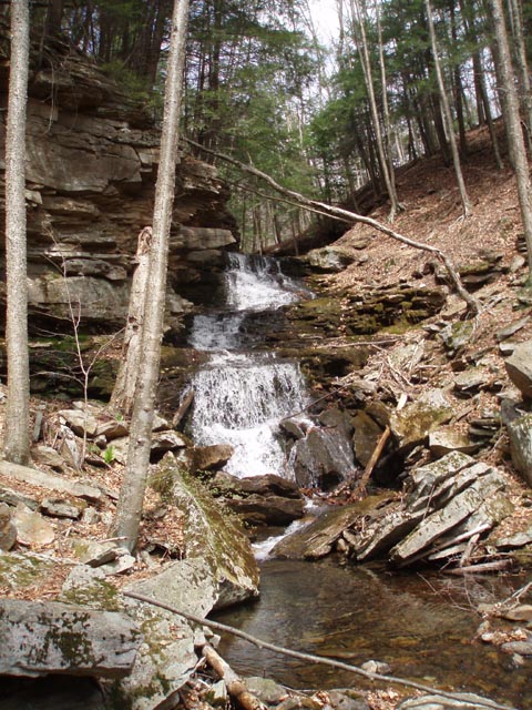
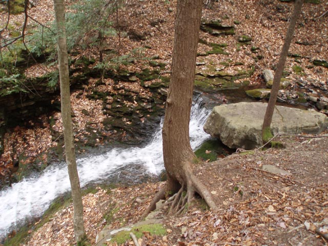
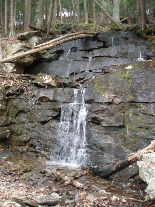
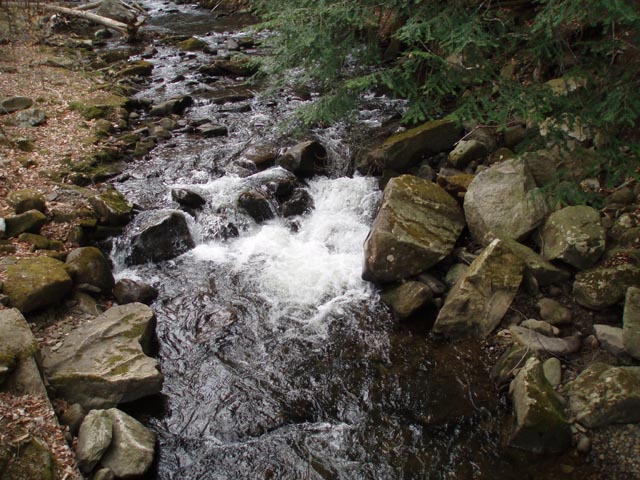
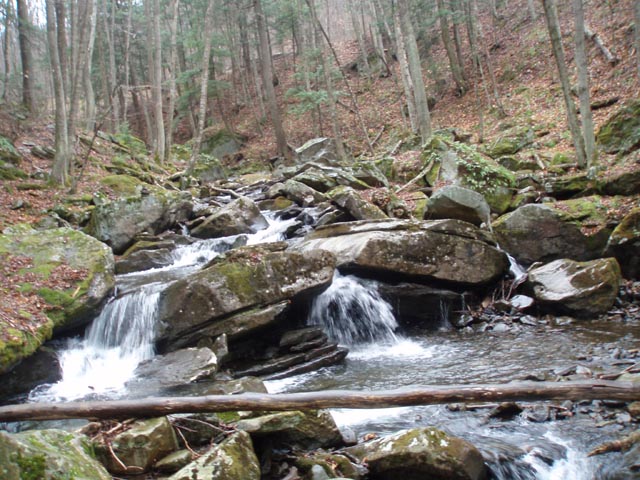
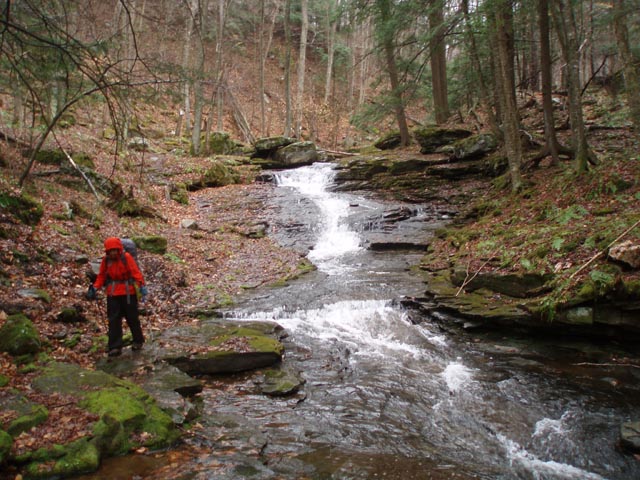
Skirt a highland bog to the left and in 0.36 miles from Loyalsock Road cross a stream with a campsite next to it. In another 0.65 miles reach a small view from Ken�s Window. Pass a nice campsite on the right on a bench along a stream. In 0.31 miles from Ken�s Window reach the blue blazed Alpine Falls Spur Trail. This is a great break spot. After your break, return to the LT and climb steeply for a short distance to arrive at the upper falls. Cross the stream here. Do not take the obvious grade on the right but continue climbing straight up the hill, out of the drainage.
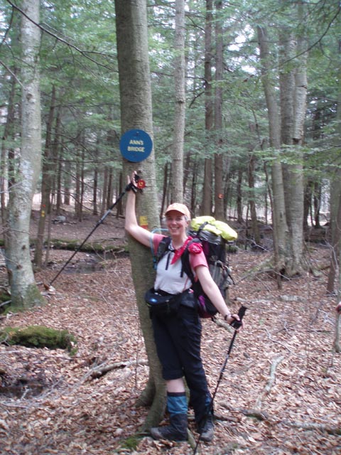
In 1.21 miles from the upper falls turn left onto Loyalsock Road. In a few yards turn right onto the trail. In 0.41 miles cross Tamarack Run at an area called Ann�s Bridge (a rotten, single log across the narrow stream). |
|
In another 1.35 miles reach the first of three campsites on the shores of Sone�s Pond. Along the way you will pass a sign for Sone�s Trail. Ignore it. This is where we spent the first of our two nights out on the trail.
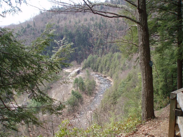
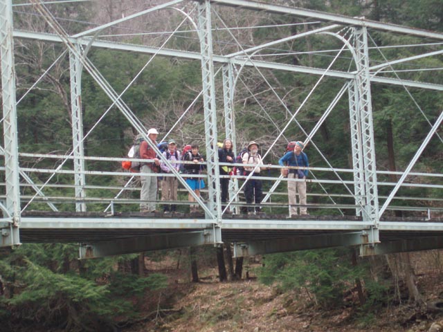
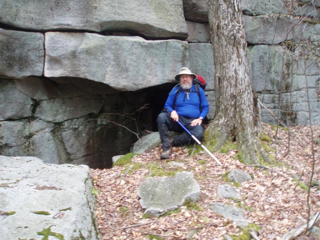
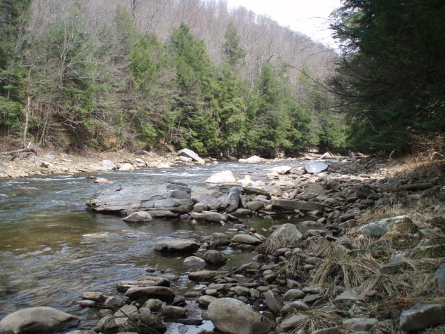
From Sone�s Pond follow to continue to follow the LT and cross Loyalsock Road for the last time. In 0.72 mile descend through a large rock garden w/cave. The trail then switchbacks down to follow a small but scenic stream. At 0.73 miles from the rock garden turn right onto a dirt road and in another 0.17 miles turn left onto Rock Run Road. Cross the creek on an old steel bridge and arrive at the junction with the RX-6 Connector Trail (blazed with yellow disks with a red �X�. This is the Link Trail.) on the right.
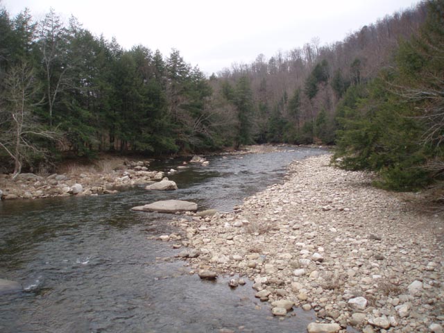
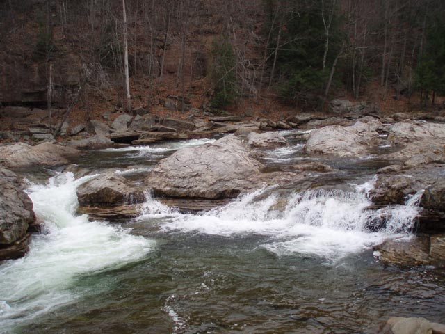
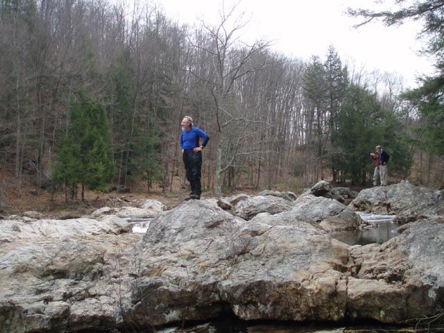
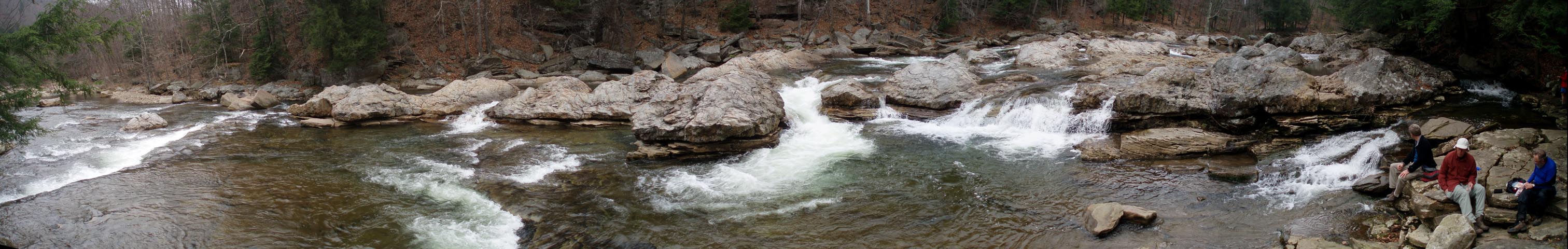
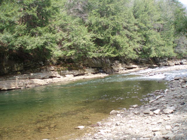
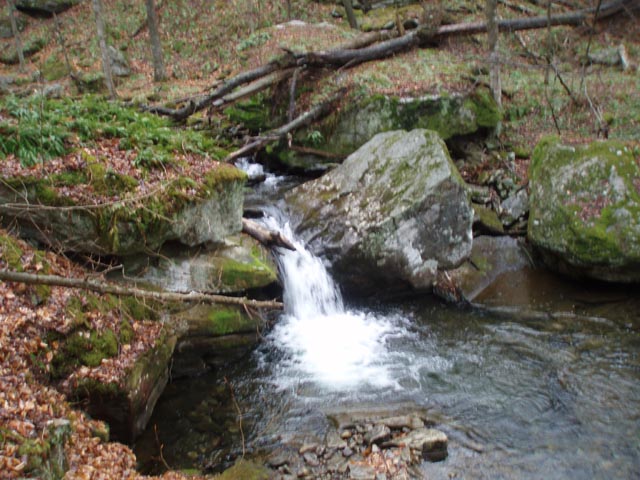
To do the out-and-back to the Haystacks (recommended) turn left here, remaining on the LT. Climb to a grassy haul road and then, after a short distance, climb steeply again on a footpath to a higher RR grade. To the right you can see where the rocks were blasted to make room for the standard gauge track that once plied through the area. Turn left onto the grade and in 1.94 miles from the road reach the junction with the RX-7 Connector (also blazed with a yellow disk with a red �X�) on the same grade. The LT descends to the left here and follows a small stream for 0.27 miles down to a lower grade and the wonderful Haystacks of Loyalsock Creek. Stop here and enjoy your surroundings. If time allows follow the grade and LT almost to trails end, visit a waterfall on a spur trail and return on the CX-7 Connector Trail to the point where you originally left the grade. This will add about 3 miles to your trek. This hike has you turning around at the Haystacks and retracing your steps back to the road.
Cross the road, walk through a parking area and follow the blazes along a dirt road for a short distance before turning right into a Hemlock grove. Camping is allowed here without a permit if staying only one night. This part of the trail stays close to the creek for the most part but at 0.50 miles from Rock Run Road it climbs steeply to Rt. 154 to avoid a part of the valley that is too narrow to hold a trail. In 0.13 miles the trail re-enters the woods and descends to the creek again. In 0.19 miles the trail flattens out. To your right is the first of 3 campsites along this stretch. There are two more marked on the map before the next steep, but short, climb. The next one is in front of a deep swimming hole and the next is just before that climb. It has a good napping rock out in the creek to sunbath on.
Shortly after the steep climb pass a hunter�s cabin on the left and descend again to the creek. Here you�ll pass the last of the campsites for a while. While it is usable it�s a bit to close to Rt154 for my taste. In 0.16 miles from this last campsite you have to ford Pole Bridge Run which flows through a culvert. This compression of the stream really increases its face velocity. If it�s flowing too hard for a safe crossing scramble up to Rt154, turn right and follow the road across a bridge and turn left into the woods to pick up the trail. If you make the ford follow the creek for a short distance before climbing up to the road and crossing the above bridge.
Initially this segment is on a gradual grade but it soon bears right onto a footpath and climbs steeply reaching an intersection with a grassy haul road in 0.70 miles. Cross this road and join another grassy road. Soon the trail splits. Follow the blazes to the left. In 0.27 miles turn left onto a dirt haul road. Pass through some dense Hemlock forests. Follow this for 0.85 miles, pass a gate and cross Cold Run Road. Shortly after this there is a nice campsite in the Hemlocks along a stream. This might be the last legal place to camp on this trek.
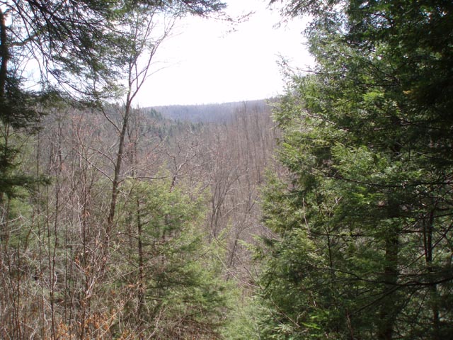
In o.55 miles climb to a deer exclosure. Turn left and follow its edge for 0.51 miles before turning left into the woods again. In another 0.58 miles the Loyalsock trail comes in from the right and shares the tread for a while as you turn left and walk through a rock garden. Cross Cold Run Road again and descend a short distance. The blue blazed Canyon Trail comes in from the right. Turn left and follow the shared trail to the Canyon Vista. After taking in the view continue on bearing to the right and descend on a very narrow footpath.
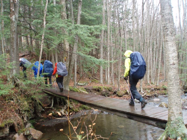
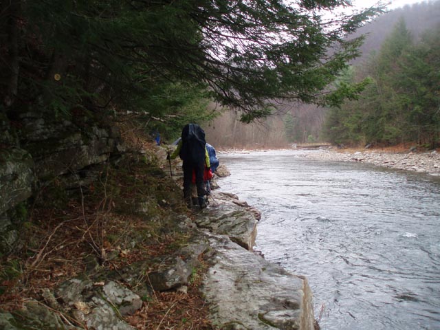
After the main descent the Canyon trail will leave to the right. Continue to follow the Link trail through some tricky rocks and arrive at Mineral Spring Road in 0.51 miles. Turn left on the road for just a few steps before veering to the right on a trail that leads to the East Branch of Double Run. The first few hundred yards or so is a tricky rock scramble. Take your time to avoid injury. Eventually you�ll reach a railroad grade. The LT will join from straight ahead in another 0.56 miles. Turn left and descend to the stream again. Cross both branches of the Run on bridges constructed by Eagle Scouts. The LT will veer to the left. Continue on the Link trail for 0.33 miles and cross Rt154. At first the trail will be wide and smooth but appears to dead end at the creek. Continue along the edge of the creek using a rock ledge as your trail. Arrive at the park cabin road in another 0.33 miles. Turn left and retrace your initial steeps back to the Visitor Center.
________________________________________ Photos
______________________________________
Name: JR Outing Critique: Four of us hiked this loop exactly as depicted in the trail notes in late august of 2015. One thing to note is the trail starts BEHIND the visitor center. We went across the wrong bridge (near the snack bar) and went up the high rocks trail instead of the LT portion, but rejoined at the vista. Of note, all the streams were dry and there was very little water until we got to Sone's pond the first night. The 2nd day we dropped our packs near the bridge and did a slack pack out and in to the haystacks. After recovering the packs we camped along the creek near the hunter's cabin. No cell coverage there but if you hike up to the road you can get a signal. Third day we kept on the link trail with no problems. You can drop the packs at the canyon vista if desired and then return via car to recover them. All in all a really nice hike. Did not see much wild life, and there were plenty of day hikers and swimmers on the creek. ______________________________________
Name: Joel Hike: Loyalsock-Link Date(s): 10/04-06/14 Rating: 5
Critique: Great
Hike! this is the second time I have done this with my sons, and
we love it here. The directions are great. My only changes
would be to note that there are plenty more campgrounds that are
not shown on the map (particularly along the loyalosock creek
after the bridge, and also between High Rocks and Ken's Window.
Also the point at which you leave the Loyalosock creek to go to
rt 154 is a bit unclear. If you chose to not ford the first
stream crossing, you must cross two bridges on 154. Ignore the
various un-blazed paths that try to leave the road to the left. ______________________________________
Name: Blake Hike: Loyalsock-Link Loop w/Haystacks Date: 04/13-14/14 Rating: 5
Critique: Great hike! I started at the Meade road comfort station. Trail descends over some rocky terrain here. I was hoping to catch the side trail to Dutchman's falls, but I missed the turn off. The hike down by the creek was beautiful. Trail turns left and heads back up to the old railroad grade where I was met by a beautiful waterfall. This railroad grade continues a ways before heading down hill to the iron bridge. right after the road walk is the first lung buster, which led to a flat section at the top. Shortly thereafter, I arrived at Sonne's pond where I broke for lunch. More walking, beautiful scenery, tons of streams everywhere. In many spots, the trail was soaked while everything around was dry. I was hoping to find a good campsite by 5:30. The last one I passed was at 4:30pm, I figured I still had light and I should look for the next one. Next thing I knew, I was at the vista for world's end state park. Now its getting dark and there's no place to set up camp. At the visitor's center, I found a park ranger who told me I could go up the butternut trail and use some primitive campsites they had there for boyscouts. Flat spots for my tent, plus picnic tables! Day 2 I took the link trail, which starts out amazing going past the creek and up to the Loyalsock vista. This led me up through the woods where I saw 2 deer, then entered a really nice hemlock grove where I stopped to fill my water in a stream. The rest of the trail was real nice. The water crossing once you get down past the highway was a little sketchy, but I made it without busting my butt. Ended up finishing the whole trail in 2 days. I would like to do it again in late summer/early fall when there's more leaves on the trees, and take my time and do 2 nights. I couldn't walk for the next 2 days after doing it all in 1 night. Overall, great experience for my first solo backpacking trip. I'm trying to decide now for Labor Day weekend if I should come back here or check out the Pinchot trail. The Black Forest trail seems really enticing, but my hiking buddy isn't in exactly the best shape and I think the climbs may kill him. ______________________________________
Date: 06/06-07/13 Rating: 5
Critique: By far the best backpacking we have done in Pennsylvania ever. The trail starts out at the visitor center with a large parking lot, and you need to register to hike. You can fill-out the paperwork if the office is not open. The people working in the office are so friendly and nice. The trail has everything from beautiful views and the scenery/vegetation changes. Oh do not get discourage if you are following the trail notes and the first 1.5 miles is nothing but straight up. You have fresh legs and a full backpack. Your legs will be screaming stop, but your eyes from the beauty will say continue. The trail markers are the best I have ever seen. Seems like every 15 feet the is a marker. The Loyalsock trail is 59 miles and you are hiking on part of it. The campsites are near water, and setup great. We had some rain and wet shoes and socks. We decided to do the haystacks and it was worth the hike. There are many streams for water sources. The trail notes are right on mark for where you are hiking. The people responsible for the trail maintenance, we would like to thank you. the campsites were clean, and had fire pits with rock chairs with flat tent areas. The second day with the overviews before the hike end was amazing. We love the workout with the 3500 feet elevation climb through the hike, which makes the views well worth it when you get to the top. I am kicking myself for not bringing a camera. Not that the camera could capture the views, which seem to limit the beauty. There were also numerous campsites that were not on the map, so do not be scared in getting to the campsite that is occupied. The first campsite on the trail seemed to be the best with the view and the rock chairs and a good distance from the trail. We stayed at the campsite at the intersection to the haystacks. It was nice and the trees provided shelter from the rain at night along with the tent. We are always looking for different places to backpack, but this one is one to come back. We did not see much traffic, but we also did go during the week in early June.
______________________________________
Name: Dennis
Hike: LT + Link Loop (starting @ eastern terminus of LT) ______________________________________
Name: Dan
Hike: Loyalsock-Link Loop w/Haystacks ______________________________________
Name: Donna
Miller
Hike: Loyalsock Link Loop ______________________________________
Name: John
Hike: Loyalsock-Link Loop ______________________________________
Name: Jeff
Mitchell
Hike: Loyalsock-Link Loop ______________________________________ |
|
|