|
Loyalsock-Link Loop with out-and-back to the Haystacks 04/29/2009 |
|
|
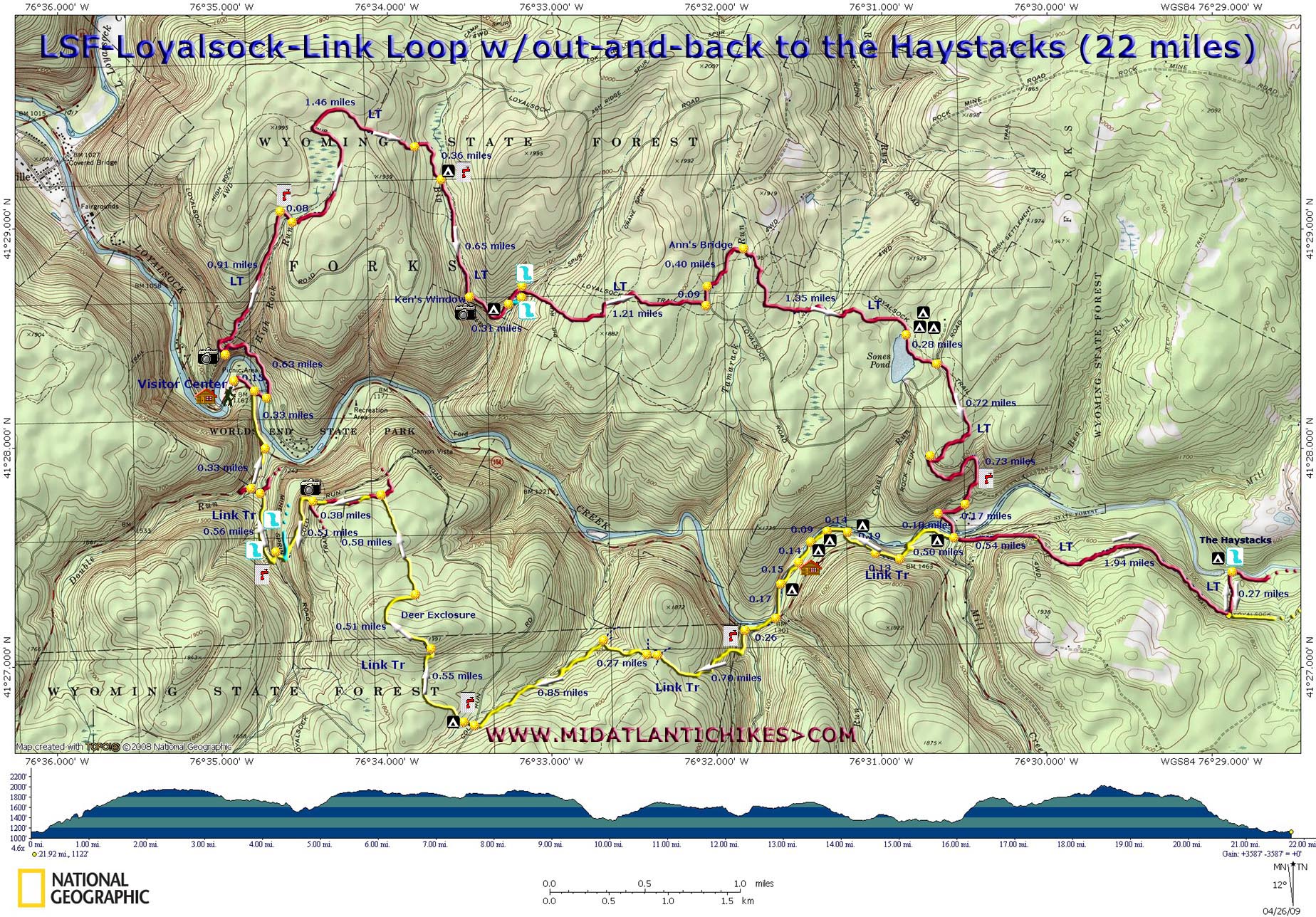
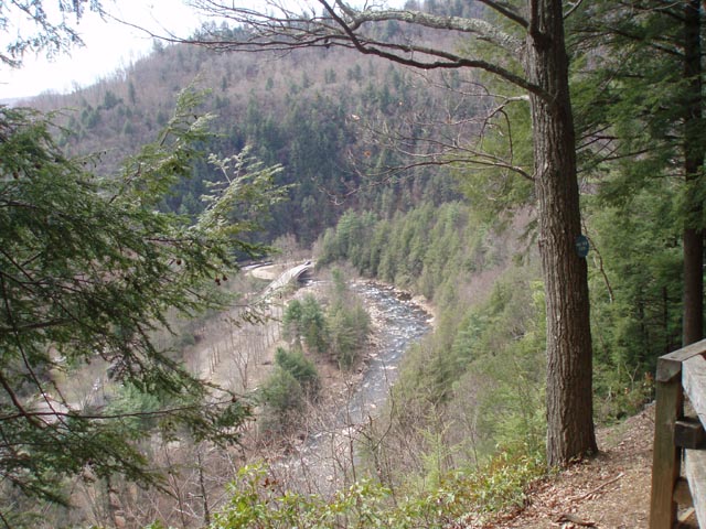
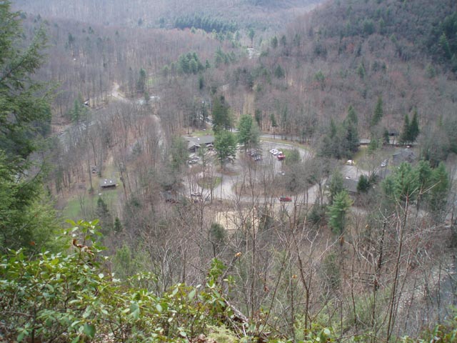
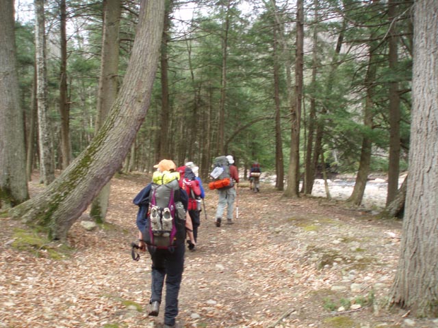
Description: The Loyalsock Trail is a 59.3 mile linear trail. The use of blazed connectors, ski trails and old logging roads and grades make smaller loops possible (especially in the eastern portion of the trail). Described here is a 17 mile circuit with a 5 mile out and back to the beautiful Haystack area of Loyalsock Creek. We give an overall rating of �moderate� to this trek but also note that there are some steep climbs and descents throughout along with a bit of a rock scramble along the upper portions of scenic Double Run. There are three vistas (Yes Agnes, one you can drive to!), waterfalls, dense Hemlock forests, Sone�s Pond and the creek itself to visit. We did this hike over three days but it can be easily done in two if you choose your campsites right and get an early start. Google Maps Custom Driving Directions The hike starts at the World�s End State Park Visitor Center. Make sure you register inside before setting off on your trip. |
|
________________________________________ |
Printable/Downloadable Map (11X17 Best) Zipped National Geographic TOPO! GPS and Universal GPX Files |
Trail Notes: From the Visitor Center parking lot turn right onto the park cabin road and cross Loyalsock Creek on a bridge. Immediately turn left into a parking area and then left onto the shared Loyalsock and High Rocks Tr. (The Loyalsock is blazed with red disks with a yellow �LT� painted on it. Most turns are marked with double red disks and/or a yellow arrow with a red bar.) Cross High Rock Run and climb steeply reaching the vista in 0.63 miles from the last parking lot. Continue to follow the rocky trail up to a more gradual footpath which eventually connects with a smooth, gradual grade. In 0.93 miles turn right (Not the way Dottie is pointing.) onto gravel Loyalsock Road but in a few yards bear left into the woods again.
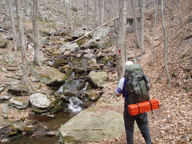
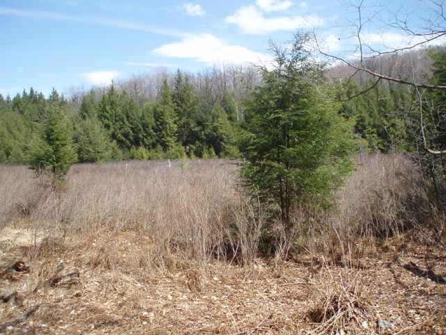
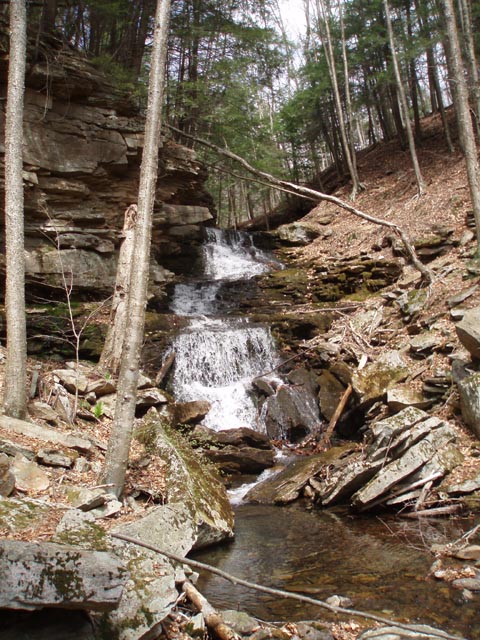
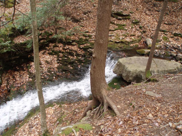
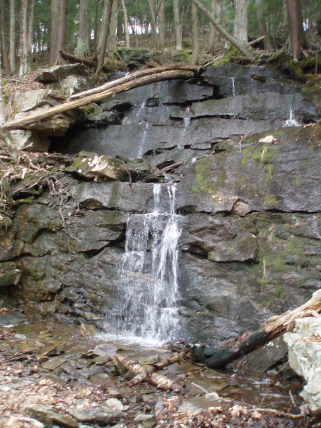
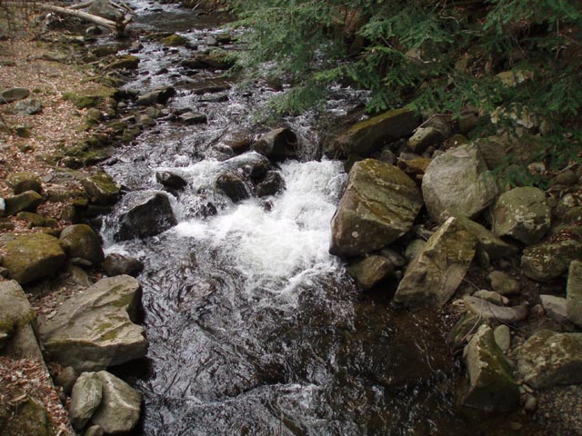
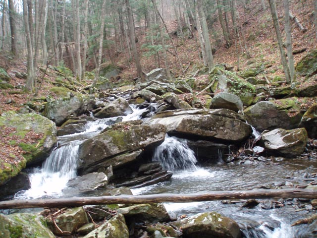
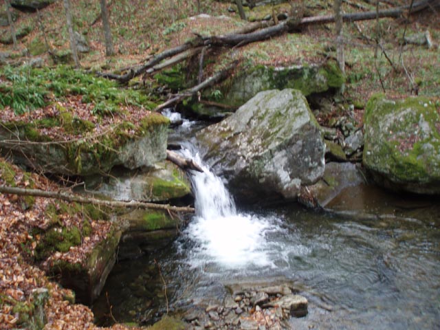
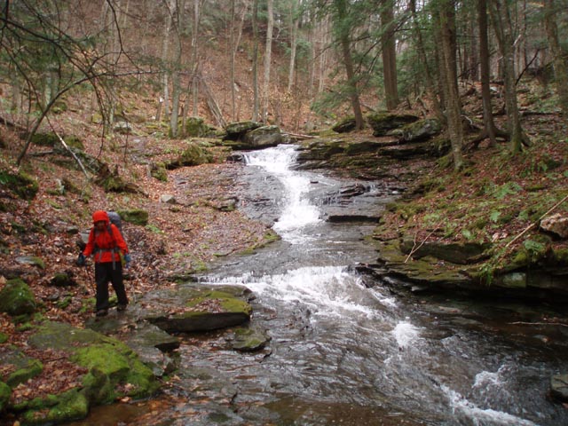
Skirt a highland bog to the left and in 0.36 miles from Loyalsock Road cross a stream with a campsite next to it. In another 0.65 miles reach a small view from Ken�s Window. Pass a nice campsite on the right on a bench along a stream. In 0.31 miles from Ken�s Window reach the blue blazed Alpine Falls Spur Trail. This is a great break spot. After your break, return to the LT and climb steeply for a short distance to arrive at the upper falls. Cross the stream here. Do not take the obvious grade on the right but continue climbing straight up the hill, out of the drainage.
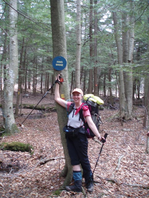
In 1.21 miles from the upper falls turn left onto Loyalsock Road. In a few yards turn right onto the trail. In 0.41 miles cross Tamarack Run at an area called Ann�s Bridge (a rotten, single log across the narrow stream). |
|
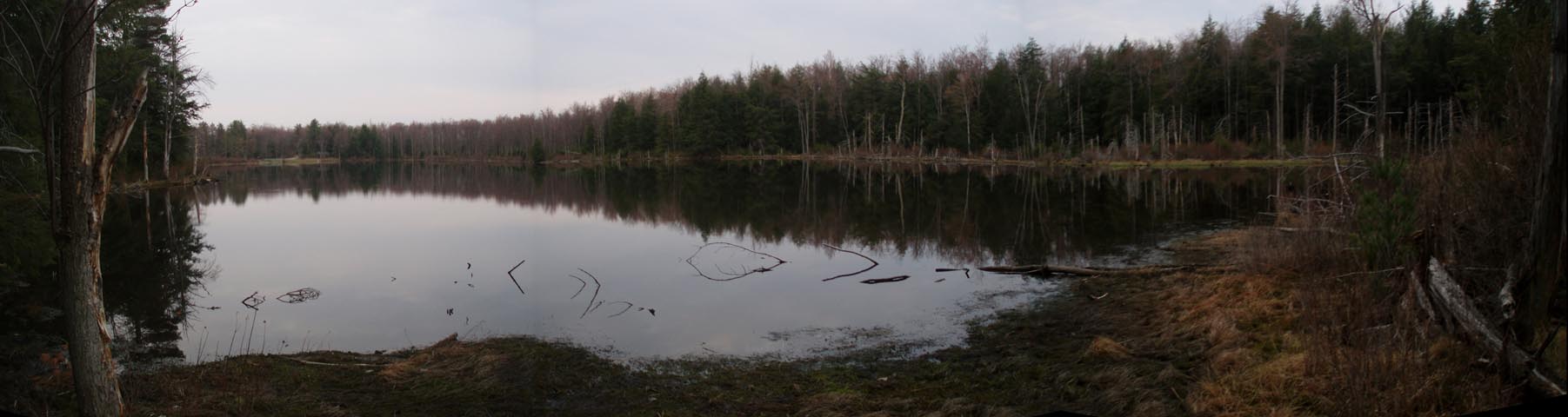
In another 1.35 miles reach the first of three campsites on the shores of Sone�s Pond. Along the way you will pass a sign for Sone�s Trail. Ignore it. This is where we spent the first of our two nights out on the trail.
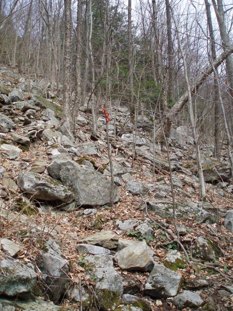
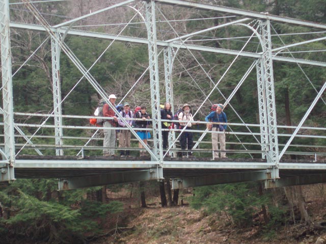
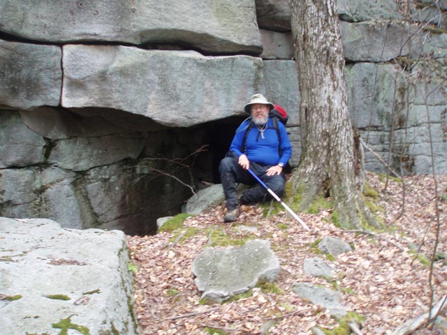
From Sone�s Pond follow to continue to follow the LT and cross Loyalsock Road for the last time. In 0.72 mile descend through a large rock garden w/cave. The trail then switchbacks down to follow a small but scenic stream. At 0.73 miles from the rock garden turn right onto a dirt road and in another 0.17 miles turn left onto Rock Run Road. Cross the creek on an old steel bridge and arrive at the junction with the RX-6 Connector Trail (blazed with yellow disks with a red �X�. This is the Link Trail.) on the right.
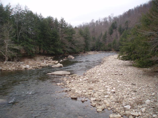
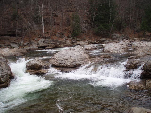
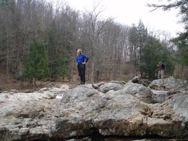
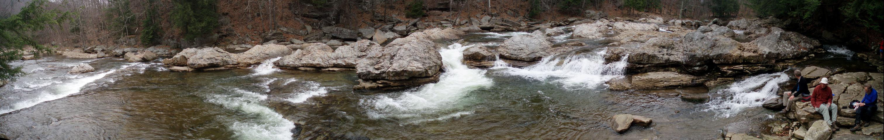
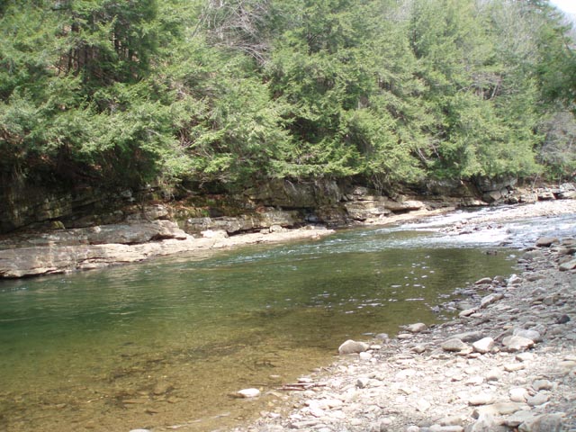
To do the out-and-back to the Haystacks (recommended) turn left here, remaining on the LT. Climb to a grassy haul road and then, after a short distance, climb steeply again on a footpath to a higher RR grade. To the right you can see where the rocks were blasted to make room for the standard gauge track that once plied through the area. Turn left onto the grade and in 1.94 miles from the road reach the junction with the RX-7 Connector (also blazed with a yellow disk with a red �X�) on the same grade. The LT descends to the left here and follows a small stream for 0.27 miles down to a lower grade and the wonderful Haystacks of Loyalsock Creek. Stop here and enjoy your surroundings. If time allows follow the grade and LT almost to trails end, visit a waterfall on a spur trail and return on the CX-7 Connector Trail to the point where you originally left the grade. This will add about 3 miles to your trek. This hike has you turning around at the Haystacks and retracing your steps back to the road.
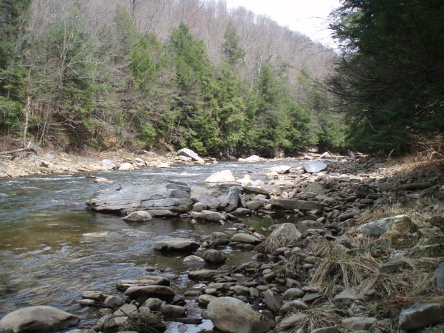
Cross the road, walk through a parking area and follow the blazes along a dirt road for a short distance before turning right into a Hemlock grove. Camping is allowed here without a permit if staying only one night. This part of the trail stays close to the creek for the most part but at 0.50 miles from Rock Run Road it climbs steeply to Rt. 154 to avoid a part of the valley that is too narrow to hold a trail. In 0.13 miles the trail re-enters the woods and descends to the creek again. In 0.19 miles the trail flattens out. To your right is the first of 3 campsites along this stretch. There are two more marked on the map before the next steep, but short, climb. The next one is in front of a deep swimming hole and the next is just before that climb. It has a good napping rock out in the creek to sunbath on.
Shortly after the steep climb pass a hunter�s cabin on the left and descend again to the creek. Here you�ll pass the last of the campsites for a while. While it is usable it�s a bit to close to Rt154 for my taste. In 0.16 miles from this last campsite you have to ford Pole Bridge Run which flows through a culvert. This compression of the stream really increases its face velocity. If it�s flowing too hard for a safe crossing scramble up to Rt154, turn right and follow the road across a bridge and turn left into the woods to pick up the trail. If you make the ford follow the creek for a short distance before climbing up to the road and crossing the above bridge.
Initially this segment is on a gradual grade but it soon bears right onto a footpath and climbs steeply reaching an intersection with a grassy haul road in 0.70 miles. Cross this road and join another grassy road. Soon the trail splits. Follow the blazes to the left. In 0.27 miles turn left onto a dirt haul road. Pass through some dense Hemlock forests. Follow this for 0.85 miles, pass a gate and cross Cold Run Road. Shortly after this there is a nice campsite in the Hemlocks along a stream. This might be the last legal place to camp on this trek.
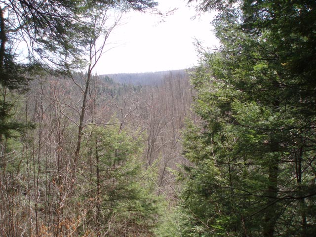
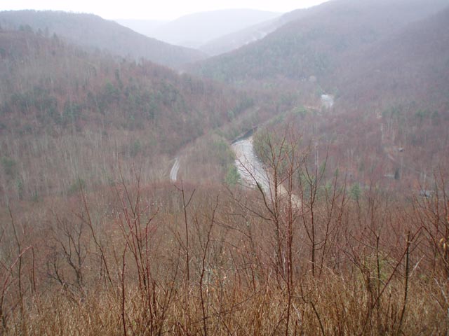
In o.55 miles climb to a deer exclosure. Turn left and follow its edge for 0.51 miles before turning left into the woods again. In another 0.58 miles the Loyalsock trail comes in from the right and shares the tread for a while as you turn left and walk through a rock garden. Cross Cold Run Road again and descend a short distance. The blue blazed Canyon Trail comes in from the right. Turn left and follow the shared trail to the Canyon Vista. After taking in the view continue on bearing to the right and descend on a very narrow footpath.
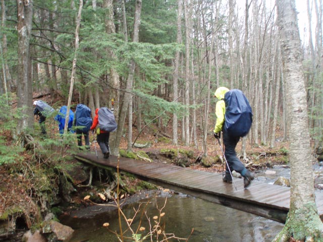
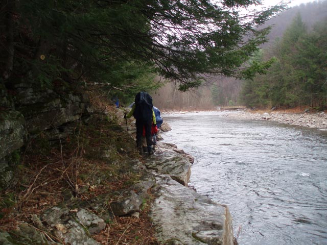
After the main descent the Canyon trail will leave to the right. Continue to follow the Link trail through some tricky rocks and arrive at Mineral Spring Road in 0.51 miles. Turn left on the road for just a few steps before veering to the right on a trail that leads to the East Branch of Double Run. The first few hundred yards or so is a tricky rock scramble. Take your time to avoid injury. Eventually you�ll reach a railroad grade. The LT will join from straight ahead in another 0.56 miles. Turn left and descend to the stream again. Cross both branches of the Run on bridges constructed by Eagle Scouts. The LT will veer to the left. Continue on the Link trail for 0.33 miles and cross Rt154. At first the trail will be wide and smooth but appears to dead end at the creek. Continue along the edge of the creek using a rock ledge as your trail. Arrive at the park cabin road in another 0.33 miles. Turn left and retrace your initial steeps back to the Visitor Center.
________________________________________ Photos
________________________________________
Name: Donna
Miller
Hike: Loyalsock Link Loop ________________________________________
Name: John
Hike: Loyalsock-Link Loop ________________________________________
Name: Jeff
Mitchell
Hike: Loyalsock-Link Loop ________________________________________ |
|
|