|
Otter Creek - NW Loop |
|
|
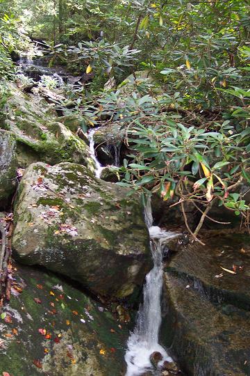
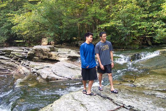
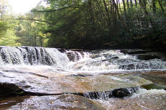
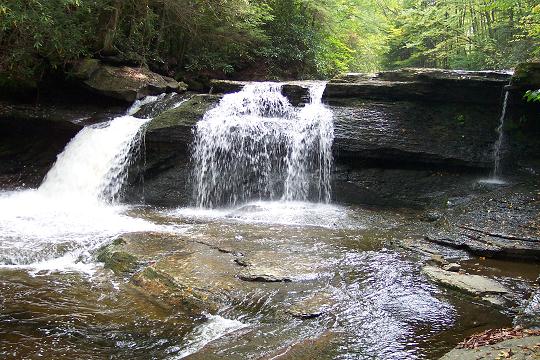
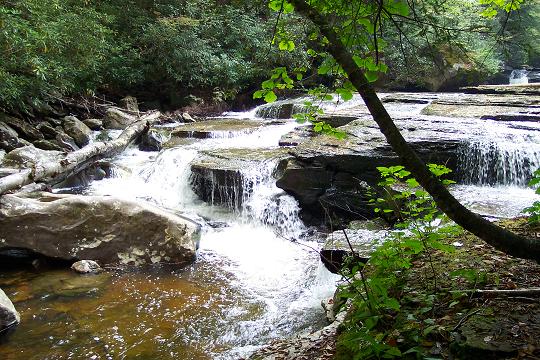
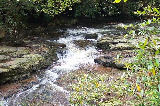
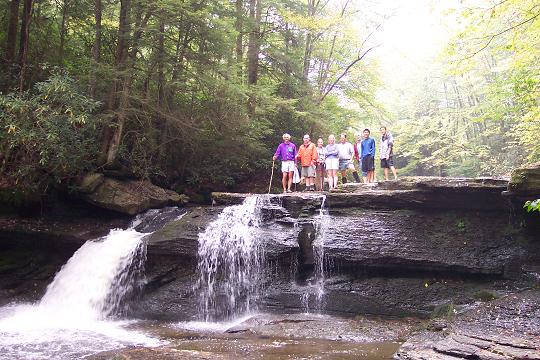
Description: This is yet another loop through the scenic Otter Creek Wilderness in the Monongahela National Forest, WV. It can be done as a day hike with an early start or a short, overnight backpack trip. Except for some potentially challenging creek crossings I would consider this one of moderate difficulty. After ice out and/or periods of heavy rain these crossings will test your skills. The first crossing cold be 2.5 to 3 feet deep although under normal conditions it is much less. There are four crossings of the main creek and one of Moore Run. Another word of caution: In the summer the last part of Turkey Run Trail (an old woods road or RR grade) will be thick with stinging nettles. Wear appropriate pants or gators! The focal point of the trek are the miles of fantastic ripples, chutes and waterfalls that make up Otter Creek. See the suggested directions in the Outing Critique below. |
|
________________________________________ |
|
|
Trail Notes: There are no signs or blazes in Otter Creek Wilderness so bring a good map(s), trail notes and a compass. Although this hike is rated moderate (except for the creek crossings) you should be or be with an experienced hiker. There are very few false trails. All trail junctions are usually marked with cairns. From the Big Springs Gap Trailhead proceed downhill toward Otter Creek. At first the trail uses an old woods road to cris-cross Spring Run. It will switch banks before finally veering away from the stream and ending at Otter Creek in about 0.78 miles. Wade/ford Otter Creek. Otter Creek Trail is on a RR grade on the other side. After crossing turn right (south) and proceed up the grade. In 1.1 miles pass the junction of Green Mt Trail on the right. Pass two campsites on the right before arriving at a third right at the next ford. Cross Otter Creek. In about 2.2 miles arrive at Moore Run. This is the best lunch spot on the creek in my opinion. After visiting this area cross Moore Run and pass a good campsite on the right. You will pass at least one more campsite on the left and another on a slight rise to the right before arriving at the next ford about 1 mile above Moore Run. Cross Otter Creek and arrive at Possession Camp, a flat, grassy area capable of housing several tents. There used to be a shelter here but it was removed in keeping with Wilderness standards. In a couple hundred yards above Possession Camp pass a large swimming hole. The junction with Possession Camp and Moore Run trails is at a large bolder to the left. At this point turn right towards the creek. Locate the cairns marking Moore Run Trail and ford Otter Creek for the last time. |
|
Moore Run Trail follows an old RR grade gradually up McGowan Mt as Otter Creek falls away from it. At about 2 miles the trail has been re-routed up a short, steep incline to yet another RR grade. Shortly after that arrive at the junction of Turkey Run Trail on the right. Turn right onto Turkey Run Trail. You will climb up and over a plateau and descend a bit to cross Turkey Run, a small stream. Shortly after crossing the run the trail climbs up to an old woods road. In the summer this could be overgrown with stinging nettles so wear long pants or gators for this part!! Follow the woods road out to FR701 which is about 3.75 miles from the last trail intersection. Turn right onto FR701 and follow it back to your vehicle. Printable/Downloadable Directions and Trail Notes _______________________________________
_______________________________________
Name: Victor
Hike: Otter Creek-Northwest _______________________________________
Name: Morgantown hikers
Hike: Otter Creek NW Loop _______________________________________ |
|
|