|
Pocosin-South River Falls Circuit |
|
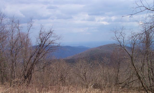
Description: This is a 9 to 10.3 mile Moderate circuit featuring some nice vistas, the ruins of Upper Pocosin Mission, 2 cemeteries and the focal point of the trip, South River Falls. This is a pretty impressive 70 foot horsetail that splits into and inverted "Y" halfway down the cliff. The nine mile loop is described here. For more mileage and elevation gain consider the optional out and back to the base of the falls. Much of the hike, including parts of the AT are either old woods roads or fire roads and a pleasure to walk on. The other sections of the AT and the South River Falls Tr are the only true footpaths in the loop. The hardest part of the trek is the final 0.5 miles out of the South River Gorge. You will climb about 500 feet in in less than 0.5 miles so save some energy and a Power Bar for the end!
The trailhead is in the South River Picnic Area. Trailhead kiosk and parking is about at the midpoint of the loop. |
|
________________________________________ |
|
Zipped National Geographic. TOPO! GPS and Universal GPX Files |
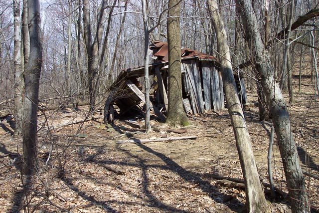
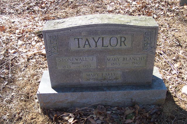
Trail Notes: From the kiosk follow blue blazed South River Falls Tr a short distance to its junction with the white blazed AT. Turn left here. In about 0.47 miles cross South River Fire Road and begin a long, gradual climb to the summit of Bald Face mountain. At the top you will find a couple of rock outcrops to the left of the trail offering westward views. As you continue north you will encounter another vista with views northward of Lewis Mt, Hazel Top and other peaks. Here the trail quickly descends along a series of short switchbacks. In 2.89 miles after crossing South River Fire Rd turn right onto the Pocosin Cabin (Can be rented from the PATC). If unoccupied this makes a great break spot with views eastward of, from left to right, Sawney Macks, Bear Stand and Panther Mountains. From the cabin descend to Pocosin Fire Rd which passes in front of it and turn right onto it. In 0.82 miles arrive at the junction of another woods road, yellow blazed Pocosin Tr. Turn right here. Immediately to the left is the ruins of Upper Pocosin Mission and to the right is it's cemetery which is marked by flag stone head stones. Continue along Pocosin trail and in 1.16 miles come to a spur trail straight ahead. (Pocosin Tr continues to the right.) The spur trail leads to the South River Cemetery. After visiting the cemetery return to the trail post and turn left. In another 0.11 miles pass through a gate and arrive at the junction of South River Fire Road. Turn right here. In another 0.14 miles pass an orange blazed trail with hiker diamonds on the left. This is a Rapidan Wildlife Management Tr. Disregard it. Continue along the South River Fire Road. The yellow blazes temporarily disappear here as you pass through the RWMA (not part of SNP) but soon re-appear. |
|
In 1.06
miles from the junction with the RWMA trail arrive at another
fire road to the left. Turn sharp left here and descend 0.39
miles to a metal horse hitching post and the junction with the
South River Falls Trail.
To complete the 10.3 mile trip continue down the road to the river. At the river turn right and follow a sketchy trail upstream to the base of the falls. Retrace your steps to the hitching post. Follow the blue blazed footpath for a couple hundred yards to a viewing area. This is another great break spot but expect company. Many folks hike directly down from the picnic area to take in the sight. From the falls viewing area continue up the blue blazed South River Falls Trail for 1.43 miles. Initially the climb will be gradual as you follow South River. With about 0.5 miles to go the trail will turn sharply away from the river and ascend, through a series of steep switchbacks, 500 feet in less than 0.5 miles before crossing the AT and bringing you back to your car. Printable/Downloadable Directions and Trail Notes ________________________________________
________________________________________
Name: Rick Outing Critique: In mid summer the forest roads were very overgrown. We missed the sharp right turn following the Pocosin cabin - the weeds were so tall it didn't look like a road, and we had to wade through several hundred meters of knee high weeds to continue - I would not call the roads a pleasure to walk on this time of year. Also, we could barely see the cemeteries through the growth. The falls were nice but the "sketchy" trail from the river to the base of the falls was wet and slick so care must be taken. Regarding the climb at the end of the circuit, we thought it was not as hard as it sounds from the description. In the end, had we known the conditions of the trails we probably would not have done the entire loop. _______________________________________
Name: Brandon
Hike: Pocosin-South River Falls Circuit ________________________________________
Name: Michael Eckert Hike:
Pocosin-South River Falls loop M.R.Hyker Note: The correction is noted and made. It seems folks are finding the hats and not reporting back to us. The hat was taped to a small overhanging tree at the falls viewing area. ________________________________________ |
|
|