|
Quehanna Trail-NE |
|
|
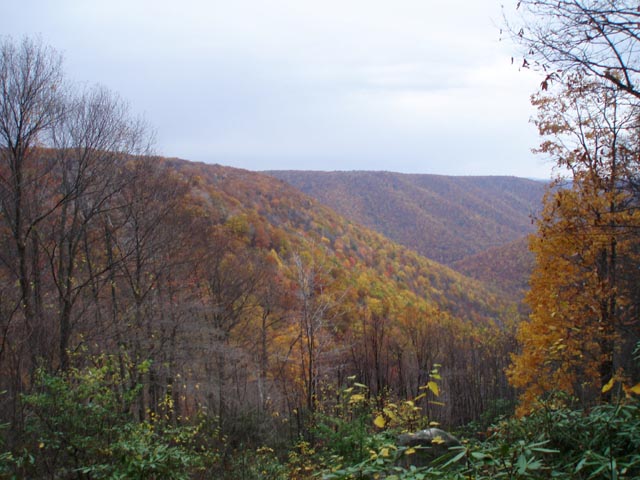
A special thanks goes to Patrick Roberts. Without his pre-hike scouting of this area this trip would have been considerably more difficult to undertake. Description: The Quehanna Wild Area is located in the Moshannon State Forest. The terrain is a pleasant mixture of a nearly flat plateau and deep ravines. The trails meander through large open heath meadows full of blue Berries, lush forests with a thick understory of ferns and Rhododendron tunnels along the many streams. While the 70 mile long The Quehanna Trail circumnavigates this area it is bisected by several connector and Ski Trails, making smaller 2 and 3 day loops � even day hikes � possible. The 27.5 mile loop described here has some steep descents and ascents, most without the aid of switchbacks, with long stretches of plateau walking in between. While water is hardly ever an issue in the Quehanna Wild Area good campsites are at a premium. |
|
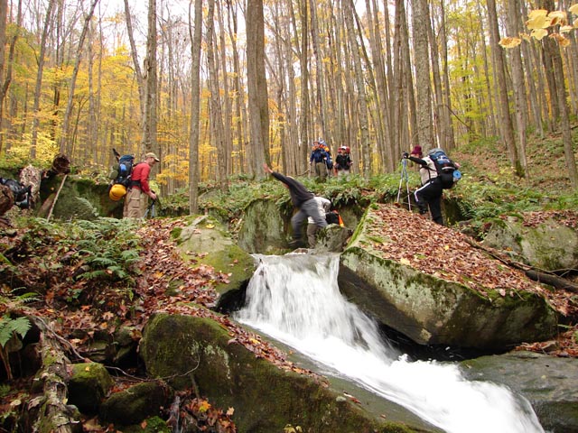
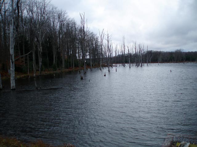
The well- established sites are shown on the map. While it may be possible to hike more than described here on any given day finding a campsite may be an issue. Safety Notes: We�ve hiked the segment of the Quehanna Tr through Porcupine Draft in August and again in October. Sometimes the stream is barely flowing but at other times the six or so stream crossings can be challenging. The trails in most of the deep hollows become overgrown with stinging nettles in the summer. Wear appropriate clothing. Pass the Beaver Run Shallow Water Impoundment Nature Area on the left (sign on the right). In about 200 yards turn right into an unsigned gravel parking area. ________________________________________ |
|
Printable/Downloadable Map (11X17 best) Zipped National Geographic. TOPO! GPS and Universal GPX Files |
Trail Notes: The Quehanna Trail East Cross Connector (Q.T.C.C.) and all other foot trails and ski trails are blazed blue. The Quehanna Trail proper is blazed orange.
Day 1: take the spur trail to the left of the parking area and join the blue blazed Q.T.C.C. turn right here.
In 0.31 miles cross the northern terminus of the new Lincoln Loop trail on the right and the Marion Brooks Loop Tr on the left. In 1.36 miles from this junction arrive at Gravel Losey Road. Turn right here. Another blue spur trail will come in from the left in 0.13 miles. In another 0.28 miles turn right onto a footpath. You are now on the orange blazed Quehanna Tr.
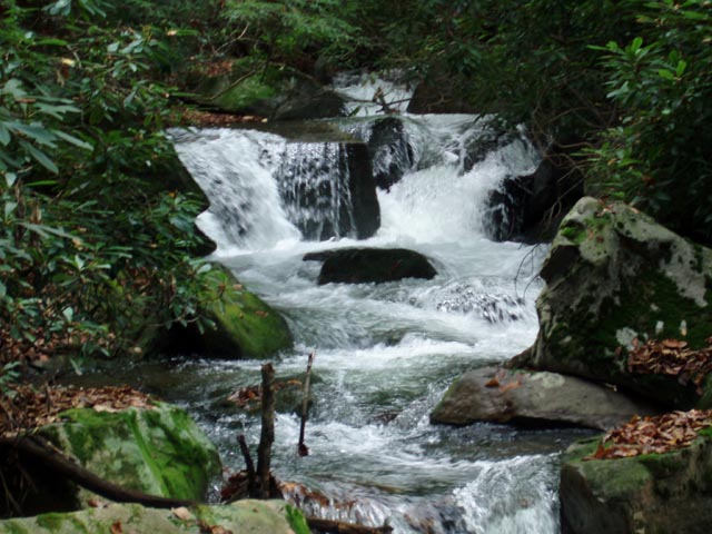
Descend through Porcupine Hollow. The descent will be steep and rocky at times. You�ll cross the run several times before joining an old railroad grade that will soon deposit you onto Red Run Road. Turn right here. In 0.34 miles turn left onto a footpath and soon pass a pretty little swimming hole. This is a great place for a break. Cross the run on a well- constructed bridge and begin a gradual ascent up Sanders Draft Run. You will cross the run 4 times before reaching the top. |
|
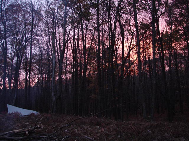
In 2.18 miles from the road pass a small campsite on the right and soon arrive at a grassy woods road. To the right is Sanders Ski Tr. Continue straight across this junction on another grassy woods road. Watch for the trail to leave the road to the right at about 0.7 miles. Turn here and in another 0.16 miles bear left onto a spur trail which leads to the Arch Spring Campsite. Set your tents up around the ruins of what appears to have been an old farm. (If this site is taken backtrack to the woods road and camp in front of an outstanding cluster of White Birch. If you look around you�ll find a fire ring.) You�ve covered about 7 miles today. Day 2: Continue East on the Quehanna Tr. In 0.31 miles arrive at the Little Fork Vista and a nice view to the north. In another 1.10 miles cross gravel Hoover Rd and in 1.01 more miles cross through 2 utility swaths. Begin a steep descent along picturesque Laurel Draft. In 2.05 miles from the utility swaths arrive at Wykoff Run Rd. Turn right onto the road and cross Laurel Draft on a bridge then turn left through a parking area to rejoin the orange blazed Quehanna Tr. Follow an old woods road a short distance and then cross Wykoff Run on a foot bridge. Climb steadily up Pine Hollow for about 1.5 miles. You�ll cross the stream 2 or 3 times before the final climb to the top of the plateau. After about 0.3 miles of flat walking arrive at Sinnemahoning Road/Tr. Turn right. In about 0.25 miles the Quehanna Tr will leave the road to the left on a footpath. You may follow it to explore Jerry�s Run and then take No. Fifteen Tr east to rejoin the route at Three Runs Road but this description keeps you straight on Sinnemahoning Road/Tr which is blazed red from this point to its end. In 2.02 miles from where the QT left the road arrive at gravel Three Runs Road (no sign). Turn right here and follow the blue blazes down the road a 100 yards or so and turn right into the woods at a Ski Trail signpost. This is Big Spring Draft Tr. You�ll closely follow the drainage for 1.02 miles before arriving at a nice campsite on the opposite bank nestled under the Hemlocks. After a bit more then 10.3 miles of hiking this is a good spot to call it a night. Day 3: Break camp and proceed west on Big Spring Draft Tr. Cross the draft and switchback left and climb gradually up a hill. In 2.13 miles from camp arrive at the junction with Wykoff Tr. Turn left onto it. In 0.87 miles cross Quehanna Highway and enter the Wykoff Run Natural Area Parking Lot with a kiosk. Turn left at the kiosk and follow the parking lot to a dirt road on the right. Turn here and walk around a forest gate. In a few steps turn left onto a blue blazed footpath. This is the David Lewis Tr. (David Lewis was a scoundrel and highwayman from a previous century.) In 1.48 miles arrive at gravel Reactor Road. The old dirt road you started on will come in from the right and the Bellefonte Posse Tr will come in from the left. (Bellefonte is a small town not far from this area. A posse was formed there to apprehend David Lewis. He was shot and captured by this group.) Straight across the road is the beginning of the Meeker Tr. Follow it. In 0.48 miles the Red Run Tr will come in from the right. Stay straight on the Meeker Tr. In another 0.48 miles cross a utility swath. There is a deep seep on the initial side. Look for some logs that make crossing it a lot easier. Arrive at another grassy woods road in another 0.43 miles. Turn right here and soon pass a nice campsite under Hemlock trees. Cross Meeker Run on a bridge and immediately turn right onto the Q.T.C.C. Follow Meeker Run for a while, passing the west terminus of the PSOC Link on the right. Just above this junction the trail will soon veer to the west and take you on a fascinating stroll through alternating deep woods and open heath meadows. In another 0.52 miles pass a spur trail on the left and then in 0.66 more miles the Bridge Tr, also on the left. In another 0.5 miles descend to and cross Beaver Run in a wide boggy area. The bridge across the run was blown out but a rock hop was created in its place. Parallel the Beaver Run Swamps for the next 0.76 miles. Cross 2 utility swaths in quick succession and re-enter the woods for just a little while. Turn right onto the breast of the Shallow Water Impoundment dam. Follow the service road past the kiosk out to the Quehanna Highway. Turn left onto the highway and follow the shoulder back to your car. Printable/Downloadable Directions and Trail Notes ________________________________________
________________________________________
Name: Matthew
Hike: Quehanna Trail NE Loop ________________________________________ |
|
|