Riprap Hollow Loop

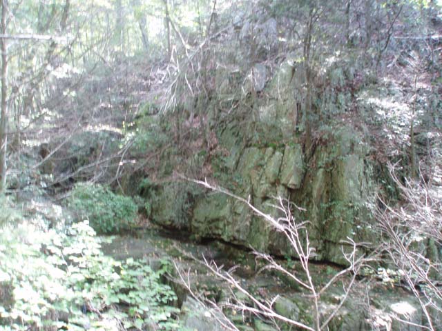
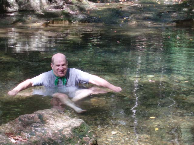
Description: This is a moderately strenuous 9.7 mile circuit in the Southern district of SNP. The elevation gain is about 2200 feet. Great views are had at Cavalry and Chimney Rocks as well as along a stretch of trail that passes through an area that has been defoliated by forest fires. A very picturesque stream with water slides, rock walls, mini-waterfalls and a nice swimming hole runs through the hollow. The hardest part of this hike is a 2.62 mile climb up Wildcat Ridge. While the name suggests that at least some of the tread is very rocky, for the most part, it is not. The final AT section is a very pleasant walk back to the car. 

Google Custom Driving Directions


Note: Google Maps often makes use of Park Fire Roads in its directions. These are closed to the public. Confirm your route with other maps! The trailhead is at the Riprap parking area on the west side of Skyline Drive north of Mile Post 90.

________________________________________


Printable/Downloadable Map

View 3-D Map

Zipped National Geographic. TOPO! GPS and Universal GPX Files 

GPS Text File for Non-TOPO! Users


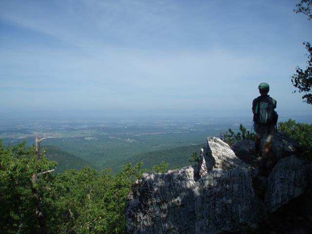
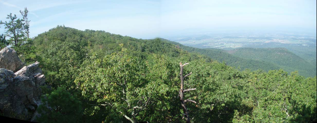
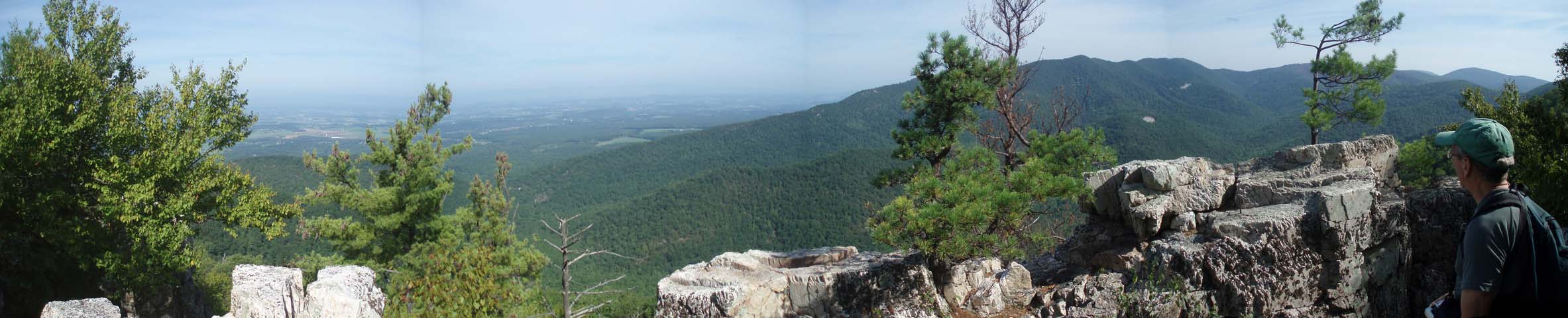
Trail Notes: All trails are signed and blazed. From the parking area follow a short blue blazed spur trail to the white blazed AT. Turn right onto it and climb gradually for 0.42 miles to the junction with blue blazed Rirprap Hollow Trail. Turn left onto it and continue climbing. In 0.83 miles arrive at Calvary Rocks and a nice vista. After taking in the view continue for another 0.46 miles to Chimney Rock Overlook. You will traverse an open area with more views as you proceed.


Descend into Riprap Hollow. As you near the bottom the trail will split (marked by a sign.). Bear right here and climb slightly for a short distance before continuing the descent. You’ll cross the stream twice. The swimming hole is between the two crossings. In 2.54 miles from Chimney Rock turn left onto Wildcat Ridge Trail and cross the stream one last time. After the crossing bear left. The trail will follow a small side stream before crossing it and climbing up the ridge. The tread will be steep at times.


In 2.62 miles from leaving the Riprap Hollow Trail arrive at the AT. Turn left onto it and hike 2.74 miles back to the initial spur trail and your car.


Critique This Outing


________________________________________

________________________________________

Outing Critiques

Name:   Jeremy
Date(s) of Hike: 08/21/2015
Hike Name : Riprap Hollow
Loop
Ranking: 3

Outing Critique: I hiked the Riprap trail clockwise starting at the Riprap trailhead.  I opted to do the “boring” AT part first and work up a sweat before hitting the swimming hole.  The AT lived up to expectations with only one slight overlook providing a preview of the mountain that would need to be climbed at the end of the hike.  The Wildcat Ridge Trail was an easy descent into the hollow and had a few overlooks.  The last mile follows a small stream until the junction with the Riprap trail.  From there the last 3ish miles were all uphill, although there was only one steep section.

The swimming hole was okay. What it lacked in size it made up for in coldness.  The 20’ waterfall was not much more than a trickle when I was there but the rock formations in that section were still pretty.  The vistas in and around Chimney Rock were typical and you could get the same view from just about any of the west facing overlooks on Skyline drive.

Overall it was not a bad hike, but there was nothing about it that would make me hike it again.  The AT and Wildcat trails do not add much value to this hike so you could hit all of the highlights by hiking counterclockwise out and back to Chimney Rock (or possibly down to the swimming hole).

Watch the video.

_______________________________________

Name: Mitch Housed                                                                                               Hike: Riprap Hollow
Date: 05/28/2011                                                                                                   Rating: 5

Critique: This was a great hike! The views are spectacular! The flora on this trip was better than most places my wife and I have seen. There are more campsites available then suggested. I counted 4-5 sites, most could handle more than one tent (2-man). Most sites also have water nearby. This was a challenging hike. Hiking Upward listed it 4 out of 5 and I'd agree. We hiked it clockwise which I feel works, at least for us, in your advantage. The AT section south of Riprap parking area is up and down. The Wildcat Ridge section is all downhill in this direction. Through the lower valley is a fairly level climb. Once you begin to ascend out of the lower valley the trail quickly steepens for the next 3/4-1 mile stretch. After the initial climb the remainder of the way is a more gradual ascent to some wonderful views. Going this direction lets you knock out 2/3 of the trip in the first day. This leaves you with about 3.5 to 4.0 miles to the Riprap parking area which is broken up with the breaks you'll take at Chimney and Calvary Rocks.

The Pros:
Views
Campsites
Great Workout
Waterways

The Cons:
Not much wildlife
Traffic

________________________________________

Name: Natasha                                                                                                         Hike: Riprap Hollow
Date: 02/09/09                                                                                                        Rating: 5

Critique: We did this hike late winter and were treated to amazing views. To think if we had hiked this trail during the summer we would not have observed the really neat geological formations in the area and appreciated the descent into and climb out of the valley. A summer hike would treat visitors to a number of pools along the stream, which were flowing well due to recent snowmelt. I thought the trail one of the rockiest around and highly recommend harder soled boots to avoid sore feet (I was regretting my boot decision a few miles in). The climb out of the valley is tough but lots of logs and rocks along the way serve as great places to take a break and enjoy the view. We liked finishing up on the AT to cool down before getting into the car.

________________________________________

VA Hikes MD Hikes WV Hikes PA Hikes Contact Us Home