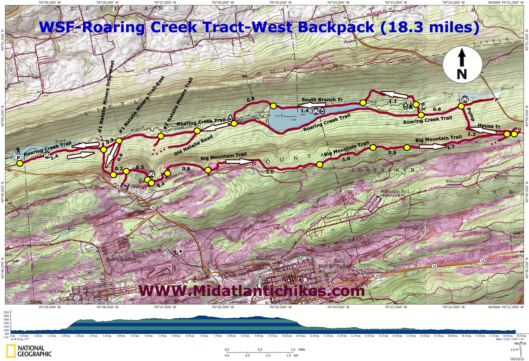
| Roaring Creek Tract-West Backpack |
|
|
Description: The DCNR states that "Weiser State Forest is located in the ridge-and-valley region of eastern PA. Named for the frontier diplomat, Conrad Weiser, the forest covers 30,000 acres on 16 tracts throughout the region." The Roaring Creek Tract is one of the largest and boasts of over 40 miles of multi-purpose trails, pretty Roaring Run and three lakes (reservoirs) with views of all of them. The backbone of the trail system is the gravel 8 mile long Roaring Run Trail. From it radiates several trails, some of them used by coal miners years ago. I consider this overnight outing a good one for experienced hikers who want to try backpacking. That is, however, not to say it�s all easy. Near the beginning there is a steep, rocky climb to the crest of Big Mountain. From there the ridge top is easy to traverse as you explore mature hardwood forest, hemlock groves and the scars of a long ago coal industry. This first day involves a total of almost 12 miles and 1400 hundred feet of E.G. camping close to Roaring Creek that night in a very dense hemlock grove at day�s end. |
|
The second day is about 7.5 miles in length with less than 100 feet of E.G. but keep in mind that the initial 1.1 miles on the South Branch trail is, at times, a trail by name only. The blazing is adequate but you really have to keep your head on a swivel to search for them as the trail frequently disappears amongst several scree fields. Google Maps Costum Driving Directions ________________________________________ |
Zipped National Geographic TOPO! GPS and Universal GPX Files |
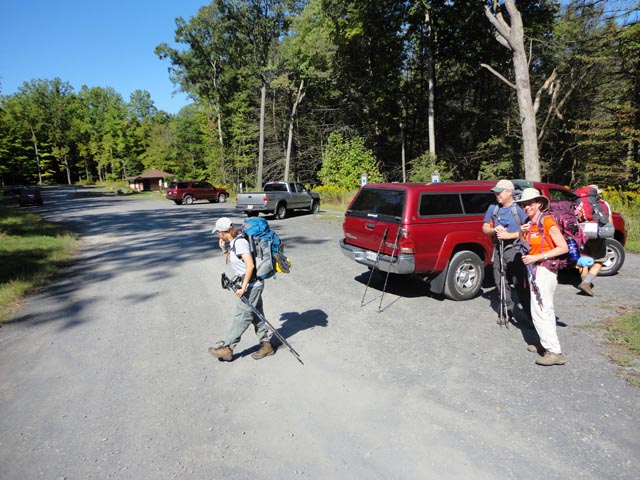
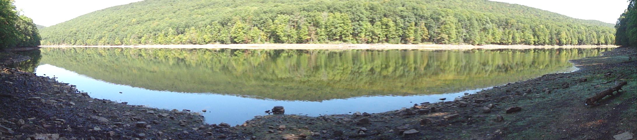
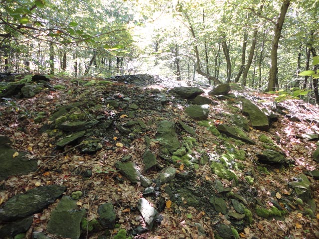
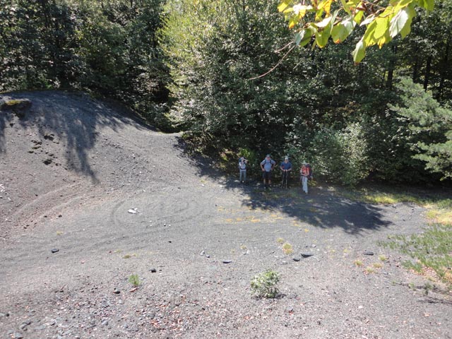
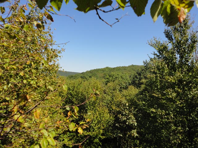
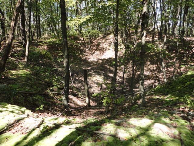
Trail Notes: From the west side parking lot join the gravel Roaring Creek Trail. All of the reservoirs are on the north side of the road. The first one is Bear Gap Reservoir. A short portage trail will take you down to its shores for a view. In 1.4 miles from the parking lot The #1 Natalie Miners Trail-West crosses the road. While a right turn here will get you to the top of Big Mountain it is not the preferred way. The route is a rocky, steep climb along an old power line swath. Continue on the road for another 0.3 miles and turn right onto the #1 Natalie Miners Trail-East and proceed to climb for 0.6 miles, turning left onto the continuation of the �-West� Trail. As you reach the crest of the ridge stop for a bit as to your right you will find evidence of a coal mine. In 0.2 miles arrive at a wide grassy road. I believe this is Old Natalie Road. It wraps itself around a knob but at some point, not clear to the hiker, descends to the left to eventually reach Roaring Run Trail. Avoid this turn if you spot it, continuing straight. As the trail continues it passes several huge mounds of cinders or mining finds on the left and becomes known as the Cinder Trail. In 0.5 miles from joining this section the Big Mountain Trail comes in from the right and the trail assumes its name. In a few steps turn left at a T intersection to stay on the Big Mountain Trail. There are several side trails that lead to roads and points of interest as you pass by old mind ditches, test holes and their subsequent mounds of earth and rock. You�ll also pass through pine groves (attempts at remediating the mountain top), open areas scrapped so severely of surface soil that all that can grow there is heath, blueberries and a few stunted trees and, especially towards the end of the ridge walk, beautiful hemlock groves. |
|
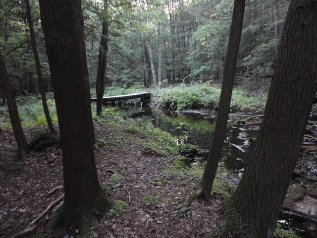
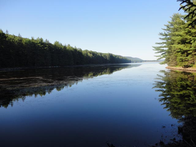
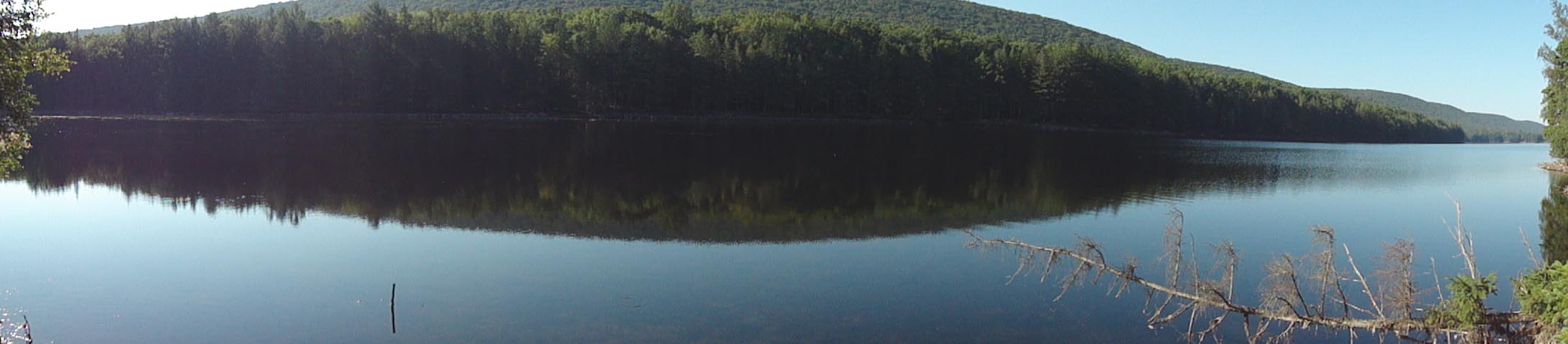
In 4.3 miles from joining the Big Mountain Trail it seems to peter out. To the left is a rock spine with a crevice. Pass through it and find yourself on a perfectly flat and straight grade lined in Hemlocks. One�s first impression might be that this is an old railroad grade but in actuality it is a buried pipeline constructed by the C.C.C. in the 1930s. Enjoy a pleasant stroll for the next 1.7 miles where the trail ends at the dirt Black Road Trail. Bear left but just for a handful of steps as you will turn left on a very short spur trail and then left again onto Pump House Road. It will switchback to the right and in 1.2 miles from joining it deposit you onto the Roaring Run Trail. Across the road is the pump house and pretty Klines Reservoir. Turn left onto the road and in 0.6 miles Come to an opening in the woods on the right. When we were there no sign existed but there was a picnic table and some yellow marking on the surrounding trees. Regardless, there is an obvious path that in 0.2 miles crosses Roaring Run on an old bridge. Immediately after crossing you will find a sweet campsite in the hemlocks to the left. This is your home for the night.
The trail varies form being sketchy to rather obvious when you first break camp but it soon makes a 90 degree turn. From this point on red blazes continue but the tread mostly disappears. That�s OK. As mentioned in the description, follow the blazes through several scree fields. Red is not a very distinct color when painted on trees so you really have to keep an eye out for them. In some places pink or yellow surveyors tape might reinforce the route. In 1.1 miles from camp the trail will turn left again and the trail regains the appearance of a real trail. The footpath ends at a service road on the northern shore of the largest of the three reservoirs, McWilliams. The next 1.4 miles makes up for all of the preceding rocks as you enjoy a pleasant lakeside stroll under the shade of giant spruce trees. As you approach the dam the trail leaves to the right on a footpath. The trail is not as hard to follow here as when you were traveling through the scree fields as you are aided by� no admission signs� on your left. The next 0.8 miles is another pleasant section of woods. At its end you�ll cross the creek again on a bridge and arrive back at Roaring Creek Road. Turn right and in 3.3 miles arrive back at the parking lot.
________________________________________
________________________________________ Outing Critiques
Name: Patrick B
Outing Critique: Did this as a
two night trip, starting at sunset Friday and hiking out noon
Sunday. Worked great as a first of the season backpacking trip,
as well as an introduction to backpacking for two of our
companions. First night we hiked to the base of the first steep
climb and made camp an appropriate distance off the trail.
Second day started with that climb, then a very pleasant mostly
level hike along the ridge. This track lacks great vistas, but
otherwise has some interesting passages through the old coal
mine(s?) area. Second night spent north of the resevoir. ________________________________________
Name: Ber Hike; Roaring Creek Tract Date: 04/18/15 Rating: 4
Critique: Good hike. We started around 9:45. First hill is no joke but ounce your up you can cover ground fairly quickly and your�e going to want to. There wasn't much going on along the big mountain ridge line a couple of coal pits but very lacking in vistas. Wildlife was quite plentiful; owls, salamander, snails, chipmunks, snake, butterflies, deer, coyotes, hawks, turkeys, ducks and geese that love to wake you up in the middle of the night. Being one of the first warm weekends this year it was quite busy, people riding 4 wheelers on the big mountain trail as well as mountain bikers and lots of folks of the main rd. maps or gps comes in handy for the fact that all trails are marked in red can get you turned around a little bit. Sign at entrance says closed for camping however all other resources we check said "primitive camping" was aloud with a open fire ban march 1- May 25 so we used a tiny stove. We ended up putting in 14 miles the first day due to the fact that good camp sites along the south branch roaring creek trail can be tough to find but if you keep going there is a great one. Terrain is rocky have ankle support. Overall if you put in some tough work the first couple of hours you can be at camp and relaxed next to the beautiful lake by 4pm with only a 4 mile walk out the next morning.
________________________________________
Name: Steve E. Hike: Roaring Creek tract Date: 09/13/14 Rating: 2.5
Critique: I did not heed the advice of an earlier reviewer and failed to call ahead to check the camping status. I arrived in the morning to discover the area is currently closed to camping. I had intending to stay one night, however decided to hike the loop in one day and substituted the Roaring Creek Trail for the South Branch Trail. Blazes are not the most obvious on Big Mountain Trail and there are numerous other paths leading in other directions. I went on a rainy day with low visibility and had a difficult time keeping the trail. There are some nice views of the reservoir, but make sure to call ahead!
________________________________________
Name: Chris Hike: Roaring Creek Tract - Backpack Date(s): 07/04-05/14 Rating: 5
Critique: My wife and I wanted to go for an overnight hike with the dog, and this one looked to be close enough to home to be a last minute decision. We started around 8:45 in the morning on July 4th expecting to hit lots of crowds. WRONG!!! Absolutely peaceful. The only people we saw were on the main trail. The trail itself was marked fairly well, with a few questionable intersections at the beginning. We thought the campsite would be crowded out because of the awesome weather on the holiday weekend, WRONG AGAIN!!! We were the only ones there for the night, we arrived at the campsite at 2:15, and had peace and quiet the whole night. This was our first time camping without a group, and I must say, in an unfamiliar place, I was quite paranoid, but didn't let on to my wife, about the possibility of a bear encounter. But, with our 85 pound black lab with us, I knew we had a good warning system in place. The night was uneventful with nothing but the sound of owls and bullfrogs. The next morning we were up, packed, and ready to go at 9:15, we continued on the well marked trail around the reservoir and back to the gravel road, where we finally encountered people. We made it back to the car by 11:45. Overall great hike that could be done in one day if you planned on it. Very easy overnight that leaves you with plenty of time for R and R. Bring cards or a book, you'll have plenty of daylight. Thanks for the great trail directions and map MRHyker! I'll continue to follow your backpacking trips!
________________________________________
Name: Patrick M. Hike: Roaring Creek Tract - Backpack Date: 05/25/14 Rating: 3.5
Critique: Great area with some really nice views, but be prepared for that short-but-intense first climb. Trail dips close to highway at times which is slightly distracting. Poor blazes mean it's easy to mistake one trail for another, so recommend not starting out at night. Lots of nice flat areas for a few tents a good ways off the trail. The Roaring Creek trail gets a bit crowded during morning-afternoon with bicyclists, day trekkers, etc. but nothing too crazy. Call ahead to make sure the trail is not closed to camping! This has been an issue before. ________________________________________
Name: Andrew Hike: Roaring Creek Tract - Backpack ________________________________________ |
|
|