|
Rocky Knob-Quarry Gap Backpack |
|
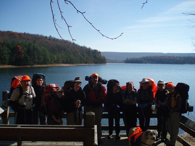
Description: This is a pretty moderate 14.7 mile overnight backpacking trip in the Michaux State Forest. In fact, if you remove the 1.3 mile out and back(one way) to the campsite and start it early enough this could be a good 12 mile day hike. The tread is a pleasant mix of old woods roads and footpaths. There is one short, steep climb on the first day and a more prolonged climb followed by a short climb on the second day. There are only 2 short rocky sections to traverse. The campsite is at a recently built shelter on Birch Run. It is a very popular site but there are numerous camping areas around it. Note: If doing this as an over-nighter contact the Michaux State Forest at 717-352-2211 and give them a description of your vehicle and license plate number. Tell them you will be parked at the end of Quarry Gap Road Road. |
|
________________________________________ |
|
Zipped National Geographic. TOPO! GPS and Universal GPX Files |
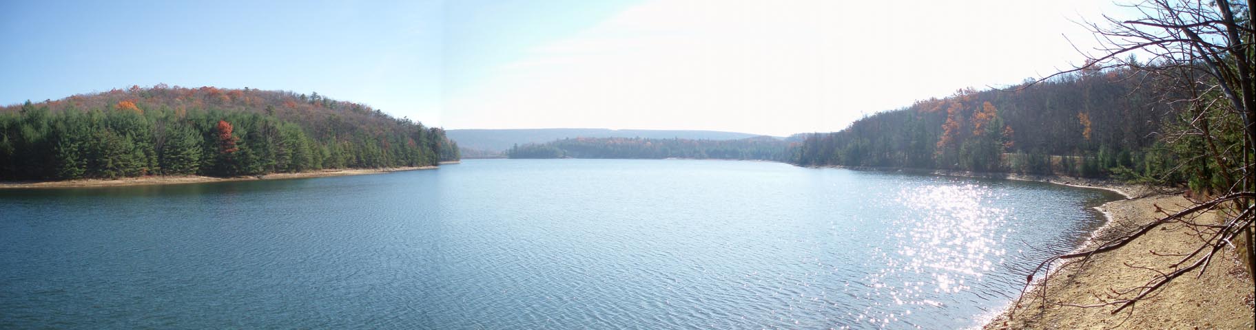
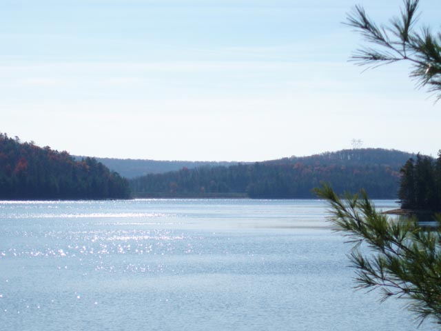
Trail Notes: All trails are blazed as shown on the map. Some but not all trail junctions are signed. Some trails used on this trek are also part of the Caledonia State Park - Quarry Gap Circuit described elsewhere on this site. Walk around the yellow forest gate and proceed along the Locust Gap Tr (No sign). This is an old woods road. You�ll pass some deer �exclosures� along the way. These fences are built to keep deer out of an area recovering from logging so that it may be studied to see how recovery differs in the absence of grazing deer. At 0.76 miles the trail splits. There is a post at the fork but the sign has been missing for several years. The left fork goes up into Hosack Run and eventually joins the AT. Stay straight or to the right of the fork and cross shallow Hosack Run as it flows over the road. Shortly after this the road forks again. The grassier wide road bears left. You want to go right onto a narrower road that goes into the woods. At 0.59 miles another road comes in from the right. Continue straight, following the blue blazes. In another 0.23 miles pass through a power line swath. From there it�s another 0.17 miles to gravel Milesburg Rd. Cross Milesburg Rd to a viewing deck that provides a nice view of Long Pine Run Reservoir. The orange blazed, unsigned Beaver Tr is to the left of the viewing deck as you stand in the parking area facing the lake. Follow it for about 0.17 miles until you come out onto gravel Birch Run Rd. Turn right and cross a stream on a bridge/culvert and turn right into the woods to pick up the continuation of the Beaver Tr. For the next 1.3 miles you�ll follow the shoreline and walk through pine plantations. As you come around the point you�ll get nice views of Rocky Knob to the north. As you reach Birch Run Rd for the second time, climb a set of old concrete steps to the road. Cross the road and join orange blazed Rocky Knob Tr. There is a sign but it is several yards back in the woods. You�ll pass a nice campsite on the left and then traverse a short rock field before veering left and climbing steeply up to a fork in the trail (0.57 miles from Birch Run Rd). Either direction will get you to where you are going but turn left for the shorter route. In another 1.37 miles arrive at another fork in the Rocky Knob Tr. |
|
Bear left here and in 0.25 miles reach the junction with the
white blazed Appalachian Tr. Turn right and in 0.61 miles cross
a dirt woods road. In another 0.69 miles arrive at the Birch Run
Shelter and camp for the night. The next day, retrace your steps back to the junction with the orange blazed Rocky Knob Tr but continue straight through the intersection remaining on the AT. In another 0.23 miles an old road will come in from the right. Stay straight on the AT. In another 0.53 miles cross gravel Ridge Rd and begin a steep descent. Watch it here! This is about the only place where you might get lost if you don�t pay attention. You�ll soon find yourself on an old woods road. The road will bear to the left. You want to leave it here and continue straight on a footpath. The white blazes follow it but it�s easy to walk by. Descend into a hollow and cross a dirt/gravel forest road and then a small stream (0.18 miles from leaving the old woods road). There is a PATC cabin to the right. Here is the steepest climb of the trip. In 0.36 miles from the cabin, come to a strange looking 4X intersection of forest roads. Walk straight through the intersection, using none of the roads, and pick up the AT on the other side. In 0.44 miles cross another old woods road and in another 0.32 miles cross another gravel/dirt forest road. Travel 1.09 miles and cross another old woods road at Methodist Hill where you will descend for 0.37 miles and cross a power line swath. Climb up the other side of the swath to regain the ridge. In 0.79 miles arrive at another strange 4X intersection of dirt/gravel forest roads. Turn slight left and follow the southbound road (Ridge Rd but it might not be signed) for less than 100 yards before reentering the woods to the left. In 0.64 miles pass the northern terminus of the Hosack Run tr on the left and begin a rapid descent to the Quarry gap Shelter and spring (0.62 miles from the last trail junction). Continue the severe drop in elevation for anther 0.63 miles until you reach an old woods road (blue blazes to the left). This is Locust Gap Tr. Turn left here and follow it back to your car(s). Printable/Downloadable Directions and Trail Notes _____________________________________
_____________________________________
Name: Jackie M. Hike: Rocky Knob-Quarry Gap Backpack Date(s): 04/13-14/14 Rating: 4
Critique: We did this outing as our first ever backpack. We then repeated it two weeks later. Great beginner 1-night backpack. The directions are impeccable and very helpful for beginners, we did not get turned around once. There is a mild ascent up Locust Gap trail and then you round the lake. Fill up at the stream after you cross Birch Run Road. If you choose to go right at the Rocky Knob split you will be greeted with a pretty steep, rocky ascent, but you're rewarded with a very nice and secluded campsite on the left side of the trail once you reach the top. We chose this route on our first trip. On our second trip we went left, the ascent is more gradual on this side up to the AT. There's a good sized campsite about .5 miles down the AT to the right. Then in the morning you back track. Be sure to fill up at the stream at the PATC cabin, there will be no water until you're near the Quarry Gap shelter. The views and terrain are varied and interesting. There are a few easy water crossings. We had a great time.
_____________________________________
Name: Peter Hike: Rocky Knob-Quarry Gap Backpack Date(s): 10/05-06/13 Rating: 3.5
Critique: As others have mentioned, this is a very well maintained area, which is nice. The weather was superb this past weekend (autumn color were showing, and it was beautiful, albeit a bit hot for the season). The hike was quite easy, but that allowed for us to enjoy the forest hiking more. The reservoir was a great perk on this hike and made up for the lack of views elsewhere. There seemed to be tons of blueberry bushes, as others have mentioned, but, unfortunately, it wasn't their season. Also, like other's said, the Quarry Gap shelter is probably the best I've ever seen. Lots of other nice campsites at many points along the trail. We didn't see many other people, nor did we see much wildlife. _____________________________________
Name: Eric Hike: Rocky Knob-Quarry Gap Date: 07/05-06/13 Rating: 4.5
Critique: Great beginner hike. Took my wife on her first time backpacking. We did this loop backward from the description. TONS of campsites along the way so you can tailor your trip to suit your needs. We ended up going all the way to the shelter, but wanting to cut down on the second day we pressed on. Just FYI the short side of Rocky Knob trail has almost NO good places to camp - it is very steep on both sides. There are campsites about .1 miles into the trail at both ends, but not on the trail so do not expect to camp there. We had hoped to and ended up pushing ourselves just a little too far to get to the good campsite just North of the reservoir. But pretty much everywhere else it seems like there are campsites every .25 miles. Definitely recommend this as a beginner hike for anyone you're trying to introduce to backpacking, and it can be done effectively either way (we would have camped on the north side of Rocky Knob trail if we had to do it again). Fantastic hike, thanks for the write up! PS. There's a fun little geocache just north of the reservoir right on this hike! I think there's another one on the AT too but we passed it...whoops!
_____________________________________
Name: ryan
booton
Hike: Rocky Knob-Quarry Gap Backpack _____________________________________
Name: Boone
Hike: Rocky Knob Quarry gap _____________________________________
Name: Tyler S.
Hike: Rocky Knob-Quarry Gap Backpack _____________________________________
Name: Moonshine
Hike: Rocky Knob-Quarry Gap Loop ______________________________________
Name: Dan D.
Hike: Rocky Knob-Quarry Gap Loop _____________________________________
Name: Moonshine
Hike: Rocky Knob - Quarry Gap Loop _____________________________________
Name: Cham
Green
Hike: Rocky Knob Quarry Gap _____________________________________ |
|
|