Rocky Mount

Description: 
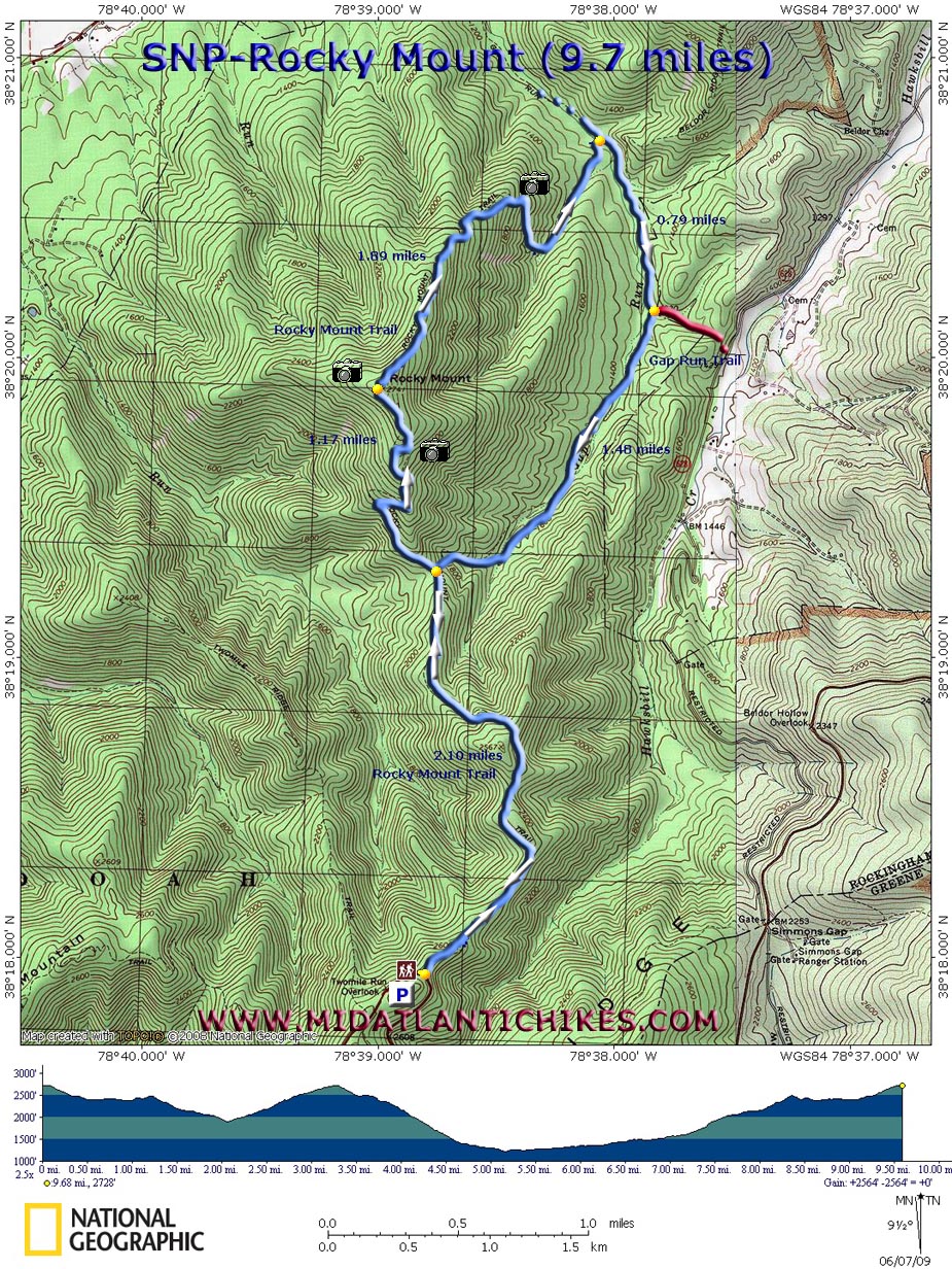
This is a strenuous 9.7 mile circuit with fantastic views. If hiked in late May or Early June you'll enjoy a pleasant hike through tunnels of Mountain Laurel. The hike along Gap Run is equally rewarding. Note that some of the 
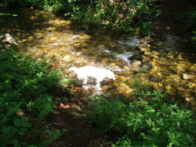
stream crossings can be challenging during periods of high water. In a couple of places the trail tends to flood rather easily. Overall there is approximately 2600 feet of elevation gain from start to finish but all but one section of climbing (the part coming out of the Gap Run drainage) is either gradual and/or via switchbacks.

Google Custom Driving Directions

The hike starts at the Two Mile Run Overlook just south of Mile Post 76 on Skyline Drive.

________________________________________


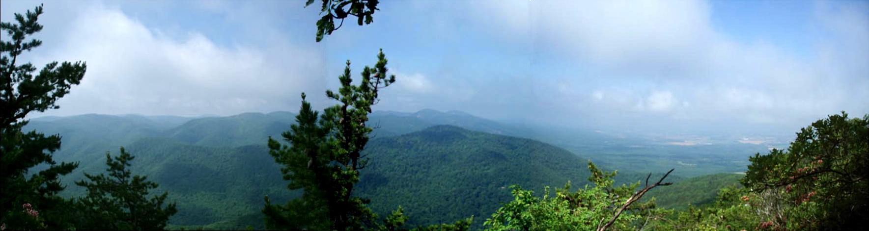
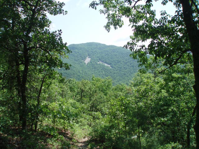
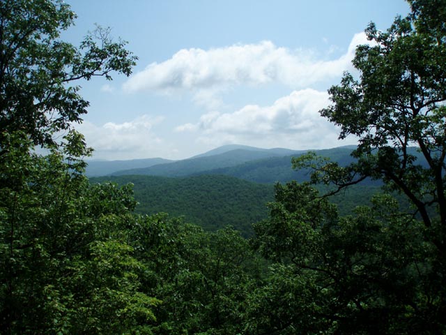
Trail Notes: From the Two Mile Run Overlook (You can see Rocky Mount to the far left in the photo.) walk North on Skyline Drive. As you pass the end of the stone retaining wall turn left onto the blue blazed Rocky Mount Trail. Over the next 2.1 miles descend into a saddle of the ridge. During this portion is where the Mountain Laurel is the most intense. Bear left at the junction of the Gap Run Trail, staying on the Rocky Mount Trail. Overall the climb is gradual with several switchbacks. You'll climb over a couple of rocky false summits that you "think" might be Rocky Mount. Continue on and in 1.17 miles from the last trail junction reach the true summit. There is no marker but the top will be obvious. Even better views can be had from nearby cliffs. Descend along the back of huge, smooth rocks and then switchback down to a tributary of Gap Run. You'll cross it twice before crossing Gap Run for the first time in 1.89 miles from the summit. Almost immediately turn right onto the Gap Run Trail at the sign post. I lost count of the total number of crossings but it is somewhere in the neighborhood of five that might cause issues. In 0.79 miles from the first Gap Run ford bear right at a sign post. (Going left leads to private property.) In another 1.46 miles climb steeply out of the drainage to find yourself back at the junction with the Rocky Mount Trail. Turn left and retrace your initial steps back to your vehicle.


Critique This Outing


________________________________________

_______________________________________

Outing Critiques

Name: Matthew Culbertson                                                                                     Hike: Rocky Mount
Date: 06/11/2010                                                                                                     Rating: 3

Critique: This trail often goes through very high grass, at least in mid June. It should also be noted that virtually all of the blooming mountain laurel is gone by this time. There are, of course, some other interesting wildflowers to be seen. I think I saw some very new Indian pipe stems rising up, though I can't be completely sure.

The trail was nicely plotted on a ridge seemingly at right angles to the main line of the Blue Ridge. Though steep, this passed along a fine route that often passed through ferns. Once we reached the junction with the Gap Run Trail, we started to climb steeply, having taken the left branch. Despite having read the trail notes, we were still tricked by the false summits. We didn't find the true summit to be obvious, though we did suspect it. We scouted along for a few more bends of the trail, but it started to fall steeply again in deeper woods, so we figured we were at the top. It appeared that after the true summit, the trail was much less used and consequently more overgrown.

The exposed cliffs at the top, just below the trail, were truly a splendid place to rest and take in the view. They offered a great vista of the lesser ridges and the main line of mountains, and narrow views of the Shenandoah Valley. The cliffs were many broken, protruding piers of rock, rather than a continuous wall.

We were here for only a few minutes before strong winds began to blow out of the valley. Soon we saw lightning in the distance, so we packed up quickly and departed, heading back the way we came rather than through the longer Gap Run portion of the hike. Fearing a downpour that never materialized fully, it took us about two hours to get back to our car at Two Mile Run Overlook.

I believe we encountered eight other hikers on this particular trip.

Rated a three, since the trail is quite overgrown (though definitely passable), and the only real views come once you get to Rocky Mount's top. They are great views, but you have to work very hard for them!

_______________________________________

Name: Jason                                                                                                               Hike: Rocky Mount
Date: 6/17/09                                                                                                            Rating: 4

Critique: Definitely a strenuous day hike but the two major climbs are spaced out nicely, so you don't get too worn down. Hike to the peak on Rocky Mount is the most strenuous section, but views from the cliffs at the top are great. If you parked at Two Mile Overlook you can even see your car from one of the cliffs.

Hike down Rocky Mount into Gap Run is very non descript but the Gap Run tributary is a nice reward. The tributary is an idyllic oasis after coming down the rocky slopes of Rocky Mount. Trail was muddy at times in the Gap Run area and while initial crossing of Gap Run could result in some wet feet if the water is high, other crossings you can almost jump over.

Stopped for lunch near Gap Run and had a black bear come up within 25 feet of us. I'm not sure if it noticed us, if it did it cleary was not interested.

Hiked this on a beautiful Friday and saw one other hiker the whole day, so expect isolation, as this hike is only for those looking for a hardy day hike. There are a couple nice camping spots in the Gap Run area so this would make a nice short backpack as well. One other thing, hike this is the direction stated on the website. The hike up Rocky Mount the other way seems brutally steep.

_______________________________________

VA Hikes MD Hikes WV Hikes PA Hikes Contact Us Home