
|
Rowlands Creek Falls Loop |
|
|
Description: When hikers think of Mount Rogers N.R.A. images of vast balds with sweeping views, rocky Wilburn Ridge, Grayson Highlands, fields and tunnels of blooming Catawba Rhododendron, wild ponies and pretty streams like Wilson Creek fill there heads. And so it should be. It is considered by many Mid-Atlantic hikers to be a lifetime goal. I know it was for me.
But there is so much more to be enjoyed after exploring this relatively small parcel of the N.R.A. After trekking through what has often become a �Hiker�s Highway� consider exploring the areas directly to the north and west, places with names like Iron, Straight and Hurricane Mountain, Comers Creek with its waterfalls and cascades, Chestnut Flats and Beartree Gap.
Described here is a moderate 12.5 mile loop with about 2200 feet of elevation gain. The steepest part is over the first 2.5 miles but the going will be slow as you stop to take in the views of the many waterfalls, cascades and slides along the way. |
|
The next 5.0 miles is along a wide, smooth retired forest road. This is followed by a descent through luscious Rhodo tunnels as you listen to the sounds of a stream playing hide and seek with you. You�ll eventually cross the stream to follow another retired forest road back to your vehicle.
The trailhead is at the first pull-off on the right after Rt 643 becomes a single lane gravel road. Google Maps Custom Driving Directions ________________________________________ |
|
Zipped National Geographic. TOPO! GPS and Universal GPX Files GPS Text File for Non-TOPO! Users
|
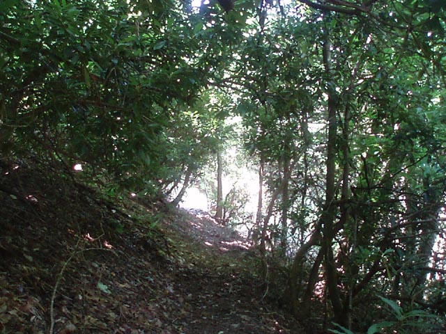
Trail Notes: All trails are blazed with orange paint. All trail junctions save one are signed. Join the Rowlands Creek Trail at Rt 643. Cross the creek and begin a long gradual climb. Most of the time you will be above the creek, looking down upon it. Watch for the many chutes, cascades and falls, some as high as 100 feet. You�ll cross the creek about 5 more times before leaving the drainage. At 1.05 miles the trail crosses a small stream. As of this posting the way is blocked by a large blowdown. It seems to be of recent vintage so it might be removed by the time you get there. (Please let us know when that happens.) For now you have to walk a few feet down this stream and scramble up the opposite bank to regain the trail. Above this is another set of falls.
In another 0.95 miles the trail turns left and crosses the creek for the final time. Here it joins an old woods road and switchbacks for 0.86 miles up to an open area called Hurricane Gap. Pass the gate and turn hard right onto another woods road. In a few feet past a faded orange blaze on the right make another right turn. At first this appears to be a narrow foot path but soon opens up to become Old FR84. (We saw a 250 pound black bear here.) This old road climbs ever so slightly before beginning a gradual descent to Jerrys Run Trail (4.94 miles from the last trail junction). Turn right onto it and descend, rapidly at first, to a crossing of the stream at 1.45 miles from the previous trail junction. Do not turn left to follow the stream after the crossing. That trail leads to private property. Instead continue straight. The trail will become old forest road 845. It will climb a bit before beginning a gradual descent through a once magnificent Hemlock forest. Many of the giants are now just grey skeletons due to the Wooly Adelgid infestation that is plaguing VA.
In 3.13 miles from joining the forest road pass through a gate and arrive back at Rt 643. Turn right and walk the road back to your vehicle.
|
|
________________________________________
________________________________________ |
|
|


