|
Roaring Plains Base Camp and Day Hike |
|
|
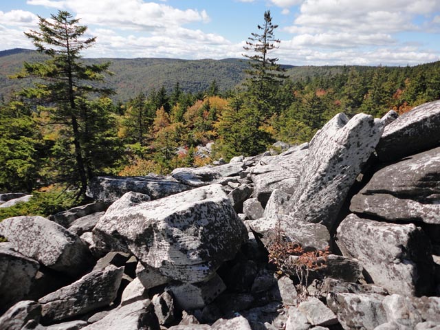
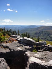
Description: This trek is similar to Roaring Plains Circuit described elsewhere on this site in that the Canyon Rim remains the focal point. It differs, however, in several ways. It allows for easier yet more scenic (Three more vistas! and interesting rock formations) access and regress to the campsite at the beginning of "The Hidden Passage". This will let you set up a base camp so you can enjoy the wonderful views and rugged terrain along the Canyon Rim without the encumbrance of a heavy pack. It also adds another 1.4 miles of exploration of the Rim with at least 2 more vistas and an additional 1.33 miles of the Roaring Plains Trail while eliminating the use of the Tee-Pee Trail. If time allows it also opens up the opportunity to make forays toward Flat Rock Plains, Mount Porte Crayon and Haystack Knob.
Caution
1: This
circuit is for experienced hikers only. Knowledge and use of a topo
map, compass and/or |
|
Caution 2: The weather on the Roaring Plains can change in the wink of an eye, even in the summer months. Be prepared for temperature extremes. During parts of this outing you will be totally exposed to the elements. High winds can be a dangerous issue at times. Google Custom Driving Directions The start/end point is the eastern trailhead of the South Prong Tr on FR 19. ________________________________________ |
|
Zipped National Geographic. TOPO! GPS and Universal GPX Files |
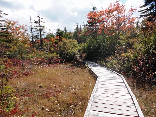
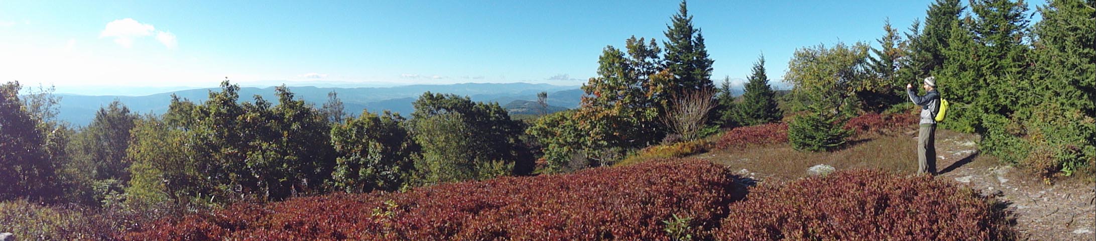
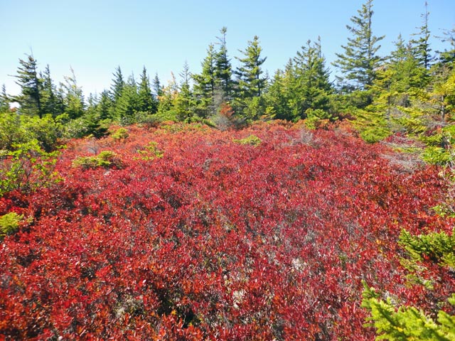
Trail Notes: From the kiosk walk south on the South Prong Trail. Sections of the trail are on boardwalks constructed to protect delicate bogs. You will pass through thick Red Spruce forests and interesting rock formations. At 1.65 miles into the hike visit a nice vista that looks across the southern ridge of Dolly Sods. Shortly after that there will be a small campsite on the right with a view of North Fork Mountain and Chimney Rocks behind it. Right after that is a footpath on the left marked by a cairn. It seems to dead end at a rock field but some scrambling w/o packs will lead to yet another good view of North Fork Mountain. In 0.47 miles after the last vista pass an obvious footpath on the left. This is the actual beginning of the Hidden Passage. Don't turn hear. In a few yards come to another trail on the left marked with a cairn. Turn here and cross a stream to arrive at your base camp. From camp follow the trail upstream and re-cross the stream at a pretty obvious point. Turn right onto the Hidden Passage. This is an unofficial trail but the tread has become more obvious with more frequent use.
Continue
in a southerly direction toward a Rhododendron thicket on the other
side of the meadow. There you will find an obvious path through the
thicket, crossing a small stream as you go. On the other side of the
thicket you will find yet another meadow. Look for the faint trail
and Beyond this campsite is an obvious grassy jeep road. Follow this to the intersection with the Pipeline Swath. This is about 0.7 miles from where the �Hidden Passage� ended at the base of the �Meadow� or 1.74 miles from your base camp. |
|
Turn left onto the Pipeline Swath and descend about 0.34 miles, cross a small stream and arrive at the remains of an old road that intersects the Pipeline. This is the beginning of Jonathan�s Canyon Rim Trail. If you feel up to a side trip stash your packs here and proceed down the Pipeline for another 0.24 miles or so until you see a cairn on the right directly across from a Forest boundary sign on the opposite side of the swath. This marks a trail out to a pretty nice overlook.
Return to the intersection of the old road. And turn left (if going up the swath) onto the old road. There is a dead tree with a blank sign mounted high on the trunk. This is the �iffiest� part of the hike.
Proceed down the road a short distance than turn right and cross a small stream. Skirt the edge of a small bog to your right. From here to the next overlook it is mostly an open woods bushwhack. Keep the rim or edge of the hill in sight and to your left and avoid any thickets to your right.
You will
eventually arrive at a very large oak tree with multiple trunks near
the beginning of another meadow/bog. Turn left here and head towards
the rim. You will find a footpath that leads out to the canyon and
another fantastic view. You�ll pass another multi-trunked tree on
your right. From here to the talus rock slope beyond the Tee Pee Trail the path
will be more obvious with
At about 0.6
miles from leaving the Pipeline you will cross Roaring Creek (last
firm chance for water for a while) and
pass red forest boundary blazes and a survey marker. Continue
following the rim. Almost any side trail to the left is apt to lead
you to a view of the surrounding area. At 0.6 miles from the creek
crossing arrive at �The Point�, the intersection of Roaring Creek
and
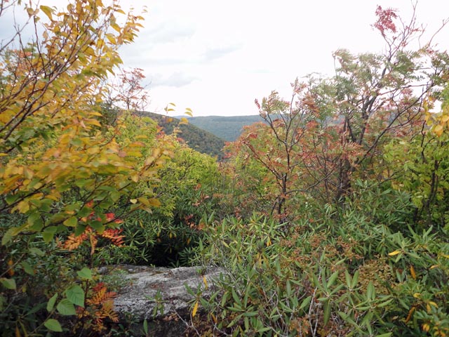
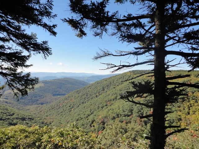
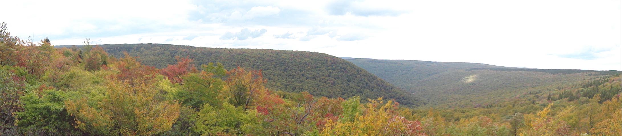
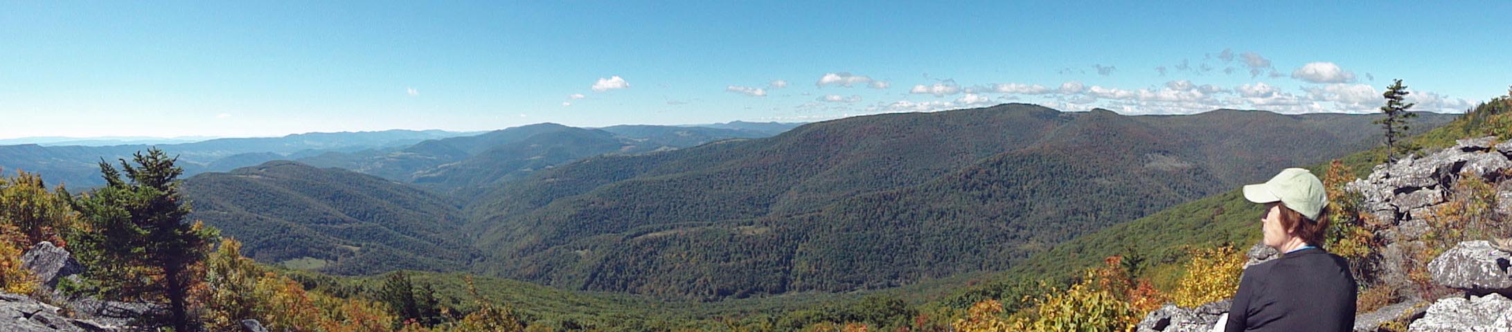
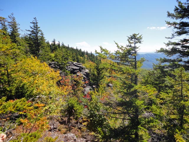
From �The Point� travel north-west along the rim, crossing more boulder fields and passing through alternating Rhododendron and heath thickets and stands of Red Spruce stopping for the views along the way. If you�re backpacking, there�s a nice established campsite with a fire ring sheltered by Red Spruce about 0.24 miles from �The Point� but it is dry. There is one or two sites suitable for a tent or two as well as another incredible view just before this without fire rings. (It was at this vista that Gadget Girl shot the Golden Sunset seen as the banner for all of the WV hike links on this site.) In another 1.15 miles, passing yet another vista or two along the way, arrive at the junction with the Tee Pee Trail at another established dry campsite with a fire ring. In another 0.32 miles arrive at another fine vista and the Mother of all talus slopes! Follow the cairns for about 0.2 miles. They will then seem to stop. Look downhill for more cairns. At the bottom will be a large flat rock. Head for that point the best you can. Don't be afraid to use your butt. That's why you have one! Once off of the talus slopes cairns will direct you to turn left. At first the trail is rocky but you will soon find yourself walking on a grassy jeep road that goes in and out of meadows and young woods. Near the end the trail might seem to fade away. Look for a long fern meadow open to the sun. The trail runs straight through it and connects directly to a well worn footpath that leads to a gigantic campsite and the junction with the blue blazed Roaring Plains Trail. On the way up you might cross a small seasonal stream. Look for a cliff behind a fire ring that offers a good view down the Long Run drainage.
To complete this circuit turn right onto the Roaring Plains Trail. In 1.33 miles you'll pass the junction with the Tee-Pee Trail on the right. It is hard to spot but is marked by an old, rotted erosion dam/log. In another 0.98 miles reach the Pipeline Swath. Jor right for a handful of steps and then left onto FR 70. In about 0.34 miles pass the Boars Nest Trail terminus on the left. In another 1.43 miles turn right onto the South Prong Trail. Climb steeply for about 0.16 miles. Need one more vista to top off the day? Turn right into a nice campsite. Bushwhack through the woods as if you were paralleling the trail you were just on but in the opposite direction and diverging away from it just a tad. Keep your eye out for a huge, multi-branched maple tree in a Rhododendron thicket. Just behind it is a sandstone rock outcrop. A scramble to the top of it will reward you with a fine view of the South Prong Drainage and the southern edge of Dolly Sods.
Return to the campsite and turn right up the South Prong trail, soon crossing a small stream (the stream you camped by) and climb a few steps to the plateau. From there it is an easy 0.28 mile back to the trail on the right that leads to your campsite.
The next day backpack out on the South Prong Trail the same way you came in.
Printable/Downloadable Trail Notes ________________________________________
________________________________________
Name: Jason Dashbach Hike: Roaring Plains Base Camp and Day Hike Date(s): 10/4-5/14 Rating: 5
Critique: Four of
us did this hike the first weekend of October 2014. It is a really
wonderful walk with amazing views at many points along the canyon
rim. We found ourselves staring the hike with snow flurries at the
trail head but no real snow ever came. The temps stayed seasonably
low both days but we didn�t see much precipitation after that. ________________________________________ Name: Mntjohn Hike: Roaring Plains Base Camp and Day Hike Date: 9/14/13 Rating: 5
Critique: my GF and i drove up FR70 to the pipeline and did a modified version of this hike. pipeline to canyon rim trail to teepee trail and back to the pipeline via the roaring plains trail. the descriptions given here are excellent, we did this with no map, compass or gps(although i did have the description and map and a compass i never had to use them.) the route was pretty obvious to me and although we did get misdirected a couple of times it never took more than a minute or two to get back on track -even on the teepee trail. the week before this we hiked the south prong from fr19 to fr70, fr70 to the pipeline and hidden passage back to the south prong and out ...again doing this without the use of map, compass or gps. had a little problem after the meadows where the hidden passage veers right, took us about 5 minutes to re-find the trail, otherwise was smooth sailing the scenery and views are second to none and we had a great time on both hikes. i highly recommend doing these hikes in segments as to allow more time for exploring and soaking up all the great views and scenery my advice to anyone wishing to hike the canyon rim and hidden passage is to study this page and the corresponding topo as much as you possibly can -get it into your bloodstrem so to speak. then i believe if you have good backcountry intuition and a good sense of direction that you will have no problems ...as always take your time and know the terrain ..print this page and the maps and you will be fine this area is fast becoming my favorite, thanks for the grat maps and trail descriptions
________________________________________
Name: JNK556 Hike: Roaring Plains Base Camp and Day Hike Date: 06/15/13 Rating: 4
Critique: Did this hike with ArfcomHkr, weather was nice, all be it still a lot of mud with all the rain we have had. South prong trail is nice, but rocky, good views off trail in the boulders. Hidden Passage is really nice, trail is pretty easy to follow, but could be confusing in some spots. Canyon rim trail is very rough, and in many places over grown, but still pretty easy to follow. We lost the trail near where you cross Roaring Creek, but picked it back up with a little searching and our GPS's. ArfcomHkr took a fall after "The Point" on some rocks, so we decided to cut the loop short and go through the TeePee trail. I wish we wouldn't have. TeePee trail is overgrown, hard to follow in alot of spots, we actually had to bushwack though a thicket to find the trail, and we ended up lost for 30min at the very end of TeePee about 25yds from the Roaring Plains intersection, as you have to pretty much fight your way though a thicket and a small seep to get out on to Roaring plains. All in all though it was a fun hike, and the views are great along the whole way, just don't try it unless you are very skilled with a GPS, compass map, and have a good sense of direction.
________________________________________
Name: Jonnie
Hike: Roaring Plains Base camp and day hike ________________________________________
Name: Matt
Hike: Roaring Plains Base Camp and Day Hike ________________________________________
Name: Jeff
Hike: Roaring Plains ________________________________________
Name: Laura M.
Hike: Roaring Plains Base Camp and Day Hike ________________________________________
Name: Donna Miller
Hike: Roaring Plains Base Camp and Day Hike ________________________________________
Name: Tim
Hike: Roaring Plains Base Camp and Day Hike ________________________________________
Name: Mark
Hike: Roaring Plains Base Camp and Day Hike ________________________________________
Name: Mike Hamilton
Hike: Roaring Plains Base Camp/Day Hike ________________________________________ |
|
|