|
Slaughter Fire Tr/Pocosin Hollow Loop |
|
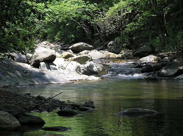
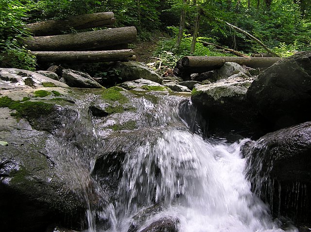
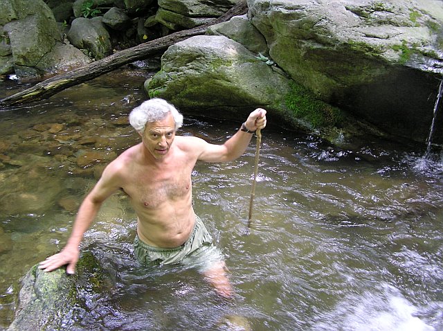
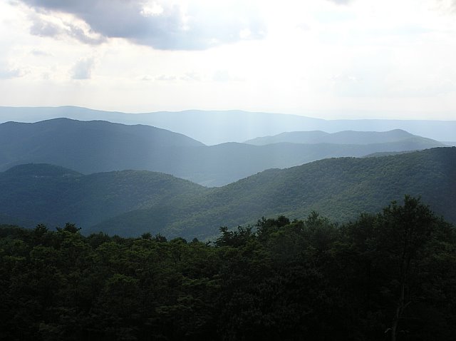
Description: This is a 12.3 mile strenuous loop in Shenandoah National Park. Probably the biggest complaints I�ve heard about hiking in this venue in season is the vast hordes of people. Solitude is at a premium. I wanted to find a hike that gets away from the crowds, was challenging and at the same time not lacking in the beauty that can be found in the Blue Ridge mountains. I think this is it. The hike starts at the Lewis Mountain Picnic Area but then descends to the eastern boundary of the park via the Slaughter Fire Road. At the bottom it parallels beautiful Conway River for a while. A wide and tricky ford of the river is followed by a scenic road walk for about 1 mile before turning back uphill along the even more scenic Pocosin Run. You�ll cross the stream about 4 times and climb about 2400 feet between here and the end of the hike. Portions of the climb are steep but other parts are spread out along nearly flat woods roads. If time allows visit the ruins and graveyard of the Upper Pocosin Mission and then the PATC Pocosin Cabin if it�s not occupied. From there you can get a nice view of some on the eastern facing mountains. |
|
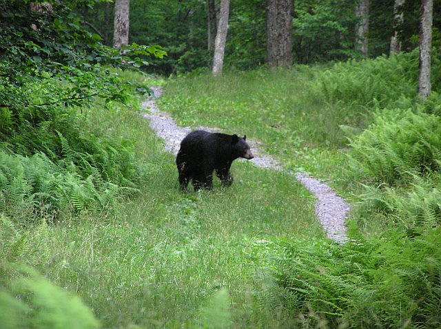
As you approach the Lewis Mountain Campground on the final leg of your trip be quite. Bears apparently like to hang around these �man-made feeding stations� and this is probably your best shot of seeing one of these bruins! Turn into the Lewis Mountain Picnic area/Campground. Immediately turn left into the Picnic Area. Follow the road around to the north-east corner. There will be a brown post on the right marking the AT spur trail. This is the beginning of the hike. ________________________________________ |
|
Zipped National Geographic. TOPO! GPS and Universal GPX Files |
Trail Notes: All trails are blaze with either white (AT), Yellow Fire Roads) or Blue (Pocosin Hollow Tr). From the picnic area follow the spur trail to the AT. Remember this junction since there is no sign. Turn left onto the AT. In 0.5 mile pass a spur trail to the Bearfence Mt shelter on the right and in another 0.19 miles arrive at the junction of Slaughter Fire road. Turn right onto the fire road and pass through the forest gate. In another 0.11 mile pass the service road to the PATC shelter on the right and continue down hill. There will be a couple of slight climbs but the tread is generally downhill. In another 1.67 miles take care as the road forks. The right fork soon degrades and becomes pretty weedy. You want to bear left and continue to follow the blazes as you follow the park boundary for a while. In about 2.2 miles from the trail split arrive at a concrete post (0.31 miles to RT667) and the Conway River. Continue to follow the old dirt road along the river until it ends at the river�s bank. Ford the river (It may be deep at times.) and follow gravel RT667 for approximately 0.94 miles. Immediately after crossing a side stream on a bridge (Pocosin Run) turn right onto a gravel road. Follow the brown park signs directing you toward the Pocosin Hollow trailhead for 0.66 miles until you re-enter the park. There will be a green arrow and a blue blaze on a tree as the trail leaves a gravel road. Shortly after that you�ll come to a brown warning sign speaking of severe trail damage as a result of a storm. This refers to the lower portion which has been repaired. Follow Pocosin Hollow Tr for 2.58 miles. The tread will alternate between steep climbs on footpaths and flat or gradually ascending woods roads. You�ll ford or rock hop the run four times before climbing steeply to The Pocosin Fire Road. |
|
Turn right onto the Pocosin Fire Road. From here most of the remaining elevation gain is relatively gradual. In 0.25 miles arrive at the junction of the Pocosin Tr/South River Tr on the right. The ruins and graveyard of the Upper Pocosin Mission is just a few steps down the trail. Continue up the Pocosin Fire Road. Pass a PATC cabin on the left. From that slight rise you can get a nice view of the east facing mountains. In 0.85 miles from the last trail junction reach the AT and the last leg of the trip. Turn right here. If it wasn�t for the fact that this stretch closely follows Skyline Drive it would be a very pleasant walk. In places you can not only hear the cars, you can see them. In 1.75 miles cross an un-signed trail junction. To the left is Lewis Mountain campground and to the right is Lewis Mountain Tr. Shortly after that pass yet another spur on the left that leads to the campground. In 0.3 more miles turn left onto the spur trail that takes you back to your starting point.
Printable/Downloadable Directions and Trail Notes ________________________________________
________________________________________ |
|
|