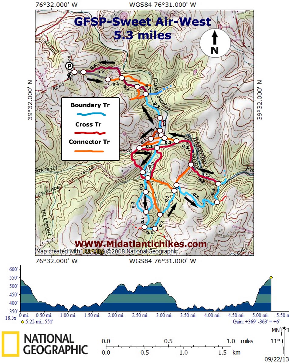
| GFSP-Sweet Air-West |
|
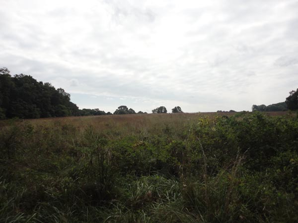
Description: This hike is the sister hike to the Sweet Air-East hike. The Little Gunpowder River splits the park into unequal halves. There are trails on both sides of the river but many hikers are reluctant to make the often knee (and sometimes thigh) deep crossings, especially in winter. Realizing this I searched for a �back door� to the park and found one at the intersection of Allison and Stansbury Roads off of Jarretsville Pike. This modified lollipop hike (There is a small loop at the end.) features rolling terrain, lush forest, open fields and meadows, a hidden pond and pleasant views of the river.
Note: The lower trails can become very muddy after prolonged wet spells and frequent equestrian travel adds to the muck.
Google Maps Custom Driving Directions
There is room on a wide gravel area for two or three cars. |
|
________________________________________ |
|
Zipped National Geographic. TOPO! GPS and Universal GPX Files |
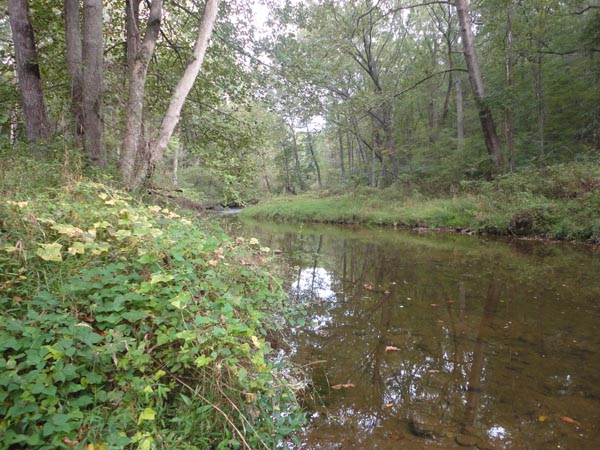
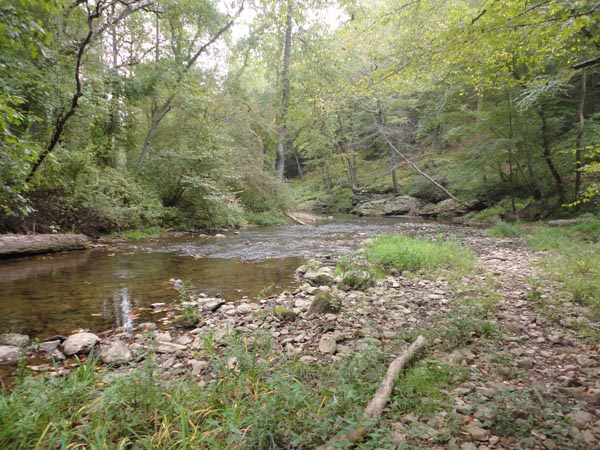
Trail Notes: Walk down the unmaintained road/driveway, passing a kiosk and trailhead on the left. You will return this way. In 0.2 miles join an orange blazed trail behind a steel gate. Turn right onto the blue blazed Boundary Trail in another 0.1 miles. Cross a feeder stream. Note the old bridge abutments to your right. The trail passes the Tranquility Farm Trail also on the right before crossing a gas pipeline right of way. This provides a fording point and view of the river. Continue on the Boundary Trail. In 0.3 miles the trail veers to the right at a sign post. In another 0.1 miles turn right onto the red Cross Trail. It climbs a short distance and then turns left as it follows a fence line for a short distance before reentering the woods. You might be confused here as a mower has created several wide swaths. They all come together eventually. You�ll pass an orange connector trail on the left. Continue straight, cross Saw Mill Branch and turn left.
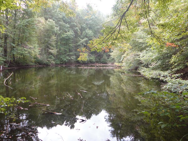
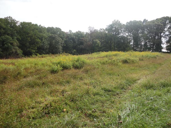
Turn right, rejoining the blue Boundary Trail. The climb is gradual. In 0.2 miles pass Green Glade Pond on the left. It is best viewed from the earthen dam. Continue on the Boundary Trail. The red Cross Trail will intersect it twice from the right and you�ll pass two orange connector trails on the left. One goes to Big Rock. The boundary trail splits. It doesn�t matter which way you go as both segments soon rejoin. In 0.1 miles after the split turn left to stay on the Boundary Trail and the left again in another 0.1 miles. Pass the opposite ends of the previously mentioned orange trails and arrive at an open meadow with a bench. Turn right here. (Going straight will shorten the hike by about 0.7 miles.) Over the next 0.5 miles the trail follows the edge of the meadow, wraps around a large field and reenters the woods. Bear left at the next trail junction to arrive at the river and a nice break spot. |
|
To continue turn left onto the red Cross trail. In 0.3 miles pass the opposite end of the orange shortcut on the left. In 0.3 miles cross Saw Mill Branch and follow an orange connector trail to reconnect with the blue Boundary Trail. Don�t worry if you miss this turn as you will soon hit the Boundary Trail and another chance to ford. Once back on the Boundary Trail retrace your original steps to the first 4X intersection you encountered on the hike. To eliminate most of the initial road walk cross the intersection and join another red blazed trail. It follows the edge of a fallow field before climbing gradually through mature forest before ending at the kiosk on the road. Turn right and return to your car.
________________________________________
________________________________________ |
|
|