.
|
|
Last Updated: 10/31/11
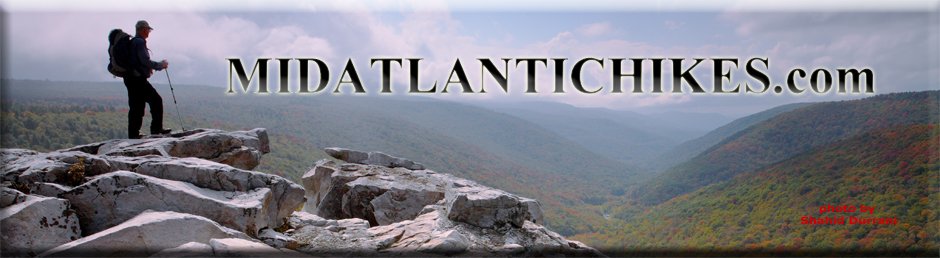
Welcome to a web site full of information on hiking in the Mid-Atlantic Region (PA, MD, VA and WV) ... topo maps, 3-D maps, elevation profiles, GPS data, directions, trail notes, photos.... everything you need to prepare for an excursion into the wilderness. Information for 279 hikes and over 3,364 trail miles are now available. Venues such as, but not limited to, Shenandoah National Park/VA, George Washington and Jefferson National Forests, VA and WV, the Monongahela National Forest in WV, state forests throughout PA, Green Ridge State Forest in MD and regional, state, county and federal parks throughout the Mid-Atlantic region are represented.
Please read the Terms of Use before using this website then click on the desired state on the map to the left to continue.
"Yet in the walks I take through nature in quest of truth and demonstration, I recognize a poetry in earth and sea and sky, ruled in their cycles of harmonious actions, deeper and more sublime than ever muse un- taught in science could inspire." William B. Rogers: First State Geologist of VA, First president of M.I.T. and namesake of Mt. Rogers, Va. |
|
___________________________________________________
Latest Published Hikes
Watoga State Park Wilderness Adventure, WV Reddish Knob Summit Backpack, VA
___________________________________________________
Bulletin Board
M.R.Hyker's 2011 Year in Review
Our Fall/Winter Day Hike Schedule is now posted. ___________________________________________________ M. R. Hyker's Latest Adventure(s) 10/15 to 17/11, Quehanna Trail-West Backpack, PA: I’m a bit late posting this but two days after the hike I had hand surgery. It was a little more painful than expected and the huge dressing made it very difficult to keyboard and work a mouse. The dressing has been greatly reduced and I am mostly pain-free so here we go. |
|
|
Nine of us piled into Ted E. Bear’s van and made the 3.5 hour drive to Parker Dam S.P. The colors were quite promising as we drove through the mountains but as we reached our destination we found the canopy being ripped off at a rapid rate by a forty mph wind and a bone chilling rain shower. By the time we were ready to roll the rain had, for the most part, ceased but the wind continued. The younger Beech and Maple trees still provided ample color for this last backpack of the year. The first 2.5 miles was nearly flat and followed Little Laurel Run, initially from high above but later along its banks. The water was coursing strongly along all of the streams this weekend. We crossed Laurel Run Road and picked up the old Goodyear Logging Railroad grade which we followed for another 2 miles, finally arriving at the intersection of McGeorge and Wallace Mine Roads. We enjoyed an abrupt change in scenery as the trail paralleled Wallace Mine Road for a bit, passing through a beautiful Red Spruce grove, just before depositing us onto the road again. Here the QT continues straight across the road. |
|
We turned left
as the road became part of the West Cross Connector Trail (W.C.C.T.).
It is my understanding, and we found it to be true, that the
previously blue blazed trails are now carrying yellow paint.) After
a quick 0.8 mile road walk we turned left back into the woods and
climbed ever so slightly over a highpoint and then crossed Caledonia
Pike. The forest map shows the trail nearly touching the headwaters
of Shagger’s Inn Shallow Water impoundment but it actually veers to
the right before it and descends to Trout Run. Immediately upon
fording it Sparky found a great campsite nestled in a groove of
Hemlocks. With the sounds of the owls, coyotes and the babbling
stream it was a peaceful night. The next morning’s hike started as a gentle climb along the run passing several small bogs which have become the epitome of Quehanna Wild Area hiking. The understory of the hardwood forest was a floor of bronze hay scented ferns. In 0.7 miles we crossed Shakers Inn Road and picked up an old gas well road, a lot of which was lined with White Pine and American Larch, obviously planted as some kind of reclamation program. The road ended in 1.5 miles at the abandoned gas well but the trail continued on a rocky footpath along the ridge. We stopped for a break in a miniature rock city where we could both get out of the cool breeze and soak up the sun like so many turtles. As the trail began to descend we passed a dry campsite with a view. The original trail builders must have realized that the grade was becoming too steep, even for PA standards, and added some switchbacks, first short and somewhat steep but becoming progressively longer and flatter, until the trail finally joined an old grade that paralleled Little Medix Road for a bit before eventually merging with it. After crossing a run on a recently constructed road bridge the trail turned up another old gas well road, crossed a tributary and followed it steeply to the next plateau. The E.G. was about 700 feet over about 0.3 miles but thankfully it was the hardest thing we would have to for the entire trip. We followed the edge of the plateau for 1.4 miles. Here the trail made an abrupt left hand turn and descended to and then along an un-named tributary of Laurel Run. Unlike yesterday, the woods were full of still green ferns, obviously a different variety than the acres of Hay Scented Ferns we had passed through to this point. Of special note is the fact that the Saunders Run Valley was still holding on to some magnificent colors. Here the West Cross Connector ended and the Q.T. continued. All so often road walks can become pretty boring but, to me anyway, this one proved to be one of the highlights. We must have been on the leeward side of the mountain and this allowed the trees to hold onto their leaves a bit longer. We left the road at the driveway of a hunter’s cabin, picked up an old grade and found a beautiful campsite along the run in a stand of mature Beech. Although we were a mere 4.5 miles from the van at a little after 2:00 we stopped for the day, holding true to an old adage: ”Never pass up a sure thing!” ,especially if you don’t know what is in store for you if you continue. It ended up being a good decision. By 4:00 o’clock it was raining and it didn’t let up for several hours. It would have been a long hard drive for Ted to get us all back to our meeting point. Sparky had erected a tarp so we were able to finish our dinners in relative dryness. While some stayed up for a while others sought out the comfort of their tents immediately after the bear bag hanging ceremony. I was in the latter group. The rain stopped around 3:00. As often happens, nature called. I slipped on my boots and exited my tent as quietly as possible (which really isn’t all that quite) and stood before an amazing site. The Harvest Moon was shinning through a thin cloud and the stars shown brightly, illuminating the fall foliage. The leaves seemed silver and the limbs and trunks appeared to be black. It was as if I was standing in the middle of some sort of 3-D photo negative. I briefly contemplated staying up for a while but my 20 degree bag was beckoning me to return and so I did. The next morning found us packing up wet gear as the sun fought its way through some low lying clouds. By the time we hit the trail it had won the fight and we enjoyed blue skies for the rest of the trip. The trail soon left the grade, crossing the run on a stout foot bridge. For the next 1.5 to 2 miles the trail undulated up and down on rocky tread as it avoided falling into the stream. Just as this was getting to be old we landed on another railroad grade, giving us time to recover while still hiking. We stopped briefly at the northern terminus of the Cut-off Trail. Here the stream formed many mini-cascades as it tumbled over large boulders. By this time my camera battery was dead but I thought to myself that Gali could do wonders with this scene. Although this was an ideal break spot we pushed on, completing the last climb and taking our break under the sun. The last 1.7 miles was a veritable stroll in the woods as we passed through hardwood forest, Quehanna bogs, Hemlock groves and then a final piece of road walking along the park’s Fairview Road. In total we covered 20.5 miles, climbed 2020 feet and saw 0 other humans along the way. I have heard others say that this route is not nearly as nice as the eastern section and they might be right. Still, it is a good trek, one that I will probably repeat but the next time I will add more of the Q.T. to it via a short road walk on Medix Road. This will add some additional vistas. |
|
_____________________________________ |
|
|
|
We backtracked to the road and immediately found the blue blazed Catoctin Trail. We were going to have to make a right hand turn on a bike trail in a short distance but I had no idea if it would be obvious or not. A passing mountain biker made the turn in front of us. We followed at a distance although P wanted to run with him. The trail was flat and well maintained but the constant bends and sharp curves made the Salamander Trail seem like a ruler. P was even having troubles staying on trail. The architect of this trail was making sure it went over every flat boulder worthy of riding over or jumping off of. Talk about getting your internal gyroscope messed up! I was considering naming it the Worm Trail since Salamander was already spoken for and a snake couldn’t possibly undulate this much when we came upon a lawn ornament with the plastic head of some kind of doll on it. The head seemed to be of a character out of a cartoon or animated movie … sort of like a Kid Neptune or something or other. |
|
The
undulations stopped briefly as we came upon
a 4X
woods road intersection. We continued straight although in
about 5 minutes we realized that turning right would also have worked,
both putting us back on the continuation of the bike trail. In about a
mile (about a half mile as the crow flies) we crossed Hamburg Road and
joined an old haul road that followed the edge of a ridge for a while.
After passing
the
namesake of the trail and crossing a stream on a
biker
bridge it began a gradual descent until we arrived at another
4X junction. Any direction would work depending on the distance you want
to hike. We turned left onto
the Catoctin Trail and then left onto an old skid road and
followed it towards Clifford Hollow, my favorite section of the forest.
The road was maintained in sections but where it made a sharp left turn
a biker
trail left it and then crossed it further on, ending with a
steep descent to
the
stream. We crossed and took a jerky break on a nice flat
rock. P rather enjoyed immersing herself in the cold mountain stream.
Another mountain biker came by and chatted with us a bit. He was going
to climb a steep biker trail and then downhill on the section of the
Catoctin Trail we were going to go up. He was sure he was going to run
into us again but this would be the last we saw of him. The hike along
the stream was mostly on a gentle old haul road and out of its sight
except where we crossed it. We could still hear it and feel its coolness
as we walked past the Mountain Laurel and Rhododendron. In a handful of
minutes we arrived at a junction with
the Catoctin Trail … again. We were again on familiar ground.
We had hiked this next section with Dot Com while doing
the Clifford Hollow Circuit. We weren’t in a race nor was I
trying to catch up with someone or trying to maintain my pace for fellow
hikers so we just took our time, stopping twice to check the map and
GPS, the whole time knowing exactly where we were. We turned left onto a
shortcut trail just before cresting the hill, walked through a grassy
stretch lined with dead trees and left onto the same skid road we used
to descend to Clifford Hollow earlier. After a very short, gradual climb
the road flattened out and alternated between walking through
Mountain
Laurel Tunnels and young open forest. I should mention here
that throughout our hike we enjoyed some nice fall colors. They weren’t
that “take your breath away, I can’t believe this is a real photo” kind
of color display. The reds, oranges and yellow were more subtle, diluted
by the still green oak forest. Somehow the mind has the ability to
filter out some of the green, concentrating the colors on some internal
canvas and providing a very soothing sensation. I don’t think there is a
camera capable of doing that. A second highlight of the hike was to be a
series of three ponds. When we arrived at the breast of
the first and largest we found that it had been drained. A
biker whom we talked to at the parking area told me that they always dry
up in the summer but, upon noticing that the drain pipe had been
“spiked” several times along its length, I doubt that it will ever fill
up. Perhaps this is one of the ponds that had been drained during the
long ago Anthrax investigation. There was another “spiked” drain pipe at
a pond along the Salamander hike. After crossing the dam
we
veered of to the right, joining another bike trail. This in
turn connected with the Catoctin Trail and soon deposited us back at our
starting point. Just before arriving there we were passed by a guy on a
dirt bike. I tried to explain to him that he was committing a big no-no
but then his potty mouth started up. I decided not to get too
confrontational and ruin our day so I just let him go on about his way.
Except for that little distraction it had been a most excellent day in
the woods.
__________________________________________________________________________________________________ Latest Outing Critiques
Name: Scott_R
Hike:
St. Mary's Wilderness
Name: Jeff
Hike:
Roaring Plains Circuit
Name: Keith Selbo Hike:
Brown Mountain - Rocky Top Loop
Name: Steve Appler
Hike:
Hybrid - Roaring Plains Circuit-modified
________________________________________________________________________________________________
|