.
|
|
Last Updated: 05/12/2014
Welcome to a web site full of information on hiking in the Mid-Atlantic Region (PA, MD, VA and WV) ... topo maps, 3-D maps, elevation profiles, GPS data, directions, trail notes, photos.... everything you need to prepare for an excursion into the wilderness. Information for 311 hikes and over 3,592 trail miles are now available. Venues such as, but not limited to, Shenandoah National Park/VA, George Washington and Jefferson National Forests, VA and WV, the Monongahela National Forest in WV, state forests throughout PA, Green Ridge State Forest in MD and regional, state, county and federal parks throughout the Mid-Atlantic region are represented.
Please read the Terms of Use before using this website then click on the desired state on the map to the left to continue.
"Yet in the walks I take through nature in quest of truth and demonstration, I recognize a poetry in earth and sea and sky, ruled in their cycles of harmonious actions, deeper and more sublime than ever muse un- taught in science could inspire." William B. Rogers: First State Geologist of VA, First president of M.I.T. and namesake of Mt. Rogers, Va. |
|
___________________________________________________
Latest Published Hikes
Browns Hollw-Massanutten-South Loop, VA Strawberry Hill Nature Preserve, PA Michaux SF-Glatfelter Area, PA
___________________________________________________
Bulletin Board
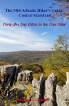
02/03/2013: The second in the series of books I am writing - The Mid-Atlantic Hiker's Guide - Central Maryland - is now in the print shop. It includes 45 day hikes from the shores of the Chesapeake Bay to Catoctin Mountain and from the Potomac River to the Mason-Dixon Line. The one hundred and eighty-four page book uses the same format as the West Virginia book (below) and will be on sale in about three weeks. Orders are now being taken.
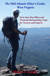
After two years of hard work my first book is finally finished - Orders are now being accepted: The Mid-Atlantic Hikers Guide: WV. I've teamed up with Scott Adams Enterprises to produce a two hundred and eighty-nine page manuscript complete with large topo maps, elevation profiles and waypoint tables, all keyed together to totally integrate the hiking experience. There are sixty-four hikes in all, ranging from a 2 mile flip-flop walk to visit the beautiful Sandstone Falls on the New River to 25+ mile, three day, strenuous forays into the wilderness areas of the Mountain State, and all other kinds of hikes in between.
___________________________________________________ M. R. Hyker's Latest Adventure(s) |
|
|
05/03-04/14 – Shenandoah Mountain Trail-South Overnight Backpack, GWNF, VA: Our original plan was to do an eighteen mile spoon shaped hike utilizing the primary trail, FR 173 and the Benson Run Trail. The projected stats were 9.3 miles and 1700 feet E.G. on Day 1 and 6.5 miles and an equivalent E.G. on day 2. As has become a common theme in many of this year’s reports things didn’t quite work out the way we planned.
Hardcore, Shortstack, Jill, Bwana (a new guy), Wooly Bully, Cognac Jack, Christopher Robin, Gumby and I started the hike at the Confederate Breastworks parking area on U.S. 250 around 11:30. I had forwarned the group that the first and last 3+ miles would be on a forest road so we were prepared for some mundane walking. Fortunately we were compensated with views of the surrounding mountains and valleys – The Great North Mountain and Deerfield Valley to the east and The rest of the Allegheny Mountains and Cowpasture Valley to the west. |
|
I think you can see beyond the Cranberry Wilderness on a clear day. Tim’s Knob on Shenandoah Mountain frequently loomed large in front of us. At around 3.0 miles we passed under a high voltage power line which offered more great views. In another quarter of a mile the Shenandoah Mountain-South Trail veered to the left on a footpath and climbed steeply for a half mile to a wildlife pond full of tadpoles and breeding newts. This was our first “packs off” break. During the climb the tread was full of leaf mulch. From here to our turn off point we had a nice mix of treadway alternating between grassy, moss covered and pine straw padded. Over the next four miles the trail generally descended along the ridge top although there were about five slight ascents, just steep enough to remind us where we were. I would say almost 70% of the time we either had broken views to the east or to the west, mostly looking at Brushy Ridge which blocked our views of the main valley. The spring wildflowers are coming out in full force now. We noted Star Chickweed, Dog-eared Chickweed, Rue Anemone, Dutchnan’s Britches, Pussy Toes, Blood Root, Indian Strawberry, Herb Robert and Round Leaf Hepatica to name just a few. We took two more breaks along the ridge walk – one near its halfway point and the last at the intersection with the forest road. The descent was long and gradual, losing about 1,000 feet over its 1.5 miles. We reached the bottom around 4:30 and found three nice campsites, all empty, along heavily flowing Benson Run with its clusters of White Trillium – some already turning pink. The wide grassy trail of the same name was also apparent – signed and blazed. We set up camp and I took another of my patented power naps before having dinner. We kept the fire small because of high winds but still had a nice chatfest with Jill mostly directing the conversation. This is when I was inspired by her to give Bwana his trail name. I hit the sack around 8:30. I must have fallen asleep quickly since I don’t recall hearing the last voice as I normally do. We were all up by 6:30, ate breakfast and broke camp. Shortly thereafter we had to alter our plans. Keep in mind that we were all prepared for a short, relatively easy day. Gumby had gotten up earlier than the rest of us and scouted a little bit of the Benson Run Trail. He reported several serious trail blockages to us. Undaunted, we decided to give it a go. As we passed a bend in the grassy road we encountered the first of several obstacles. We climbed over and crawled under several until I could get a better straight away view up the valley– nothing but serious blowdowns (photo by Christopher Robin) and heavy brush for as far as the eye could see. I wanted so badly to put this hike as planned in my upcoming book but I wasn’t about to risk the health and safety of the group to do it. It could become a real energy sapping experience with heavy packs and at some point we might still have to surrender and fight our way back to camp only to retrace yesterday’s trek. I bowed my head and sounded the retreat while we were still fresh. The decision meant an additional three miles and an extra 800 feet of E.G. but at least we knew what we had in front of us and a full day to do it. I was the slowest in the group, nothing unusual there, but I still felt confident I could make it. I would just have to go slower and take more breaks. At the top of the road we said goodbye to Bwana. He had planned some tutoring sessions based on our original itinerary and was going to miss them if he didn’t haul his very capable butt out of there. I don’t think I’ve ever met a nicer young man. He really jelled well with us old fogies. Needless to say the rest of the hike was the mirror image of yesterday’s except we all don’t remember all of those little descents that we now had to climb up. We stuck to our two mile break rule so the group wouldn’t get to far ahead of me, the last being at the junction of the Georgia Camp Trail, 1.5 miles from he cars. The group must have been way out in front of me because most dropped their packs to explore this trail in search of a final view and they found one. I personally didn’t have the energy to join them but Christopher Robins shared his photos with me: Eventually we reassembled, I sucked down the last of my water and we headed back to the cars, arriving at the Confederate Breastworks by 2:00, a little more tired and sore than planned but all in general good health and high spirits. (I just found out that Bwana really did haul his but out of there. He was back in Richmond at exactly 1:55. His appointment was at 2:00!) Needless to say we made a bee line to Tee-bone Tooter. The place is under new management and some remodeling has been done – mostly very nice but with one major disappointment. What always made this establishment unique to me was the … ummm … taxidermy above the rest rooms. The previous owner took them with him. We enjoyed really large portions of good after hike food – Sausage gravy and biscuits, Tee-Bone burgers (12 oz of beef, two kinds of cheese, bacon, lettuce and tomato), extra large Philly Cheese Steak (It was so large Betty just ate the internals, leaving the bun behind.) and other sundry lunch and breakfast dishes. I drank the wonderful sweet tea until my back teeth were floating (That will teach me to try to do a 10 mile hike with 6 miles worth of water!). As we left our after-hike feast we exchanged hugs and handshakes and continued on an uneventful drive back home. Post Hike Analysis: Talked to Ranger Christian Canary and found out that the area was hit by a severe storm. While they and their volunteers were able to restore the Shenandoah Mountain Trail-South they have not been able to get to the lesser used trail. He put it on his list for fall maintenance. ________________________________________________________________________________________________ |
|
Latest Outing Critiques
Date: 05/11/14 Rating: 4
Critique: Overall this was a very enjoyable hike. We did the loop on a beautiful sunny day after spending the weekend at Trout Pond campground and didn't encounter another soul on the trail. Although the hike includes a bit of forest road walking, the views of Wolf Gap/Massanutten/Shenandoah NP along that stretch more than make up for it. We included the out-and-back to the first overlook along North Mountain Trail, and though this added a bit more ascent along particularly rocky tread, it was well worth it as we were rewarded with an amazing view southeast beyond the southern tip of Massanutten. I would highly recommend doing this hike if you are staying at Trout Pond.
05/09/14
Rating: 4
Critique: We followed the trail notes and they were quite helpful.
This had to be one of the best hikes and worst hikes I've ever done in
summer. The worst part was loosing the trail 1/2 way on the Tee Pee and
ending up bushwhacking thru thick laurel to the pipeline. The trails are
just not marked well. The rock and bog on the trail seemed to never end
either. But the rest of the trail made up for it and more. There was
truly a full range of experience and the views on the rim were
fantastic. Campsites were all inviting and I am looking forward to doing
it again. A map, compass and even a GPS are a must for this trail, this
is not for novices. I would rate this trail very highly, thanks WV.
Name: Jackie M. Hike: Rocky Knob-Quarry Gap Backpack Date(s): 04/13-14/13 Rating: 4
Critique: We did this outing as our first ever backpack. We then repeated it two weeks later. Great beginner 1-night backpack. The directions are impeccable and very helpful for beginners, we did not get turned around once. There is a mild ascent up Locust Gap trail and then you round the lake. Fill up at the stream after you cross Birch Run Road. If you choose to go right at the Rocky Knob split you will be greeted with a pretty steep, rocky ascent, but you're rewarded with a very nice and secluded campsite on the left side of the trail once you reach the top. We chose this route on our first trip. On our second trip we went left, the ascent is more gradual on this side up to the AT. There's a good sized campsite about .5 miles down the AT to the right. Then in the morning you back track. Be sure to fill up at the stream at the PATC cabin, there will be no water until you're near the Quarry Gap shelter. The views and terrain are varied and interesting. There are a few easy water crossings. We had a great time.
Name: Wooly Bully & Shorstack Hike: FMF-Clifford Hollow Loop Date: 04/28/14 Rating: 4
Critique: We did this on a clear and warm day. Without the overhead leaf cover there was an open feeling to the woods, and the mountain laurel provided a lot of green close to the ground. This route must be spectacular when the laurel blooms! The first half of the hike follows the Catoctin Trail, passing thru two valleys. This second descent crosses a pretty stream several times, easy rock-hops. The long and fairly steep ascents made for a good workout. The north end of the route follows mountain bike paths and a power line right-of-way. In general, bearing to the left keeps you on track. The last part follows the Gambrill State Park Yellow Trail. Fairly level, rocky in places, and paralleling Gambrill Park Road. At the end we added a little distance at the end by turning left and taking the Yellow trail counterclockwise around the base of the "High Knob" area, for 9.8 miles. This made for a nice day.
Name: Erin Hike: Caledonia SP-Quarry Gap Date; 04/20/14 Rating: 2
Critique: If you like walking in the woods, this is a nice hike. However, it's not a very picturesque hike; we didn't even take out our camera's once. The unnamed blue trail mentioned at the beginning is now called the "3 Valley Trail." Locust Grove Trail is now marked as part of the Locust Gap Trail. The Hosack Run Trail is also marked on the sign post now in paint. There are no longer any deer enclosures (exclosures would be a better word). You'll notice rolled up fencing in a few spots. You'll also notice an abundance of young trees where the fencing would have been. My partner said at the end, "it'll be like we never did it." No views. Not very challenging. Meh. Not worth the 2.5 hour drive.
Name: Chris R. Hike: Old Loggers Path Date(s): 04/12 to 13/14 Rating: 3
Critique: THE BRIDGE AT MASTEN HAS NOW BEEN REPAIRED. I wanted to inform hikers that the bridge is rebuilt. Pleasant stream road is still closed to traffic from around Masten for about 3 miles west to about Short run. According to the ranger at Hillsgrove, it is open for hikers to make a loop out of the southern or northern loop, but is undrivable. The road is now in the process of being repaired as well. Attached is a picture of the bridge if needed. Heading counterclockwise from Masten, there is a nice break spot at a campsite off to the right of the trail about a mile or so before the intersection of Rock Run and Yellow dog run. We discovered a seeping water fall below the small cliff below the campsite which was a pleasant surprise. After teaming up with a group of 6 guys from south Jersey we headed out to Rock Run for a one night loop hike. Due to time we made a small loop using Old Loggers Path clockwise from Masten to Rock Run/Yellow dog run. Then returned to Masten via Old loggers Path to Ellenton Road, to Short Run trail, Cherry Ridge trail back to Old Loggers path. It took about 3 1/2 hours to hike back from Rock Run campsite. Note: If you plan on arriving late into Masten contact the Hillsgrove Ranger Station off of Rt. 87 to get a camping permit in the C.C.C camp prior to getting going the next morning.
Name: Sally Hike: Dolly Sods North Backpack Date(s): 04/12 to 13/14 Rating: 5
Critique: I did a quick overnight trip and was not disappointed. A few notes: 1. The signage is much better than when this trail was first described. In places where it is indicated there is just a post or a cairn, there are now clear signs. 2. That said -- there are points where a certain trail turns or looks uncertain and there are no blazes to guide you. The description is very helpful here -- also look for footprints. 3. Some boggier places now have wooden walkways, which are nice. 4. This hike was wet when I went, but the weather was nice, so it worked out. Definitely prepare with waterproof boots! And bring extra socks! You're going to need them. A pair of Chacos or the like for crossing streams would be a nice extra. 5. You have to park farther away than this description indicates -- this adds about a mile at the beginning and end of the hike. And the beginning, it's all uphill. At the end, it's downhill. 6. You should pack in water for the first couple of miles as there isn't a place to get water until you're on the hike (so fill up at home or at a rest stop). Once on the hike, there are about 4 places to fill up on water: the first is your first crossing of Red Creek. The second is the small spring described next to the emergency camping spot (though I wouldn't be certain if this would be flowing in dryer times or late summer), the fourth is at your camping spot by red creek, and the fifth is when you cross Red Creek again on the second day. I liked so many sure opportunities for water since it meant I didn't have to carry a lot (which is heavy!) This was a fantastic trip. The weather in mid April was very warm and the solitude was a delight. There were small patches of snow left, which I took advantage of when I got hot and put a scoop in my cap to cool down. I will definitely be returning.
|