| Thickhead Wild Area-Detweiler Natural Area Loop |
|
|
Description: The Rothrock State Forest is named for the late Dr. Joseph Rothrock, a native of Mifflin County, who is recognized as the Father of Forestry in Pennsylvania. Through his guidance the state purchased thousands of acres of barren forest to protect them from future abuse. These lands eventually became Bald Eagle and Rothrock State Forests. What exists today was made possible by men and women like him. Located just south of State College the forest has become a retreat for students and teachers as well as local residents and distant adventurers like us. It supports a well maintained trail system as well as a portion of the Mid State Trail (MST) which runs form Greenridge SF, MD in the south to the New York Border above the PA Grand Canyon. Described here is a relatively strenuous 10.4 mile hike through some of the prettiest parts of the forest. It can be done as a day hike or as a short overnight backpack. The hiker can add more mileage to it or use it as a base from which to launch other day hikes. Note that the hills are very steep and in many places the terrain is pretty rocky. High top leather boots are strongly recommended. |
|
Google Maps Custom Driving Directions The hike starts at Penn-Roosevelt SP day use (picnic) area. An optional starting point is at the Bear Meadows parking area. The Mid State Trail is part of the Great Eastern Trail (GET). ________________________________________ |
Zipped National Geographic TOPO! GPS and Universal GPX Files |
Trail Notes: The MST is blazed Orange. All other trails are blazed blue.
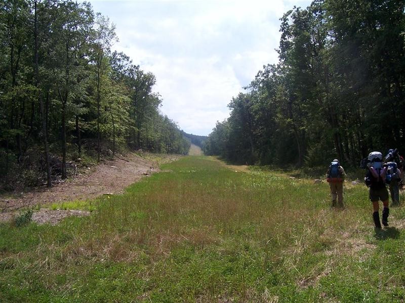
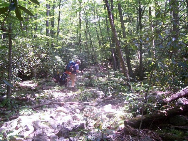
From the lake (currently drained) walk north up the road past the new restrooms and bear left onto the MST. Climb, steeply near the top, for 0.91 miles to Thickhead Mountain Road. Descend steeply for 0.21 miles to the top of Detweiler Run drainage. The MST turns left here (your return route. Save some strength for it.). Continue straight on the Shingle Trail, climbing steeply for 0.21 miles to Detweiler Road. The next 0.71 miles will take you up and over Thickhead Mountain to a hunter�s cottage and the John Wert trail. Turn left onto it. The gravel road soon turns into a wonderful trail passing through Hemlocks and Rhodos with the darkly stained Sinking Creek off to your right. In 0.19 miles cross a gas pipeline. In another 1.93 miles arrive at a giant Hemlock in the middle of the trail. To the right, across the creek is a very large campsite in a grove of Hemlocks. A smaller campsite is on the trail just beyond this mammoth landmark. These are the best places to camp if spending the night.
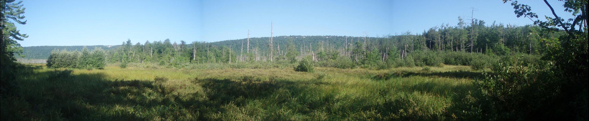
Continuing on, follow the trail for another 0.30 miles to Bear Meadows Road. A brief walk to the right down to the Bear Meadows parking area will reward you with a great view of the meadows and their surrounding mountains. A short, flat hike around the meadows themselves as well as a longer more challenging trek along the ridge above them will be added to this site soon. |
|
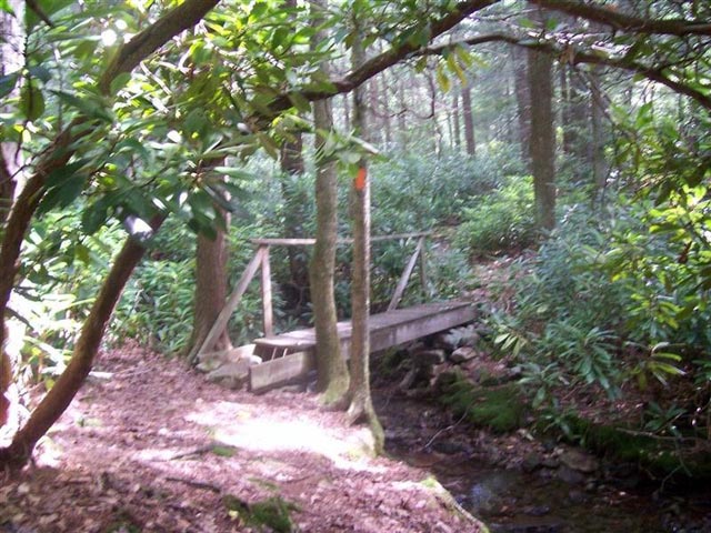
After visiting the meadows retrace your steps and walk up Bear Meadows Road for 1.01 miles and turn left onto the MST. Descend steeply for 0.50 miles to Wampler Road. Turn left and hike 0.17 miles to gated Detweiler Road. The MST descends on a footpath to the right for 0.19 miles to a junction with the Greenwood Furnace Spur on the right. There are 2 small campsites here and a really nice one a bit down the Greenwood Furnace Spur. Turn left, staying on the MST and enjoy the gurgling stream, moss covered rocks, Rhodo thickets and Hemlocks as you hike. In 1.85 miles cross the stream on a bridge and join the very rocky Reichley Brothers Railroad Grade. Here is where your tough boots come in. You will soon exit the natural area, cross the same pipeline you crossed earlier and rejoin the RR grade. The pesky ankle biting rocks continue for another 1.05 miles without a break until you return to the Shingle Trail junction. From here turn right on the MST and retrace your original steps back to Penn-Roosevelt SP.
________________________________________ Most Photos by Rob Gelner
________________________________________
Name: Andrew Hike: Thickhead Wild Area/Detweiler Natural Area Loop Date(s): 6/21-22/14 Rating: 5
Critique: Did a quick overnighter (5pm-9pm then 5am-8am) mostly following the route outlined on the web site, except I took the Shingle Path all the way up to Tussey Mountain Trail and looped back to Bear Meadows Rd. Some climbs are steep but mostly a very manageable hike. Scenery along the route is beautiful and the John Wert path is especially nice with centuries-old hemlocks. The suggestion for the campsite on the Greenwood Furnace Spur is perfect - very nice campsite on soft ground right alongside the creek. I made the mistake of leaving my breakfast (sealed in plastic bags) outside during the night and by next morning it's all gone-a sneaky black bear must have taken it. He even left all the utensils intact and did not touch my garbage bag at all. _______________________________________ |
|
|