|
Trayfoot Mt-Paine Run Loop |
|
|
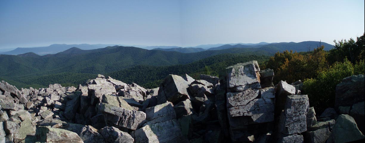
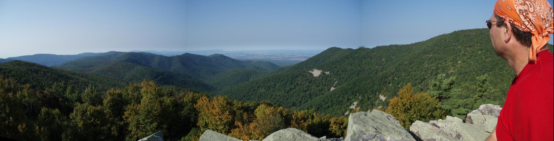
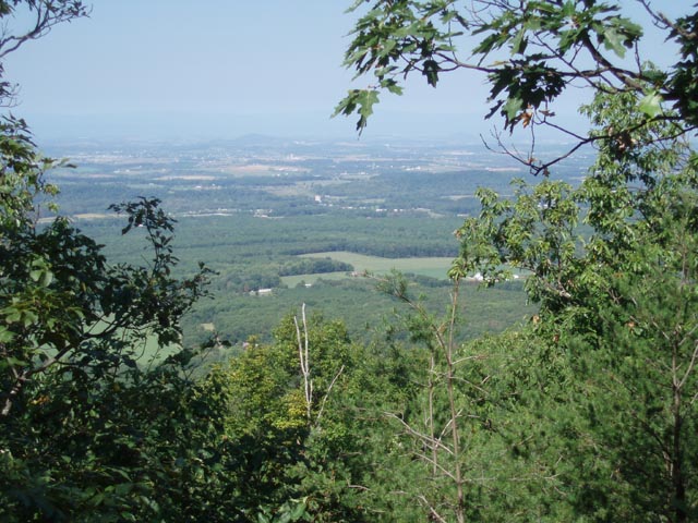
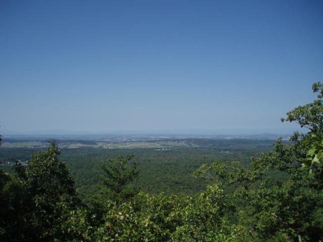
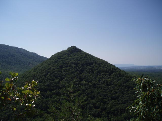
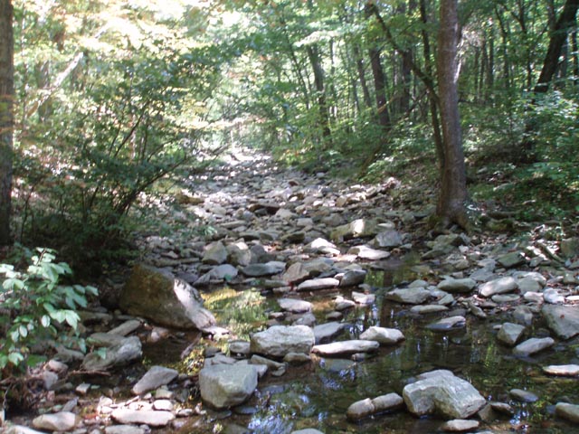
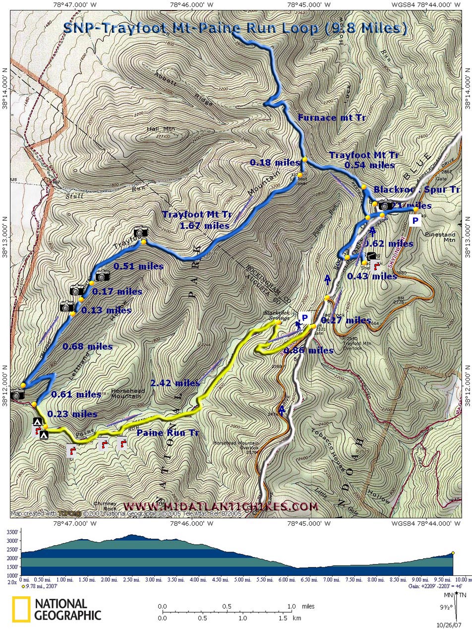
Description: This is a strenuous 9.8 mile loop in the southern district of SNP. While the highlight of the trek, undoubtedly, has to be the near 360 degree view from Black Rock more fine views are to be had along the ridge of Trayfoot Mountain, the last being one of Buzzard Rock and the surrounding ridges and valleys. The Paine Run Trail, an old fire road, spends little time along the stream as it climbs slowly back towards the parking area. Parts of it are exposed to the sun as the result of a forest fire on its southern flank so be prepared. Near the end it switchbacks up nearly 400 feet in 0.86 miles.
Note: Google Maps often makes use of Park Fire Roads in its directions. These are closed to the public. Confirm your route with other maps! The trailhead is at the Blackrock Gap parking area on the west side of Skyline Drive south of Mile Post 87. |
|
|
Zipped National Geographic. TOPO! GPS and Universal GPX Files |
Trail
Notes:
From the parking area cross Skyline Drive and turn left
(north) onto the AT. In 0.27 miles cross SLD and
continue on the AT. at 0.43 miles come to a 4X
intersection. On the right is a spur that goes to the
Blackrock Hut and spring. The blue blazed trail to the
left parallels the AT and, I believe, is technically
part of the Trayfoot Mountain Trail. You'll cross it
later. Stay straight on the AT as you continue to climb.
In another 0.62 miles cross the blue blazed trail. (To
the right is the Blackrock parking area.) Follow the AT
as it wraps around Blackrock itself. Drop your pack,
grab your camera and climb to one of the premier vistas
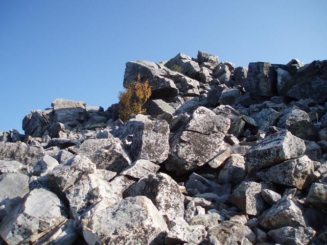
in the park. Near the front or western edge of Blackrock turn left onto the blue blazed spur trail of the same name. Soon you will merge with the Trayfoot Mountain Trail which comes in sharply from the left. Climb an old fire road for about 0.72 miles to the summit passing Furnace Mountain Trail on the right near the top. The absolute high point is marked with a concrete pole and USGS marker. Once at the summit you will have fairly easy walking along the ridge. In 1.67 miles you'll pass a vista with a nice view across Paine Run valley. It another 0.51 miles you'll pass a rock outcrop and views to the north-west and south-east. In another 0.68 miles you'll reach yet another rock formation with a great view of Buzzard Rock straight ahead and the ridges and valleys around it. From this point the trail switchbacks quickly down to the Paine Run Trail. Turn left (upstream) and in 0.23 miles cross the run itself. There is a small campsite just before crossing but a slightly bigger and better one on the other side. The next 2.42 miles is a pretty leisurely walk as you slowly climb towards your starting point. Be prepared for some bright sun in places as it appears that much of the canopy on the right was destroyed by fire some time ago. Near the top the trail/road will make a hard right turn and switchback up nearly 400 feet in 0.86 miles, depositing you quickly at your vehicle. |
|
_______________________________________
_______________________________________
Name: J.
Plue
Hike: Trayfoot Mt / Paine Run Loop Rain in Hampton Roads and Richmond did not stop me from making the Sunday trip out here, determined to hike mountains rain or shine. Once leaving Richmond, the rain stopped and clouds parted, revealing sun and blue skies. Blackrock is indeed unique and quite the place to stop and view the valley. The rock formations on Trayfoot's ridge are simply amazing, as is the view of Buzzard Rock.
Had my dog
with me, who has never hiked a field, much less the Blue
Ridge. He enjoyed the whole trip and surprisingly had energy
to burn the whole hike...until the final .86 mile climb. It
is correct that the final 400ft elevation gain is no joke.
All in all, finished in about 5.5 hours. Not bad for a
couple less experienced guys and a dog from the flatlands of
Norfolk. _______________________________________
Name: The
Tick
Hike: Trayfoot Mt/Paine Run Loop _______________________________________
Name: B.
Failon
Hike: Trayfoot Mt/Paine Run Loop _______________________________________
Name: B.
Gordon
Hike: Trayfoot Mt/Paine Run Loop ________________________________________ |
|
|