|
Wild Oak N.R.T.-Grooms Ridge Trail Loop |
|
|
Description: The 27 mile Wild Oak National Recreation Trail (W.O.N.R.T.) is considered one of the crown jewels of the North River Ranger District. (the others being the Ramsey Draft Wilderness trails and the Shenandoah Mountain-South Trail.) Although usually considered to be a backpacking trail it can also be broken down into shorter point to point hikes (See the W.O.N.R.T.-North Segment Shuttle) and in a couple of places shorter loops (See the W.O.N.R.T.-North River Gorge Loop). This is another challenging loop. With 2500 feet of elevation gain (2100 of it in the first 4.5 miles) it is quite the workout. The hiker is rewarded with several views of the surrounding mountains. A one mile walk on a lightly traveled gravel forest road is required to close the loop. |
|
________________________________________ |
|
Zipped National Geographic. TOPO! GPS and Universal GPX Files |
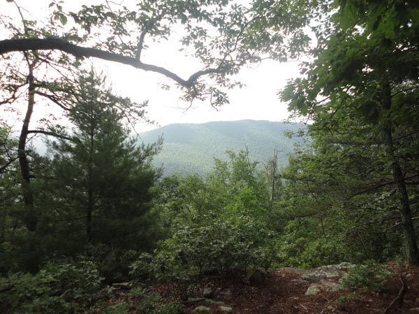
Trail Notes: From the parking area pick up the white blazed spur trail next to the kiosk. In 0.2 miles turn right onto the W.O.N.R.T. (also blazed white). The trail climbs steadily, passing a small but clear pond in 0.5 miles. In another 0.7 miles reach a nice southerly view of Lookout Mountain. Check your pulse as you reach the summit of Grindstone Mountain. In a mere 1.7 miles you�ve completed nearly half (1100 feet) of the elevation gain for the day. The next 1100 feet of E.G., although still challenging, is spread out over 2.7 miles. In 1.1 miles the footpath ends at an old jeep road. To the left is the yellow blazed Little Skidmore Trail. This can serve as an emergency bailout route as it will take you down the FR95, west of where you parked. To complete the hike turn right onto the jeep road. The trail generally remains wide but quickly loses the jeep road feel. There is one place where invasive Russian Olive bushes are badly encroaching upon the trail but the nuisance is short lived.
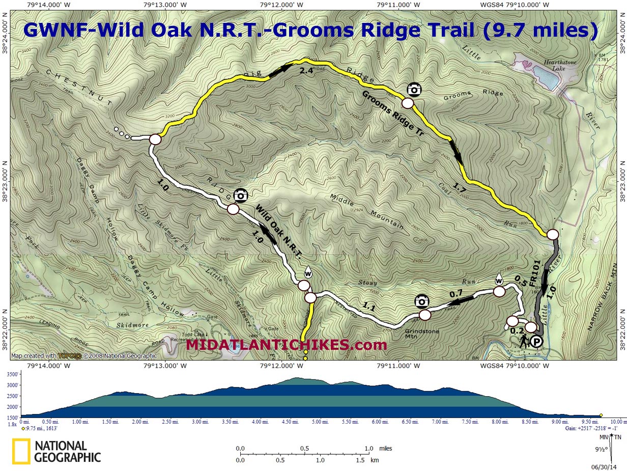
About 0.1miles beyond the last trail junction you�ll pass a much larger pond. It is teaming with life. Since there is little canopy over it in the summer months expect an algal bloom on its service. The trail continues upward in a roller coaster fashion with a couple of false summits. In a mile from the pond you�ll pass two nice views, the first to the north, looking at Big Ridge, your return route and shortly after that to the south with views of Trimble and Hankey Mountains. |
|
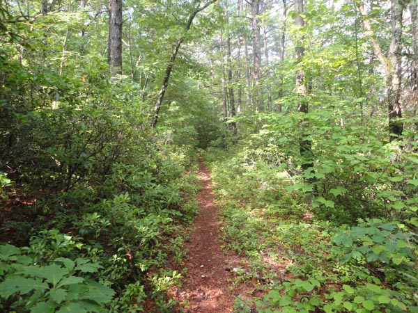
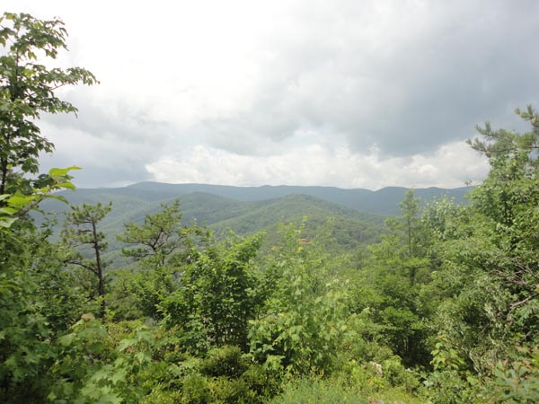
Near constant climbing persists for the next mile until you reach the junction with the yellow blazed Grooms Ridge Trail on the right. A thin log lays across this terminus primarily to dissuade W.O.R.N.T. through hikers from missing their turn. For this hike you want to turn right onto it, immediately passing its sign on the right and a yellow blaze on the left. I�ve jokingly remarked to others that if the W.O.N.R.T. is one of the crown jewels of the ranger district�s trail inventory then the Grooms Ridge Trail must surely be it�s red-headed step daughter. (I have no malice towards red-heads or step daughters. It�s just an archaic saying that I have been exposed to.) The trail is about five miles in length. There is severe trail encroachment in places, mostly over parts of the uppermost 1.5 miles, primarily where the canopy has been destroyed, possibly by Gypsy Moths. The maple saplings and blueberry bushes are growing in leaps and bounds. Trail conditions continue to improve as you go along. The trail generally descends through its course but with still with enough upward character to add almost another 400 feet of E.G. to the trek. The last climb is very steep albeit short in duration. On a clear day the mostly westward view might be the coup de grace of the day.
Although the trail conditions have been gradually improving along the ridge it improves even more so after a quick descent from this perch. The trail is wide, brushed back and well blazed. I suspect that this last 1.7 mile section sees more TLC as people probably use it a lot to reach the awesome vista. It also probably helps that the forest is healthier preventing the initial trail encroachment issues you may have witnessed. Now the hiker is truly on a downhill track. Watch out for the large flat rocks. They can be slippery. Turn right onto gravel FR101 and follow it for 1.0 miles. Turn right onto paved FR95 and in a few steps arrive back at the trailhead.
_______________________________________
________________________________________ |
|
|